- Cranberry Wilderness
-
Contents
Cranberry Wilderness Part of Monongahela National Forest Wilderness Area 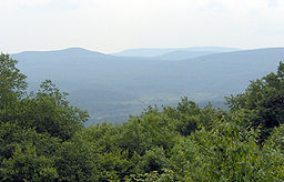 Cranberry Wilderness
Country United States State West Virginia Counties Pocahontas, Webster Elevation 3,400 ft (1,036.3 m) Coordinates 38°16′36″N 80°19′57″W / 38.27667°N 80.3325°W Highest point Black Mountain - location west of Woodrow - elevation 4,556 ft (1,388.7 m) - coordinates 38°16′20″N 80°14′18″W / 38.27222°N 80.23833°W Lowest point Williams River - location at Three Forks of Williams River - elevation 2,400 ft (731.5 m) - coordinates 38°20′17″N 80°22′35″W / 38.33806°N 80.37639°W Area 47,815 acres (19,350 ha) [1] Established 1983-01-01 Management Monongahela National Forest Owner US Forest Service IUCN category Ib - Wilderness Area Nearest city Marlinton, West Virginia 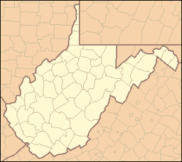
 Location of Cranberry Wilderness in West Virginia
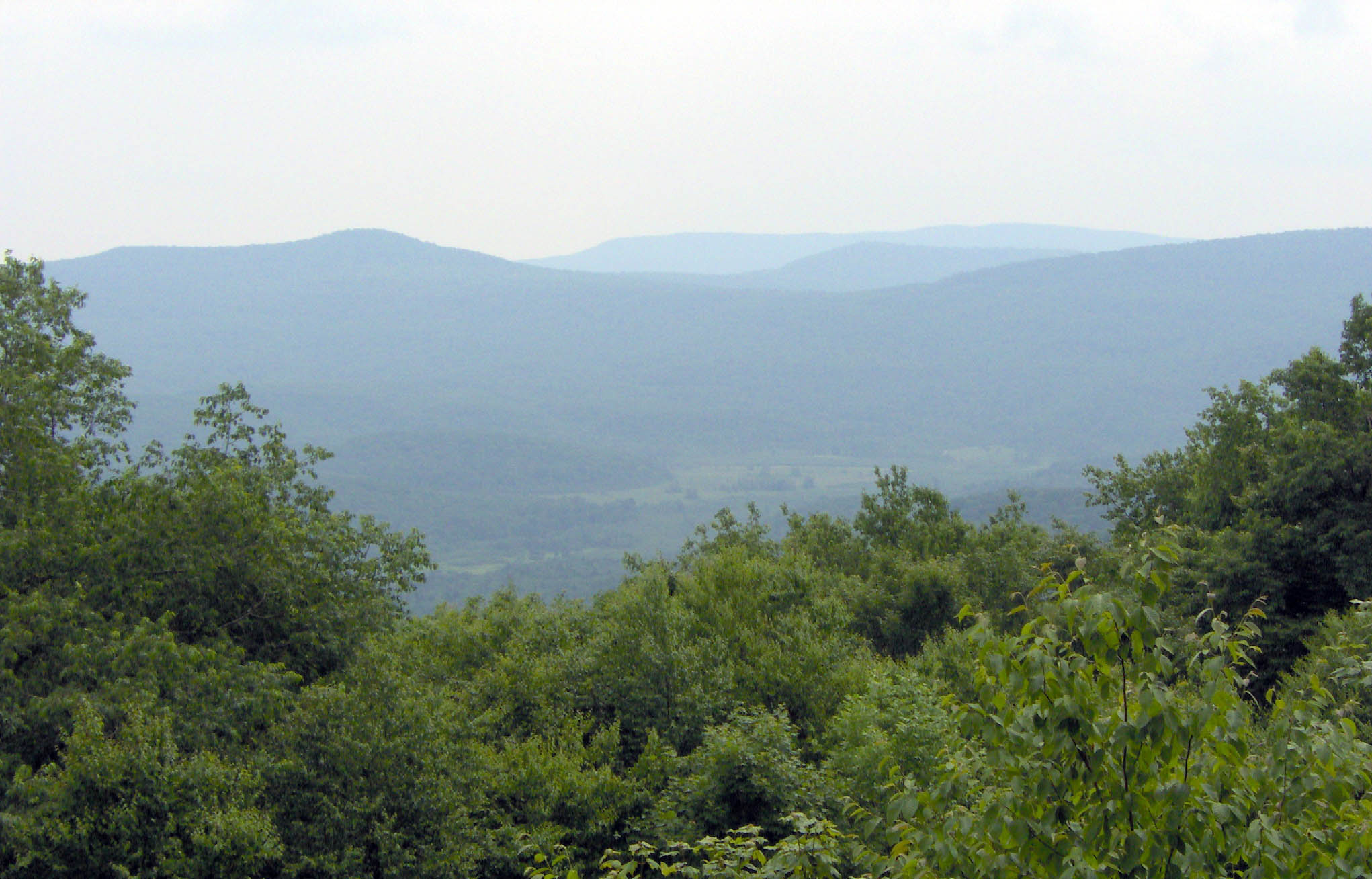
Website: Monongahela National Forest Wilderness Areas The Cranberry Wilderness is a 47,815-acre (194 km2) U.S. Wilderness area in the Monongahela National Forest of southeast West Virginia, USA.[1] Its name derives from the nearby Cranberry Glades as well as from the Cranberry River and Cranberry Mountain. In addition to being wilderness, it is a designated black bear sanctuary.
Geography
The Cranberry Wilderness is located mostly in Pocahontas County, with a small portion in Webster County. The Wilderness is drained by the Williams River and the Cranberry River, both of which are tributaries of the Gauley River, which in turn unites with the New River to form the Kanawha, a tributary of the Ohio. The area just to the east of the Cranberry Wilderness is drained by tributaries of the Greenbrier River which flows into the New.
The Wilderness is located in the Yew Mountains, which are part of the Allegheny Mountains. The highest point in the Wilderness is along Black Mountain at 4,556 feet (1,389 m), although there is a slightly higher point at 4,603 feet (1,403 m) just outside of the Wilderness. The lowest elevation in the Wilderness is at 2,400 feet (730 m) along the Williams River at Three Forks of Williams River, where it exits the Wilderness.
2009 addition
The Omnibus Public Land Management Act of 2009 added 11,951 acres (4,836 ha) of adjacent land to the Cranberry Wilderness.[2] This area, which was previously known as the Cranberry Backcountry, is located between the Williams River and the Cranberry River. It protects several tributaries of both the Williams and Cranberry Rivers which are popular trout streams. The area already has an excellent trail system connected to the original wilderness.
The national Rainbow Gathering has been held twice at the Cranberry Wilderness — in 1980 and in 2005.[3]
See also
References
- ^ a b "Cranberry Wilderness". Monongahela National Forest. http://fs.usda.gov/wps/portal/fsinternet/!ut/p/c5/04_SB8K8xLLM9MSSzPy8xBz9CP0os3gjAwhwtDDw9_AI8zPyhQoYAOUjMeXDfODy-HWHg-zDrx8kb4ADOBro-3nk56bqF-RGGGSZOCoCAPi8eX8!/dl3/d3/L2dJQSEvUUt3QS9ZQnZ3LzZfME80MEkxVkFCOTBFMktTNUJIMjAwMDAwMDA!/?navtype=BROWSEBYSUBJECT&recid=12368&actid=&navid=110000000000000&pnavid=&ss=110921&position=&ttype=recarea&pname=Monongahela%20National%20Forest%20-%20Cranberry%20Wilderness. Retrieved April 13, 2010.
- ^ "Omnibus Public Lands Management Act of 2009". Library of Congress. http://hdl.loc.gov/loc.uscongress/legislation.111hr146. Retrieved 2009-05-14.
- ^ Rainbow Annual Gathering history page, accessed April 19, 2008
External links
- Cranberry Wilderness map
- Wilderness.net
- Cranberry Wilderness, West Virginia - GORP
- TopoQuest topographic map
- West Virginia Wilderness Coalition
National Recreation Areas Wilderness Areas Big Draft Wilderness • Cranberry Wilderness • Dolly Sods Wilderness • Laurel Fork North Wilderness • Laurel Fork South Wilderness • Otter Creek Wilderness • Roaring Plains West Wilderness • Spice Run Wilderness
Observation Towers Lakes Lake Sherwood • Spruce Knob Lake • Summit Lake
Mountains and Summits Allegheny Front • Allegheny Mountain • Back Allegheny Mountain • Backbone Mountain • Barton Knob • Bickle Knob • Champe Rocks • Cheat Mountain • Gaudineer Knob • Mount Porte Crayon • North Fork Mountain • River Knobs • Seneca Rocks • Shavers Mountain • Spruce Knob • Spruce Mountain
Other Major Areas Blackwater Canyon • Camp Allegheny • Bear Rocks Preserve • Canaan Valley • Cheat Summit Fort • Cranberry Glades • Fernow Experimental Forest • Gaudineer Scenic Area • Germany Valley • Highland Scenic Highway • Sinks of Gandy • Smoke Hole Canyon
Rivers and Creeks US Forest ServiceCategories:- IUCN Category Ib
- Monongahela National Forest
- Protected areas of Pocahontas County, West Virginia
- Protected areas of Webster County, West Virginia
- Wilderness Areas of West Virginia

Wikimedia Foundation. 2010.