- Cranberry River (West Virginia)
-
Cranberry River River 
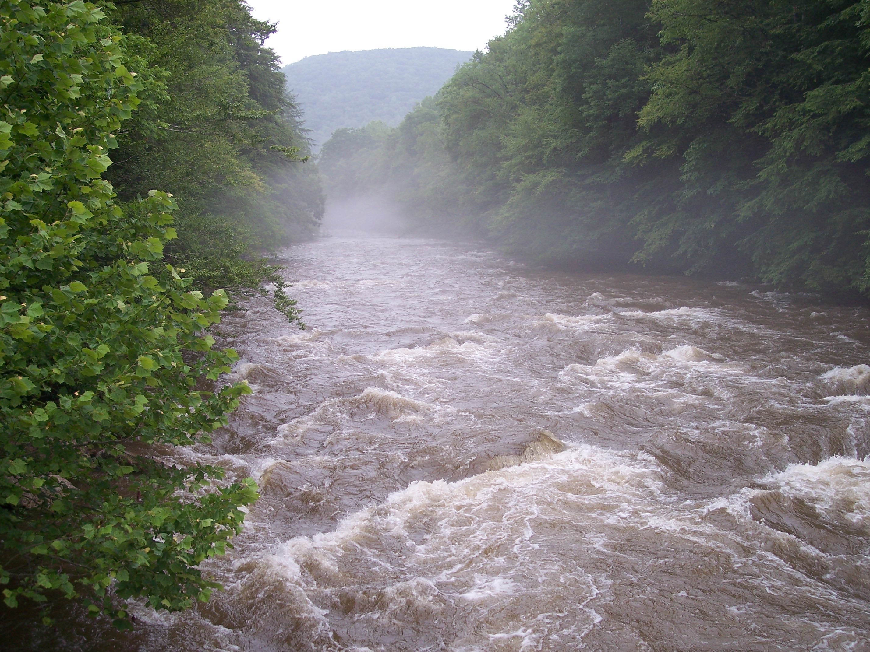
Country United States State West Virginia Counties Pocahontas, Webster, Nicholas Source South Fork Cranberry River [1] - location Cranberry Mountain, Pocahontas County, WV - elevation 3,890 ft (1,186 m) - coordinates 38°12′48″N 80°13′14″W / 38.21333°N 80.22056°W Secondary source North Fork Cranberry River [2] - location Black Mountain, Pocahontas County, WV - elevation 4,364 ft (1,330 m) - coordinates 38°14′03″N 80°14′32″W / 38.23417°N 80.24222°W Source confluence [3] - location Pocahontas County, WV - elevation 3,176 ft (968 m) - coordinates 38°15′28″N 80°19′27″W / 38.25778°N 80.32417°W Mouth Gauley River [3] - location Woodbine, WV - elevation 1,919 ft (585 m) - coordinates 38°17′58″N 80°36′49″W / 38.29944°N 80.61361°W Length 24 mi (39 km) [3] Basin 74 sq mi (192 km2) [4] Discharge for near Richwood, WV - average 317 cu ft/s (9 m3/s) [5] - max 3,450 cu ft/s (98 m3/s) (1970) - min 50 cu ft/s (1 m3/s) (1986)  Cranberry River at the Woodbine Picnic Area after a heavy rain
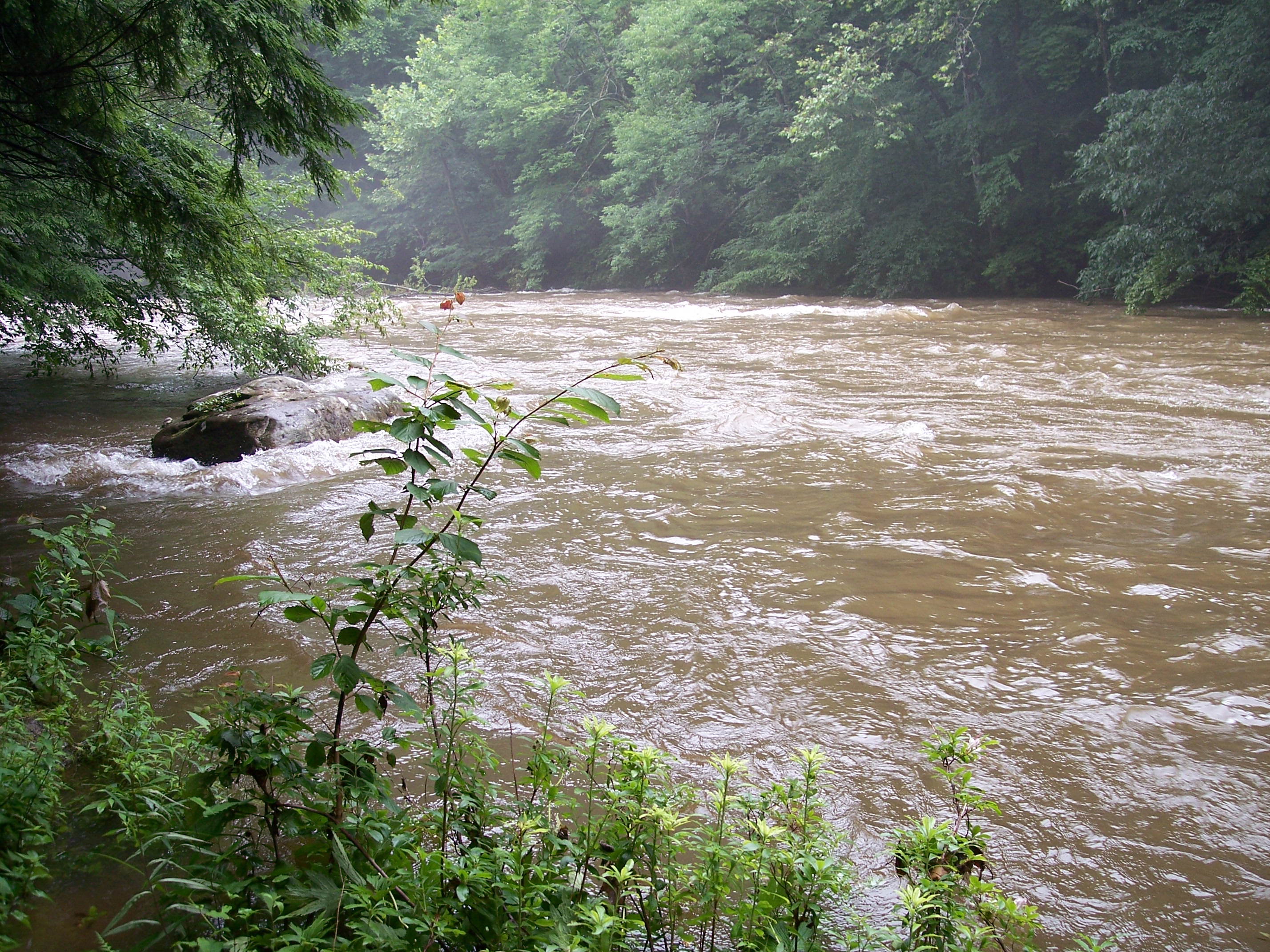
The Cranberry River is a tributary of the Gauley River located in southeastern West Virginia, USA.[6] It is a part of the Mississippi River watershed, by way of the Gauley, Kanawha, and Ohio Rivers, draining an area of 74 square miles (192 km2).[4]
The river has also been known historically as Cranberry Creek.[3]
Contents
Geography
The Cranberry River is formed in southwestern Pocahontas County by the confluence of its North and South forks.[3] The South Fork, the longer of the two at a length of 9 miles (14 km)[1], rises on Cranberry Mountain just west of the Highland Scenic Highway before flowing through the Cranberry Glades Botanical Area. The North Fork rises about 2 miles (3.2 km) north on Black Mountain.
Below the confluence of its forks, the Cranberry flows for 24 miles (39 km) generally westward towards its mouth at the Gauley River near Craigsville.
Since the river flows mostly through United States Forest Service land, no more than a handful of people live along its banks; the few that do reside near the mouth of the river.[citation needed] However, the Cranberry River has several pay campgrounds, free campsites, and picnic areas along its banks.[7]
Fishing
The Cranberry River and its small tributaries are regarded as some of the finest trout streams in the eastern United States. Until recently, however, trout fishing on the south fork was limited to the lower half of the river due to acid rain. The West Virginia Division of Natural Resources has worked to counter this problem by installing a liming station on the north fork of the river.[8]
See also
- List of West Virginia rivers
External links
- Monongahela National Forest map of the Richwood area, including the course of the Cranberry River and recreational amenities along its banks
- Real-time water data for the Cranberry River
References
- ^ a b "South Fork Cranberry River". Geographic Names Information System, U.S. Geological Survey. http://geonames.usgs.gov/pls/gnispublic/f?p=gnispq:3:::NO::P3_FID:1553558. Retrieved 2008-12-30.
- ^ "North Fork Cranberry River". Geographic Names Information System, U.S. Geological Survey. http://geonames.usgs.gov/pls/gnispublic/f?p=gnispq:3:::NO::P3_FID:1552331. Retrieved 2008-12-30.
- ^ a b c d e "Cranberry River". Geographic Names Information System, U.S. Geological Survey. http://geonames.usgs.gov/pls/gnispublic/f?p=gnispq:3:::NO::P3_FID:1557372. Retrieved 2008-12-30.
- ^ a b Grafton, Emily. 2006. "Cranberry River." The West Virginia Encyclopedia. Ken Sullivan, editor. Charleston, WV: West Virginia Humanities Council. ISBN 0-9778498-0-5.
- ^ "USGS 03187500 CRANBERRY RIVER NEAR RICHWOOD, WV". National Water Information System. U.S. Geological Survey. Archived from the original on 2008-12-30. http://www.webcitation.org/5dSxObvc9. Retrieved 2008-12-30.
- ^ DeLorme (1997). West Virginia Atlas & Gazetteer. Yarmouth, Maine: DeLorme. ISBN 0-89933-246-3.
- ^ Big Rock Campground, Cranberry Campground, Cranberry River campsites, Woodbine Picnic Area, in the Monongahela National Forest
- ^ Gasper, Donald C. New Native Brook Trout Streams, A New Wilderness (pdf)
Categories:- Rivers of West Virginia
- Monongahela National Forest
- Geography of Nicholas County, West Virginia
- Geography of Pocahontas County, West Virginia
- Geography of Webster County, West Virginia
Wikimedia Foundation. 2010.