- Mount Porte Crayon
-
Mount Porte Crayon Summit Name origin: David Hunter Strother's pseudonym Porte Crayon Country United States State West Virginia Counties Pendleton, Randolph Part of Allegheny Front Range Allegheny Mountains Elevation 4,770 ft (1,453.9 m) [1] Prominence 1,590 ft (484.6 m) [2] Coordinates 38°55′44″N 79°27′22″W / 38.92889°N 79.45611°W Management Monongahela National Forest Owner US Forest Service Easiest access off-trail hike Topo map USGS Laneville Nearest city Harman, West Virginia 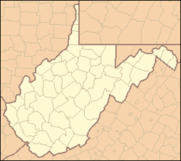
 Location of Mount Porte Crayon in West Virginia
Website: Monongahela National Forest Mount Porte Crayon is a mountain in the Roaring Plains Wilderness of the Monongahela National Forest. It is situated in the extreme northeastern corner of Randolph County, West Virginia, USA, and rises to an elevation of 4,770 feet (1,450 m), the elevational climax of the Allegheny Front.[citation needed] The mountain is named for 19th century writer and illustrator David Hunter Strother (1816–88), known as "Porte Crayon", who produced a wide array of West Virginia landscapes in his work.
Contents
Geography
Mount Porte Crayon is the sixth highest point in the state of West Virginia and the northernmost of the top ten state highpoints. It is also the highest point on the Roaring Plains, a natural extension of the Dolly Sods Wilderness. The summit area is presently set aside as an 8.11-acre (32,800 m2) prescribed management area, and is a Research Natural Area, for a native mountaintop red spruce forest that is home to endangered northern flying squirrel and endangered Cheat Mountain salamander. Mount Porte Crayon is the remote headwaters to three drainages and is the highest point on the Eastern Continental Divide in West Virginia, Maryland, and Pennsylvania.
History
Naming
A group of admirers formed the "Porte Crayon Memorial Society" in 1940. Upon learning of the 4,760-foot (1,451 m) promontory (as it was then measured) in the heart of the writer-illustrator's beloved highland terrain, they successfully lobbied to have it named in his honor. On July 5, 1940, a dedication ceremony was held at the top of the Mountain following a three-hour trek to the site. It included a eulogy, a singing of the national anthem, and the raising of the Star-Spangled Banner atop a spruce flagpole.[3]
Nature Conservancy preserve
In 2008, the Nature Conservancy established a new preserve on 100 acres (0.4 km2) of red spruce-northern hardwood forest and shrub-filled pastures which are slowly returning to woodland. The Mount Porte Crayon Preserve is wrapped around the southern shoulder of its namesake Mountain and borders Monongahela National Forest's Roaring Plains Wilderness for more than three-fourths of a mile.[3] This is part of an ongoing, long-term program by the Nature Conservancy to protect 1,800 acres (7 km2) at Mount Porte Crayon.[citation needed]
Climate
Mount Porte Crayon is notorious for its inclement weather and strong winds. The prevailing westerly winds are so severe, they have deformed the red spruce trees, causing branches to grow on only one side. The summit itself is very isolated and difficult to access. Although some may make a summit bid into an overnight trip, experienced hikers with a map and compass and/or GPS can easily summit Mount Porte Crayon as a day hike.
Recreation
Hiking
Mount Porte Crayon remains one of West Virginia's most inaccessible peaks, since it is far from the nearest trail, let alone a public road. A walk to the summit using the U.S. Forest Service's Flat Rock Run Trail or Roaring Plains Trail totals 5+ miles and is a 2,500-foot (762 m) gain endeavor. This involves a three-mile bushwhack through dense spruce thicket (including half a mile of some very thick spruce and rhododendron). Summiting Mount Porte Crayon is for experienced hikers only and should not be underestimated. Views are afforded from a crag, known as Thunderstruck Rock, about a quarter mile from the summit.
A visit to the Nature Conservancy's preserve, which is open to the public, involves a 3-mile round-trip hike from the junction of the aforementioned trails along the Mount Porte Crayon Grade — a former railroad swath that now accommodates an unmarked and unmaintained trail onto the preserve.
Ski resort plans
Mount Porte Crayon has been involved in controversy due to plans by Bill Bright, developer of the Winterplace and Glade Springs resorts, who wants to bring a ski resort to the area.[4][5][6][7] The proposed ski area is rumored to be named "Almost Heaven Mountain Resort" and will have the largest vertical drop south of New York.[8]
References
- ^ U.S. Geological Survey (1995). Laneville, West Virginia quadrangle (Map). 1:24,000, 7.5-Minute Series (Topographic). ISBN 0-607-90826-2.
- ^ "West Virginia Summits". PeakList.org. Archived from the original on 2009-01-16. http://www.webcitation.org/5dsdeIkpq. Retrieved 2008-04-22.
- ^ a b Steelhammer, Rick (May 4, 2008). "It's Just Wild, Terrific Country". Charleston Gazette. http://www.wvgazette.com/News/200805030348. Retrieved October 7, 2010.
- ^ "W. Va. ski resort still in the works". Washington Times. 2003-10-12. Archived from the original on 2009-03-01. http://www.webcitation.org/5exPDvYLN. Retrieved 2009-03-01.
- ^ Sherwood, John (2003-09-30). "Porte Crayon Ski Resort Considered". DCSki. Archived from the original on 2009-03-01. http://www.webcitation.org/5exMPTj0r. Retrieved 2009-03-01.
- ^ "Porte Crayon ski resort planned". The Highlands Voice (West Virginia Highlands Conservancy): p. 3. 2003-09. Archived from the original on 2009-03-01. http://www.webcitation.org/5exORYkBo. Retrieved 2009-03-01.
- ^ McGinnis, Helen (2004-09). "Bright assembles property for Almost Heaven Mountain Resort". The Highlands Voice (West Virginia Highlands Conservancy): p. 4. Archived from the original on 2009-03-01. http://www.webcitation.org/5exKIevG4. Retrieved 2009-03-01.
- ^ Sherwood, John (2006-01-21). "Almost Heaven Mountain Resort Update". DCSki. Archived from the original on 2009-03-01. http://www.webcitation.org/5exKOhaPF. Retrieved 2009-03-01.
External links
National Recreation Areas Wilderness Areas Big Draft Wilderness • Cranberry Wilderness • Dolly Sods Wilderness • Laurel Fork North Wilderness • Laurel Fork South Wilderness • Otter Creek Wilderness • Roaring Plains West Wilderness • Spice Run Wilderness
Observation Towers Lakes Lake Sherwood • Spruce Knob Lake • Summit Lake
Mountains and Summits Allegheny Front • Allegheny Mountain • Back Allegheny Mountain • Backbone Mountain • Barton Knob • Bickle Knob • Champe Rocks • Cheat Mountain • Gaudineer Knob • Mount Porte Crayon • North Fork Mountain • River Knobs • Seneca Rocks • Shavers Mountain • Spruce Knob • Spruce Mountain
Other Major Areas Blackwater Canyon • Camp Allegheny • Bear Rocks Preserve • Canaan Valley • Cheat Summit Fort • Cranberry Glades • Fernow Experimental Forest • Gaudineer Scenic Area • Germany Valley • Highland Scenic Highway • Sinks of Gandy • Smoke Hole Canyon
Rivers and Creeks US Forest Service Categories:- Geography of Randolph County, West Virginia
- Mountains of West Virginia
- Allegheny Mountains
- Monongahela National Forest
- Geography of Pendleton County, West Virginia
- Nature Conservancy preserves
- Protected areas of Pendleton County, West Virginia
- Protected areas of Randolph County, West Virginia
- Nature reserves in West Virginia

Wikimedia Foundation. 2010.