- Bickle Knob
Geobox|Summit
name = Bickle Knob
native_name =
other_name =
other_name1 =
topo_maker = USGS
topo_
range = Allegheny Mountains
parent =
category =
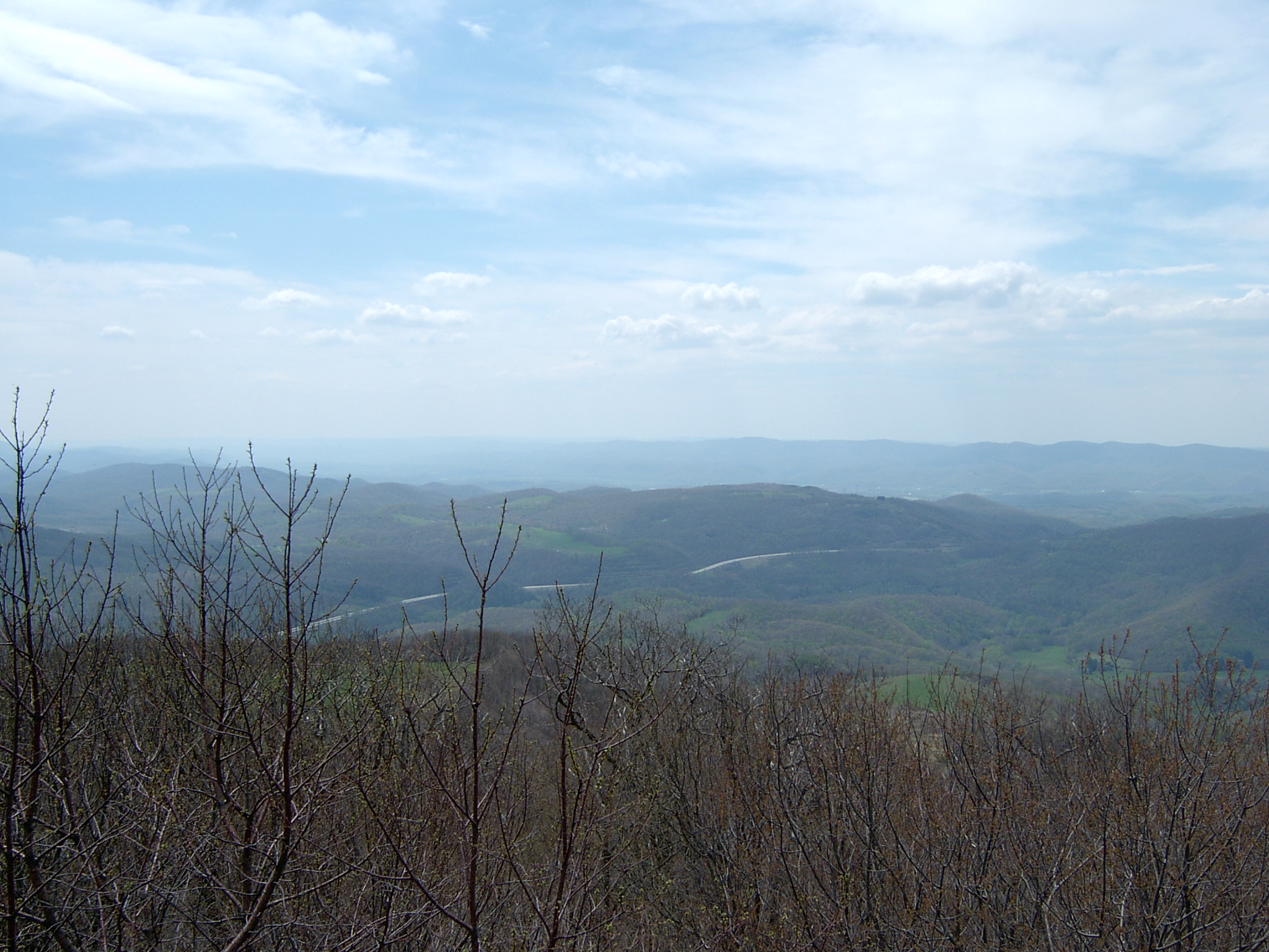
image_caption = View looking southwest from Bickle Knob
etymology_type =
etymology =
country = United States
country_
state = West Virginia
state_
region_type = County
region = Randolph
district_type =
district =
district1 =
district2 =
city =
city1 =
location =
lat_d = 38
lat_m = 56
lat_s = 03
lat_NS = N
long_d = 79
long_m = 43
long_s = 53
long_EW = W
elevation_imperial = 4003
elevation_round = 1
elevation_note = cite gnis|1554541|Bickle Knob|2008-05-31]
prominence_imperial = 998
prominence_note = [cite web|url=http://www.peaklist.org/USlists/WV500.html|title=West Virginia Summits|publisher=PeakList.org|accessdate=2008-05-31]
area_unit = acre
area_imperial =
area_round = 1
area_note =
area1_imperial =
area1_type =
length_imperial =
length_orientation =
width_imperial =
width_orientation =
highest =
highest location =
highest_lat_d =
highest_lat_m =
highest_lat_s =
highest_lat_NS =
highest_long_d =
highest_long_m =
highest_long_s =
highest_long_EW =
highest_elevation_imperial =
lowest =
lowest_location =
lowest_lat_d =
lowest_lat_m =
lowest_lat_s =
lowest_lat_NS =
lowest_long_d =
lowest_long_m =
lowest_long_s =
lowest_long_EW =
lowest_elevation_imperial =
biome =
biome_share =
biome1 =
biome1_share =
geology =
geology1 =
plant =
plant1 =
animal =
animal1 =
access = drive-up via 91A
established_type =
established =
established_note =
established1_type =
established1 =
established1_note =
owner =USDA Forest Service
management =Monongahela National Forest
management_lat_d =
management_lat_m =
management_lat_s =
management_lat_NS =
management_long_d =
management_long_m =
management_long_s =
management_long_EW =
management_elevation =
visitation =
visitation_year =
free_type = Nearest city
free_label = Nearest city
free = Elkins,West Virginia
free1_type =
free1 =

map_caption = Location of Bickle Knob in West Virginia
map_locator = West Virginia
map_first =
website = [http://www.fs.fed.us/r9/mnf/rec/observation_towers/bickle_tower.htm Bickle Knob Observation Tower]Bickle Knob is a mountain summit located east of Elkins in Randolph County,
West Virginia . Easily accessible during warm-weather months, Bickle Knob is also home to one of the few remaining observation towers inMonongahela National Forest .Observation Tower
The most prominent feature at Bickle Knob is its observation tower. Formerly a
fire tower , the original cab has been removed and replaced with a wooden viewng platform. The observation tower provides 360-degree views of the surrounding area including theShavers Fork River ,Tygart Valley River valley, and the theU.S. Route 33 crossing ofCheat Mountain . The tower is not handicapped-accessible.Other facilities
Bickle Knob also features a small picnic grounds and a pit toilet.
Accessing Bickle Knob
Bickle Knob is located at the end of Forest Route 91A, a spur from Stuart Memorial Drive (FR 91). Both roads are gravel but can easily be traversed by normal passenger cars. Stuart Memorial Drive is a parking scenic path as it traces the edge of the
Shavers Fork River canyon. Due to the high elevation of the area and the fact that FR 91 is not plowed in the wintercite web|url=http://www.fs.fed.us/r9/mnf/rec/observation_towers/bickle_tower.htm|title=Bickle Knob Observation Tower|publisher=Monongahela National Forest |accessdate=2008-05-31] , travel is not recommended when snow is present as the road may be hazardous.ee also
*
Olson Observation Tower , another Monongahela National Forest observation tower
*Cheat Mountain
*Shavers Fork River
*Monongahela National Forest References


Wikimedia Foundation. 2010.