- Tygart Lake State Park
Geobox|Protected Area
name = Tygart Lake State Park
native_name =
other_name =
other_name1 =
category = West Virginia State Park
category_iucn = V
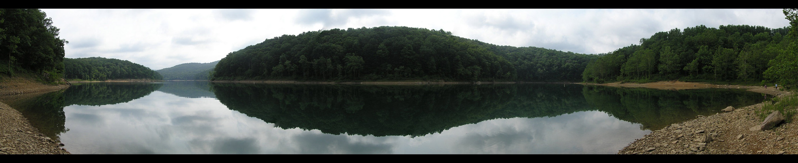
image_caption =Tygart River Lake
etymology_type =
etymology =
country = United States
country_
state = West Virginia
state_
region_type = County
region = Taylor
district_type =
district =
district1 =
district2 =
city =
city1 =
location =
lat_d = 39
lat_m = 18
lat_s = 16
lat_NS = N
long_d = 80
long_m = 01
long_s = 20
long_EW = W
elevation_imperial = 1375
elevation_round = 1
area_unit = acre
area_imperial = 391
area_round = 1
area1_imperial =
area1_type =
length_imperial =
length_orientation =
width_imperial =
width_orientation =
highest =
highest location =
highest_lat_d =
highest_lat_m =
highest_lat_s =
highest_lat_NS =
highest_long_d =
highest_long_m =
highest_long_s =
highest_long_EW =
highest_elevation_imperial =
lowest =
lowest_location =
lowest_lat_d =
lowest_lat_m =
lowest_lat_s =
lowest_lat_NS =
lowest_long_d =
lowest_long_m =
lowest_long_s =
lowest_long_EW =
lowest_elevation_imperial =
biome =
biome_share =
biome1 =
biome1_share =
geology =
geology1 =
plant =
plant1 =
animal =
animal1 =
established_type = Established
established = 1945
established_note = cite book|title=Where People and Nature Meet: A History of the West Virginia State Parks|publisher=Pictorial Histories Publishing Company|location=Charleston,West Virginia |date=April 1988|isbn=0-933126-91-3]
established1_type =
established1 =
owner =West Virginia Division of Natural Resources
management_location =
management_lat_d =
management_lat_m =
management_lat_s =
management_lat_NS =
management_long_d =
management_long_m =
management_long_s =
management_long_EW =
management_elevation =
visitation =
visitation_year =
free_type = Nearest city
free_label = Nearest city
free = Grafton,West Virginia
free1_type =
free1 =

map_caption = Location of Tygart Lake State Park in West Virginia
map_locator = West Virginia
map_first =
website = [http://www.tygartlake.com Tygart Lake State Park]Tygart Lake State Park sits on 391 acres (1.58 km²) [ [http://www.nrac.wvu.edu/gap/pub.htm Strager, J.M, and Yuill, C.B., "THE WEST VIRGINIA GAP ANALYSIS PROJECT FINAL REPORT", Appendix 4, Natural Resource Analysis Center, West Virginia University, Morgantown, West Virginia, 2002.] ] along the shores of Tygart Lake in Taylor County near Grafton,
West Virginia ,United States .Features
* 20-room Tygart Lake Lodge
* Lodge restaurant
* 2 gift shops
* Golfing
* 11 cabins
* 40 camp sites (26 with electric hookup)
* Hiking trails
* Boating
* Fishing
* Marina with boat rentals
* Waterskiing
* Swimming in Tygart Lake
* Picnic areaee also
*
List of West Virginia state parks
*state park References
External links
* [http://www.tygartlake.com/ Official site]

Wikimedia Foundation. 2010.