- Watters Smith Memorial State Park
Geobox|Protected Area
name = Watters Smith Memorial State Park
native_name =
other_name =
other_name1 =
category = West Virginia State Park
iucn_category = V
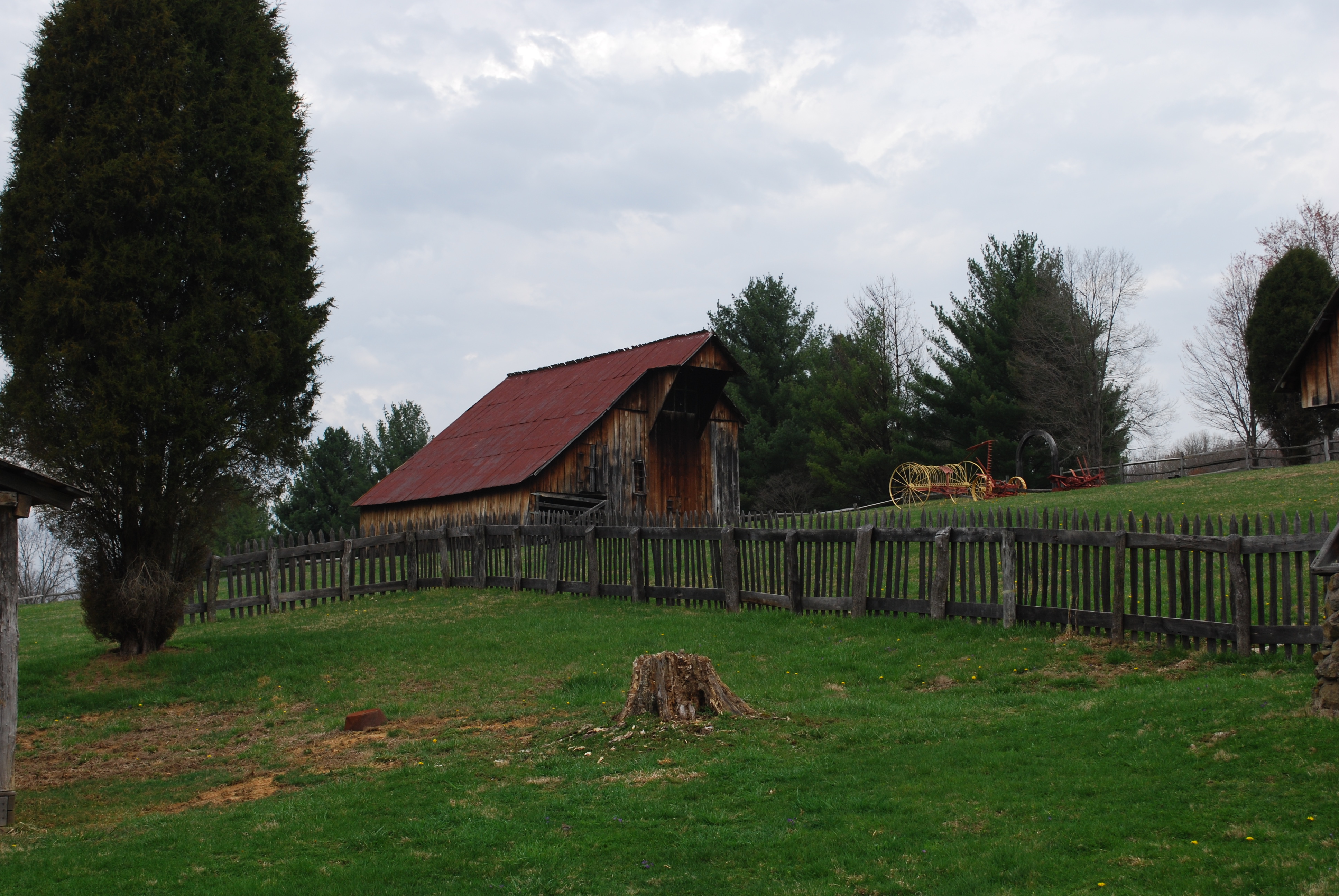
image_caption = Buildings from the Watters Smith family farm.
etymology_type =
etymology =
country = United States
country_
state = West Virginia
state_
region_type = County
region = Harrison
district_type =
district =
district1 =
district2 =
city =
city1 =
location =
lat_d = 39
lat_m = 10
lat_s = 16
lat_NS = N
long_d = 80
long_m = 24
long_s = 29
long_EW = W
elevation_imperial = 1033
elevation_round = 1
area_unit = acre
area_imperial = 532
area_round = 1
area1_imperial =
area1_type =
length_imperial =
length_orientation =
width_imperial =
width_orientation =
highest =
highest location =
highest_lat_d =
highest_lat_m =
highest_lat_s =
highest_lat_NS =
highest_long_d =
highest_long_m =
highest_long_s =
highest_long_EW =
highest_elevation_imperial =
lowest =
lowest_location =
lowest_lat_d =
lowest_lat_m =
lowest_lat_s =
lowest_lat_NS =
lowest_long_d =
lowest_long_m =
lowest_long_s =
lowest_long_EW =
lowest_elevation_imperial =
biome =
biome_share =
biome1 =
biome1_share =
geology =
geology1 =
plant =
plant1 =
animal =
animal1 =
established_type = Established
established = 1949
established_note = [ [http://www.watterssmithstatepark.com/history.html Watters Smith Memorial State Park History, accessed April 1, 2008] ]
established1_type =
established1 =
owner =West Virginia Division of Natural Resources
management_location =
management_lat_d =
management_lat_m =
management_lat_s =
management_lat_NS =
management_long_d =
management_long_m =
management_long_s =
management_long_EW =
management_elevation =
visitation =
visitation_year =
free_type = Nearest city
free_label = Nearest city
free = Lost Creek,West Virginia
free1_type =
free1 =

map_caption = Location of Watters Smith Memorial State Park in West Virginia
map_locator = West Virginia
map_first =
website = [http://www.waterssmithstatepark.com Watters Smith Memorial State Park]Watters Smith Memorial State Park is a convert|532|acre|km2|sing=on historical park with a pioneer homestead and museum located in Harrison County,
West Virginia . The homestead, rising above Duck Creek, is a memorial to settler Watters Smith, who was born inTrenton, New Jersey , in 1767, and moved to Harrison County in what was thenVirginia , in 1796, with his wife Elizabeth Davisson Smith. Alog cabin similar to the original was moved and reconstructed on the park, together with farm buildings typical of early 1800s settlement. The more modern Smith family home (c. 1876) has been restored as a museum, and an additional museum houses many local farm artifacts from earlier eras. Guided tours are offered fromMemorial Day weekend throughLabor Day . In addition, the park features swimming, picnicking, hiking trails, and horseback riding.ee also
*
List of West Virginia state parks References
External links
* [http://www.watterssmithstatepark.com/ Official site]

Wikimedia Foundation. 2010.