- Marlinton, West Virginia
-
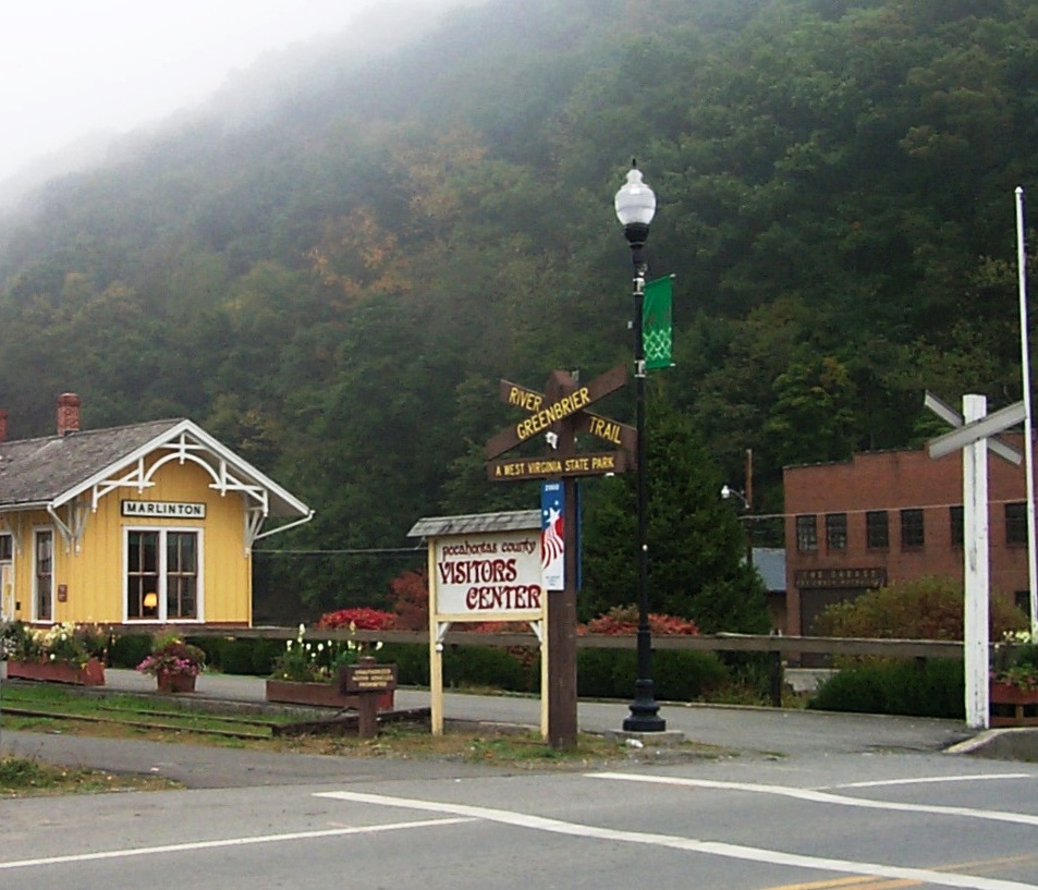
Marlinton, West Virginia — Town — Visitors Center and Trailhead in Marlinton.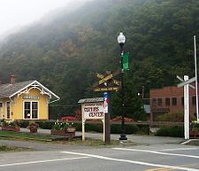 Location of Marlinton, West Virginia
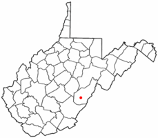
Coordinates: 38°13′29″N 80°5′41″W / 38.22472°N 80.09472°WCoordinates: 38°13′29″N 80°5′41″W / 38.22472°N 80.09472°W Country United States State West Virginia County Pocahontas Area – Total 2.3 sq mi (6.0 km2) – Land 2.2 sq mi (5.8 km2) – Water 0.1 sq mi (0.3 km2) Elevation 2,126 ft (648 m) Population (2000) – Total 1,204 – Density 539.8/sq mi (208.4/km2) Time zone Eastern (EST) (UTC-5) – Summer (DST) EDT (UTC-4) ZIP code 24954 Area code(s) 304 FIPS code 54-51676[1] GNIS feature ID 1552003[2] Marlinton is a town in Pocahontas County, West Virginia, United States. The population was 1,204 at the 2000 census. It is the county seat of Pocahontas County[3].
Contents
History
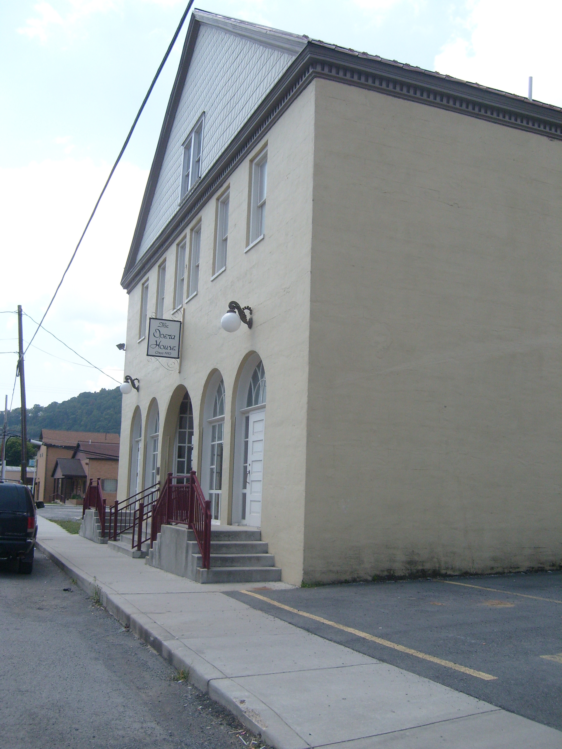
Located at Marlinton and listed on the National Register of Historic Places are the Frank and Anna Hunter House, IOOF Lodge Building, Marlinton Chesapeake and Ohio Railroad Station, Marlinton Opera House, Pocahontas County Courthouse and Jail, and Pocahontas Times Print Shop.[4] Located near Marlinton are Droop Mountain Battlefield and New Deal Resources in Watoga State Park Historic District.[4]
Demographics
As of the census[1] of 2000, there were 1,204 people, 552 households, and 290 families residing in the town. The population density was 539.8 inhabitants per square mile (208.5/km²). There were 653 housing units at an average density of 292.8 per square mile (113.1/km²). The racial makeup of the town was 97.92% White, 1.16% African American, 0.08% Native American, 0.08% Asian, 0.08% from other races, and 0.66% from two or more races. Hispanic or Latino of any race were 0.17% of the population.
There were 552 households out of which 22.5% had children under the age of 18 living with them, 37.9% were married couples living together, 12.7% had a female householder with no husband present, and 47.3% were non-families. 42.4% of all households were made up of individuals and 21.4% had someone living alone who was 65 years of age or older. The average household size was 2.04 and the average family size was 2.80.
In the town the population was spread out with 19.6% under the age of 18, 7.5% from 18 to 24, 22.8% from 25 to 44, 24.8% from 45 to 64, and 25.2% who were 65 years of age or older. The median age was 45 years. For every 100 females there were 83.5 males. For every 100 females age 18 and over, there were 76.6 males.
The median income for a household in the town was $21,293, and the median income for a family was $33,125. Males had a median income of $26,500 versus $16,477 for females. The per capita income for the town was $14,957. About 17.5% of families and 24.0% of the population were below the poverty line, including 29.0% of those under age 18 and 16.2% of those age 65 or over.
Gallery
-
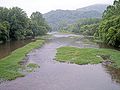
The Greenbrier River in Marlinton
References
- ^ a b "American FactFinder". United States Census Bureau. http://factfinder.census.gov. Retrieved 2008-01-31.
- ^ "US Board on Geographic Names". United States Geological Survey. 2007-10-25. http://geonames.usgs.gov. Retrieved 2008-01-31.
- ^ "Find a County". National Association of Counties. http://www.naco.org/Counties/Pages/FindACounty.aspx. Retrieved 2011-06-07.
- ^ a b "National Register Information System". National Register of Historic Places. National Park Service. 2010-07-09. http://nrhp.focus.nps.gov/natreg/docs/All_Data.html.
Municipalities and communities of Pocahontas County, West Virginia County seat: MarlintonTowns 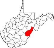
CDPs Bartow | Cass | Frank | Green Bank | Huntersville
Unincorporated
communitiesArbovale | Beard | Beard Heights | Boyer | Braucher | Brownsburg | Buckeye | Burner | Burnsides | Burr | Campbelltown | Clawson | Clover Lick | Deer Creek | Denmar | Dilleys Mill | Droop | Dunmore | Edray | Frost | Harter | Hosterman | Jacox | Kennison | Knapp | Linwood | Lobelia | Locust | Mace | May | Mill Point | Minnehaha Springs | Nida | Nottingham | Olive | Onoto | Raintown | Raywood | Rimel | Seebert | Sitlington | Slaty Fork | Snowshoe | Spice | Spruce | Stillwell | Stony Bottom | Thornwood | Thorny Creek | Violet | Walnut | Wanless | Warwick | Watoga | West Union | Wildell | Woodrow
Ghost towns Gertrude | Mill Run | Sunset
Categories:- Populated places in Pocahontas County, West Virginia
- Towns in West Virginia
- County seats in West Virginia
-


Wikimedia Foundation. 2010.