- Mill Point, West Virginia
-
Mill Point, West Virginia — Unincorporated community — 
 Mill Point, West Virginia
Coordinates: 38°09′29″N 80°10′51″W / 38.15806°N 80.18083°WCoordinates: 38°09′29″N 80°10′51″W / 38.15806°N 80.18083°W Country United States State West Virginia County Pocahontas Elevation 2,198 ft (670 m) Time zone Eastern (EST) (UTC-5) – Summer (DST) EDT (UTC-4) Area code(s) 304 & 681 GNIS feature ID 1552112[1] Mill Point is an unincorporated community in Pocahontas County, West Virginia, United States. Mill Point is located at the junction of U.S. Route 219, West Virginia Route 39, and West Virginia Route 55 2.5 miles (4.0 km) northeast of Hillsboro.
References
- ^ "US Board on Geographic Names". United States Geological Survey. 2007-10-25. http://geonames.usgs.gov. Retrieved 2008-01-31.
Municipalities and communities of Pocahontas County, West Virginia Towns 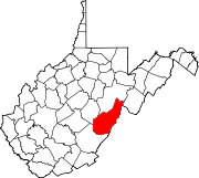
CDPs Bartow | Cass | Frank | Green Bank | Huntersville
Unincorporated
communitiesArbovale | Beard | Beard Heights | Boyer | Braucher | Brownsburg | Buckeye | Burner | Burnsides | Burr | Campbelltown | Clawson | Clover Lick | Deer Creek | Denmar | Dilleys Mill | Droop | Dunmore | Edray | Frost | Harter | Hosterman | Jacox | Kennison | Knapp | Linwood | Lobelia | Locust | Mace | May | Mill Point | Minnehaha Springs | Nida | Nottingham | Olive | Onoto | Raintown | Raywood | Rimel | Seebert | Sitlington | Slaty Fork | Snowshoe | Spice | Spruce | Stillwell | Stony Bottom | Thornwood | Thorny Creek | Violet | Walnut | Wanless | Warwick | Watoga | West Union | Wildell | Woodrow
Ghost towns Gertrude | Mill Run | Sunset
Categories:- Populated places in Pocahontas County, West Virginia
- Unincorporated communities in West Virginia
- Pocahontas County, West Virginia geography stubs


Wikimedia Foundation. 2010.