- Huntington, West Virginia
-
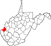
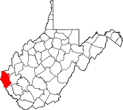
City of Huntington, West Virginia — City — Huntington's Central Business District as seen from the Robert C. Byrd Bridge at 6th Street Nickname(s): The Jewel City, The River City Location in the State of West Virginia Coordinates: 38°25′15″N 82°25′25″W / 38.42083°N 82.42361°W Country United States State West Virginia Counties Cabell, Wayne Founded 1775 Incorporated 1871 Government – Mayor Kim Wolfe (R) Area – City 18.0 sq mi (46.6 km2) – Land 15.9 sq mi (41.2 km2) – Water 2.1 sq mi (5.4 km2) Elevation 564 ft (172 m) Population (2010) – City 49,138 – Density 3,234.1/sq mi (1,248.4/km2) – Metro 286,012 Time zone EST (UTC-5) – Summer (DST) EDT (UTC-4) ZIP Code 25701-25729, 25755, 25770-25779 Area code(s) 304 & 681 FIPS code 54-39460[1] GNIS feature ID 1540605[2] Website www.cityofhuntington.com Huntington is a city in Cabell and Wayne counties in the U.S. state of West Virginia, along the Ohio River. Most of the city is in Cabell County, for which it is the county seat.[3] A small portion of the city, mainly the neighborhood of Westmoreland, is in Wayne County. Its population was 49,138 at the 2010 census.[4] Huntington is a part of the Huntington-Ashland, WV-KY-OH, Metropolitan Statistical Area (MSA). As of 2009, the MSA's population was 285,624. Huntington is the largest city within the MSA and the second largest city in West Virginia, behind Charleston. The city is also the home of Marshall University.
Contents
History
The city was named for Collis P. Huntington, who founded Huntington in 1870 as the western terminus for the Chesapeake and Ohio Railway (C&O) on the land west of the mouth of the Guyandotte River at the Ohio River. It was created as a railroad town for the C&O, when it initially stretched from Richmond, Virginia to the Ohio River. The city houses numerous railroad shops which expanded east to Newport News (and coal piers) and west to eventually reach Cincinnati and Chicago in the years after its founding.
The first permanent settlement in what is now modern-day Huntington was founded in 1775 as "Holderby's Landing."
Huntington was incorporated in 1871 near the earlier city of Guyandotte. Guyandotte, which became a neighborhood of Huntington in 1911, was founded in 1799 on land that was originally part of the 28,628-acre (115.85 km2) French and Indian War veteran's Savage Grant.[5] Meriwether Lewis passed the Guyandotte and Big Sandy River peninsula on or about September 20, 1803 on his way down the Ohio River before meeting up with William Clark in Clarksville, Indiana.
Historically, the old Federal Era town of Guyandotte has homes dating back to 1820 and a graveyard containing 18th century French and Colonial-era settlers, including surnames such as LeTulle, Holderby, and Buffington. Huntington was known as Holderby's Landing prior to 1871 and the Buffington family held the tracts of land that became the Huntington Land Company. The Buffingtons were the only revolutionary-era Savage Grant claimants to continuously reside within the area, and later generations of Buffingtons were associated with Marshall College (later a university) were business partners of Collis P. Huntington. Albert Gallatin Jenkins, a Confederate Army General, had his plantation home in nearby Lesage, which has since become a historical landmark. The James River and Kanawha Company toll road reached both Guyandotte and the Big Sandy River in 1829, bringing overland commerce to the area.
At the time of Huntington's founding, Holderby's Landing was already the home of Marshall College, a normal school that had been founded in 1837 as Marshall Academy by John Laidley in honor of his friend, US Supreme Court Chief Justice, John Marshall.[5] Originally, Marshall Academy was essentially a boarding school, under the control of the Southern Methodist Church, for wealthy high school students. In 1857, the school became Marshall College, which in turn became a public institution in 1867. The college later became Marshall University in 1961 and now occupies a large portion of the city to the immediate east of the downtown CBD.
In 1891, work constructing the first school building for African Americans was begun. Douglass High School was named for U.S. abolitionist leader Frederick Douglass. Among the school's early graduates in 1896 was Carter G. Woodson, who became its principal four years later. Dr. Woodson became a noted teacher, educator and historian, and was one of the first blacks to be awarded a doctorate from Harvard University. Known as the father of Afro-American History,[6] in 1926, he founded Negro History Week, which later became Afro-American History Month. Public school desegregation resulted in the closing of Douglass High School in 1961. The building was placed on the register of historic places in 1985.[7]
By the 1950 census, Huntington had peaked at a high of 86,000 residents. Beginning in the early 1960s, Huntington's dense population began to spread out across the surrounding areas which can be attributed to the typicality of urban sprawl. The city of Huntington's population declined as the metropolitan area actually saw increases in population. Although still an industrial city. Huntington is also now effectively a regional medical community – the two hospitals, St. Mary's and Cabell-Huntington Hospital, are the largest employers – and a university town, thanks to the presence of Marshall University, which has an enrollment of approximately 16,000 students.[8]
As transportation has improved, residents began spreading out around Huntington in suburban settings even in Kentucky and Ohio. Huntington's population decline can be totally attributed to this as the metropolitan area population has remained the same or increased in the last 30 years. Huntington is often grouped into the "Rust Belt" syndrome list of cities at first glance (a list of U.S. industrial cities that experienced decline in the 1970s and 1980s due to shifts in the American economy). These first glances fastidiously attribute the city of Huntington's population decline to that, but in actuality, this syndrome has never occurred in Huntington. As modern highways made transportation to Huntington easier, so did the residents take advantage of this by building new communities outside the city limits. The city of Huntington failed to annex these areas which resulted in a loss of population. However, the metropolitan statistical area has not decreased. In "Rust Belt" communities, the whole region declines which is simply not the case with Huntington.
In the 1970s, federal urban renewal programs destroyed part of the downtown. However, in 2005 downtown again began to prosper with construction of the Pullman Square, retail and entertainment lifestyle center. The Harris Riverfront Park promenade is now well-attended along the Ohio River downtown.
Southern Airways Flight 932
Main article: Southern Airways Flight 932On November 14, 1970, a chartered Southern Airways McDonnell-Douglas DC-9 jet transporting 75 Marshall University football players, coaches, staff, and supporters crashed just short of the Tri-State Airport in adjoining Ceredo, West Virginia. Everyone on board was killed.
A movie titled We Are Marshall, starring Matthew McConaughey and Matthew Fox, was released locally on December 12, 2006, and nationally on December 22, 2006. The movie depicts the aftermath of the aviation disaster for the families and university.
Geography and climate
According to the United States Census Bureau, the city has a total area of 18.0 square miles (47 km2), of which, 15.9 square miles (41 km2) of it is land and 2.1 square miles (5.4 km2) of it (11.51%) is water. The Guyandotte River joins the Ohio River in Huntington, about 5 mi (8 km) east of its downtown.
Due to its position in the westernmost and lowest altitude areas of the state, the city is on the northern limits of a warmer and milder Humid subtropical climate,[9] unlike the hilly uplands of West Virginia which are located in the Allegheny Mountains and the Appalachian Mountains. Huntington is warmed by westerly winds from the Midwest, and made humid by the Ohio River, but avoids the bitter cold and high winds of the interior of West Virginia. Huntington enjoys temperate four seasons, with hot (70–90 degrees) summers and snowy (20–50 degrees) winters. Fall and spring tend to be cool and wet, but Huntington fills the roughly three-mile wide flood plain of the south bank of the Ohio River for sixty city blocks and portions of the hills to the immediate south.
Climate data for Huntington, West Virginia Month Jan Feb Mar Apr May Jun Jul Aug Sep Oct Nov Dec Year Average high °F (°C) 41
(5)46.1
(7.8)56.3
(13.5)66.6
(19.2)74.6
(23.7)81.7
(27.6)85.1
(29.5)83.7
(28.7)77
(25)66.4
(19.1)55.1
(12.8)45.3
(7.4)64.9 Average low °F (°C) 24.5
(−4.2)27.5
(−2.5)35.5
(1.9)43.7
(6.5)52.6
(11.4)60.9
(16.1)65.4
(18.6)64.1
(17.8)56.8
(13.8)44.8
(7.1)36.6
(2.6)28.9
(−1.7)45.1 Precipitation inches (mm) 3.31
(84.1)2.90
(73.7)3.70
(94)3.30
(83.8)4.46
(113.3)3.91
(99.3)4.38
(111.3)3.77
(95.8)2.72
(69.1)2.85
(72.4)3.19
(81)3.25
(82.6)41.72
(1,059.7)Snowfall inches (cm) 8.9
(22.6)7.5
(19.1)4.7
(11.9)0.8
(2)0
(0)0
(0)0
(0)0
(0)0
(0)0
(0)1.1
(2.8)3.1
(7.9)26.2
(66.5)Avg. precipitation days 14.1 12.6 13.6 12.9 13.2 11.8 11.2 9.7 8.6 9.2 11.3 12.9 141.1 Avg. snowy days 7.0 5.3 3.3 0.7 0 0 0 0 0 0 1.3 4.1 21.7 Source: The Weather Channel (records),[10] NOAA (normals, 1971–2000)[11] The city's primary public recreation center is Ritter Park (named for Charles L. Ritter who donated the land). The park area encompasses a walking and cycling path, tennis courts, an outdoor amphitheater, a multi-terraced rose garden, and a stone-tiered reflecting pond built by the Works Progress Administration and Civilian Conservation Corps in the late 1930s. Four Pole Creek runs the entire length of Ritter Park and is crossed by numerous wooden and stone footbridges.
Government and politics
Huntington has, since 1985, operated under a strong mayor/city council form of government.[12] The mayor is elected to four-year terms in partisan elections contested at the same time as United States presidential elections. The current mayor is former Cabell County Sheriff Kim Wolfe, a Republican who is currently in his first term. Mayors in Huntington are term-limited to three terms[13] and have the authority to veto acts of the city council.
Huntington's city councilors are also elected to four-year terms at the same time as the mayor. There are eleven members of the council, nine of whom represent single-member districts, while the other two are elected at-large by the city as a whole. Huntington's city council has the authority to draft and debate ordinances and can override a mayoral veto with a two-thirds majority. There are currently nine Democrats and two Republicans on the city council.[14]
District City Council District City Council District 1 Jim Ritter (D) District 7 Scott Caserta (D) District 2 Teresa Loudermilk (D) District 8 Russ Houck (D) District 3 Frances Jackson (D) District 9 James Insco (D) District 4 Nate Randolph (R) At Large Steve Williams (D) District 5 Sandra Clements (D) At Large Rebecca Thacker (D) District 6 Mark Bates (R) The city also serves as the county seat of Cabell County.[3] The Cabell County Courthouse is located in downtown Huntington on a parcel that covers an entire city block. Within the building are the offices for all of the county's elected officials and their employees, including the sheriff, county commissioners, county clerk, magistrates, and Circuit Court judges.
Demographics
Historical populations Census Pop. %± 1880 3,174 — 1890 10,108 218.5% 1900 11,923 18.0% 1910 31,161 161.4% 1920 50,177 61.0% 1930 75,572 50.6% 1940 78,836 4.3% 1950 86,353 9.5% 1960 83,627 −3.2% 1970 74,315 −11.1% 1980 63,684 −14.3% 1990 54,844 −13.9% 2000 51,475 −6.1% 2010 49,138 −4.5% As of the census[1] of 2000, there were 51,475 people, 22,955 households, and 12,235 families residing in the city. The population density was 3,234.1 people per square mile (1,248.4/km²). There were 25,888 housing units at an average density of 1,626.5 per square mile (627.9/km²). The ethnic makeup of the city was 89.61% White, 7.49% Black or African American, 0.20% Native American, 0.82% Asian, 0.05% Pacific Islander, 0.30% from other races, and 1.53% from two or more races. Hispanic or Latino of any race were 0.85% of the population.
There were 22,955 households out of which 20.6% had children under the age of 18 living with them, 36.9% were married couples living together, 13.1% had a female householder with no husband present, and 46.7% were non-families. 37.6% of all households were made up of individuals and 15.1% had someone living alone who was 65 years of age or older. The average household size was 2.12 and the average family size was 2.80.
In the city the population was spread out with 17.7% under the age of 18, 17.5% from 18 to 24, 24.9% from 25 to 44, 21.8% from 45 to 64, and 18.0% who were 65 years of age or older. The median age was 37 years. For every 100 females there were 88.7 males. For every 100 females age 18 and over, there were 85.8 males.
The median income for a household in the city was $23,234, and the median income for a family was $34,756. Males had a median income of $30,040 versus $21,198 for females. The per capita income for the city was $16,717. About 17.5% of families and 24.7% of the population were below the poverty line, including 29.8% of those under the age of 18 and 12.5% of those 65 and older.
Institutions
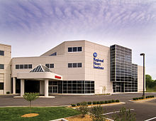
Huntington is home to several medical centers. St. Mary's Medical Center and Cabell Huntington Hospital provide healthcare for Huntington and the surrounding metropolitan area. St. Mary's and Cabell-Huntington are jointly designated as the only trauma center in the region. St. Mary's is home to a regional heart institute, regional cancer center and regional neuroscience center. The Marshall University Medical Center is located at Cabell-Huntington. In addition, the Marshall University Medical School, now known as the Joan C. Edwards School of Medicine in honor of Joan C. Edwards, a major benefactor, has a comprehensive cancer care center. It is also a distinguished leader nationwide for rural health care delivery.
The Huntington Veteran's Administration (VA) Medical Center, located on Spring Valley Drive, is an 80-bed medical and surgical care facility that offers primary inpatient and outpatient care, along with mental health services and subspeciality outpatient options. It is also the primary teaching facility for the Marshall University School of Medicine and is also affiliated with the Pikeville College School of Osteopathic Medicine. In 1993, the Robert C. Byrd Clinical Addition expanded the hospital's surgery, radiology, laboratory, cardiology, nuclear medicine, and rehabilitation services and renovated inpatient care facilities. In 1998, a $10 million research facility was completed[15]
The city is also home to the state's largest psychiatric hospital, Mildred Mitchell-Bateman Hospital.
A banking and commerce center for the area between 1880 and the present, Huntington developed along the river's shore with its 19th-century urban industry. The Chesapeake and Ohio Railroad had its western terminus in Huntington and railroad tracks bifurcate the city today. The railroad was historically the leading Huntington industry, along with coal, railcars, nickel, steel and glass.
Public health issues
A report issued by the Centers for Disease Control August 15, 2008, using survey data from 2006, reported that Huntington is among the unhealthiest cities in America. The survey found that 24.3% of adults 18 years-of-age or older reported themselves as in poor to fair health.[16] The survey also found that 48.1% of residents over 65 years of age in the Huntington-Ashland, West Virginia-Kentucky-Ohio statistical area had all their natural teeth extracted. In addition, the CDC reports that 45.5% of adults over the age of 20 years are obese. 21.6% of adults over 45 years of age reported a diagnosis of coronary heart disease while another 12.7% of adults aged 18 or older reported a diagnosis of diabetes. An Associated Press article describes lifestyle and cultural barriers as obstacles to better public health.[17] As examples, the article describes local eating habits (the number of pizza shops in Huntington alone exceeding the total number of health clubs available in the entire state of West Virginia), the relatively sedentary culture, and poor education as causes for health issues described in the CDC report. In an MSNBC report published November 16, 2008, Huntington was rated as the unhealthiest city in the United States. The study took into consideration obesity rates, toothlessness and levels of healthcare.[18]
Despite the high levels of obesity, the lack of basic dental care, and some of the highest incidents of diabetes and heart disease in the United States, Huntington city leaders have not identified the general unhealthy population as a significant problem. Former Huntington Mayor, David Felinton, has said, referring to the Huntington's public health problems, "It doesn't come up."[19]
As a consequence of Huntington's high rates of obesity, diabetes and coronary heart disease, Huntington was selected by Jamie Oliver to be the location of his television series, Jamie Oliver's Food Revolution.
Economy
Main article: Cityscape of Huntington, West Virginia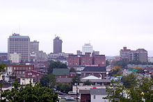 Huntington, as seen from Marshall University.
Huntington has a central business district, located directly south of the Ohio River, east of the Robert C. Byrd Bridge, and west of 11th Street. It has another smaller business district, known as "Old Central City," that is well known for its antique shops. There are several heavy industrial plants that line the Ohio River and the Guyandotte River, but the dominance of Marshall University's research prominence and the growing service sector, especially in the medical field, is reversing the effects of the rust belt that have plagued Huntington for two decades.
The city also has a wealth of architecture, most of it constructed at a time when Huntington was dominated by the Chesapeake and Ohio Railroad and the Baltimore and Ohio Railroad. The city can also lay claim to a new urban renewal stance, brought on by Heritage Village, Pullman Square, and the continued investment in numerous downtown properties. Offshoots of the Pullman Square project include the renovation of many historical structures along 3rd Avenue, a new 9th Street Plaza, and the Old Main Corridor project.[20]
Huntington is also home to Heiner's Bakery. Founded in 1905, Heiner's employs nearly 500 people in its 130,000-square-foot (12,000 m2) facility. The company's products are sold under the Heiner's and Sara Lee names in grocery, retail, and convenience stores.[21]
Huntington is still a base for the metal working and welding trades with the repair of rail road rolling stock, barges, and river boat equipment. Huntington Special Metals, West Virginia Steel, Martin Steel, Huntington Plating, Richwood Industries, Hammers Industries, plus several others. These major fabricating firms serve the railroads, river transportation, steel making, coal, oil, natural gas, electrical, windpower, biofuel, and other important industries.
Neighborhoods
The city is divided into several neighborhoods,[22] including:
- Altizer
- Downtown
- Fairfield
- Guyandotte
- Highlawn
- Southeast Hills
- Southside
- Walnut Hills
- West End/Old Central City
- Westmoreland
Culture
Annual events and fairs
Huntington is home to numerous unique events and fairs held throughout the year.
Name Location Date Comments St. George Greek Festival St. George Greek Orthodox Church 701 11th Ave. Huntington, WV 25701 September 24–26, 2010 A festival with Greek food, music, and dancing.[23] Chilifest Downtown district – 4th Avenue and Plaza September 15–17 State championship is held every year, with chili cooks coming from West Virginia and other states to compete for a berth in the national competition. Tsubasacon Big Sandy Superstore Arena first full weekend in October; 2011 dates are October 7–9 An anime convention featuring guests, a game room, a vendor room, panels, and special events.[24] Guyandotte Civil War Days Guyandotte Early-November This festival features arts and crafts, food, and entertainment.[25] Guyandotte Heritage Days Guyandotte November This historic-themed festival features reenactment of the Confederate raid and the Union reprisal. It features period music, museums, 'living histories', and craft displays. Hilltop Festival Huntington Museum of Art 2nd weekend in September This event offers entertainment, children's activities, a petting zoo, book fair, arts and crafts, and concessions. X-Fest Harris Riverfront Park Within the first 3 weeks of September Rock/alternative music concert that allows local bands to play with bigger bands. Huntington Music & Arts Festival Ritter Park Amphitheater Last Saturday in August Festival centered around local and regional music and visual artists Huntington Dogwood Arts and Crafts Festival Big Sandy Superstore Arena April This features the demonstration and sale of traditional arts and crafts plus specialty ethnic foods. [3] Jazz-MU-Tazz Marshall University June A summer jazz festival, it is a weekend of music that features jazz cabarets, outdoor concerts, and numerous activities. Lions Tri-State Arts & Crafts Festival Big Sandy Superstore Arena 1st weekend in December An old-fashioned arts and crafts fair that includes over 200 exhibitors featuring a variety of arts and crafts and homemade foods and sweets. Old Central City Days Central City district in West Huntington 3rd weekend in June This event offers numerous entertainment and shopping options in addition to the existing stock of storefronts, historic tours, and various food vendors at the new farmers market "depot." Pilot Club of Huntington's Antique Show and Sale Big Sandy Superstore Arena Last complete weekend in September. An antique show and sale that features more than 40 dealers representing more than 10 states and West Virginia. Ritter Park Days Ritter Park Weekends in July and August. Features children-based activities and programs. West Virginia Day Celebration Downtown district – 9th Street Plaza June 20 This features live entertainment, jugglers, food, crafts, and more. St. Patrick's Day Celebration Downtown Huntington March 14 This features live entertainment by musical and dance groups appropriate for St. Patrick's Day. West Virginia Hot Dog Festival Pullman Square district – 3rd Avenue, downtown Huntington Last Saturday in July The WV Hot Dog Festival celebrates the unique variations of local/regional hot dogs Historical structures and museums
Huntington is home to the "Central City" historic district in downtown, and is on the National Register of Historic Places. It is loosely bound by 3rd Ave to the North, 5th Ave to the South, 10th St to the East, and 6th–7th Sts, to the West.
Old Main at Marshall University, sits on Hal Greer Boulevard at 4th Avenue, in the Highlawn District, and is listed on the National Register of Historic Places. The Trustees of Marshall Academy purchased the land at Maple Grove for $40 in 1839. The building has been renovated several times. The 1870 renovation is the earliest section of Old Main to survive to the present.[26]
The Huntington Museum of Art is located in the hills above Ritter Park, featuring numerous collections and exhibitions; it is also home to the C. Fred Edwards Conservatory.
The Museum of Radio and Technology is located near the west end of the park in a renovated elementary school. The Cabell County Courthouse and the Carnegie Library in the downtown also hold historical interests.
The Keith-Albee Theatre, a former Vaudeville palace in the "Art Deco" style from the 1920s, is one of the architectural masterpieces of downtown Huntington, located along 4th Avenue. It is currently being renovated to become one of the state's largest performing arts centers.
One block south, 5th Avenue is noted for its many historical church buildings. The city is also the site of an Adena Native American burial mound.
Traditional "drive-in" restaurants and hot dog stands are popular in the city.
Parks and outdoor attractions
Main article: Recreation in Huntington, West VirginiaSee also: Pink bridgeHuntington is home to eleven parks located in the neighborhoods of Huntington, the most visible being Harris Riverfront Park in the downtown and Ritter Park. Camden Park, an amusement park, is also adjacent to the city. Camden Park is West Virginia's only amusement park. The park has been open since 1903. [27] Pullman Square features many restaurants and shops and a stage for live performances. Huntington is in the process of building the towns first dog park. After trying for years to accrue donations to break ground, Huntington entered and won the Pet Safe Bark For Your Park contest which donated $100,000 to build a local dog park. The ground breaking ceremony was held on August 18, 2011. The dog park will be located on three acres of land connected to Ritter Park and plans to be opened in the summer of 2012. [28]
Sports
Huntington's sports scene is dominated by Marshall University athletics and high school/amateur sports. It was also home to the Huntington Blizzard, an ECHL ice-hockey team that was in existence from 1993 to 2000 at the Big Sandy Superstore Arena, the Huntington Heroes indoor football team in the AIFA from 2006 to 2008, and a succession of minor league baseball teams in the 1990s at St. Cloud Commons.
Starting in 2011, the Huntington Hammer will play at the Big Sandy Superstore Arena as a member of the Ultimate Indoor Football League.
Media
Print
Huntington has one of West Virginia's largest daily circulating newspapers, The Herald-Dispatch, with an average weekday circulation of just over 25,000.[citation needed] The paper is owned by Champion Industries.
Television
Call sign Channel Description WOWK 13 CBS affiliate broadcasting from both Huntington/Charleston WPBY 33–34 West Virginia Public Broadcasting WSAZ 3 NBC affiliate broadcasting from Huntington WCHS 8 ABC affiliated station broadcasting from Charleston. WQCW 30 CW affiliated station from Portsmouth, Ohio. WVAH 11 Fox affiliate broadcasted from Charleston. Radio
- Note: These are the only stations that are licensed to the city of Huntington.
Call sign Frequency Format Description / Notes WMUL 88.1 FM College Radio This is operated by Marshall University. WVPN 89.9 FM NPR West Virginia Public Radio WCMI-FM 92.7 FM Rock 92.7 FM and 98.5 FM, The Planet "The Real Rock Station," Kindred Communications, Huntington, WV WCMI-AM [4] ESPN 1340 AM, WCMI-AM, Kindred Communications, Catlettsburg, KY WDGG 93.7 FM Country Kindred Communications, Huntington, WV WBVB 97.1 FM Greatest Hits B97.1 "The Tri-State's Greatest Hits" WMGA 97.9 FM AC Connoisseur Media; Huntington, WV WKEE 100.5 FM Top 40 100.5 WKEE WRXV 101.5 FM Classic rock 101.5 BOB FM "BOB Plays Everything." WTCR 103.3 FM Country WTCR (AM) 1420/FOX Sports is licensed to Kenova, West Virginia WKLC 105.1 FM Rock Rock 105 "Everything That Rocks." [WAMX-FM] 106.3 FM Rock WEMM-FM 107.9 FM Southern Gospel Southern Gospel/Teaching "Gospel 107.9" WVHU 800 AM News/Talk News Talk 800 & 1600 (simulcast) WRVC (AM) 930 AM/94.1 FM News radio Talk (6 a.m-4 p.m.) ESPN: 4 p.m.-6 a.m. M-F, All weekend Kindred Communications, Huntington, WV. WNBL 1200 AM Southern Gospel Southern Gospel and Patriotic Music Education
 Old Main is the oldest building on Marshall University's campus and home to many of its administrative offices.
The residents of Huntington are served by the Cabell County School System, which includes Huntington High School, Cabell Midland High School, Cabell County Career Technology Center, five middle schools, and 19 elementary schools. Huntington is also home to colleges and universities including Marshall University, Mountwest Community & Technical College, the Robert C. Byrd Institute, the Huntington Junior College, and the Tri-State Institute of Pharmaceutical Sciences [5].
The Cabell County Public Library system operates a main branch downtown and seven branches in neighboring towns.
Infrastructure
Roads
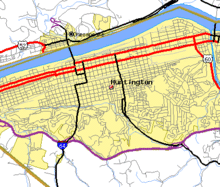
Main article: Roads of Huntington, West VirginiaHuntington is located along Interstate 64, which skirts the city to the south. It has four interchanges that serve the city: US 52 (West Huntington Expressway), WV 152/WV 527, WV 10, and US 60.
US 60, part of the historic Midland Trail, runs through the entire length of Huntington from west to east, cutting through West Huntington, downtown, East Huntington, and along the Guyandotte River. US 52 cuts through West Huntington along the West Huntington Expressway, but its presence is brief. It has an interchange at Madison Avenue and one for US 60.
The city is the northern terminus for WV 10, a scenic highway that follows the Guyandotte River for much of its length and connects Huntington to Princeton. It is also the southern terminus of WV 2, which parallels the entirety of West Virginia's section of the Ohio River, and facilitates much traffic towards Point Pleasant and Parkersburg.
Huntington utilizes a grid-like street pattern featuring several wide boulevard-style avenues that run east and west. Most notable of these are 3rd and 5th Avenues. The city has a numbered street naming system, with avenues running east and west (parallel to the Ohio River) and streets running north and south.
The city has connections over the Ohio River to Proctorville, Ohio via the East Huntington Bridge, and to Chesapeake, Ohio via the Robert C. Byrd Bridge and the West Huntington Bridge.
Rail
See also: Huntington (Amtrak station)Since its founding as the western terminus of the C&O Railroad, Huntington has served as a major break of bulk point between rail traffic and the Ohio River/Mississippi River watershed. Much of the coal mined in southern West Virginia is brought to Huntington by train to be transshipped and then transported by river barges to industrial centers in other parts of the United States. CSX, the successor company to C&O, continues to maintain a regional office, a rail yard, a freight car light repair shop and a locomotive heavy repair facility in the city.[citation needed]
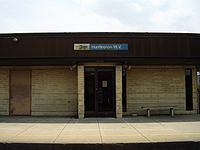
The city was once a hub for passenger rail service in the region, but accounts for a significantly smaller portion of rail traffic than in the early decades of the 20th century. Huntington, however, has an Amtrak station that lies on the Cardinal line running between New York City and Chicago via Washington, D.C. and Cincinnati.[29]
Bus
Tri-State Transit Authority provides fixed-route bus service throughout Huntingon and Ironton, Ohio.
River
The Port of Huntington-Tristate is the largest inland port in the United States in both in terms of total tonnage and ton-miles.[30] This is due in large part to the coal traffic from the railroads and the petroleum products produced by the Marathon Petroleum Company oil refinery in nearby Catlettsburg, Kentucky that use the Port of Huntington/Tri-State to load their products onto barges.
Air
Tri-State Airport, located southwest of the city, is a public airport with two runways. Commercial air service is provided by three airlines: Allegiant Air, Delta Connection and US Airways Express.
Notable people
- "Big Ben" Bowen: a child who raised awareness of childhood cancer
- William C. Campbell: golfer & twice president of the United States Golf Association
- Don Chafin: The sheriff of Logan County, and a commander in the Battle of Blair Mountain
- Justice M. Chambers: Medal of Honor recipient
- Larry Coyer: NFL and college football coach, currently Defensive Coordinator with the Indianapolis Colts
- Dagmar: 1950s television personality
- Brad Dourif: Academy Award-nominated actor
- Joan C. Edwards: singer, entrepreneur
- Delos Carleton Emmons: Lieutenant General, US Army Air Force
- Robert E. Femoyer: Medal of Honor recipient
- David Ginsburg: (1912–2010), presidential adviser and executive director of the Kerner Commission.[31]
- Hal Greer: former professional basketball player
- Jim Grobe: college football coach, currently with Wake Forest University
- Chase Harrison: professional soccer player
- Henry D. Hatfield: former governor of West Virginia
- Hawkshaw Hawkins: Country music singer
- Eloise Hughes Smith: survivor of the RMS Titanic
- Jackie Hunt: College Football Hall of Fame member
- Albert G. Jenkins: Confederate Brigadier General
- Katie Lee Joel: celebrity and television personality
- Craig Johnson: novelist
- Carwood Lipton: WW2 military officer, prominently featured in the book and television series Band of Brothers
- Peter Marshall: actor, singer, television personality and game show host
- O. J. Mayo: Memphis Grizzlies basketball player
- Jeff Morrison: professional tennis player
- Dwight Morrow: businessman, politician and diplomat
- Patrick Patterson: Former University of Kentucky and current Houston Rockets basketball player
- Rick Reed: former major league baseball pitcher
- Soupy Sales: comedian
- Michael W. Smith: singer
- Ruth C. Sullivan: co-founder of Autism Society of America, founder of the Autism Services Center in Huntington
- Jim Thornton: current Wheel of Fortune announcer
- Bill Walker: New York Knicks basketball player.
- Kayla Williams: US gymnast, World Vault Gold Medalist
- Carter G. Woodson: founder of Black History Month
- Steve Yeager: former major league baseball catcher
See also
References
- ^ a b "American FactFinder". United States Census Bureau. http://factfinder.census.gov. Retrieved 2008-01-31.
- ^ "US Board on Geographic Names". United States Geological Survey. 2007-10-25. http://geonames.usgs.gov. Retrieved 2008-01-31.
- ^ a b "Find a County". National Association of Counties. http://www.naco.org/Counties/Pages/FindACounty.aspx. Retrieved 2011-06-07.
- ^ Annual Estimates of the Population for Incorporated Places in West Virginia, Listed Alphabetically: April 1, 2000 to July 1, 2009.. Retrieved 2008-07-09.
- ^ a b City of Huntington. "Huntington History". http://www.cityofhuntington.com/pages/history.html.
- ^ "Carter G. Woodson Birthplace, Buckingham County". Xroads.virginia.edu. April 3, 1950. http://xroads.virginia.edu/~MA04/kane/thesis/cgwbirthplace.htm. Retrieved January 24, 2011.
- ^ "Douglass High School". Marshall.edu. http://www.marshall.edu/orahist/douglass.html. Retrieved January 24, 2011.
- ^ Marshall University Admissions. "Admissions frequently asked questions". http://www.marshall.edu/admissions/faq.htm. Retrieved June 15, 2006.
- ^ "Charleston-Huntington Climate Summary – Eyewitness News Storm Team Weather". Wchstv.com. http://www.wchstv.com/newsroom/wx/climatesummary.shtml. Retrieved January 24, 2011.
- ^ "Monthly Averages for Huntington, WV – Temperature and Precipitation". The Weather Channel. http://www.weather.com/outlook/health/fitness/wxclimatology/monthly/USWV0358. Retrieved July 26, 2011.
- ^ "Climatography of the United States No. 20 (1971–2000)" (PDF). National Oceanic and Atmospheric Administration. 2004. http://cdo.ncdc.noaa.gov/climatenormals/clim20/va/448906.pdf. Retrieved February 14, 2010.
- ^ The Associated Press (March 27, 2006). "Huntington Charter". http://wowktv.com/story.cfm?func=viewstory&storyid=9721. Retrieved June 15, 2006.
- ^ "Incumbent Felinton wins tight race", The Herald-Dispatch, May 13, 2008.
- ^ Clerk of Cabell County (November 4, 2008). "2008 Cabell County Election Results". http://www.huntingtonnews.net/local/el45.html. Retrieved February 2, 2009.
- ^ "Huntington VA Medical Center." Department of Veteran Affairs. Oct 2. 2006 [1].
- ^ Surveillance of Certain Health Behaviors and Conditions Among States and Selected Local Areas --- Behavioral Risk Factor Surveillance System (BRFSS), United States, 2006 [2]
- ^ W. Virginia town shrugs at poorest health ranking[dead link]
- ^ "W. Virginia town shrugs at being fattest city - Health - Health care - msnbc.com". MSNBC. November 17, 2008. http://www.msnbc.msn.com/id/27697364/. Retrieved January 24, 2011.
- ^ "W. Virginia town shrugs at being fattest city - Health - Health care - msnbc.com". MSNBC. November 17, 2008. http://www.msnbc.msn.com/id/27697364/. Retrieved January 24, 2011.
- ^ "Huntington: Economy – Major Industries and Commercial Activity". City-data.com. http://www.city-data.com/us-cities/The-South/Huntington-Economy.html. Retrieved January 24, 2011.
- ^ Heiner's Bakery. "About Us". http://www.heinersbakery.com/about.html.
- ^ City of Huntington. "Touring Huntington". http://www.cityofhuntington.com/pages/tour-home.html.
- ^ "St. George Orthodox Church". Stgeorgehwv.org. http://www.stgeorgehwv.org/festival. Retrieved January 24, 2011.
- ^ "Tsubasacon 2011 – October 7,8,9". Tsubasacon.org. http://www.tsubasacon.org/. Retrieved January 24, 2011.
- ^ "Guyandotte Civil War Days". Web.archive.org. Archived from the original on April 25, 2005. http://web.archive.org/web/20050425101455/http://www.geocities.com/guyandottecwdays/home.html. Retrieved January 24, 2011.
- ^ Marshall University. "Old Main History". http://www.marshall.edu/library/speccoll/virtual_museum/old_main/history.asp.
- ^ http://www.camdenpark.com/
- ^ http://www.barkforyourpark.com/
- ^ Amtrak. "Cardinal/Hoosier State". http://www.amtrak.com/servlet/ContentServer?pagename=Amtrak/am2Route/Horizontal_Route_Page&c=am2Route&cid=1081256321680&ssid=134. Retrieved June 17, 2006.
- ^ Waterborne Commerce Statistics Center. "Top twenty inland ports for 2003". http://www.iwr.usace.army.mil/ndc/wcsc/pdf/inlandport03f.pdf. Retrieved June 17, 2006.
- ^ Grimes, William. "David Ginsburg, Longtime Washington Insider, Dies at 98", The New York Times, May 25, 2010. Retrieved June 1, 2010.
External links
- City of Huntington
- [6]
- Cabell-Huntington Convention and Visitors Bureau
- Marshall University
- The Greater Huntington Park and Recreation District
- U.S. Army Corps of Engineers – Huntington District
- Huntington during the 1937 flood
- Huntington Data
- Huntington Junior College
Coordinates: 38°24′47″N 82°26′01″W / 38.413033°N 82.433642°W
Articles related to Huntington City of Huntington Topics Cityscape • Culture • Economy • Education • Geography • Government • History • Media • People • Recreation • Transportation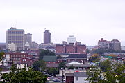
Top subjects Neighborhoods Altizer • Downtown • Fairfield • Guyandotte • Highlawn • Southeast Hills • Southside • Walnut Hills • West End/Old Central City • WestmorelandSuburbs Municipalities and communities of Cabell County, West Virginia County seat: HuntingtonCity Huntington‡
Town Village CDPs Other
communitiesFootnotes ‡This populated place also has portions in an adjacent county or counties
Municipalities and communities of Wayne County, West Virginia Cities Towns CDPs Unincorporated
communitiesArdel | Armilda | Bethesda | Booton | Bowen | Brabant | Buffalo Creek | Centerville | Coleman | Cove Gap | Crockett | Cyrus | Dickson | Doane | Dunlow | East Lynn | Echo | Effie | Elmwood | Ferguson | Fleming | Genoa | Gilkerson | Girard | Glenhayes | Grandview Gardens | Hidden Valley | Hubbardstown | Kiahsville | Mineral Springs | Missouri Branch | Neal | Nestlow | Oakview Heights | Quaker | Radnor | Saltpetre | Shoals | Sidney | Stepptown | Stiltner | Stonecoal | Sweet Run | Tripp | Webb | Westmoreland | Wilsondale | Winslow
Footnotes ‡This populated place also has portions in an adjacent county or counties
Huntington–Ashland, WV–KY–OH, Metropolitan Statistical Area Principal cities 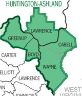
Municipalities with population
over 5,000Municipalities with population
1,000-5,000Barboursville • Burlington • Catlettsburg • Ceredo • Coal Grove • Culloden CDP • Greenup • Kenova • Milton • Raceland • Russell • South Point • South Shore • Wayne • Westwood CDP • Worthington • WurtlandMunicipalities with population
under 1,000West Virginia counties Kentucky counties Ohio counties Categories:- Cities in West Virginia
- County seats in West Virginia
- Populated places in Cabell County, West Virginia
- Guyandotte River
- Huntington, West Virginia
- West Virginia populated places on the Ohio River
- University towns in the United States
- Populated places in Wayne County, West Virginia
- Huntington–Ashland metropolitan area
Wikimedia Foundation. 2010.


