- Flatwoods, Kentucky
Infobox Settlement
imagesize =
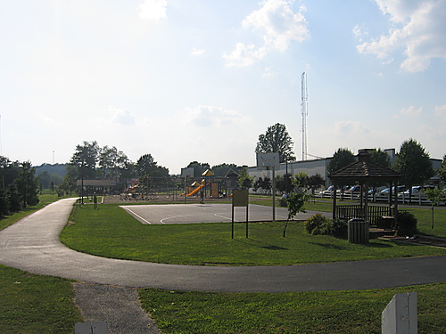
image_caption = B.F. Crager Park in Flatwoods.
official_name = City of Flatwoods, Kentucky
settlement_type =City
nickname = Good Neighbor Community
website = http://www.flatwoodsky.org |right|Location of Flatwoods, Kentucky
mapsize = 250px
map_caption = Location in the state ofKentucky
mapsize1 =
map_caption1 =
subdivision_type = Country
subdivision_type1 = State
subdivision_type2 = County
subdivision_name =United States
subdivision_name1 =Kentucky
subdivision_name2 = Greenup
government_type =
leader_title =Mayor
leader_name =Robert "Bobby" F. Crager (D)
area_footnotes =
established_date =
area_magnitude = 1 E8
area_total_km2 = 11.6
area_land_km2 = 11.6
area_water_km2 = 0
area_total_sq_mi = 4.5
area_land_sq_mi = 4.5
area_water_sq_mi = 0.0
elevation_m = 208
elevation_ft = 682
latd = 38 |latm = 31 |lats = 23 |latNS = N
longd = 82 |longm = 43 |longs = 10 |longEW = W
population_as_of = 2000
population_note =
population_total = 7605
timezone = EST
utc_offset = -5
timezone_DST = EDT
utc_offset_DST = -4
latitude = 38°31′23″N
longitude = 82°43′10″W
postal_code_type =ZIP code
postal_code = 41139
area_code = 606
blank_name = FIPS code
blank_info = 21-27802
blank1_name = GNIS feature ID
blank1_info = 0492225
footnotes =Flatwoods is a city in Greenup County,
Kentucky ,United States . The population was 7,605 at the 2000 census. Bobby F. Crager is the city's mayor. Flatwoods is a part of theHuntington-Ashland, WV-KY-OH, Metropolitan Statistical Area (MSA). As of the 2000 census, the MSA had a population of 288,649.Locally, Flatwoods is considered to be a "
bedroom community ", as it has no large employer within the city. Many residents work forCSX Transportation , AK Steel,Marathon Oil ,King's Daughters Medical Center , or [http://www.olbh.com Our Lady of Bellefonte Hospital] . There are five institutions of higher education located within 30-40 minutes of Flatwoods. TheOhio University Southern Campus ,Marshall University ,Kentucky Christian University ,Ashland Community and Technical College and,Shawnee State University .History
Flatwoods was originally named Advance; Advance Methodist Church formed a Sunday school beginning in 1860. The name was later changed to Cheap, after
John Cheap , a blind Methodist minister. The City returned to the name of Advance with a post office established in 1918. In 1938, the Post Office was renamed Flatwoods, and the town was incorporated in 1938 under that name. Flatwoods is named for the areas original topography, a belt of flat wooded land, approximately 650 feet in elevation, running parallel to theOhio River .Points of Interest
*The Oaks - an 18 hole public golf course.
*Greenbo Lake State Resort Park is located within 25 minutes of Flatwoods.
Education
The majority of the city sits within the [http://www.russell-ind.k12.ky.us/ Russell Independent School District] , which also includes the cities of Russell and Bellefonte. The main campus for the district, which includes Russell High School, Russell Middle School, Russell Primary School and the Russell Area Technology Center, sits on the Russell/Flatwoods city line (the school's mailing addresses are Russell but they primarily receive police and fire protection from Flatwoods). In addition, one school, Russell-McDowell Intermediate School, sits firmly within the Flatwoods city limits.
In addition, a small section of Flatwoods is in the [http://www.raceland.k12.ky.us Raceland-Worthington Independent School District] .
Notable People
*
Billy Ray Cyrus ,country music artist andtelevision actor
*Ron Cyrus , longtime member of theKentucky House of Representatives and father of Billy Ray Cyrus
*Lynndie England , participant in theAbu Graib prison torture scandal
*Larry Pancake,country music artist and local television actor
* Doug Little who wrote the number one Christian song King of Kings, sung bythe Rambos .Geography
Flatwoods is located at coor dms|38|31|23|N|82|43|10|W|city (38.522992, -82.719556)GR|1.
According to the
United States Census Bureau , the city has a total area of 4.5square mile s (11.6km² ), all of it land.Demographics
As of the
census GR|2 of 2000, there were 7,605 people, 3,114 households, and 2,282 families residing in the city. Thepopulation density was 1,691.9 people per square mile (654.0/km²). There were 3,338 housing units at an average density of 742.6/sq mi (287.0/km²). The racial makeup of the city was 98.19% White, 0.38% African American, 0.20% Native American, 0.36% Asian, 0.30% from other races, and 0.58% from two or more races. Hispanic or Latino of any race were 0.58% of the population.There were 3,114 households out of which 31.3% had children under the age of 18 living with them, 58.0% were married couples living together, 12.6% had a female householder with no husband present, and 26.7% were non-families. 24.1% of all households were made up of individuals and 11.3% had someone living alone who was 65 years of age or older. The average household size was 2.41 and the average family size was 2.85.
In the city the population was spread out with 23.0% under the age of 18, 7.7% from 18 to 24, 28.0% from 25 to 44, 25.0% from 45 to 64, and 16.3% who were 65 years of age or older. The median age was 40 years. For every 100 females there were 87.5 males. For every 100 females age 18 and over, there were 82.1 males.
The median income for a household in the city was $31,115, and the median income for a family was $39,023. Males had a median income of $36,184 versus $20,904 for females. The
per capita income for the city was $17,633. About 9.7% of families and 11.6% of the population were below thepoverty line , including 12.0% of those under age 18 and 10.3% of those age 65 or over.References
External links
* [http://www.ashlandalliance.com/ Chamber of Commerce]
* [http://www.tourgreenupcounty.com/ Greenup County Tourism Commission]
Wikimedia Foundation. 2010.