- Ceredo, West Virginia
-
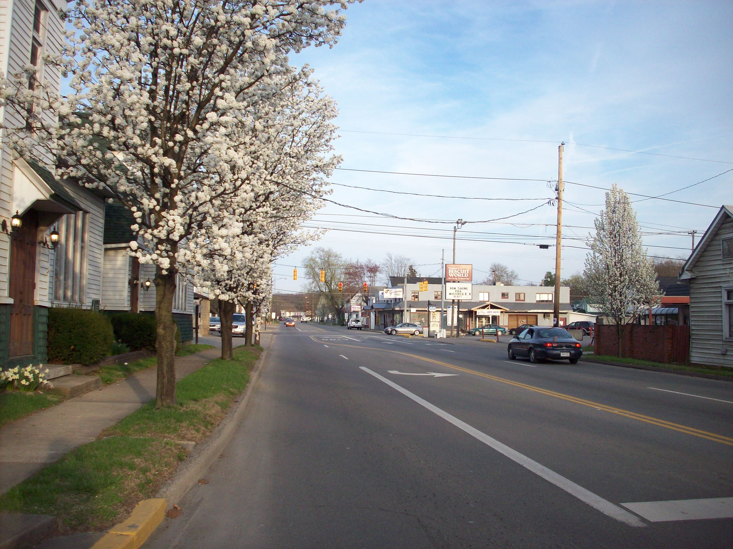
Ceredo, West Virginia — City — Looking east along U.S. Route 60 from C Street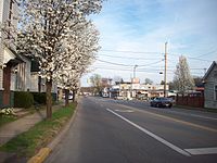 Location of Ceredo, West Virginia
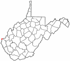
Coordinates: 38°23′36″N 82°33′37″W / 38.39333°N 82.56028°WCoordinates: 38°23′36″N 82°33′37″W / 38.39333°N 82.56028°W Country United States State West Virginia County Wayne Area - Total 2.0 sq mi (5.2 km2) - Land 1.3 sq mi (3.5 km2) - Water 0.7 sq mi (1.8 km2) Elevation 551 ft (168 m) Population (2000) - Total 1,675 - Density 1,246.5/sq mi (481.3/km2) Time zone Eastern (EST) (UTC-5) - Summer (DST) EDT (UTC-4) ZIP code 25507 Area code(s) 304 FIPS code 54-14308[1] GNIS feature ID 1537176[2] 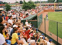 Residents of Ceredo enjoying a Little League Baseball game.
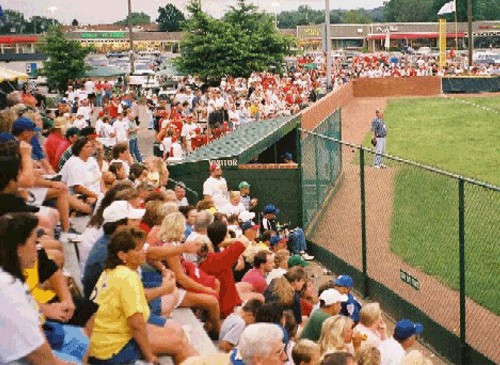
Ceredo is a city in Wayne County, West Virginia, along the Ohio River. The population was 1,675 at the 2000 census. Ceredo is a part of the Huntington-Ashland, WV-KY-OH, Metropolitan Statistical Area (MSA). As of the 2000 census, the MSA had a population of 288,649.
The city is also near the location of the Southern Airways Flight 932 aviation disaster. On November 14, 1970, a McDonnell Douglas DC-9 airplane carrying the Marshall University football team crashed on a hillside on approach to the Tri-State Airport, killing all on board. A movie about the tragedy, We Are Marshall, was released in 2006.
Contents
Geography
Ceredo is located at 38°23′36″N 82°33′37″W / 38.39333°N 82.56028°W (38.393406, -82.560246)[3].
According to the United States Census Bureau, the city has a total area of 2.0 square miles (5.2 km²), of which, 1.3 square miles (3.5 km²) of it is land and 0.7 square miles (1.8 km²) of it (33.66%) is water.
Demographics
As of the census[1] of 2000, there were 1,675 people, 821 households, and 466 families residing in the city. The population density was 1,246.5 people per square mile (482.6/km²). There were 888 housing units at an average density of 660.8 per square mile (255.9/km²). The racial makeup of the city was 97.73% White, 0.06% Native American, 0.78% Asian, 0.12% Pacific Islander, 0.30% from other races, and 1.01% from two or more races. Hispanic or Latino of any race were 0.90% of the population.
There were 821 households out of which 19.0% had children under the age of 18 living with them, 43.8% were married couples living together, 10.5% had a female householder with no husband present, and 43.2% were non-families. 41.0% of all households were made up of individuals and 23.6% had someone living alone who was 65 years of age or older. The average household size was 2.01 and the average family size was 2.69.
In the city the population was spread out with 17.9% under the age of 18, 7.7% from 18 to 24, 22.7% from 25 to 44, 25.6% from 45 to 64, and 26.1% who were 65 years of age or older. The median age was 46 years. For every 100 females there were 73.0 males. For every 100 females age 18 and over, there were 68.6 males.
The median income for a household in the city was $24,323, and the median income for a family was $33,700. Males had a median income of $30,735 versus $21,615 for females. The per capita income for the city was $14,733. About 10.4% of families and 15.0% of the population were below the poverty line, including 9.0% of those under age 18 and 13.6% of those age 65 or over.
History
Abolitionists founded Ceredo to demonstrate the superiority of an economic system not based on slave labor. Eli Thayer, an abolitionist congressman from Massachusetts, believed that bringing abolitionists like himself into southern states could ultimately bring about the end of slavery. While some welcomed the newcomers, several area newspapers published opinions against this "invasion." The newspaper of nearby Ashland, Kentucky, however, supported this move. By 1857, the city was fully established with a newspaper of its own and several industries.
With John Brown's raid at Harpers Ferry in 1859 and the outbreak of the Civil War in 1861, the situation for this abolitionist colony appeared bleak. Its purpose to bring about the peaceful end of slavery over, several residents volunteered for pro-Union regiments.
The Z. D. Ramsdell House was listed on the National Register of Historic Places in 1983.[4]
Famous residents
- Dagmar, TV star of the 1950s lived in Ceredo in the 1990s
- Beau Smith, comic book writer, publicist, columnist
- James Dixon Williams - Hollywood movie pioneer and co-founder of First National Pictures was born in Ceredo about 1877
See also
References
- ^ a b "American FactFinder". United States Census Bureau. http://factfinder.census.gov. Retrieved 2008-01-31.
- ^ "US Board on Geographic Names". United States Geological Survey. 2007-10-25. http://geonames.usgs.gov. Retrieved 2008-01-31.
- ^ "US Gazetteer files: 2010, 2000, and 1990". United States Census Bureau. 2011-02-12. http://www.census.gov/geo/www/gazetteer/gazette.html. Retrieved 2011-04-23.
- ^ "National Register Information System". National Register of Historic Places. National Park Service. 2009-03-13. http://nrhp.focus.nps.gov/natreg/docs/All_Data.html.
External links
- Town of Ceredo - official site
Municipalities and communities of Wayne County, West Virginia Cities Ceredo | Huntington‡ | Kenova
Towns CDPs Unincorporated
communitiesArdel | Armilda | Bethesda | Booton | Bowen | Brabant | Buffalo Creek | Centerville | Coleman | Cove Gap | Crockett | Cyrus | Dickson | Doane | Dunlow | East Lynn | Echo | Effie | Elmwood | Ferguson | Fleming | Genoa | Gilkerson | Girard | Glenhayes | Grandview Gardens | Hidden Valley | Hubbardstown | Kiahsville | Mineral Springs | Missouri Branch | Neal | Nestlow | Oakview Heights | Quaker | Radnor | Saltpetre | Shoals | Sidney | Stepptown | Stiltner | Stonecoal | Sweet Run | Tripp | Webb | Westmoreland | Wilsondale | Winslow
Footnotes ‡This populated place also has portions in an adjacent county or counties
Huntington–Ashland, WV–KY–OH, Metropolitan Statistical Area Principal cities 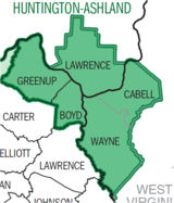
Municipalities with population
over 5,000Municipalities with population
1,000-5,000Barboursville • Burlington • Catlettsburg • Ceredo • Coal Grove • Culloden CDP • Greenup • Kenova • Milton • Raceland • Russell • South Point • South Shore • Wayne • Westwood CDP • Worthington • WurtlandMunicipalities with population
under 1,000West Virginia counties Kentucky counties Ohio counties Categories:- Cities in West Virginia
- Populated places in Wayne County, West Virginia
- Huntington–Ashland metropolitan area


Wikimedia Foundation. 2010.