- Buckhannon, West Virginia
Infobox Settlement
official_name = Buckhannon, West Virginia
settlement_type =City
nickname =
motto =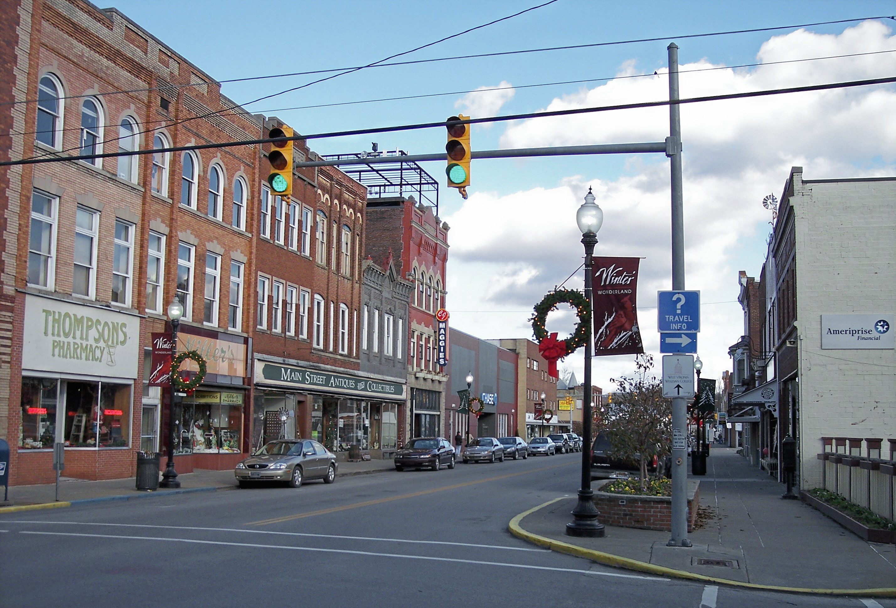
imagesize = 250px
image_caption = East Main Street in Buckhannon in 2006
image_
mapsize = 250px
map_caption = Location of Buckhannon, West Virginia
mapsize1 =
map_caption1 =subdivision_type = Country
subdivision_name =United States
subdivision_type1 = State
subdivision_name1 =West Virginia
subdivision_type2 = County
subdivision_name2 = Upshurgovernment_footnotes =
government_type =
leader_title =
leader_name =
leader_title1 =
leader_name1 =
established_title =
established_date =unit_pref = Imperial
area_footnotes =
area_magnitude =
area_total_km2 = 6.4
area_land_km2 = 6.4
area_water_km2 = 0.0
area_total_sq_mi = 2.5
area_land_sq_mi = 2.5
area_water_sq_mi = 0.0population_as_of = 2000
population_footnotes =
population_total = 5725
population_density_km2 = 893.5
population_density_sq_mi = 2314.2timezone = Eastern (EST)
utc_offset = -5
timezone_DST = EDT
utc_offset_DST = -4
elevation_footnotes =
elevation_m = 436
elevation_ft = 1430
latd = 38 |latm = 59 |lats = 21 |latNS = N
longd = 80 |longm = 13 |longs = 27 |longEW = Wpostal_code_type =
ZIP code
postal_code = 26201
area_code = 304
blank_name = FIPS code
blank_info = 54-11188GR|2
blank1_name = GNIS feature ID
blank1_info = 1536594GR|3
website =
footnotes =Buckhannon is the only incorporated city in and the
county seat of Upshur County,West Virginia ,United States ,GR|6 and is located along theBuckhannon River . The population was 5,725 at the 2000 census. Buckhannon is home toWest Virginia Wesleyan College and the West VirginiaStrawberry Festival , held annually on the third week of May. The city is located 115 miles northeast from the capital city of Charleston and 140 miles south ofPittsburgh, Pennsylvania . Buckhannon is also home of the Sago Mine Tragedy that happened on January 2, 2006, resulting in the deaths of 12 of 13 trapped miners.Geography
The city lies in the foothills of the
Allegheny Mountains . The elevation at the county courthouse is 1,432 feet above sea level. Buckhannon is located at coor dms|38|59|21|N|80|13|27|W|city (38.989237, -80.224254)GR|1.According to the
United States Census Bureau , the city has a total area of 2.5square mile s (6.4km² ), all of it land.Demographics
As of the
census GR|2 of 2000, there were 5,725 people, 2,159 households, and 1,180 families residing in the city. Thepopulation density was 2,314.2 people per square mile (894.9/km²). There were 2,424 housing units at an average density of 979.8/sq mi (378.9/km²). The racial makeup of the city was 96.16% White, 2.01% African American, 0.10% Native American, 0.84% Asian, 0.02% Pacific Islander, 0.28% from other races, and 0.59% from two or more races. Hispanic or Latino of any race were 0.96% of the population.There were 2,159 households out of which 22.6% had children under the age of 18 living with them, 41.1% were married couples living together, 10.9% had a female householder with no husband present, and 45.3% were non-families. 40.0% of all households were made up of individuals and 19.1% had someone living alone who was 65 years of age or older. The average household size was 2.08 and the average family size was 2.78.
In the city the population was spread out with 15.5% under the age of 18, 28.1% from 18 to 24, 19.2% from 25 to 44, 19.8% from 45 to 64, and 17.4% who were 65 years of age or older. The median age was 31 years. For every 100 females there were 81.3 males. For every 100 females age 18 and over, there were 78.4 males.
The median income for a household in the city was $23,421, and the median income for a family was $36,975. Males had a median income of $30,691 versus $18,041 for females. The
per capita income for the city was $12,959. About 15.8% of families and 24.8% of the population were below thepoverty line , including 32.7% of those under age 18 and 11.2% of those age 65 or over.Name
Buckhannon was supposedly named by local white settlers for
Buckongahelas , a renowned chief and commander of theLenape during theNorthwest Indian War and theAmerican Revolution . Many years prior to these conflicts, his favorite hunting grounds were located near the present site of the city. The name Buckongahelas was widely misspoken by these Anglo-Saxon settlers as "Buckongehanon". The name was further anglicized to its present form of "Buckhannon". [http://www.buchamber.com/history_template.php?page_name=buckongahelas&page_type=resident]History
The history of Upshur County begins with the initial discovery and settling of the Buckhannon River Valley. Englishmen brothers
Samuel and John Pringle were soldiers serving in theFrench and Indian War . In 1761, they decided to abandon their post atFort Pitt (present-day Pittsburgh, Pennsylvania). They traveled southward and upstream along theMonongahela River andTygart Valley River . When they came upon a fork in the latter river, they took the right-hand-side river that branched into the main river. This junction is located at the mouth of the Buckhannon River.The two brothers arrived in present-day Upshur County in 1764. They took up shelter and residence in an eleven-foot-deep cavity in a once-towering
American sycamore . The hollow of this botanical giant was made their sole dwelling for about three years. This Sycamore, known as "The Pringle Tree", is now a third-generation tree. It stands beside a stream named Turkey Run in a meadow beside the Buckhannon River. While living in this naturally beautiful river valley, the Pringle brothers survived frigid winters. They hunted rabbits, turkey, the once-plentifulAmerican Bison , and fish-notably trout. They also skillfully avoided prowling timber wolves. It is written that Samuel survived hunting experiences with anAmerican black bear and later aMountain Lion .In the Autumn of 1767, their ammunition was running dangerously low; two charges of powder more exactly. Although they feared capture and incarceration for desertion, it was John whom finally decided to return for supplies. The closest settlements to their newfound home were on the South Branch Potomac River or Wappatomaka, located north-easterly about two hundred miles away. When he eventually returned to the Sycamore, he brought back news that neither man was wanted by any military authorities. Peace had been declared between the two warring parties and the brothers could safely return to the nearest civilization.
The Pringle Brothers decided to leave the river valley and move to the South Branch settlements. John never returned to resettle at the Sycamore, but later made a home in the Commonwealth of
Kentucky instead. Samuel returned with his wife Mrs. Charity Pringle (née Cutright). Settlers accompanying them include John Cutright, Jr.- (Charity's brother), Thomas Hughes, John and Elizabeth Jackson, and their sons George and Edward Jackson. A permanent settlement was finally established by 1770 including the fortified structure known as Bush's Fort.The City of Buckhannon was established on Monday
January 15 ,1816 and chartered by theVirginia General Assembly in 1852. Buckhannon was part of the Commonwealth ofVirginia until the secession of West Virginia into its own state onJune 20 ,1863 during theAmerican Civil War . The town was incorporated by Act of theWest Virginia Legislature on ThursdayMarch 9 ,1933 . The first courthouse was built in 1854. As the only meeting place in town, it also served as an opera house and town hall. Electricity was installed in 1891 replacing oil lamps. The building suffered fire damage in its first six months. It was razed in 1898. In its place, a Classical Revival style courthouse, designed by Charleston architectHarrison Albright , was begun in 1899 and completed in 1901. It is still in use today. An annex of the same style was added in 1995. In the cornerstone of the main building is a time capsule filled with turn of the 19th century artifacts.
* http://members.citynet.net/warner/upshur.html* "Images of America: Upshur County" by The Upshur County Historical Society, pages 07, 09, and 10.
* "The Scout of the Buckongehanon", by John Camillus McWhorter, pages 32 - 41, 48 - 49.
Crime
* Buckhannon has very rare murders or extreme disputes, but almost leads West Virginia in theft, trespassing, assault, underage drink or drug use, methamphetamine lab busts, and other crimes.
* "Buckhannon-Upshur Middle School" and "Buckhannon-Upshur High School" have gotten at least 8 code reds since November 2004. Another crimes have been 22 caliber shells being found in the High School, fake 911 school shooting calls, and bomb threats.
Tragedies
* One notable tragedy is the
Sago Mine Disaster which killed 12 and left one survivor after what authorities say was alightning strike in thecoal which lead to an explosion. It was the worstmining disaster in the US since a 2001 disaster inAlabama killed 13 people, and the worst disaster in West Virginia since a 1968 incident that killed 78 people. National and International News crews were in the area for about three to four days.*2008 studies show that
West Virginia leads the nation as Buckhannon leads West Virginia in fatal accidents from the ages of 15-21. Buckhannon has had at least 7 die that went or just graduated from Buckhannon-Upshur High School.Politics and Notoriety
* Upshur County and its County Seat have been a Republican majority since the days of the
American Civil War . Citizens during this era were staunch supporters of the Republic then led by PresidentAbraham Lincoln . Their local militias and soldiers served on the side of the Union.
* One ofStonewall Jackson 's sisters, Laura Ann Jackson Arnold, was later a resident of Buckhannon. "Her true sympathy always was with the North, much to the dismay of her brother."
*Stonewall Jackson's grandparents were some of the first residents of Buckhannon.
* The present-day City of Buckhannon was the first permanent settlement betweenFort Pitt (Pennsylvania) and theGulf of Mexico .
* The city motto is "The Promise of Tomorrow with the Dignity of Yesterday."
* Buckhannon is noted for having many of West Virginia's private-citizen millionaires living in its City and dispersed throughout Upshur County.
* Buckhannon has a net worth of more than 500 million dollars.
* The name Buckhannon became well-known in legal circles after a landmark 2001 U.S. Supreme Court case named [http://www.law.cornell.edu/supct/html/99-1848.ZO.html "Buckhannon Board and Care Home v. West Virginia Department of Health and Human Resources"] . ["Images of America: Upshur County" by The Upshur County Historical Society, page 37.] [ [http://www.city-data.com/city/Buckhannon-West-Virginia.html Buckhannon, West Virginia (WV) Detailed Profile - relocation, real estate, travel, jobs, hospitals, schools, crime, news, sex offenders ] ]Government
Charter of the City of Buckhannon:
* http://host.ci.buckhannon.wv.us/site/Forms_files/charter.pdfThe City of Buckhannon is under a
Mayor-council government system.The Mayor of the City of Buckhannon serves as a "Strong Mayor" with aCity Council made up of himself, the City Recorder, and five council members. The election of the Mayor occurs every four years in the same year as the presidential elections. By law, the City Recorder succeeds to the Office of Mayor acting as the Chief Executive in the event of the sitting Mayor's death or vacancy. The City Recorder also administers the Mayoral Oath of Office.The City Council of the City of Buckhannon-
* Kenny Davidson- Mayor of the City of Buckhannon
* Nancy C. Shobe- City Recorder and City Treasurer
* M. Keith Queen- City Councilman
* Pamela M. Cuppari- City Councilwoman
* Jerry Henderson- City Councilwoman
* Elizabeth Lee- City CouncilmanEducation
The institutions of public primary and secondary learning serving the community of Buckhannon are operated by Upshur County Schools.
* Upshur County Board of Education, http://boe.wvlink.com/upshurschools/, news and events with current links to all public, county schools (K-12).
* West Virginia Wesleyan College, http://www.wvwc.edu/, is a private institution of higher education situated within the City of Buckhannon in a picturesque, sylvan setting.
Notable natives
*
Jayne Anne Phillips (b. 1952), novelist and short story writer
*Stephen Coonts (b. 1946), novelist
*Chris Wallace , general manager of theMemphis Grizzlies ee also
*
Sago Mine disaster (January 2006)
*West Virginia
*Gangs
*Coal Mining
*Skateboarding
*Rednecks References
External links
* [http://www.ci.buckhannon.wv.us/ City of Buckhannon website]
* [http://www.buchamber.com/ Buckhannon-Upshur Chamber of Commerce]
* [http://www.upshurda.com/ Upshur County Development Authority]
* [http://www.wvstrawberryfestival.com/ West Virginia Strawberry Festival]
* [http://www.therecorddelta.com/ The Record Delta newspaper]
* [http://members.citynet.net/warner/upshur.html]
Wikimedia Foundation. 2010.