- U.S. Route 52
-
U.S. Route 52
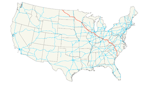
Route information Length: 2,072 mi[1] (3,335 km) Existed: 1926[1] – present Major junctions West end: Hwy 39 at Portal, ND  I-29 in Fargo, ND
 I-35W in Minneapolis, MN
 I-35E in St. Paul, MN
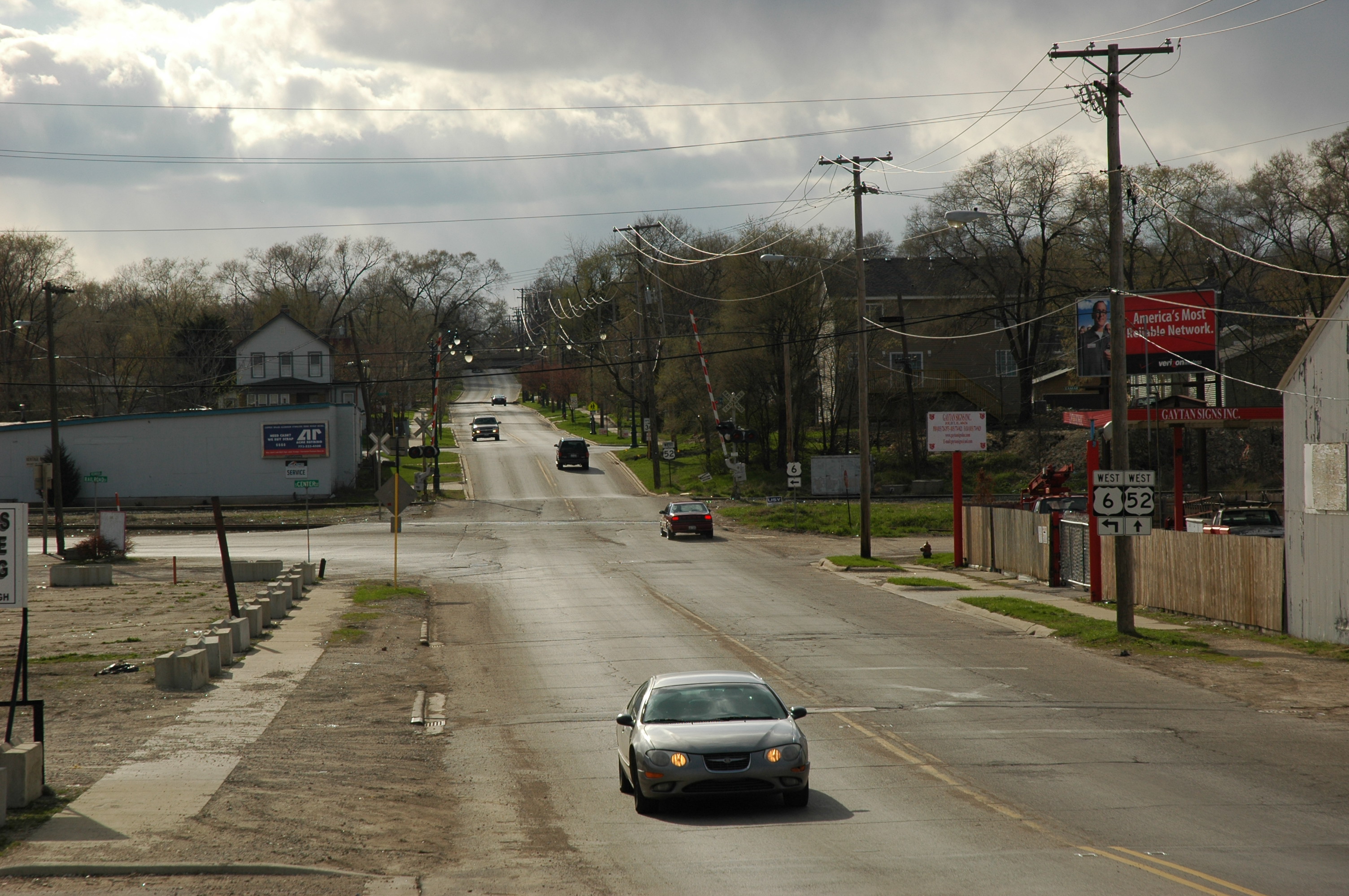
 I-80 at Joliet, IL


 I-65 / I-69 / I-70 in Indianapolis, IN

 I-74 / I-75 in Cincinnati, OH
 I-64 at Huntington, WV

 I-77 / I-81 near Wytheville, VA
 I-40 in Winston-Salem, NC
 I-95 near Florence, SC
South end: Line Street in Charleston, SC Highway system United States Numbered Highways
List • Bannered • Divided • ReplacedU.S. Route 52 is a United States highway that runs across the northern, eastern and southeastern regions of the United States. Contrary to most other even-numbered U.S. Highways, US 52 primarily follows a northwest-southeast route, and is signed north–south or east–west depending on the local orientation of the route.
The highway's northwestern terminus is at Portal, North Dakota, on the Canadian border, where it continues as Saskatchewan Highway 39. The southeastern terminus of US 52 is in Charleston, South Carolina, at Number 2 Meeting Street and White Point Gardens along the Charleston Harbor.
US 52 is one of five U.S. highways to cross the Mississippi River more than once. It crosses the river three times: at Minneapolis via the Dartmouth Bridge, at St. Paul by the Lafayette Bridge, and between Iowa and Illinois by the Savanna–Sabula Bridge. The others are U.S. Route 61, which crosses the Mississippi four times, U.S. Route 169, which crosses three times, and U.S. Route 2 and U.S. Route 67, which each cross twice.
Contents
Route description
Lengths mi km SC 161 259 NC 153 169.5 VA 85 137 KY WV 186 299 OH 190 IN IL IA 164 264 MN 377 607 ND 361 581 Total 2,072 3,335 North Dakota
In North Dakota, US 52 continues from Highway 39 from the Canada-United States border at North Portal, Saskatchewan and Portal, North Dakota to the Red River in Fargo, a distance of 361 miles (581 km). US 52 passes through Burke, Ward, McHenry, Pierce, Sheridan, Wells, Foster, Stutsman, Barnes, and Cass counties.
US 52 is a two-lane highway in most areas, except for four lane segments between Burlington and Minot, Jamestown and Buchanan, and Jamestown and Fargo. Some segments in Fargo are six lanes.
US 52 is co-signed with US 2 near Minot, where it also intersects with US 83. US 52 is also co-signed with US 281 for 44 miles (71 km) between Jamestown and Carrington. US 52/US 281 in Jamestown is on sign different streets. Include 5th Street NW to 1st Ave, and to west bus loop. The former US 52 route was assign to 10th street SE, 12th Ave SE, and 14th Street SE cosigned with Business Loop 94. The 93.5 miles (150 km) between Jamestown and Fargo are co-signed with Interstate 94.
Minnesota
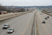
In the state of Minnesota, U.S. 52 enters the state with Interstate 94 at Moorhead and follows Interstate 94 southeast all the way to the Twin Cities. The portion of the highway which overlaps Interstate 94 is unsigned. From downtown St. Paul, U.S. 52 continues on its own southeast to Rochester and the Iowa border. South of the Twin Cities and through Rochester to Interstate 90, the road is being gradually improved to a freeway. It is currently a freeway from I-90, through Rochester, and into Oronoco. It is also a freeway from Interstate 94 in St. Paul to just south of Concord Blvd in Inver Grove Heights. The rest of the highway between Oronoco and Inver Grove Heights in built to expressway standards.
Iowa
Main article: U.S. Route 52 in IowaU.S. 52 enters Iowa north of the unincorporated community of Burr Oak. It passes by Luther College on the west side of Decorah. At Calmar the road turns to a southwest-northeast orientation. It joins with U.S. Route 18 just to the west of Postville. The two highways overlap until a point east of the unincorporated community of Froelich. U.S. 52 roughly parallels the Mississippi River for the rest of its path through Iowa. At Luxemburg it joins with Iowa Highway 3 and turns east. The two highways run together to downtown Dubuque, where it intersects U.S. Highway 61 and U.S. Highway 151.
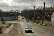
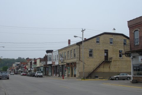
 U.S. 52 passes through downtown Bellevue, Iowa
South of Dubuque, U.S. 52, U.S. 61, and U.S. 151 share a freeway routing until 52 departs in Key West to remain close to the Mississippi River. Just west of Sabula the highway turns to an east–west orientation at the junction of Iowa Highway 64 and the northern terminus of U.S. Route 67. In Sabula, the highway becomes a 'wrong way' road. Northbound traffic travels south, and vice versa, from Sabula to the Savanna–Sabula Bridge, where U.S. 52 crosses into Illinois.
North of Dubuque, Iowa, US 52 is routed on to a narrow and often winding road. While scenic, the road has been the scene of numerous accidents over the years owing to this nature. Between 1964 and 1967, this segment of the route was called Alternate US 52 and US 52 was rerouted south from Luxemburg, Iowa to Dyersville, Iowa along Iowa Highway 136, and east from Dyersville to Dubuque along U.S. Route 20.[2]
The entire length of U.S. 52 in Iowa is located within the unglaciated Driftless Area.
Illinois
In Illinois, U.S. 52 runs from the Savanna-Sabula Bridge with Iowa Highway 64 and Illinois Route 64 at Savanna southeast passing through the cities of Dixon, Amboy and Mendota. U.S. 52 then passes through the southern portion of Joliet, where it is a major thoroughfare in the city of Joliet (Jefferson Street), avoiding the city of Chicago proper. It joins with U.S. Route 45 through Kankakee, and then runs concurrently with U.S. Route 24 east of Watseka to the Indiana state line.
Indiana
In Indiana, U.S. 52 runs in a northwest-southeast direction. It passes through Lafayette and Indianapolis. Northwest of Indianapolis, U.S. 52 runs along the same general area as, and is considered an alternative route to, Interstate 65. In the Indianapolis area, it is overlapped with Interstate 865 and Interstate 465. East of Indianapolis, it is considered an alternative to Interstate 74 before joining it before entering Ohio.
Ohio
U.S. 52 enters Ohio concurrently with Interstate 74 in northwestern Hamilton County. U.S. 52 then parallels Interstate 75 from Interstate 74's terminus into and through downtown Cincinnati. It skirts the Cincinnati riverfront along Pete Rose Way in the vicinity of Paul Brown Stadium and Great American Ball Park. From this point eastward, U.S. 52 generally follows the Ohio River. There is a brief concurrency with Interstate 275 near California, a suburb of Cincinnati. Towns along its path include New Richmond, Aberdeen, Ripley and Manchester. The section between Interstate 275 and New Richmond was modernized in the 1960s. Parts of the old route run parallel to the newer highway. Around Portsmouth and Ironton U.S. 52 has several freeway or expressway sections. In Portsmouth, U.S. 52 intersects with U.S. 23. At Chesapeake, U.S. 52 crosses the Ohio River into Huntington, West Virginia.
The sections of U.S. 52 that follow the Ohio River are known as the Ohio River Scenic Byway, which is part of the National Scenic Byway Project. The section between SR 125 and SR 73 (near Portsmouth) is also designated as Scenic Scioto Heritage Trail. This portion of U.S. 52, along the Ohio between Cincinnati and Huntington, is the only part where it falls in geographical sequence, south of U.S. 50 and north of U.S. 60.
West Virginia
US 52 serves western and southern portions of West Virginia, running from Huntington to Bluefield. The highway is undergoing a major expansion project as of 2007.
During its run in West Virginia, U.S. 52 enters Kentucky briefly, as described in the next paragraph. (Eventually, however, U.S. 52 leaves West Virginia and enters Virginia.)
Kentucky
U.S. 52 enters Kentucky twice along the Williamson, West Virginia bypass, in order to prevent the blasting of several hillsides in West Virginia. These stretches were completed in 1996 as part of the Corridor G (U.S. Route 119) project. The speed limit in West Virginia is 65 mph (105 km/h), but drops to 55 mph (89 km/h) along the Kentucky portions.
Virginia
U.S. 52 enters Virginia from West Virginia, and in Virginia closely follows Interstate 77. It enters southwestern Virginia near Bluefield and passes through Wytheville and Hillsville before leaving the state south of Cana.
North Carolina
Main article: U.S. Route 52 in North Carolina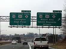 The north–south directions of US 52 in Winston-Salem.
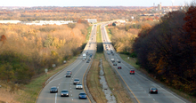
US 52 enters North Carolina just north west of Mount Airy. It goes by Pilot Mountain, one of the most distinctive natural features in North Carolina. Through the Piedmont Triad region, US 52 is mostly a limited-access freeway. The route joins Interstate 85 Business into Lexington, North Carolina and shares Interstate 85 around Salisbury, North Carolina. The segment of US 52 from Interstate 40 in Winston-Salem, North Carolina to Lexington is currently being upgraded to Interstate highway standards for the future Interstate 285 corridor. The segment from northern Winston-Salem to just south of Mount Airy is expected to form part of the Interstate 74 corridor through North Carolina.
South of the Triad area, after splitting from Interstate 85 in Salisbury, US 52 is typically a two-lane route linking some of the state's smaller cities and towns. Albemarle is the largest municipality along this segment of US 52 to the South Carolina state line.
South Carolina
Main article: U.S. Route 52 in South CarolinaU.S. 52 enters South Carolina northeast of Cheraw. From Darlington southward it is a multilane highway and Freeway, passing through Florence, Lake City, Kingstree, Moncks Corner and North Charleston before U.S. 52's terminus at number 2 Meeting Street and White Point Gardens in Charleston.
History
Historically, US 52 was routed along University Avenue between Minneapolis and St. Paul. In the 1980s and 1990s, the highway was gradually shifted onto its present route along Interstate 94. However, there was a gap in the definition of the highway for a few years until 1995. Since then, it has been routed along the interstate between the Twin Cities, although as of 2007, there was still a sign on University Avenue entering Hennepin County telling motorists to follow County Highways 36 and 37 to reach US 52—which kept them on University, then on 4th St. for historic westbound US 52. Historic westbound US 52 then crossed the Central Avenue bridge (current Minnesota State Highway 65) and turned onto the current routing of County Highway 81 northwest to Osseo. It then followed the current route of U.S. Highway 169 north to Anoka.
In Rochester, Minnesota, US 52 was recently expanded to six lanes. Long term plans have US 52 from St. Paul to Interstate 90 becoming a freeway, and some have suggested that when the conversion is complete, the freeway should become a spur route for Interstate 90 (I-X90). Currently, Interstate 90 has no spur routes in Minnesota. Also, US 52's route through Rochester has exit numbers, presently the only non-Interstate in Minnesota to have them.
U.S. Route 121 (1926)
Established in 1926, US 121 traversed from Lexington, North Carolina to Max Meadows, Virginia, estimated to be 107 miles (172 km). In North Carolina it overlapped with NC 66; in Virginia it was overlapped with SR 15. In 1934, US 52 was extended southeast into Virginia and North Carolina, and replaced all of US 121.[3][4][5]
Major intersections
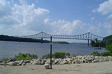 US Highway 52 crosses the Mississippi River at Savanna, Illinois and Sabula, Iowa. Shown here is the Savanna-Sabula Bridge.
Along U.S. 52's route, there are many places where the route crosses an Interstate (intersection), and many places where U.S. 52 shares its route with an Interstate (concurrency).
- Interstate 94 concurrency between Jamestown, North Dakota and St. Paul, Minnesota (signed concurrently in North Dakota, unsigned in Minnesota)
- Interstate 29 in Fargo, North Dakota (while concurrent with I-94)
- Interstate 694 concurrency in Minneapolis, Minnesota (while concurrent with I-94)
- Interstate 494 in Maple Grove, Minnesota (while concurrent with I-94)
- Interstate 394 in Minneapolis, Minnesota (while concurrent with I-94)
- Interstate 35W in Minneapolis, Minnesota (while concurrent with I-94)
- Interstate 35E concurrency in St. Paul, Minnesota (while concurrent with I-94)
- Interstate 494 in Inver Grove Heights, Minnesota
- Interstate 90 near Rochester, Minnesota
- Interstate 88 in Dixon, Illinois
- Interstate 39 in Troy Grove, Illinois
- Interstate 55 in Joliet, Illinois
- Interstate 80 in Joliet, Illinois
- Interstate 57 in Kankakee, Illinois
- Interstate 65 concurrency between Lebanon, Indiana and Zionsville, Indiana
- Interstate 865 concurrency in Zionsville, Indiana
- Interstate 465 concurrency between Zionsville, Indiana and Warren Park, Indiana
- Interstate 69 in Indianapolis, Indiana (while concurrent with I-465)
- Interstate 70 in Indianapolis, Indiana (while concurrent with I-465)
- Interstate 74 concurrency between the Indiana/Ohio border and Cincinnati, Ohio
- Interstate 275 concurrency in Miamitown, Ohio (while concurrent with I-74)
- Interstate 75 brief concurrency in Cincinnati, Ohio
- Interstate 275 brief concurrency near California, Ohio
- Interstate 64 concurrency between Huntington, West Virginia and Kenova, West Virginia
- Interstate 77 concurrency between Bluefield, West Virginia and Rocky Gap, Virginia
- Interstate 81 concurrency between Wytheville, Virginia and Fort Chiswell, Virginia (with Interstate 77)
- Interstate 74 in Mount Airy, North Carolina
- Interstate 40 in Winston-Salem, North Carolina
- Interstate 85 concurrency between Lexington, North Carolina and Salisbury, North Carolina
- Interstate 95 in Florence, South Carolina
- Interstate 526 in North Charleston, South Carolina
See also
Related routes
- U.S. Route 152
Bannered and suffixed routes
Main article: Bannered routes of U.S. Route 52References
- ^ a b Droz, Robert V. U.S. Highways: From US 1 to (US 830). URL accessed 02:55, July 4, 2006 (UTC).
- ^ Iowa Highways Page US 52
- ^ "NCRoads.com: U.S. 21". http://members.cox.net/ncroads/ushwys/us021121.html#121. Retrieved 2011-02-28.
- ^ "US Numbered Highways". http://www.us-highways.com/usbt.htm. Retrieved 2011-02-28.
- ^ "U.S. 52 Charleston, South Carolina, to Portal, North Dakota". http://www.fhwa.dot.gov/infrastructure/us52.cfm. Retrieved 2011-02-28.
External links
 Main U.S. Routes
1 2 3 4 5 6 7 8 9 10 11 12 13 14 15 16 17 18 19 20 21 22 23 24 25 26 27 28 29 30 31 32 33 34 35 36 37 38 40 41 42 43 44 45 46 48 49 50 51 52 53 54 55 56 57 58 59 60 61 62 63 64 65 66 67 68 69 70 71 72 73 74 75 76 77 78 79 80 81 82 83 84 85 87 89 90 91 92 93 94 95 96 97 98 99 101 163 400 412 425 Lists U.S. Routes • Bannered • Divided • Bypassed Browse numbered routes ←  ND 50
ND 50ND ND 53  →
→←  MN 51
MN 51MN US 53  →
→←  Iowa 51
IA Iowa 56  →
→←  US 51
US 51IL IL 53  →
→← US 51KY KY 52  →
→←  NC 51
NC 51NC NC 53  →
→←  SC 51
SC 51SC SC 53  →Categories:
- U.S. Highway System
- U.S. Highways in Minnesota
- U.S. Highways in North Dakota
- U.S. Highways in Indiana
- U.S. Highways in Ohio
- U.S. Highways in Kentucky
- U.S. Highways in South Carolina
- Transportation in Cincinnati, Ohio
- U.S. Route 52
- Scenic byways in Ohio


Wikimedia Foundation. 2010.