- U.S. Route 73
Infobox U.S. Route
article_route=73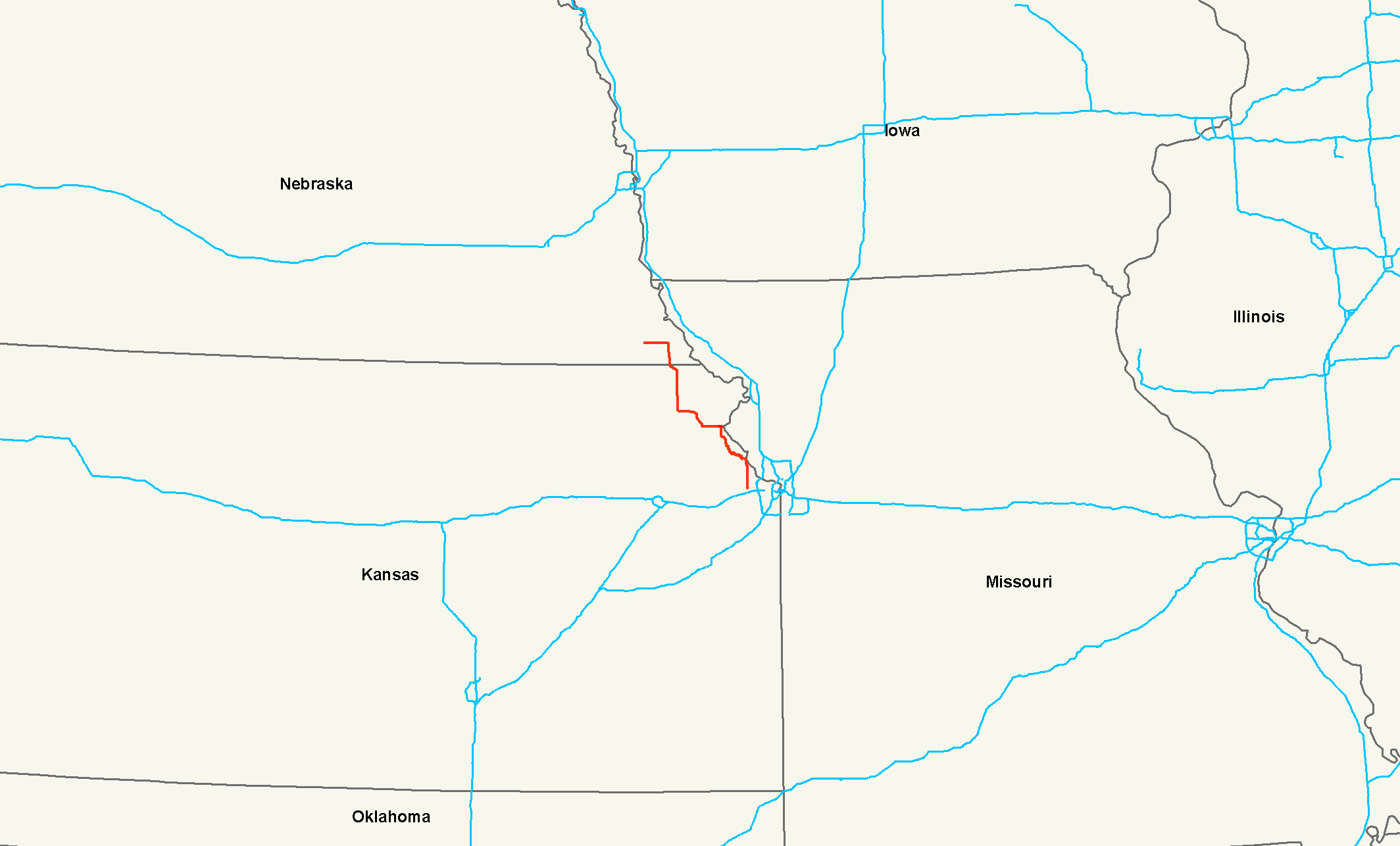
length_mi=112
length_ref= [http://www.us-highways.com/us1830.htm US Highways from US 1 to US 830] Robert V. Droz]
length_km=180
yrcom=1926
direction_a=South
direction_b=North
from=Jct|state=KS|I|435 at Kansas City, KS
junction=Jct|state=KS|US|59 at Atchison, KS
Jct|state=KS|US|36 at Hiawatha, KS
to=Jct|state=NE|US|75 near Dawson, NEU.S. Route 73 is a north-south
United States highway that runs for 112 miles (180 km) from northeastKansas to southeastNebraska . The highway's southern terminus isKansas City, Kansas atInterstate 435 . Its northern terminus is nearDawson, Nebraska atU.S. Highway 75 .Route description
Kansas
U.S. Route 73 begins at I-435 in Kansas City in a concurrency with U.S. Route 24 and U.S. Route 40. It goes west around
Kansas Speedway until meeting K-7. It then turns north with K-7 through Lansing, where it intersects K-5, to go through Leavenworth. It goes northwesterly from Leavenworth, meeting K-192 near Lowemont and at Atchison, turns west. At Atchison, it loses K-7 and is briefly concurrent with U.S. Route 59. It goes west and turns northwest near Lancaster at its intersection with K-9. It goes through Huron and begins a concurrency with K-20 near Everest. It goes west into Horton and intersects U.S. Route 159. The two highways continue north together and meet U.S. Route 36 at Hiawatha. After a brief northwesterly routing through Reserve, US-73 and US-159 turn north and enter Nebraska.Nebraska
U.S. Route 73 enters Nebraska south of Falls City still concurrent with U.S. Route 159. They run north into Falls City and separate. Shortly after leaving Falls City, US 73 turns west, passes through Verdon, and ends at
U.S. Route 75 just north of Dawson.History
The original southern terminus was at
Atoka, Oklahoma at an intersection withU.S. Highway 75 . From the creation of the highway in 1926 until 1935, US 73 was split betweenOswego, Kansas andHorton, Kansas . US 73E followed modernUS 160 from Oswego to Columbus, then modernUS 69 to Kansas City, where it then latched onto what is now US 73. The US 73E designated then went from Kansas City to Horton. US 73W followed the route of modernU.S. Route 59 from Oswego to K-39, K-39 west to Chanute, modernU.S. Route 169 from Chanute to Garnett, modern US 59 again from Garnett to Nortonville, and then modernU.S. Route 159 from Nortonville to Horton. In 1935, US 73 was truncated at Kansas City with the modern designations taking over the old routes and US 69 taking over the Atoka-Oswego segment. In Kansas City, US 73 previously followedU.S. Route 24 into downtownKansas City, Kansas , terminating at theIntercity Viaduct (Lewis & Clark Viaduct ), beforeInterstate 435 was completed.Nebraska also had a split highway, with the split between Tekamah and Winnebago between 1935 and 1957. US 73E went north through Decatur along the current route of
U.S. Route 75 , while US 73W went west from Tekamah along currentNebraska Highway 32 to Oakland, then north from Oakland in a concurrency withU.S. Route 77 .The original northern terminus was at
Auburn, Nebraska , but in 1932, the highway was extended toSouth Sioux City, Nebraska . In 1965, the route was shortened toWinnebago, Nebraska . In 1984, U.S. 75 was removed from western Iowa alongInterstate 29 and placed on U.S. 73's route, superseding it throughOmaha, Nebraska and truncating the highway to its present northern terminus nearDawson, Nebraska .References
###@@@KEYEND@@@###
Wikimedia Foundation. 2010.