- Garnett, Kansas
Infobox Settlement
official_name = Garnett, Kansas
settlement_type =City
nickname =
motto =
imagesize =
image_caption =
image_
imagesize =
image_caption =
image_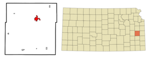
mapsize = 250px
map_caption = Location of Garnett, Kansas
mapsize1 =
map_caption1 =subdivision_type = Country
subdivision_name =United States
subdivision_type1 = State
subdivision_name1 =Kansas
subdivision_type2 = County
subdivision_name2 = Anderson
government_footnotes =
government_type =
leader_title =
leader_name =
leader_title1 =
leader_name1 =
established_title =
established_date =unit_pref = Imperial
area_footnotes =
area_magnitude =
area_total_km2 = 8.0
area_land_km2 = 7.8
area_water_km2 = 0.2
area_total_sq_mi = 3.1
area_land_sq_mi = 3.0
area_water_sq_mi = 0.1population_as_of = LookupUSEstPop|2025925|EYR
population_total = LookupUSEstPop|2025925|EST
population_density_km2 = 434.2
population_density_sq_mi = 1124.6timezone = Central (CST)
utc_offset = -6
timezone_DST = CDT
utc_offset_DST = -5
elevation_footnotes =
elevation_m = 326
elevation_ft = 1070
latd = 38 |latm = 16 |lats = 58 |latNS = N
longd = 95 |longm = 14 |longs = 27 |longEW = Wpostal_code_type =
ZIP code
postal_code = 66032
area_code = 785
blank_name = FIPS code
blank_info = 20-25925GR|2
blank1_name = GNIS feature ID
blank1_info = 0477665GR|3
website =
footnotes =Garnett is a city in Anderson County,
Kansas ,United States . The population was 3,368 at the 2000 census, and it was estimated to be formatnum:LookupUSEstPop|2025925|EST in the year LookupUSEstPop|2025925|EYR.LookupUSEstPop|2025925|EYRSubEst"> It is thecounty seat of Anderson CountyGR|6.Geography
Garnett is located at coor dms|38|16|58|N|95|14|27|W|city (38.282652, -95.240906)GR|1.
According to the
United States Census Bureau , the city has a total area of 3.1square mile s (8.0km² ), of which, 3.0 square miles (7.7 km²) of it is land and 0.1 square miles (0.2 km²) of it (2.92%) is water.Demographics
Garnett's population was estimated to be formatnum:LookupUSEstPop|2025925|EST in the year LookupUSEstPop|2025925|EYR, LookupUSEstPop|2025925|TXT.LookupUSEstPop|2025925|EYRSubEst">Cite web| url=http://www.census.gov/popest/estimates.php| title=Population Estimates| publisher=U.S. Census Bureau, Population Division| Annual estimates of the population to 2025925|EDT. Released 2025925|RDT. Population change is from 2025925|IDT to 2025925|EDT.]
As of the
census GR|2 of 2000, there were 3,368 people, 1,439 households, and 886 families residing in the city. Thepopulation density was 1,124.6 people per square mile (434.9/km²). There were 1,597 housing units at an average density of 533.2/sq mi (206.2/km²). The racial makeup of the city was 96.97% White, 0.39% African American, 1.04% Native American, 0.27% Asian, 0.06% Pacific Islander, 0.53% from other races, and 0.74% from two or more races. Hispanic or Latino of any race were 1.45% of the population.There were 1,439 households out of which 28.8% had children under the age of 18 living with them, 50.2% were married couples living together, 8.5% had a female householder with no husband present, and 38.4% were non-families. 34.7% of all households were made up of individuals and 21.1% had someone living alone who was 65 years of age or older. The average household size was 2.25 and the average family size was 2.91.
In the city the population was spread out with 24.4% under the age of 18, 7.5% from 18 to 24, 23.3% from 25 to 44, 20.7% from 45 to 64, and 24.1% who were 65 years of age or older. The median age was 41 years. For every 100 females there were 88.2 males. For every 100 females age 18 and over, there were 82.1 males.
The median income for a household in the city was $31,518, and the median income for a family was $38,095. Males had a median income of $31,175 versus $19,858 for females. The
per capita income for the city was $16,265. About 9.2% of families and 13.0% of the population were below thepoverty line , including 18.6% of those under age 18 and 9.9% of those age 65 or over.Transportation
Rail
The area has one railroad, six freight lines and six interstate carriers.
Roads
Garnett is at the crossroads of
U.S. Route 59 ,U.S. Route 169 andK-31 .Interstate 35 is located 19 miles north of here andInterstate 70 is approximately 50 miles away.Air
The
Garnett Industrial Airport is located along U.S. 169. The nearest international air service is at theKansas City International Airport , 90 miles away.Lagerstätte
Garnett is famous for its
fossil founds from the lateCarboniferous period. Thelagerstätte is about 300 million years old and contains some of the earliest reptiles on earth.Notable natives
*
Arthur Capper - former Governor of Kansas and US Senator.
*Chris Burney ofBowling for Soup
*Edgar Lee Masters - Poet, Lawyer, PlaywrightReferences
External links
* [http://www.garnettks.net/ Garnett official website]
Wikimedia Foundation. 2010.