- Nortonville, Kansas
-
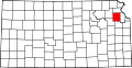
Nortonville, Kansas — City — Location of Nortonville, Kansas
Coordinates: 39°25′3″N 95°19′54″W / 39.4175°N 95.33167°WCoordinates: 39°25′3″N 95°19′54″W / 39.4175°N 95.33167°W Country United States State Kansas County Jefferson Area – Total 0.4 sq mi (1.1 km2) – Land 0.4 sq mi (1.1 km2) – Water 0.0 sq mi (0.0 km2) Elevation 1,165 ft (355 m) Population (2010) – Total 637 – Density 1,443.6/sq mi (557.4/km2) Time zone Central (CST) (UTC-6) – Summer (DST) CDT (UTC-5) ZIP code 66060 Area code(s) 913 FIPS code 20-51525[1] GNIS feature ID 0478236[2] Nortonville is a city in Jefferson County, Kansas, United States. The population was 620 at the 2000 census. It is part of the Topeka, Kansas Metropolitan Statistical Area.
Contents
Geography
Nortonville is located at 39°25′3″N 95°19′54″W / 39.4175°N 95.33167°W (39.417496, -95.331626)[3].
According to the United States Census Bureau, the city has a total area of 0.4 square miles (1.0 km2), all of it land.
Demographics
Historical populations Census Pop. %± 1960 595 — 1970 727 22.2% 1980 692 −4.8% 1990 643 −7.1% 2000 620 −3.6% 2010 637 2.7% U.S. Decennial Census As of the census[1] of 2000, there were 620 people, 233 households, and 154 families residing in the city. The population density was 1,443.6 people per square mile (556.7/km²). There were 255 housing units at an average density of 593.8 per square mile (229.0/km²). The racial makeup of the city was 97.10% White, 0.32% African American, 0.65% Native American, 0.48% from other races, and 1.45% from two or more races. Hispanic or Latino of any race were 1.29% of the population.
There were 233 households out of which 32.6% had children under the age of 18 living with them, 57.9% were married couples living together, 7.3% had a female householder with no husband present, and 33.5% were non-families. 30.0% of all households were made up of individuals and 21.5% had someone living alone who was 65 years of age or older. The average household size was 2.46 and the average family size was 3.10.
In the city the population was spread out with 26.0% under the age of 18, 6.9% from 18 to 24, 24.4% from 25 to 44, 16.5% from 45 to 64, and 26.3% who were 65 years of age or older. The median age was 40 years. For every 100 females there were 87.9 males. For every 100 females age 18 and over, there were 80.7 males.
The median income for a household in the city was $38,281, and the median income for a family was $40,781. Males had a median income of $32,250 versus $18,500 for females. The per capita income for the city was $15,523. About 6.1% of families and 9.1% of the population were below the poverty line, including 13.4% of those under age 18 and 6.5% of those age 65 or over.
References
- ^ a b "American FactFinder". United States Census Bureau. http://factfinder.census.gov. Retrieved 2008-01-31.
- ^ "US Board on Geographic Names". United States Geological Survey. 2007-10-25. http://geonames.usgs.gov. Retrieved 2008-01-31.
- ^ "US Gazetteer files: 2010, 2000, and 1990". United States Census Bureau. 2011-02-12. http://www.census.gov/geo/www/gazetteer/gazette.html. Retrieved 2011-04-23.
External links
Municipalities and communities of Jefferson County, Kansas Cities McLouth | Meriden | Nortonville | Oskaloosa | Ozawkie | Perry | Valley Falls | Winchester
Townships Unincorporated
communitiesDunavant | Grantville | Half Mound | Lakeside Village | Mooney Creek | Newman | Rock Creek | Thompsonville | Williamstown
Categories:- Cities in Kansas
- Populated places in Jefferson County, Kansas
- Topeka metropolitan area


Wikimedia Foundation. 2010.