- Chanute, Kansas
-
Chanute, Kansas — City — Location of Chanute, Kansas
Coordinates: 37°40′37″N 95°27′23″W / 37.67694°N 95.45639°WCoordinates: 37°40′37″N 95°27′23″W / 37.67694°N 95.45639°W Country United States State Kansas County Neosho Area - Total 6.2 sq mi (16.1 km2) - Land 6.1 sq mi (15.9 km2) - Water 0.1 sq mi (0.2 km2) Elevation 958 ft (292 m) Population (2000) - Total 9,411 - Density 1,533.7/sq mi (592.2/km2) Time zone Central (CST) (UTC-6) - Summer (DST) CDT (UTC-5) ZIP code 66720 Area code(s) 620 FIPS code 20-12500[1] GNIS feature ID 0484936[2] Website www.Chanute.org Chanute is a city in Neosho County, Kansas, United States. Founded on January 1, 1873, it was named after railroad engineer and aviation pioneer Octave Chanute. The city's population was 9,411 at the 2000 census. Chanute is the largest city in Neosho County.
Contents
History
In 1870 when the Leavenworth, Lawrence & Galveston Rail Road (later the Atchison, Topeka & Santa Fe, now the BNSF Railway) crossed the Missouri, Kansas and Texas line within the limits of Neosho county four rival towns sprang up, in the vicinity of the junction: New Chicago, Chicago Junction, Alliance, and Tioga. Two years of the most bitter animosity ensued until the four were consolidated in 1872, and the name of Chanute given it in honor of Octavius Chanute, a railroad civil engineer. [3]
Though Chanute was not founded until 1873, settlers had begun populating the area as early as 1856. With the LL&G Railroad set to arrive shortly thereafter, the early residents of the towns of Tioga, Chicago Junction, Alliance, and New Chicago needed an innovative solution to an escalating dispute over which town would claim the right to house the LL&G Railroad’s new land office. The towns were unable to settle their differences until an individual by the name of Octave Chanute came to town. Octave was the Chief Engineer and General Superintendent of the LL&G Railroad. In 1872, he suggested the towns merge together to end the bickering. On January 1, 1873 the towns merged and became chartered as the City of Chanute.
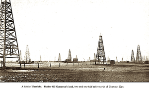
With the Southern Kansas Railroad locating a division headquarters in Chanute, the city began to flourish. In 1887, Chanute boasted a rapid growth in flourmills, grain elevators, banks, drug and hardware stores, and natural gas. In 1903, the City of Chanute established the electric utility, and in the years to follow, established the gas, water, wastewater, and refuse utilities. In 2011, local residents raised environmental concerns [4] regarding Chanute's Ash Grove cement plant. The plant provides 131 jobs and burns hazardous waste.[5] Chanute is one of only a handful of remaining full-service cities in the State of Kansas.
Geography
According to the United States Census Bureau, Chanute has a total area of 6.2 square miles (16 km2), of which, 6.1 square miles (16 km2) of it is land and 0.1 square miles (0.26 km2) of it (1.61%) is water.
Climate
Climate data for KCNU Month Jan Feb Mar Apr May Jun Jul Aug Sep Oct Nov Dec Year Record high °F (°C) 75
(24)83
(28)95
(35)96
(36)99
(37)108
(42)116
(47)113
(45)107
(42)98
(37)89
(32)77
(25)116
(47)Average high °F (°C) 40.5
(4.7)47.2
(8.4)57.8
(14.3)67.9
(19.9)75.8
(24.3)84.7
(29.3)90.5
(32.5)89.3
(31.8)81.0
(27.2)70.0
(21.1)55.3
(12.9)44.0
(6.7)67.0 Daily mean °F (°C) 30.8
(−0.7)36.6
(2.6)46.6
(8.1)56.4
(13.6)65.3
(18.5)74.3
(23.5)79.5
(26.4)78.0
(25.6)69.7
(20.9)58.4
(14.7)45.1
(7.3)34.5
(1.4)56.3 Average low °F (°C) 21.0
(−6.1)26.0
(−3.3)35.4
(1.9)44.9
(7.2)54.8
(12.7)63.8
(17.7)68.5
(20.3)66.7
(19.3)58.4
(14.7)46.8
(8.2)34.8
(1.6)25.0
(−3.9)45.5 Record low °F (°C) −23
(−31)−13
(−25)−4
(−20)14
(−10)28
(−2)38
(3)48
(9)45
(7)30
(−1)17
(−8)1
(−17)−17
(−27)−23
(−31)Precipitation inches (mm) 1.28
(32.5)1.90
(48.3)3.47
(88.1)3.83
(97.3)5.29
(134.4)5.05
(128.3)4.24
(107.7)3.96
(100.6)3.95
(100.3)4.03
(102.4)3.06
(77.7)1.89
(48)41.95
(1,065.5)Source: National Weather Service[6][7] Demographics
Historical populations Census Pop. %± 1880 887 — 1890 2,826 218.6% 1900 4,208 48.9% 1910 9,272 120.3% 1920 10,286 10.9% 1930 10,277 −0.1% 1940 10,142 −1.3% 1950 10,109 −0.3% 1960 10,849 7.3% 1970 10,341 −4.7% 1980 10,506 1.6% 1990 9,488 −9.7% 2000 9,411 −0.8% U.S. Decennial Census As of the census[1] of 2000, there were 9,411 people, 3,864 households, and 2,496 families residing in the city. The population density was 1,533.7 people per square mile (591.8/km²). There were 4,262 housing units at an average density of 694.6 per square mile (268.0/km²). The racial makeup of the city was 93.20% White, 1.42% African American, 1.11% Native American, 0.47% Asian, 0.04% Pacific Islander, 1.39% from other races, and 2.37% from two or more races. Hispanic or Latino of any race were 3.89% of the population.
There were 3,864 households out of which 30.6% had children under the age of 18 living with them, 49.9% were married couples living together, 10.8% had a female householder with no husband present, and 35.4% were non-families. 31.7% of all households were made up of individuals and 16.1% had someone living alone who was 65 years of age or older. The average household size was 2.34 and the average family size was 2.92.
In the city the population was spread out with 25.2% under the age of 18, 10.1% from 18 to 24, 25.2% from 25 to 44, 20.5% from 45 to 64, and 18.9% who were 65 years of age or older. The median age was 38 years. For every 100 females there were 88.0 males. For every 100 females age 18 and over, there were 84.8 males.
The median income for a household in the city was $29,912, and the median income for a family was $36,630. Males had a median income of $25,696 versus $17,938 for females. The per capita income for the city was $16,288. About 12.0% of families and 15.0% of the population were below the poverty line, including 20.3% of those under age 18 and 9.9% of those age 65 or over.
Education
Public Schools
Chanute public schools (Unified School District #413) include one elementary school, one middle school, and one high school. Elementary schools included, up to the 2008-09 school year: Lincoln Kindergarten, Alcott Elementary, Hutton Elementary, and Murray Hill Elementary. Currently, only one elementary school is in operation,the newly built Chanute Elementary School, which combined all the separate elementary schools into one big, new building. Chanute’s middle school is Royster Middle School. Chanute’s high school is Chanute High School. Chanute’s public school system also includes Chanute High School-affiliated New Beginnings Academy, a program for students lacking credits to graduate and designed for individuals who have dropped out or are in danger of dropping out of high school. High school credits for New Beginnings Academy are provided by Chanute High School.
Private schools
Chanute is also home to two private schools: Saint Patrick Catholic School and Chanute Christian Academy. Saint Patrick Catholic School provides schooling for students from pre-school(ages three to four) through the fifth grade while Chanute Christian Academy provides schooling for students from kindergarten through the twelfth grade.
St. Patrick Catholic School was awarded the Governor's Award for meeting the standard of excellence and scoring in the top 5% on Kansas assessments in both reading and math.[8]
Colleges
Chanute’s only college is the Neosho County Community College known locally as NCCC, or sometimes as NC3. Neosho County Community College is a public, two-year institution, that currently provides post-secondary education for just under 3,200 students.
Area attractions
The Chanute area has many tourist attractions known for their historical significance.
- Martin and Osa Johnson Safari Museum
The Martin and Osa Johnson Safari Museum offers award winning exhibits and programs that highlight the achievements of Martin and Osa Johnson, pioneering documentary filmmakers, photographers, authors, explorers, and Kansans. A trip to the museum allows one to relive the Johnsons’ 1917-1936 adventures in Africa, Borneo and the South Seas. Additional exhibits feature the rich cultures and art of Africa.[citation needed]
- Tioga Suites Hotel
The Tioga Suites Hotel was built in 1929 as Kansas' first "fireproof" hotel. All exterior and interior walls, floors and ceilings are masonry or concrete. This Art Deco building is listed on the National Register of Historic Places. It has been completely remodeled and modernized. Known as the "Jewel of Southeast Kansas" it is the hub of many of the community and area activities. It is located in the heart of downtown Chanute.[citation needed]
- Chanute Art Gallery
The Chanute Art Gallery includes more than 1,500 square feet of exhibit area and houses a Permanent Core Collection of more than 500 works of art that includes 25 mediums, representing 135 artists. Special exhibits change every month. Collections include: The Luigi Kasimir Etchings, European and Oriental Art, The Kansas Prairie Printmakers and local and area artists.[citation needed]
- Chanute Historical Museum
The Chanute Historical Museum is commonly known as the Flat Iron Building, this unusual structure is now home to a museum featuring Chanute artifacts. It houses a large genealogy collection and various artifacts from Chanute's colorful history, including an extensive collection of MKT Railroad memorabilia. Members of the Chanute Historical Society opened the museum in June 2005. The collection on display contains sports, railroad and aviation memorabilia.[citation needed]
- Downtown & Historic Homes
Both the downtown and historic home districts offer a variety of architectural styles and beautiful examples of restoration. The historic home driving tour takes you down broad, tree-lined streets that make you feel you have stepped back into another era. Chanute's wonderful downtown is filled with historic buildings, most of which have been restored to their original beauty. Chanute also has several examples of WPA projects.
- Cardinal Drug Store
Th Cardinal Drug Store in downtown Chanute is the home of one of the oldest original soda fountains in Kansas. It has a collection of Coke memorabilia and medicine bottles. Cardinal is located at 103 East Main Street.[citation needed]
- Austin Bridge
The King Bridge Company constructed the Austin Bridge in 1872. The 160-foot bowstring arch design spanned the Neosho River east of what is now Chanute. Local pioneers invested $15,000 in the bridge for their economic future of getting livestock and crops to the railhead. In 1910 the bridge was moved downstream to the community of Austin. In 1972 it was closed to vehicular traffic, remaining open to foot traffic. On September 15, 1977 the bridge was added to the National Register of Historic Places. In August of 1999 the bridge was moved into Santa Fe Park to become the southern terminus of a 3.11 mile hike/bike path. A Federal grant, Neosho County and the City of Chanute funded the project.[citation needed]
- Summit Hill Gardens
Summit Hill Gardens was the first school in Neosho County. Summit Hill was restored and a historic home and modern structure were added to the family residence. It has a flower and herb garden. It is located at 2605 160th Road.[citation needed]
- Chanute-Write Brothers Memorial
Located in the heart of downtown, this sculpture was dedicated in September 2003 and a gift to the community by the Chanute High School Class of 1941. The sculpture honors engineer and city namesake, Octave Chanute, and the Wright Brothers. Chanute was a mentor to Wilbur and Orville Wright and very influential in the early days of flight exploration. The sculpture measures 23 feet from wingtip to wingtip and 20 feet from nose to tail. The project was in partnership with the City of Chanute.[citation needed]
Transportation
Highways
Major highways running through Chanute are US-169 (North-South) and K-39 (East-West). US-75 and US-59 both are within 10 miles of Chanute. These highways provide easy access to I-70, I-35, and US-400. A full-line of trucking companies serves Chanute.
Railways
The South Kansas Oklahoma (SKO) Railroad serves Chanute, as well as Southern and Eastern Kansas and Northern Oklahoma. The SKO connects to several major railroads allowing local businesses the opportunity to bid and negotiate their rail transportation costs to acquire the best possible price to all locations throughout North America.
Airports
Chanute's Martin Johnson Municipal Airport is a general aviation airport with a 4,255-foot runway and taxiway. Expansion of services and infrastructure is in the planning stages, including new T-hangars and pavement improvements.
Bus
The Greyhound Lines has a bus stop in Chanute.[9]
Other
Google Earth
The Macintosh version of Google Earth, software that allows the user to "fly" over the surface of the earth, mapped with high-quality satellite photography and accurate topographical data, has a default position when started up that is centered exactly on the town of Chanute (specifically, on the corner of Lincoln and Main). This may be verified by running the software on the Macintosh and zooming in from the default start position without rotating the virtual globe at all. This location was set by Dan Webb, who was born and raised in Chanute, graduated from the University of Kansas in 1986, and is now a senior software engineer at Google. Webb is a long time friend of Brian McClendon, who centered the Windows version of Google Earth on his hometown of Lawrence, Kansas.
Notable people
- eden ahbez (1908–1995), Songwriter and mystic, lived in the town in his youth, when known as George McGrew.
- Osa Johnson, Adventurer, author, and documentary filmmaker
- Jennifer Knapp, Christian Singer-Songwriter
- Paul Lindblad, MLB player
- Ralph Miller, Hall of Fame basketball coach
- Kustom Amplification, had a factory in Chanute. Bud Ross changed the face of American Music in the 60's and 70's.[10]
Gallery
-
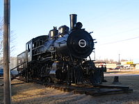
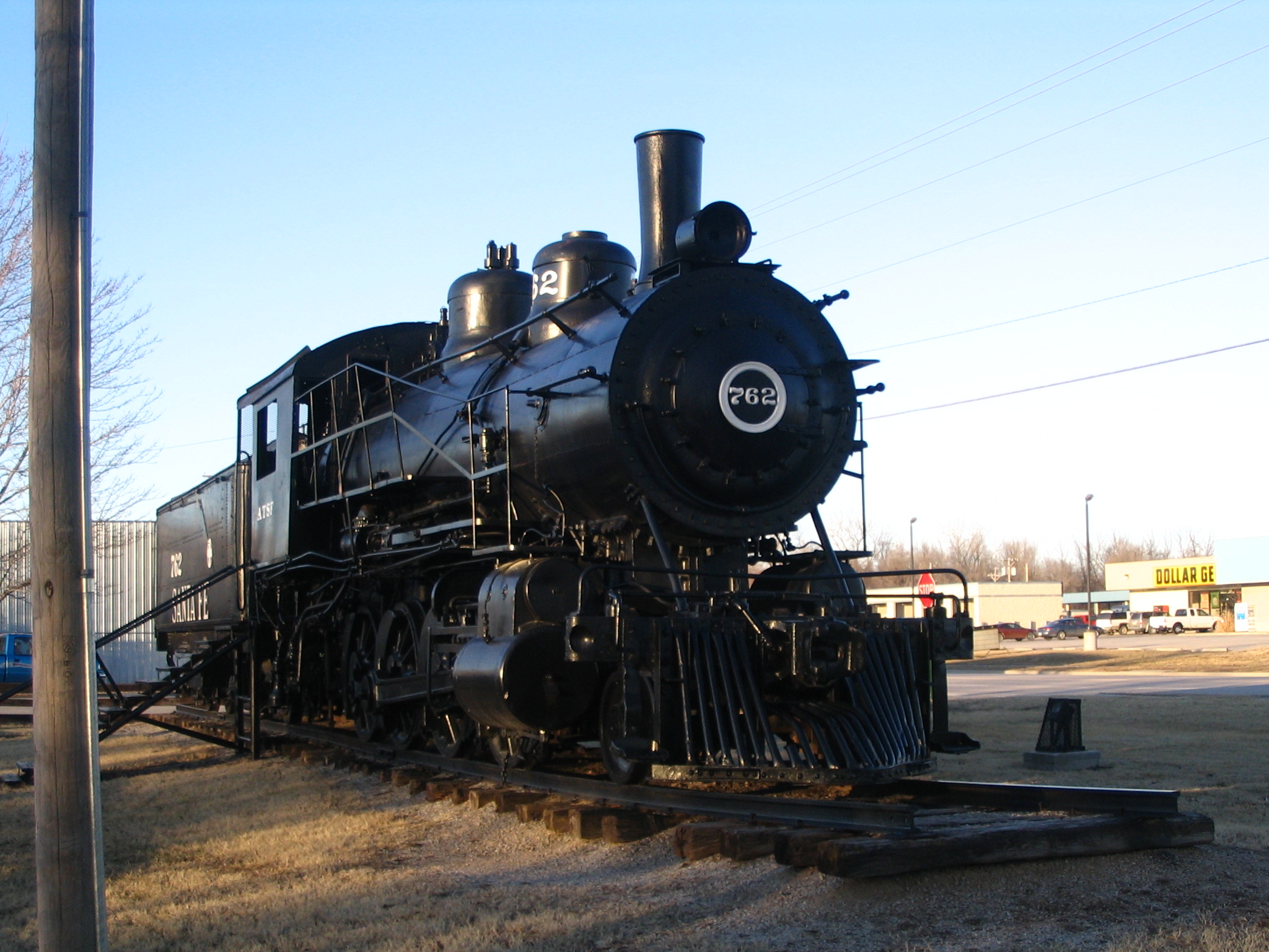
Steam locomotive in Santa Fe Park of Chanute.
-
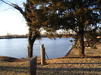
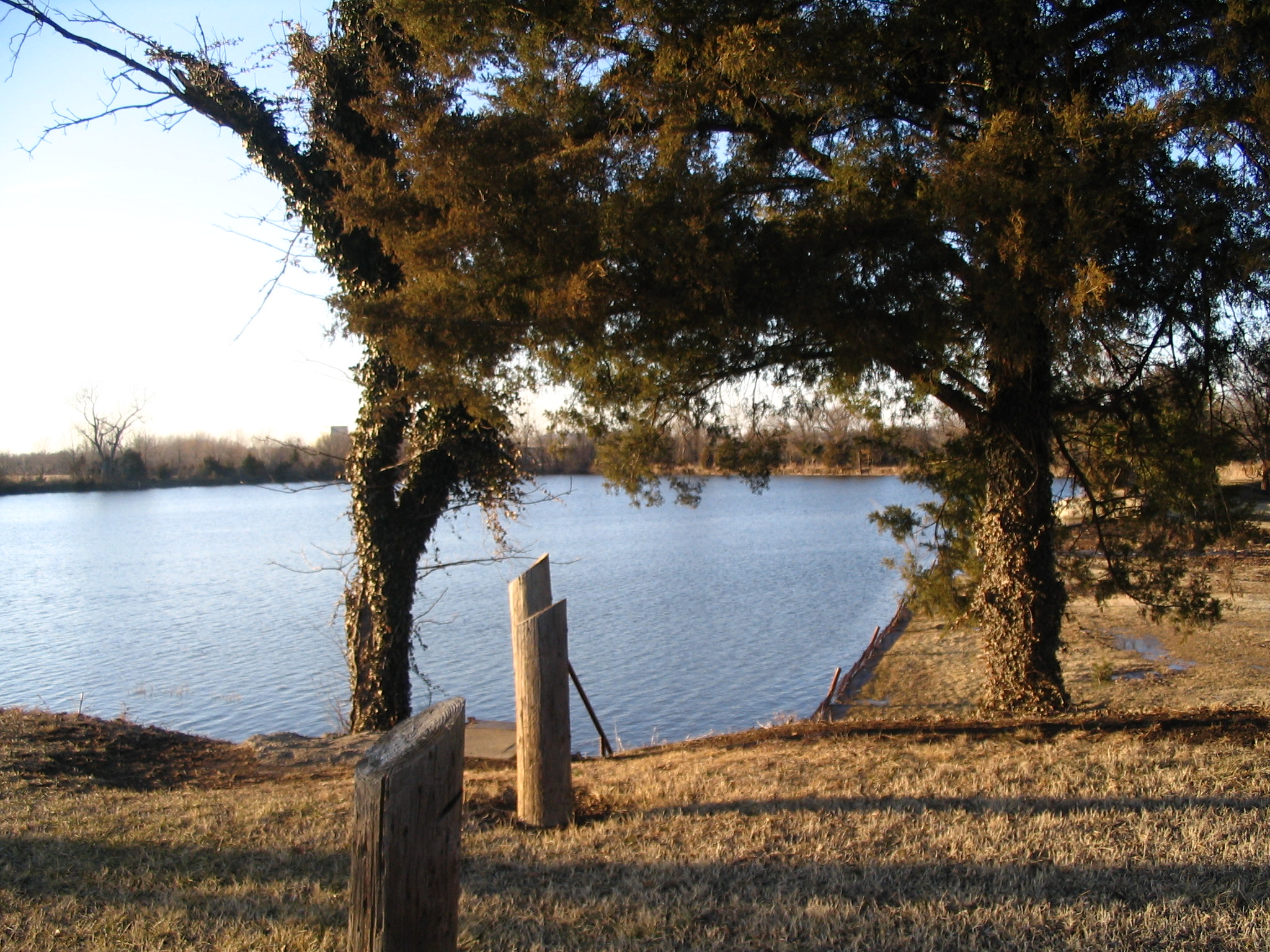
Lake in Santa Fe Park of Chanute.
See also
References
- ^ a b "American FactFinder". United States Census Bureau. http://factfinder.census.gov. Retrieved 2008-01-31.
- ^ "US Board on Geographic Names". United States Geological Survey. 2007-10-25. http://geonames.usgs.gov. Retrieved 2008-01-31.
- ^ Chanute History
- ^ Harris, Sarah, and Howard Berkes (2011-11-10). "A Family's Fight To Clear The Air : NPR". http://www.npr.org/2011/11/10/142193309/a-familys-fight-to-clear-the-air. Retrieved 2011-11-17.
- ^ Berkes, Howard (2011-11-10). "EPA Regulations Give Kilns Permission To Pollute : NPR". NPR.org. http://www.npr.org/2011/11/10/142183546/epa-regulations-give-kilns-permission-to-pollute. Retrieved 2011-11-17.
- ^ "National Weather Service Climate Normals". National Weather Service. http://www.crh.noaa.gov/ict/climate/viewnorms.php. Retrieved September 7, 2010.
- ^ "National Weather Service Climate Records". National Weather Service. http://www.crh.noaa.gov/ict/climate/viewrecords.php. Retrieved September 7, 2010.
- ^ http://www.stpatrickschoolchanute.com/index.html, St Patrick School Chanute, KS
- ^ Greyhound Lines - Bus stops in Kansas
- ^ History of Kustom Amps
External links
Municipalities and communities of Neosho County, Kansas County seat: Erie Cities 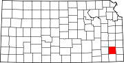
Unincorporated
communitiesKimball | Leanna | Morehead | Odense | Rollin | Shaw | South Mound | Urbana
Categories:- Cities in Kansas
- Populated places in Neosho County, Kansas
- Populated places established in 1873


Wikimedia Foundation. 2010.