- Calmar, Iowa
Infobox Settlement
official_name = Calmar, Iowa
settlement_type =City
nickname =
motto =
imagesize =
image_caption =
image_
imagesize =
image_caption =
image_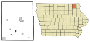
mapsize = 250x200px
map_caption = Location of Calmar, Iowa
mapsize1 =
map_caption1 =subdivision_type = Country
subdivision_name =
subdivision_type1 = State
subdivision_name1 =
subdivision_type2 = County
subdivision_name2 = Winneshiek
government_footnotes =
government_type =
leader_title =
leader_name =
leader_title1 =
leader_name1 =
established_title =
established_date =unit_pref = Imperial
area_footnotes =area_magnitude =
area_total_km2 = 2.7
area_land_km2 = 2.7
area_water_km2 = 0.0
area_total_sq_mi = 1.1
area_land_sq_mi = 1.1
area_water_sq_mi = 0.0population_as_of = 2000
population_footnotes =
population_total = 1058
population_density_km2 = 388.7
population_density_sq_mi = 1006.8timezone = Central (CST)
utc_offset = -6
timezone_DST = CDT
utc_offset_DST = -5
elevation_footnotes =
elevation_m = 384
elevation_ft = 1260
latd = 43 |latm = 10 |lats = 55 |latNS = N
longd = 91 |longm = 51 |longs = 59 |longEW = Wpostal_code_type =
ZIP code
postal_code = 52132
area_code = 563
blank_name = FIPS code
blank_info = 19-10045
blank1_name = GNIS feature ID
blank1_info = 0455057
website =
footnotes =Calmar is a city in Winneshiek County,
Iowa ,United States . The population was 1,058 at the 2000 census. It is located at the junction of U.S. Highway 52 and State highways 150 and 24. Both 150 and 24 have their terminating points in Calmar.Geography
Calmar is located at coor dms|43|10|55|N|91|51|59|W|city (43.182054, -91.866446)GR|1.
According to the
United States Census Bureau , the city has a total area of 1.0square mile s (2.7km² ), all of it land.Demographics
As of the
census GR|2 of 2000, there were 1,058 people, 452 households, and 269 families residing in the city. Thepopulation density was 1,006.8 people per square mile (389.0/km²). There were 482 housing units at an average density of 458.7/sq mi (177.2/km²). The racial makeup of the city was 98.87% White, 0.19% African American, 0.09% Native American, 0.19% Asian, and 0.66% from two or more races. Hispanic or Latino of any race were 0.47% of the population.There were 452 households out of which 27.2% had children under the age of 18 living with them, 49.8% were married couples living together, 7.1% had a female householder with no husband present, and 40.3% were non-families. 30.3% of all households were made up of individuals and 14.6% had someone living alone who was 65 years of age or older. The average household size was 2.33 and the average family size was 2.97.
In the city the population was spread out with 23.3% under the age of 18, 14.7% from 18 to 24, 26.6% from 25 to 44, 18.6% from 45 to 64, and 16.8% who were 65 years of age or older. The median age was 36 years. For every 100 females there were 105.0 males. For every 100 females age 18 and over, there were 104.8 males.
The median income for a household in the city was $36,250, and the median income for a family was $50,063. Males had a median income of $29,875 versus $21,708 for females. The
per capita income for the city was $17,958. About 3.4% of families and 9.6% of the population were below thepoverty line , including 5.7% of those under age 18 and 17.5% of those age 65 or over.chools
Calmar is the home to one of two campuses of
Northeast Iowa Community College .South Winneshiek High School is located in Calmar. Its elementary and middle schools are located in Ossian.
References
External links
* [http://www.calmaria.com/ Official Site - City of Calmar]
Wikimedia Foundation. 2010.