- Minnesota State Highway 65
-
Trunk Highway 65
Route information Maintained by Mn/DOT Length: 272.511 mi[2] (438.564 km) Existed: 1934[1] – present Major junctions South end:  CR 152 (Washington Ave.)
in Minneapolis MN 47 (University Ave.) at Minneapolis
 I-694 at Fridley
 U.S. 10 at Blaine
 MN 95 at Cambridge
 MN 23 at Mora
 MN 210 at McGregor
 U.S. 2 at Swan River
 U.S. 169 near Pengilly, Nashwauk
North end:  U.S. 71 near Littlefork
Location Counties: Hennepin, Anoka, Isanti, Kanabec, Aitkin, Itasca, Koochiching Highway system Minnesota Trunk Highways
Interstate • U.S. • State
Inter-County • County roads • Legislative routes←  US 65
US 65MN 66  →
→Minnesota State Highway 65 is a highway in east-central and northeast Minnesota, which runs from its intersection with Washington Avenue (Hennepin County Road 152) at the north end of downtown Minneapolis and continues north to its northern terminus at its intersection with U.S. Highway 71 in Littlefork near International Falls.
Highway 65 is a four lane expressway between Interstate 694 in Fridley to just north of State Highway 95 at Cambridge.
The route continues as a two-lane road from Cambridge to its northern terminus at Littlefork in northern Minnesota.
State Highway 65 is 273 miles (439 km) in length.
Contents
Route description
State Highway 65 serves as a north–south route between Minneapolis, Fridley, Blaine, Cambridge, Mora, McGregor, Nashwauk, and Littlefork in east-central and northeast Minnesota.
The roadway is one of three Minnesota state marked highways to carry the same number as an existing U.S. marked highway within the state, the others being Highways 61 and 169.

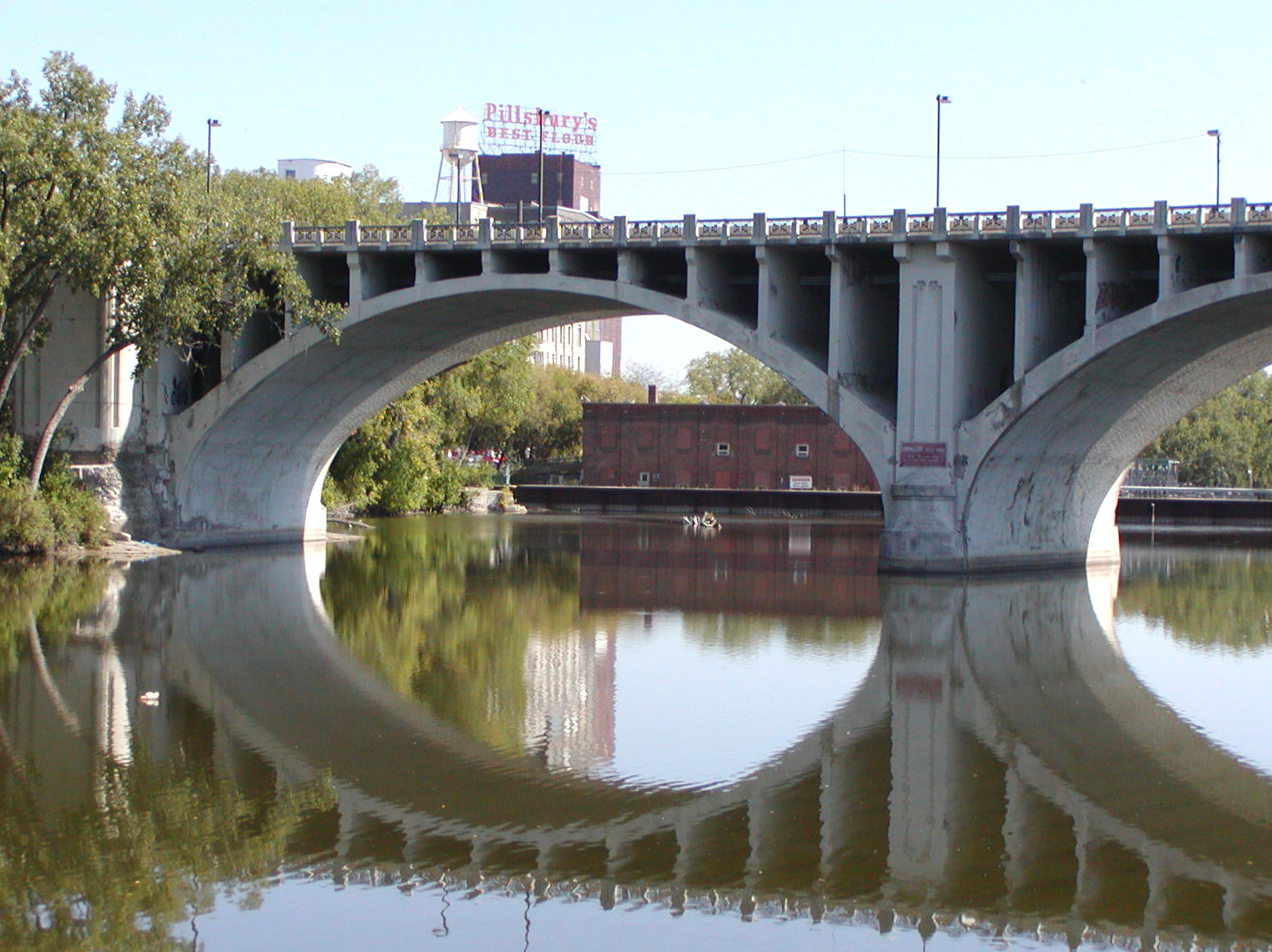
State Highway 65 begins at the intersection of Washington Avenue (County 152) and 3rd Avenue South at the north end of downtown Minneapolis. Highway 65 is signed locally as 3rd Avenue South in downtown Minneapolis. 3rd Avenue South leads to the Third Avenue (Mississippi River) Bridge and becomes Central Avenue upon crossing the river. After its intersection with Hennepin Avenue, the route becomes Central Avenue NE. Highway 65 is signed locally as Central Avenue NE for this section. Many Minnesota landmarks are located on Central Avenue NE including the Aveda Institute, the Heights Theater, and the National Sports Center. The route remains Central Avenue until separating in Ham Lake, except for a split in Fridley and Spring Lake Park between I-694 and U.S. Highway 10.[3]
The route is a divided highway from Minneapolis to Cambridge, with a 60 MPH speed limit, increasing to 65 MPH speed limit beginning in Ham Lake, just outside of Blaine.
Savanna Portage State Park in Aitkin County is located 11 miles northeast of the junction of Highway 65 and County Road 14 in Shamrock Township near McGregor. The park entrance is located on County Road 14 in nearby Balsam Township.
Minnesota DNR website for Savanna Portage State Park - LinkHistory
State Highway 65 was authorized in 1934 and 1935. The route was numbered as an extension of old U.S. Highway 65.
By 1940, the route was paved from Minneapolis to just north of McGrath in Aitkin County. By 1949, the route was paved as far north as Libby. By 1953, the route was paved north to its intersection with U.S. Highway 2 at Swan River in Itasca County. Sections of Highway 65 north of U.S. 2 were paved in the 1960s and 1970s. The last section of Highway 65 paved was through the Nett Lake Indian Reservation in 2000.
The expressway section of Highway 65 between I-694 in Fridley to Spring Lake Park was constructed on a new alignment in 1953.
The Highway 65 expressway bypass in Cambridge was completed circa 1993.
A portion of State Highway 65 used to be part of old U.S. Highway 65. U.S. 65 still enters Minnesota from Iowa, but ends now in the city of Albert Lea, where it has a junction with Interstate 35. I-35 and I-35W roughly follow the same route old U.S. 65 used to take from Albert Lea to downtown Minneapolis. Before the freeways were built, the original U.S. 65 had followed Lyndale Avenue between Burnsville and Minneapolis.
In July 2005, a small section of State Highway 65 in downtown Minneapolis, between Washington Avenue and I-35W, was turned back to city maintenance. The southern terminus of State Highway 65 is now at the intersection of Washington Avenue and 3rd Avenue South in downtown Minneapolis. However the feeder ramp from I-35W north to downtown may again be considered MN-65 like it was in 2005, since the updated mileposts now label the MN-65 shield along this segment.
Major intersections
County Location Mile[4][5][2] Destinations Notes Hennepin Minneapolis 1.394 CR 152 (Washington Avenue)Mississippi River 1.537-1.895 Third Avenue Bridge Hennepin Minneapolis - MN 47 (University Avenue)3.058  CR 153 (Lowry Avenue)
Old U.S. 8 Anoka Fridley 6.222-6.499 I-694Interchange Spring Lake Park 9.945-10.288  CR 10
CR 10Interchange, old U.S. 10 Blaine 10.955-11.154 US 10Interchange 15.301-15.646  CR 14
CR 14Interchange, old MN 242 west Isanti Isanti 35.936 
 CR 5 / Inter-County H
Cambridge 41.283-41.931 MN 95Stanchfield Township 51.032-51.133  MN 107
Kanabec Brunswick Township 58.851  MN 70
MN 70Mora 63.334 MN 23South end of MN 23 overlap 64.996 MN 23North end of MN 23 overlap Ford Township 81.783  MN 27
MN 27South end of MN 27 overlap Aitkin Williams Township 88.854  MN 18
MN 18Rice River Township 105.180 MN 27North end of MN 27 overlap McGregor 116.649 MN 210East end of MN 210 overlap 117.850 MN 210West end of MN 210 overlap Shamrock Township 124.908  MN 232
Jacobson 146.784  MN 200
South end of MN 200 overlap 147.178 MN 200north end of MN 200 overlap Itasca Swan River 153.704 US 2Greenway Township 172.574 US 169South end of US 169 overlap Lone Pine Township 175.243 US 169North end of US 169 overlap Carpenter Township 208.147  MN 1
MN 1West end of MN 1 overlap 212.168 MN 1East end of MN 1 overlap Koochiching Littlefork 270.020  MN 217
East Koochiching 270.739 US 711.000 mi = 1.609 km; 1.000 km = 0.621 mi
Concurrency terminus • Closed/Former • Incomplete access • UnopenedReferences
- ^ Riner, Steve. "Details of Routes 51-75". Unofficial Minnesota Highways Page. http://www.steve-riner.com/mnhighways/r51-75.htm. Retrieved 2004-06-24.
- ^ a b "Trunk Highway Log Point Listing - Construction District 1" (PDF). Minnesota Department of Transportation. August 20, 2010. http://www.dot.state.mn.us/roadway/data/reports/logpoint/d1.pdf. Retrieved October 24, 2010.
- ^ Froehlig, Adam. "Minnesota Highway 65". Minnesota State Highway Endings. http://www.ajfroggie.com/roadpics/mn-ends/mn065.htm. Retrieved 2004-04-03.
- ^ "Trunk Highway Log Point Listing - Construction District 5" (PDF). Minnesota Department of Transportation. August 20, 2010. http://www.dot.state.mn.us/roadway/data/reports/logpoint/metrolpt.pdf. Retrieved October 24, 2010.
- ^ "Trunk Highway Log Point Listing - Construction District 3" (PDF). Minnesota Department of Transportation. August 23, 2010. http://www.dot.state.mn.us/roadway/data/reports/logpoint/d3.pdf. Retrieved October 24, 2010.
Categories:- State highways in Minnesota

Wikimedia Foundation. 2010.