- Minnesota State Highway 1
-
Trunk Highway 1
Route information Maintained by Mn/DOT Length: 345.954 mi[2] (556.759 km) Existed: 1933[1] – present Major junctions West end:  ND 54 at the Red River,
the Minnesota — North Dakota state line US 75 at Warren
 US 59 at Thief River Falls
 MN 89 at Red Lake

 US 71 / MN 46 at Northome
 MN 38 at Effie
 MN 65 at Togo
 US 53 at Cook
 MN 169 at Ely
East end:  MN 61 at Illgen City
Location Counties: Marshall, Pennington, Clearwater, Beltrami, Koochiching, Itasca,
Saint Louis, LakeHighway system Minnesota Trunk Highways
Interstate • U.S. • State
Inter-County • County roads • Legislative routes←  I-694
I-694US 2  →
→Minnesota State Highway 1 is a highway in northwest and northeast Minnesota, which runs from North Dakota Highway 54 at the North Dakota state line (at the Red River in Oslo) and continues east to its eastern terminus at its intersection with Minnesota Highway 61 at the unincorporated town of Illgen City in Beaver Bay Township on the North Shore of Lake Superior. At 346 miles (557 km) in length, Highway 1 is the longest state route in Minnesota.[1]
Contents
Route description
State Highway 1 serves as an east–west route between Oslo, Warren, Thief River Falls, Red Lake, Northome, Cook, Tower, Ely, and Beaver Bay Township.
The roadway passes through the following forests:
- Finland State Forest in Lake County
- Superior National Forest in Lake and Saint Louis counties
- Bear Island State Forest in Lake and Saint Louis counties
- Kabetogama State Forest in Saint Louis County
- George Washington State Forest in Itasca County
- Koochiching State Forest in Koochiching County
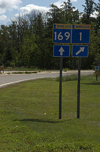
The route runs concurrent with State Highway 169 for 26 miles (42 km) from Vermilion Lake Township (west of Tower) to Ely.
State Highway 1 also runs concurrent with State Highway 89 for 28 miles (45 km) on the southwest side of Red Lake. This is the longest concurrency with another state highway within Minnesota.
History
Most of State Highway 1 was authorized in 1933,[3] except for a section between U.S. 75 and State Highway 32 at Thief River Falls which was part of Minnesota Constitutional Route 33 authorized in 1920.[1]
The route was given the Highway 1 designation because it was one of the longest trunk highways, and would allow re-use of the Route 1 markers removed from along U.S. 61 and U.S. 65 in 1934.[1]
When it was marked in 1934, it was only paved from U.S. 75 to Highway 32 and from Highway 169 to Ely.[4]
As recently as 1963, significant portions of Highway 1 were unpaved.
Highway 1 still had an unpaved segment in 1996, between U.S. 53 and State Highway 169 in northern Saint Louis County. At that point it was swapped with paved Saint Louis County Road 22.[1]
Major intersections
County Location Mile[5][2] Destinations Notes Red River of the North 0.000 ND 54Marshall Oak Park Township 1.554  MN 220
West end of MN 220 concurrency Alvarado 6.555 MN 220East end of MN 220 concurrency Warren 17.050 US 75Pennington Thief River Falls 44.457 US 59West end of US 59 concurrency 45.771 US 59
 MN 32
MN 32East end of US 59 concurrency
South end of MN 32 concurrency46.118 MN 32North end of MN 32 concurrency Goodridge Township 63.367  MN 219
Clearwater No major junctions Beltrami Red Lake Indian Reservation 89.331 MN 89North end of MN 89 concurrency 116.960 MN 89South end of MN 89 concurrency Cormant Township 141.331  MN 72
MN 72West end of MN 72 concurrency Shooks 146.400 MN 72East end of MN 72 concurrency Koochiching Northome (unorganized territory) 151.288 US 71South end of US 71 concurrency Northome 154.276 US 71North end of US 71 concurrency 154.564 MN 46Northome (unorganized territory) 178.128  MN 6
MN 6North end of MN 6 concurrency Itasca Effie (unorganized territory) 180.452 MN 6South end of MN 6 concurrency Effie 186.656 MN 38Carpenter Township 211.369 MN 65West end of MN 65 concurrency 215.424 MN 65East end of MN 65 concurrency St. Louis Linden Grove 229.223  MN 73
MN 73Field Township 236.245 US 53North end of US 53 concurrency Sherman Corner 244.377 US 53South end of US 53 concurrency Peyla 258.848 MN 169West end of MN 169 concurrency Tower 263.159  MN 135
Ely 286.208 MN 169East end of MN 169 concurrency Lake Illgen City 347.340 MN 611.000 mi = 1.609 km; 1.000 km = 0.621 mi
Concurrency terminus • Closed/Former • Incomplete access • UnopenedReferences
- ^ a b c d e Steve Riner (July 26, 2003). Details of Routes 1-25. Unofficial Minnesota Highways Page. Accessed August 27, 2004.
- ^ a b "Trunk Highway Log Point Listing - Construction District 1" (PDF). Minnesota Department of Transportation. September 4, 2009. http://www.dot.state.mn.us/roadway/data/reports/logpoint/d1.pdf. Retrieved August 21, 2010.
- ^ "Chapter 440-H.F. No. 2000", Session Laws of Minnesota for 1933 (Mike Holm, Secretary of State): pp. 881-897
- ^ Minnesota Highway Department (May 1, 1934). 1934 Map of Trunk Highway System, State of Minnesota (Map). http://reflections.mndigital.org/cdm4/item_viewer.php?CISOROOT=/mdt&CISOPTR=210&DMSCALE=25&DMWIDTH=800&DMHEIGHT=800&DMX=1418&DMY=484&DMMODE=viewer&DMTEXT=&REC=15&DMTHUMB=1&DMROTATE=0. Retrieved November 16, 2010.
- ^ "Trunk Highway Log Point Listing - Construction District 2" (PDF). Minnesota Department of Transportation. September 4, 2009. http://www.dot.state.mn.us/roadway/data/reports/logpoint/d2.pdf. Retrieved August 21, 2010.
External links
- Minnesota Highway 1, MN Highway Endings.
Categories:- State highways in Minnesota
- Transportation in Lake County, Minnesota
- Transportation in St. Louis County, Minnesota
- Transportation in Itasca County, Minnesota
- Transportation in Koochiching County, Minnesota
- Transportation in Beltrami County, Minnesota
- Transportation in Pennington County, Minnesota
- Transportation in Marshall County, Minnesota
- Transportation in Clearwater County, Minnesota


Wikimedia Foundation. 2010.