- Northome, Minnesota
-
Northome, Minnesota — City — Nickname(s): Big Bear Capitol Location of Northome, Minnesota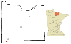
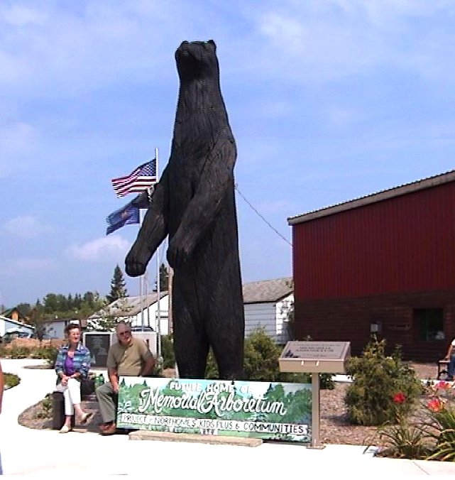
Coordinates: 47°52′23″N 94°16′44″W / 47.87306°N 94.27889°WCoordinates: 47°52′23″N 94°16′44″W / 47.87306°N 94.27889°W Country United States State Minnesota County Koochiching Area – Total 1.9 sq mi (4.9 km2) – Land 1.5 sq mi (3.9 km2) – Water 0.4 sq mi (1.0 km2) Elevation 1,440 ft (439 m) Population (2010)[1] – Total 200 – Density 151.3/sq mi (58.4/km2) Time zone Central (CST) (UTC-6) – Summer (DST) CDT (UTC-5) ZIP code 56661 Area code(s) 218 FIPS code 27-47122[2] GNIS feature ID 0657633[3] 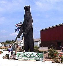 Carved wooden Black Bear Statue at Northome
Northome is a city located in the southwestern corner of Koochiching County, Minnesota, United States. The population was 200 at the 2010 census.[1] The county seat is International Falls, about 70 miles (110 km) away.
U.S. Route 71 and State Highways 1 and 46 meet in Northome.
Contents
Fair
The Northome Fairgrounds hold the annual Koochiching County Fair, which celebrated its 100th anniversary in August 2006.
Fair events include:
- Demolition derby
- ATV race
- "Scenic Sinkhole Scramble" runs of 2 miles (3.2 km) and 10 km
- Animal and crafts judging and a related Bear Fest parade in the city of Northome.
History
Northome was founded in 1903 and enjoyed a boom time early in the 20th century as a logging town.
By the 1930s the big white and red pines were gone and pine trees were essentially locally extirpated due to the unsustainable logging practices of the time[4], and farming gained importance. Many farmers relocated here from the Dust Bowl conditions in the Dakotas at that time.
The Burlington Northern Railroad had a depot in Northome until the late 1970s, although passenger service discontinued long before that. Today the railroad bed is part of a large network of snowmobile trails.
Geography
According to the United States Census Bureau, the city has a total area of 1.9 square miles (4.9 km2), of which, 1.5 square miles (3.9 km2) of it is land and 0.4 square miles (1.0 km2) of it (19.58%) is water.
Northome is located at 47°52′19″N 94°16′48″W / 47.87194°N 94.28°W (47.871986, -94.280248). There are named townships around Northome (Bridgie, Englewood, Wildwood, etc.) but in Koochiching County all townships are unincorporated. Therefore, for Census and other government purposes, the city of Northome also lends its name to the surrounding Unorganized Territory of Northome (approximately 300 square miles (800 km2) of SW Koochiching County, excluding Northome and Mizpah, with 500 people in the 2000 census). It could be that the name "Northome" is derived from the Norwegian place name "Norheim" which is found in 4 places in Norway. The name literally means north home.
Economy
Important sources of employment in the area include resorts, health care/assisted living facilities, and the Northome School. The local newspaper was the Northome Record, produced from 1905-2007. Shortly after the Northome Record ceased the Northome Area News was created by a local family.
Wildlife
The town is on the shores of Bartlett Lake; to the south is Island Lake, popular for fishing and swimming. The lake holds Northern Pike, crappie, perch, and Bull Head. Other smaller lakes are in the area as well, together supporting a variety of fish including walleye and northern pike. Unlike most of the rest of the Lower 48 states, timber wolves (the grey wolf) were never eradicated from this area,[5] and wolves can still be heard at night, though rarely seen. There have also been occasional reports of cougar sightings.
Demographics
Primary occupations in the area are logging timber, farming, healthcare and resorts/tourism. The largest single employer is the Northome School. As of the census[2] of 2000, there were 230 people, 87 households, and 46 families residing in the city. The [population density]] was 151.3 people per square mile (58.4/km²). There were 113 housing units at an average density of 74.4 per square mile (28.7/km²). The racial makeup of the city was 96.96% White, 1.74% Native American, and 1.30% from two or more races.
There were 87 households out of which 26.4% had children under the age of 18 living with them, 48.3% were married couples living together, 2.3% had a female householder with no husband present, and 47.1% were non-families. 42.5% of all households were made up of individuals and 32.2% had someone living alone who was 65 years of age or older. The average household size was 2.21 and the average family size was 3.07.
In the city the population was spread out with 22.6% under the age of 18, 3.9% from 18 to 24, 19.6% from 25 to 44, 23.5% from 45 to 64, and 30.4% who were 65 years of age or older. The median age was 48 years. For every 100 females there were 71.6 males. For every 100 females age 18 and over, there were 61.8 males.
The median income for a household in the city was $25,417, and the median income for a family was $36,250. Males had a median income of $30,556 versus $20,375 for females. The per capita income for the city was $14,758. About 13.0% of families and 24.2% of the population were below the poverty line, including 22.0% of those under the age of eighteen and 20.8% of those sixty five or over.
Outdoor Activities
Fall brings the deer hunters and in the winter snowmobiling is a growing activity, supporting a small industry with a network of trails leading to nearby communities, including across the Big Bog State Recreation Area to Waskish Township. Winters also support ice-fishing, as cold temperatures occasionally dipping down to −40° (F or C) create ice that can support small snowplows to clear roads on the lakes.
References
- ^ a b "2010 Census Redistricting Data (Public Law 94-171) Summary File". American FactFinder. U.S. Census Bureau, 2010 Census. http://factfinder2.census.gov/faces/tableservices/jsf/pages/productview.xhtml?pid=DEC_10_PL_GCTPL2.ST13&prodType=table. Retrieved 23 April 2011.
- ^ a b "American FactFinder". United States Census Bureau. http://factfinder.census.gov. Retrieved 2008-01-31.
- ^ "US Board on Geographic Names". United States Geological Survey. 2007-10-25. http://geonames.usgs.gov. Retrieved 2008-01-31.
- ^ "Short Supply—1900". http://www.mnhs.org/places/sites/fhc/shortsupply.html. Retrieved 2011-03-11.
- ^ "Wolf Range 1978-1998". http://files.dnr.state.mn.us/natural_resources/animals/mammals/wolves/RangeExpansion.pdf.
External links
- City of Northome website - Link, community calendar, etc.
- Northome School website - Link, District 363
- LakesnWoods.com website -- Northome, Minn. Guide - Link, collection of Northome information
Municipalities and communities of Koochiching County, Minnesota Cities Big Falls | International Falls | Littlefork | Mizpah | Northome | Ranier
Unorganized
territoriesUnincorporated
communitiesBirchdale | Craigsville | Indus | Island View | Loman | Margie | Pelland | Ray
Indian
reservationCategories:- Populated places in Koochiching County, Minnesota
- Cities in Minnesota


Wikimedia Foundation. 2010.