- Illinois Route 64
-
Illinois Route 64
Route information Maintained by IDOT Length: 138.82 mi[2] (223.41 km) Existed: 1924[1] – present Major junctions West end: 
 U.S. Route 52/Iowa Highway 64 at Savanna
East end:  US 41 in Chicago
Location Counties: Carroll, Ogle, DeKalb, Kane, DuPage, Cook Highway system Illinois state highway system
Illinois Tollway system←  I-64
I-64US 66  →
→Illinois Route 64 is an east–west road in north-central Illinois. Its western terminus is at the Iowa state line, connecting with U.S. Route 52 and Iowa Highway 64 via the Savanna-Sabula Bridge at the Mississippi River west of Savanna . Route 64 then travels east through Mount Carroll, Lanark, Mount Morris, Oregon, Sycamore, Lily Lake, Saint Charles and the western suburbs of Chicago before terminating at Lake Shore Drive (U.S. Highway 41) on the city's north side. Route 64 is 138.82 miles (223.41 km) long.[2]
Contents
Route description
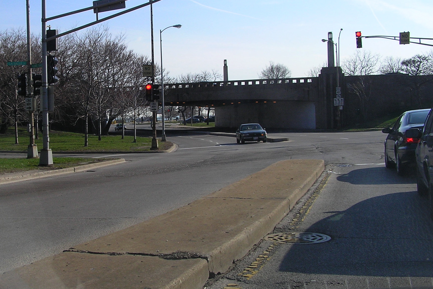
 Eastbound endpoint of Illinois Route 64 at U.S. Route 41.
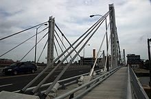 North Avenue Bridge over the Chicago River, looking east
Illinois 64 overlaps U.S. Highway 52 between the Iowa state line and Brookville — a distance of over 20 miles (32 km) — so that the Route 64 designation can carry over to Iowa. East of the Mississippi River, Illinois Route 64 is largely a rural, undivided surface road from Savanna to the Fox River in Saint Charles.
At St. Charles, Illinois 64 enters the Chicago metro area and becomes a 4 lane road, taking on the name of Main Street. Just east of St. Charles, Route 64 becomes North Avenue and retains this designation until just before its terminus in Chicago at U.S. 41 (Lake Shore Drive). At Illinois Route 59, the road widens further from 4 lanes to 6 lanes and becomes a divided highway until its intersection with Illinois Route 83 in Elmhurst. From Elmhurst to Interstate 294 it remains a 4-lane surface street, but it widens to a 6 lane divided highway once again through the towns of Stone Park and Northlake. At the Des Plaines River and Illinois Route 43, North Avenue becomes 4 lanes for the rest of its route through Chicago. One-half mile (0.8 km) west of U.S. 41, Illinois 64 turns north onto LaSalle Boulevard, and then east, before terminating at Lake Shore Drive.
North Avenue is a main east–west artery in Chicago itself, and one of only seven state routes to enter the city. It is located at the 1600 North parallel of Chicago. Just east of the Kennedy Expressway (Interstates 90/94), the North Avenue Bridge carries Illinois 64 over the North Branch of the Chicago River. The hybrid suspension/cable-stayed bridge was built in 2006, replacing a bascule bridge dating back to 1907.
Between Halsted and Sheffield Avenues, North Avenue has become a shopping destination, known as the Clybourn Corridor.
Illinois Truck Route 64
Illinois 64 has one alternate route; Illinois Truck Route 64, a bypass around a truck-prohibited, residential section of Elmhurst. Eastbound truck traffic is rerouted north along Illinois Route 83, east along U.S. Highway 20 (Lake Street) and then onto Interstate 290 before being allowed to return to Illinois 64. Westbound truck traffic follows the same route in reverse.
As early as 1989, the city of Elmhurst had sought to block trucks from traveling on North Avenue through its city limits. For a time, Illinois House of Representatives minority leader Lee Daniels supported a plan to reduce North Avenue from four lanes to two, prohibiting trucks from traveling through the residential neighborhood.[3] By 1994, the village had agreed to reconstruct North Avenue and add a single set of left-turn lanes at Myrtle Avenue.[4] Reconstruction of North Avenue in Elmhurst took place in 1997.[5]
History
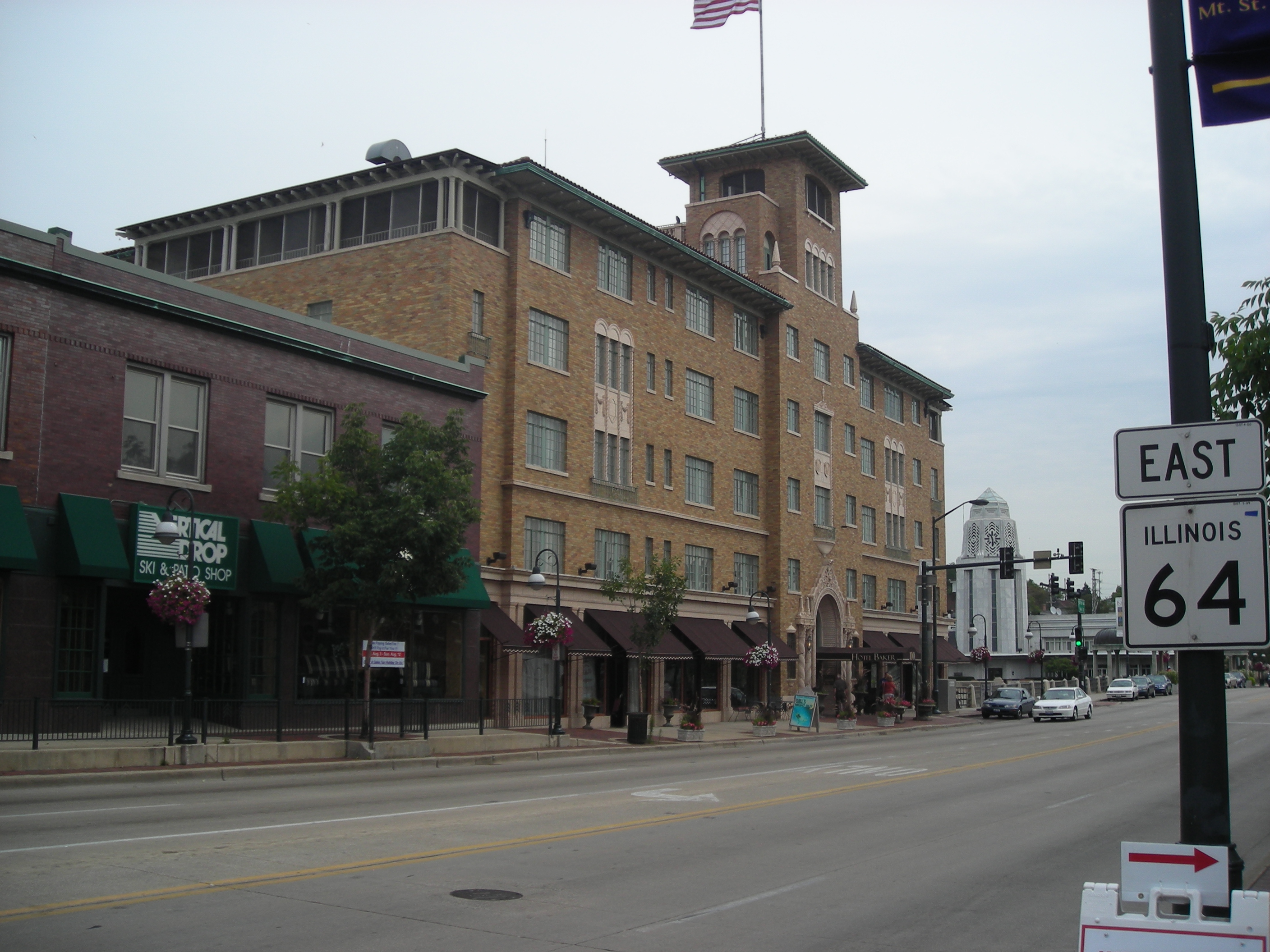
 Illinois Route 64 in downtown St. Charles
SBI Route 64 was Illinois 64 from Sycamore to Chicago. In 1937 it was extended west to what was then U.S. Route 51 (and is now Illinois Route 251). Afterwards, it was extended further west to U.S. Route 52, and then following it to the state line. Much like Illinois Route 92, there is no particular reason for extending Route 64 through Iowa and Nebraska, as existing U.S. Routes served any major cities on the State Route 64s better.[1]
Major Junctions
County Location Junction Notes Cook Chicago US 41 (Lake Shore Drive)Eastern Terminus  I-90
I-90 IL 50 (Cicero Ave.)
 IL 43 (Harlem Ave.)
Melrose Park  IL 171 (1st Ave.)
Northlake 
 US 12 / US 45
No direct access DuPage Elmhurst  US 20
US 20Use for 290 east  I-294
I-294No direct access - use I-290 west  I-290
I-290 IL 83 (Kingery Hwy.)
Lombard  IL 53 (Rohlwing Rd.)
 I-355
I-355West Chicago  IL 59
IL 59Kane St. Charles  IL 25
IL 25 IL 31
IL 31Lily Lake  IL 47
IL 47DeKalb Sycamore  IL 23
IL 23References
- ^ a b Carlson, Rick. Illinois State Highways Page: Routes 61 thru 80. Last updated March 15, 2006. Retrieved March 24, 2006.
- ^ a b Illinois Technology Transfer Center (2006). "T2 GIS Data". http://www.dot.state.il.us/gist2/select.html. Retrieved 2007-11-08.
- ^ Mehler, Neil H. (1989-07-14). "Elmhurst seeks truck ban on North Avenue". Chicago Tribune. http://docs.newsbank.com/openurl?ctx_ver=z39.88-2004&rft_id=info:sid/iw.newsbank.com:NewsBank:CTRB&rft_val_format=info:ofi/fmt:kev:mtx:ctx&rft_dat=0FF78891D9204989&svc_dat=InfoWeb:aggregated5&req_dat=AA98CDC331574F0ABEAFF732B33DC0B2. Retrieved 2008-07-17.
- ^ Mannion, Annemarie (1994-01-13). "North Ave. plan now ready". Chicago Tribune. http://docs.newsbank.com/openurl?ctx_ver=z39.88-2004&rft_id=info:sid/iw.newsbank.com:NewsBank:CTRB&rft_val_format=info:ofi/fmt:kev:mtx:ctx&rft_dat=0EB425892153FBFF&svc_dat=InfoWeb:aggregated5&req_dat=AA98CDC331574F0ABEAFF732B33DC0B2. Retrieved 2008-07-17.
- ^ Chicago Tribune (1997-11-18). "North Avenue, other streets to open after re-pavement". Chicago Tribune. http://docs.newsbank.com/openurl?ctx_ver=z39.88-2004&rft_id=info:sid/iw.newsbank.com:NewsBank:CTRB&rft_val_format=info:ofi/fmt:kev:mtx:ctx&rft_dat=0EB428D27405E8A3&svc_dat=InfoWeb:aggregated5&req_dat=AA98CDC331574F0ABEAFF732B33DC0B2. Retrieved 2008-07-17.
External links
Categories:- State highways in Illinois


Wikimedia Foundation. 2010.