- Mount Morris, Illinois
-
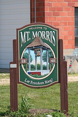
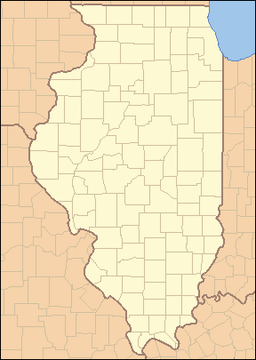
Mount Morris Village Sign leading on Rt. 64 leading into Mount Morris.Motto: Let Freedom Ring Country United States State Illinois County Ogle Township Mt. Morris Elevation 909 ft (277 m) Coordinates 42°02′51″N 89°26′02″W / 42.0475°N 89.43389°W Area 3.0 sq mi (8 km2) - land 3.0 sq mi (8 km2) - water 0.0 sq mi (0 km2) Population 2,998 (2010) Density 994.3 / sq mi (384 / km2) Postal code 61054 Area code 815 Wikimedia Commons: Mount Morris, Illinois Website: http://www.toi.org/MOUNTMORRISTOWNSHIP/ Mount Morris is a village in Mount Morris Township, Ogle County, Illinois, United States. The population was 2,998 at the 2010 census, down from 3,013 at the 2000 census.
Contents
Geography
Mount Morris is located at 42°2′51″N 89°26′2″W / 42.0475°N 89.43389°W (42.047614, -89.433972).[1]
According to the United States Census Bureau, the village has a total area of 1.2 square miles (3.1 km2), all of it land.
History
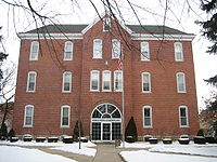
Mt. Morris is home of the Illinois Freedom Bell, which is located in the town square. The area that is now the town square used to be the campus of one of Illinois' first institutes of higher learning, Mount Morris College.[citation needed] It was first a Methodist school and was later affiliated with the Church of the Brethren. The college closed after numerous fires, including one fire that leveled the boys' dormitory.[citation needed] Fires have played a major role in village history. The village's old junior high school, while undergoing demolition, caught fire and burned right before the school district merged with the Oregon School District in 1993. (The first graduating class of the newly combined Oregon School District was class of 1994.)[citation needed] In addition, several shops on Wesley Avenue, the main street, were lost to a fire on December 5, 1999. On February 12, 2004, the Rahn Elementary School was lost to fire when a janitor attempted to thaw out a gas line with an industrial tile heat gun.[citation needed]
Recreation
Parks include Dillehay Park, Mounder Park, and Zickuhr Park.[citation needed] Dillehay Park is located in the southeast portion of the village. Zickuhr Park is located in the western part of town, and has one softball diamond, basketball courts, and an array of playground equipment.[citation needed] Mounder Park houses a skating park, a pavilion, and the playground equipment that was donated by the school after the Rahn fire.
Demographics
As of the census[2] of 2000, there were 3,013 people, 1,259 households, and 810 families residing in the village. The population density was 2,585.1 people per square mile (994.3/km²). There were 1,337 housing units at an average density of 1,147.1 per square mile (441.2/km²). The racial makeup of the village was 97.15% White, 0.17% African American, 0.20% Native American, 0.43% Asian, 0.13% Pacific Islander, 1.00% from other races, and 0.93% from two or more races. Hispanic or Latino of any race were 2.75% of the population.
There were 1,259 households out of which 29.3% had children under the age of 18 living with them, 50.8% were married couples living together, 10.6% had a female householder with no husband present, and 35.6% were non-families. 32.2% of all households were made up of individuals and 14.9% had someone living alone who was 65 years of age or older. The average household size was 2.28 and the average family size was 2.86.
In the village the population was spread out with 23.8% under the age of 18, 7.3% from 18 to 24, 26.5% from 25 to 44, 19.9% from 45 to 64, and 22.5% who were 65 years of age or older. The median age was 40 years. For every 100 females there were 90.8 males. For every 100 females age 18 and over, there were 86.0 males.
The median income for a household in the village was $41,333, and the median income for a family was $51,019. Males had a median income of $39,323 versus $20,840 for females. The per capita income for the village was $20,326. About 6.0% of families and 6.9% of the population were below the poverty line, including 13.2% of those under age 18 and 5.9% of those age 65 or over.
See also
References
- ^ "US Gazetteer files: 2010, 2000, and 1990". United States Census Bureau. 2011-02-12. http://www.census.gov/geo/www/gazetteer/gazette.html. Retrieved 2011-04-23.
- ^ "American FactFinder". United States Census Bureau. http://factfinder.census.gov. Retrieved 2008-01-31.
External links
- Description of Mount Morris
- Mt. Morris Public Library
- Mt. Morris Fire Department
- Oregon-Mt. Morris School merger
- The Kable Brothers Company
- Mt. Morris History
Municipalities and communities of Ogle County, Illinois Cities Villages Adeline | Creston | Davis Junction | Forreston | Hillcrest | Leaf River | Monroe Center | Mount Morris | Stillman Valley
Townships Brookville | Buffalo | Byron | Dement | Eagle Point | Flagg | Forreston | Grand Detour | LaFayette | Leaf River | Lincoln | Lynnville | Marion | Maryland | Monroe | Mt. Morris | Oregon-Nashua | Pine Creek | Pine Rock | Rockvale | Scott | Taylor | White Rock | Woosung
Unincorporated
communitiesBaileyville | Brookville | Buffalo Grove | Chana | Daysville | Egan | Flagg | Flagg Center | Grand Detour | Haldane | Harper | Hazelhurst‡ | Holcomb | Kings | Lindenwood | Lost Nation | Paynes Point | Stratford | Woosung
Footnotes ‡This populated place also has portions in an adjacent county or counties
Categories:- Populated places in Ogle County, Illinois
- Villages in Illinois
- Mount Morris, Illinois
Wikimedia Foundation. 2010.


