- Mount Morris Park Historic District
-
Mount Morris Park Historic District

Location: Bounded roughly by Lenox Ave., Mount Morris Park West, and W. 124th and W. 119th Sts., (original)
Roughly bounded by Adam Clayton Powell, Jr. Blvd. and Mt. Morris Park W. from W. 118th to W. 124th Sts., (increase), New York, New York[1]Coordinates: 40°48′17″N 73°56′49″W / 40.80472°N 73.94694°WCoordinates: 40°48′17″N 73°56′49″W / 40.80472°N 73.94694°W Built: 1878 Architect: Multiple; including in the increase: Angell, Edward L.; Baxter, Charles Architectural style: Queen Anne, Late 19th And 20th Century Revivals, Romanesque (original)
Beaux Arts, Second Empire, Renaissance (increase)Governing body: Local (original) and State (increase)[1] NRHP Reference#: 73001221 Added to NRHP: February 06, 1973 (original)
May 24, 1996 (increase)[1]Mount Morris Park Historic District was designated to be a historic district by New York City Landmarks Preservation Commission in 1971. It is a large 16-block area in east central Harlem. The boundaries are West 118th and West 124th Streets, Fifth Avenue, and Adam Clayton Powell Jr. Boulevard (Seventh Avenue). "Doctor's Row" is West 122nd Street, Mount Morris Park West and Malcolm X Boulevard. The name Mount Morris remains a mystery to some despite the 18th century local prominence of the Gouverneur Morris family.
The houses that cover Mount Morris Park Historic District are designed in the late 19th and early 20th century residential row houses and church architecture. There are several unaltered streetscapes. Romanesque Revival, neo-Grec, Queen Anne, and 1893's World Columbian Exposition in Chicago were among the influences that created the eclectic style from the Gilded Age.
Before the European settlements the rocky hill of Manhattan mica-schist was used by the Native Americans as a lookout station to see over the entire island. In 1658, Dutch colonists established Nieuw Haarlem and named the hill Slang Berg (which translates to "snake hill"). The nearness of the Harlem River made Slang Berg a militarily strategic location.
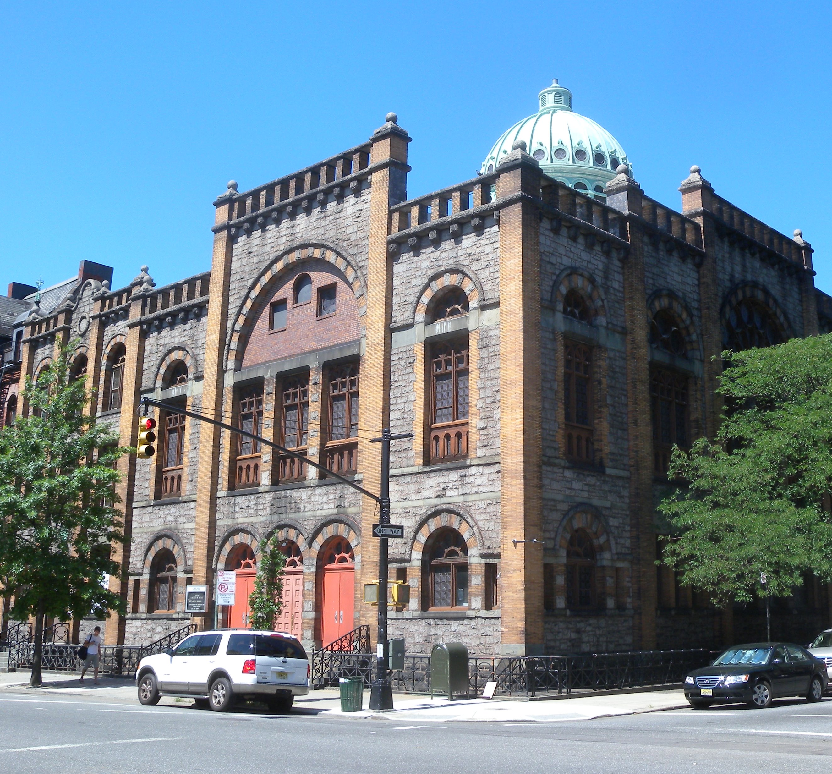
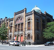 Mt Morris Ascension Presbyterian Church
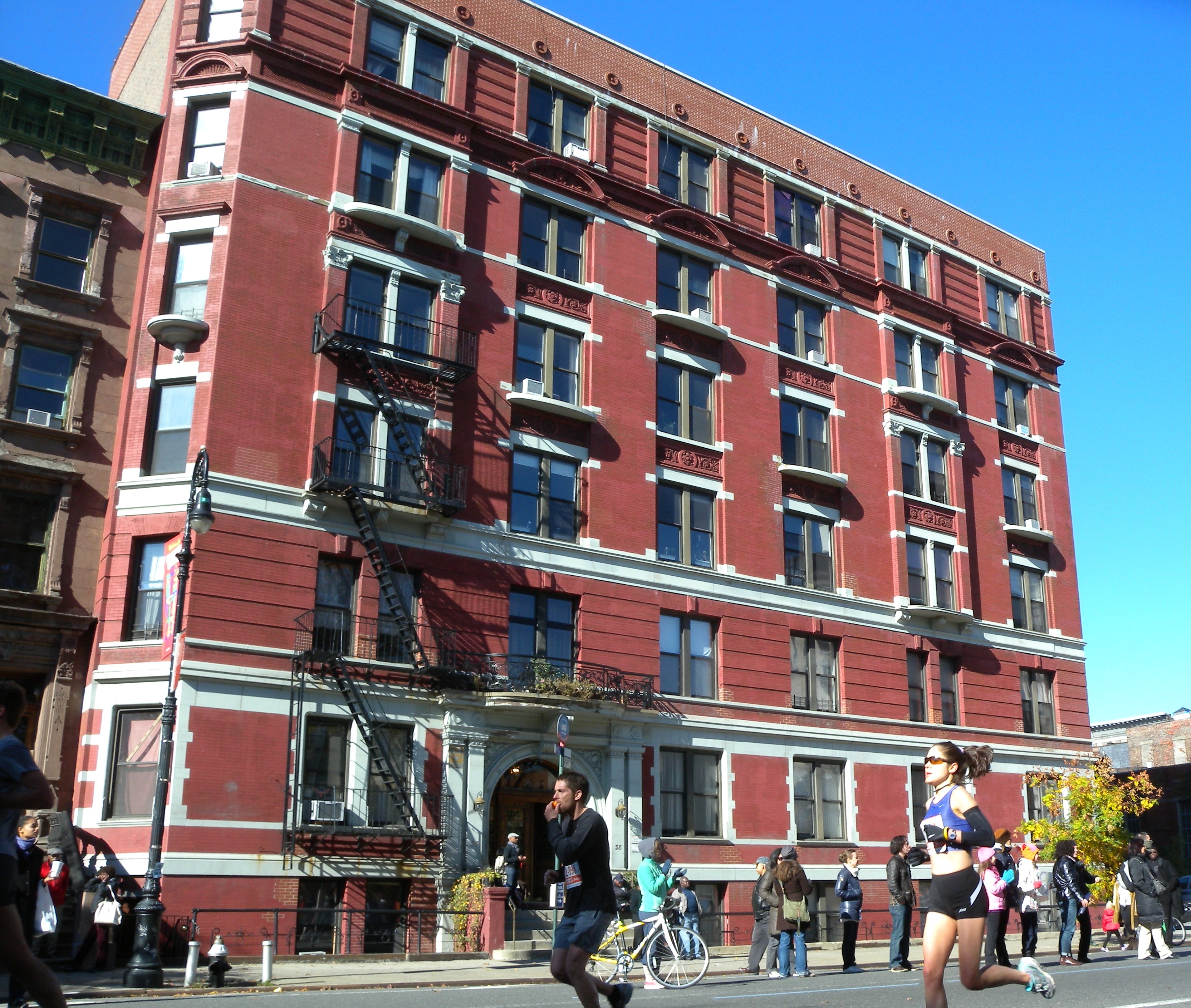
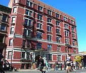 Apartment house on Mt Morris Park West
On September 4, 1839, Mount Morris Square became a 20-acre (81,000 m2) residential square which was formerly a race track for horses, out of 173 acres (0.70 km2) owned by the Benson family land grant farm.
In 1973, the name of the land was changed to Marcus Garvey Park. This was in honor of the international Pan-African movement leader. In 1973, a part of the current district was listed on the National Register of Historic Places.[1]
In 1981, the Mount Morris Park Community Association (MMPCIA) was created. They wanted to make a 21st century Renaissance. They promoted buildings such as: Apollo Theatre, National Black Theatre, Schomburg Library, the Studio of Harlem, and many African and Caribbean restaurants that serve soul food in Central Harlem. They sponsored annual Historic Neighborhood House Tours, held on the second week of June. The association features historic brownstones and landmark buildings open for the public to view.
In 1996, the boundaries of Mount Morris Park District were expanded. They were pushed west to include blocks between Lenox Avenue and Seventh Avenue, and south to include some of West 118th Street.[1] An extension is contemplated to reflect the area on National Register of Historic Places.
References
- ^ a b c d e "National Register Information System". National Register of Historic Places. National Park Service. 2008-04-15. http://nrhp.focus.nps.gov/natreg/docs/All_Data.html.
U.S. National Register of Historic Places Topics Lists by states Alabama • Alaska • Arizona • Arkansas • California • Colorado • Connecticut • Delaware • Florida • Georgia • Hawaii • Idaho • Illinois • Indiana • Iowa • Kansas • Kentucky • Louisiana • Maine • Maryland • Massachusetts • Michigan • Minnesota • Mississippi • Missouri • Montana • Nebraska • Nevada • New Hampshire • New Jersey • New Mexico • New York • North Carolina • North Dakota • Ohio • Oklahoma • Oregon • Pennsylvania • Rhode Island • South Carolina • South Dakota • Tennessee • Texas • Utah • Vermont • Virginia • Washington • West Virginia • Wisconsin • WyomingLists by territories Lists by associated states Other  Category:National Register of Historic Places •
  Portal:National Register of Historic PlacesCategories:
- Historic districts in New York City
- Queen Anne architecture in New York
- Harlem, New York
- National Register of Historic Places in Manhattan

Wikimedia Foundation. 2010.