- Interstate 81
Infobox road
route=81
type=I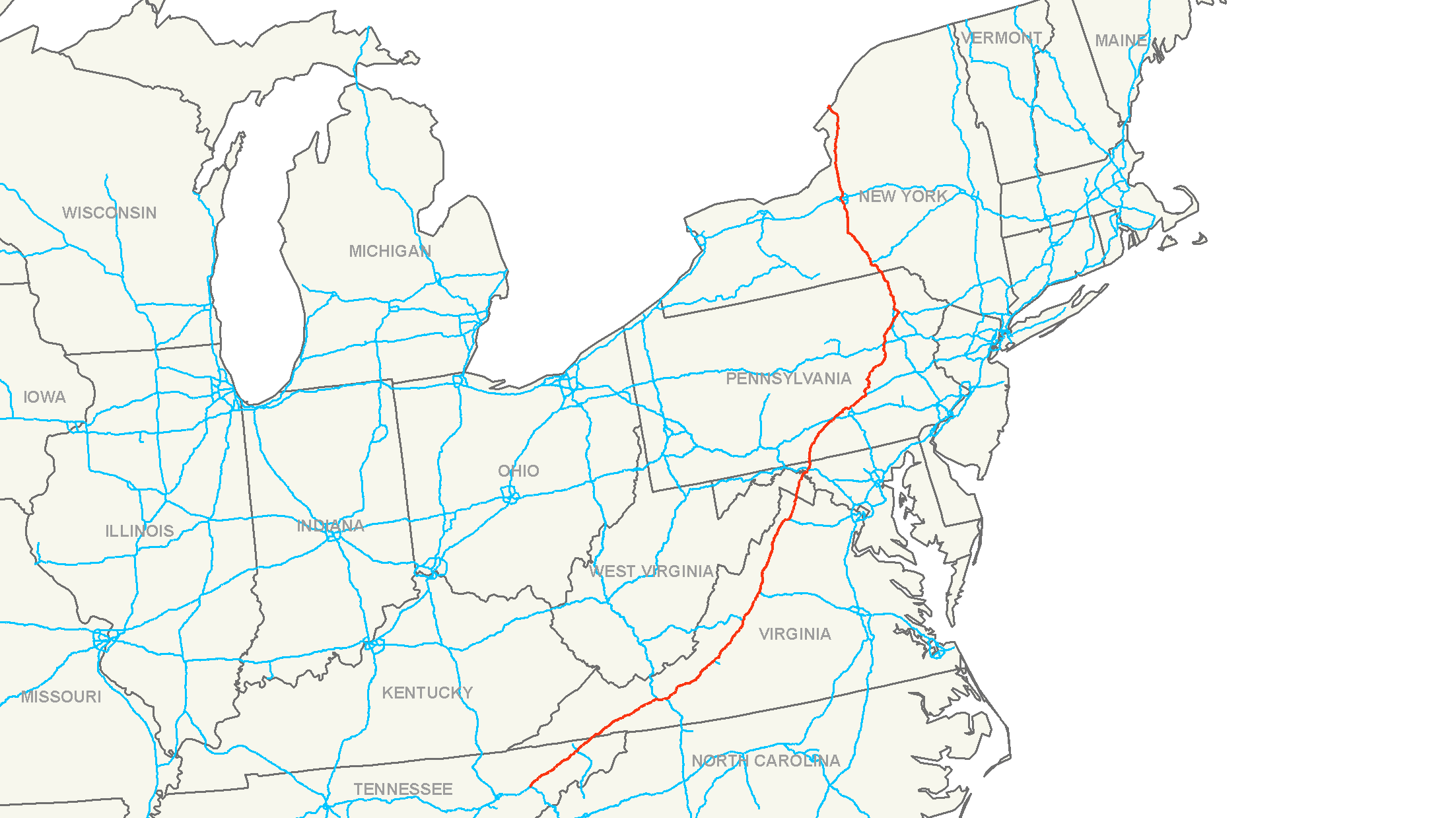
year_established=
length_mi=846
length_km=1361
direction_a=South
direction_b=North
terminus_a=
terminus_b=)
junction=
commons=categoryInterstate 81 (abbreviated I-81) is an
interstate highway in the eastern part of theUnited States . Its southern terminus is atInterstate 40 inDandridge, Tennessee ; its northern terminus is onWellesley Island (nearFishers Landing, New York ) at the Canadian border, where theThousand Islands Bridge connects it to Highway 401, the main freeway connecting Windsor-Detroit andToronto toMontreal .Interstate 81 largely traces the path of the
Appalachian Mountains , often paralleling its older U.S. highway counterpart,U.S. Route 11 . While mostly rural, it is heavily used as a trucking corridor, often as a bypass of the busierInterstate 95 to the east.Route description
-
TN || 75 ||121
-
VA || 323 || 520
-
WV || 23 ||37
-
MD || 11 ||18
-
PA || 234 ||377
-
NY || 183 || 294Tennessee and Virginia
:"Main articles: Interstate 81 in: Tennessee | Virginia"Interstate 81 begins in Tennessee at Interstate 40 in Dandridge. The route parallels the Appalachian Mountains for much of its route through Tennessee and Virginia, serving such cities as Roanoke, Blacksburg, Lexington, Staunton, Harrisonburg, and Winchester. In Harrisonburg, I-81 cuts through
James Madison University . It parallels its older counterpart,U.S. Route 11 , for its entire length in Virginia.West Virginia and Maryland
:"Main articles: Interstate 81 in: West Virginia | Maryland"Interstate 81 briefly enters the eastern panhandle of West Virginia, serving the city of Martinsburg. It then traverses the state of Maryland at one of its narrowest points, passing through the "Hub City" of Hagerstown where it intersects with a large number of other routes.
Pennsylvania
Interstate 81 forms a major north-south corridor through the state of Pennsylvania, serving the boroughs of Chambersburg and Carlisle, where it meets the
Pennsylvania Turnpike but does not interchange with it. Around the state capital of Harrisburg, the route forms the northeastern section of Pennsylvania's Capital Beltway. The route then travels northeast towards theWyoming Valley , where it serves the cities of Wilkes-Barre and Scranton, then heads north through theEndless Mountains region towards the state line.New York
Interstate 81 enters the New York state near Binghamton. It parallels
U.S. Route 11 in a north-south direction, serving the cities of Syracuse (where it intersects theNew York State Thruway ), and Watertown. The route ends at the Canadian border at theThousand Islands Bridge , where it crosses the St. Lawrence River, continuing as Highway 137.Major intersections
*
*
*, where I-81 North overlaps I-77 South, and vice versa).
*.
*
*
*)
*
*)
*)
*)
*
*
*
*
*
*Auxiliary routes
There are three current child routes either providing access to, or bypassing, various cities along the Interstate 81 route.
Current
*I-381 -
Bristol, Virginia
*I-581 -Roanoke, Virginia
*I-481 -Syracuse, New York Past
*I-181 -
Kingsport, Tennessee : Deleted in August2005 whenInterstate 26 took over I-181's entire length.
*I-81E - CurrentInterstate 380 (Pennsylvania) External links
* [http://www.empirestateroads.com/week/week65.html Thousand Islands Bridge System] , showing the bridges and connections at the northern terminus
* [http://www.fhwa.dot.gov/planning/econdev/i81va.htm Economic Development History of Interstate 81 in Virginia] , a Federal Highway Administration report.
Wikimedia Foundation. 2010.