- Roanoke, Virginia
-
For the metropolitan area, see Roanoke metropolitan area. For unsuccessful colonization attempt, see Roanoke Colony.
Roanoke, Virginia — City — From top left: the Hotel Roanoke, the Taubman Museum of Art, the Roanoke Star, the Wells Fargo Tower, St. Andrew's Roman Catholic Church, and the Dr. Pepper sign.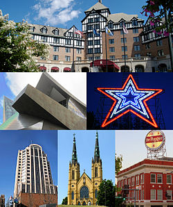
Seal
LogoNickname(s): The Star City of The South or Magic City Location in Virginia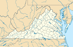
 Roanoke, Virginia
Coordinates: 37°16′15″N 79°56′30″W / 37.27083°N 79.94167°W Country United States State Virginia Government - Type Council-Manager - Mayor David A. Bowers Area - City 43 sq mi (111.1 km2) - Land 42.9 sq mi (111.1 km2) - Water 0.0 sq mi (0.1 km2) Elevation[1] [2] 883–1,740 ft (269–530 m) Population (2010[3]) - City 97,032 - Density 2,261.8/sq mi (873.1/km2) - Metro 302,200 Time zone Eastern (EST) (UTC-5) - Summer (DST) EDT (UTC-4) ZIP Codes 24001–24020, 24022–24038, 24040, 24042–24045, 24048, 24050, 24155, 24157 Area code(s) 540 FIPS code 51-68000[4] GNIS feature ID 1499971[5] Website www.roanokeva.gov Roanoke is an independent city in the Mid-Atlantic U.S. state of Virginia and is the tenth-largest city in the Commonwealth. It is located in the Roanoke Valley of the Roanoke Region of Virginia.[6] The population within the city limits was 97,032 as of 2010.[7] It is the largest municipality in Southwest Virginia, and is the principal municipality of the Roanoke Metropolitan Statistical Area (MSA). In 2009 the Roanoke MSA had an estimated population of 303,418 residents. [7] It is composed of the independent cities of Roanoke and Salem, and the counties of Botetourt, Craig, Franklin and Roanoke. Bisected by the Roanoke River, Roanoke is the commercial and cultural hub of much of the surrounding area of Virginia and southern West Virginia.
History
Incorporation
The town first called Big Lick was established in 1852 and chartered in 1874. It was named for a large outcropping of salt which drew the wildlife to the site near the Roanoke River.[8] In 1882 it became the town of Roanoke, and in 1884 it was chartered as the independent city of Roanoke. The name Roanoke is said to have originated from an Algonquian word for shell "money".[9] This was also the name of the river that bisected it (probably where shells had come from) and the county.[10] The city grew frequently through annexation through the middle of the twentieth century.[11] The last annexation was in 1976. The state legislature has since prohibited cities from annexing land from adjacent counties. Roanoke's location in the Blue Ridge Mountains, in the middle of the Roanoke Valley between Maryland and Tennessee, made it the transportation hub of western Virginia and contributed to its rapid growth.
Colonial influence
During colonial times the site of Roanoke was an important hub of trails and roads. The Great Wagon Road, one of the most heavily travelled roads of eighteenth century America, ran from Philadelphia through the Shenandoah Valley to the future site of the City of Roanoke, where the Roanoke River passed through the Blue Ridge. The Roanoke Gap proved a useful route for immigrants to settle the Carolina Piedmont region. At Roanoke Gap, another branch of the Great Wagon Road, the Wilderness Road, continued southwest to Tennessee.
Railroads and coal
In the 1850s, Big Lick became a stop on the Virginia and Tennessee Railroad (V&T) which linked Lynchburg with Bristol on the Virginia-Tennessee border.
After the American Civil War (1861–1865), William Mahone, a civil engineer and hero of the Battle of the Crater, was the driving force in the linkage of 3 railroads, including the V&T, across the southern tier of Virginia to form the Atlantic, Mississippi & Ohio Railroad (AM&O), a new line extending from Norfolk to Bristol, Virginia in 1870. However, the Financial Panic of 1873 wrecked the AM&O's finances. After several years of operating under receiverships, Mahone's role as a railroad builder ended in 1881 when northern financial interests took control. At the foreclosure auction, the AM&O was purchased by E.W. Clark & Co., a private banking firm in Philadelphia which controlled the Shenandoah Valley Railroad then under construction up the valley from Hagerstown, Maryland. The AM&O was renamed Norfolk and Western Railway (N&W).
Frederick J. Kimball, a civil engineer and partner in the Clark firm, headed the new line and the new Shenandoah Valley Railroad. For the junction for the Shenandoah Valley and the Norfolk and Western roads, Kimball and his board of directors selected the small Virginia village called Big Lick, on the Roanoke River. Although the grateful citizens offered to rename their town "Kimball", at his suggestion, they agreed to name it Roanoke after the river. As the N&W brought people and jobs, the Town of Roanoke quickly became an independent city in 1884. In fact, Roanoke became a city so quickly that it earned the nickname "Magic City".
Kimball's interest in geology was instrumental in the development of the Pocahontas coalfields in western Virginia and West Virginia. He pushed N&W lines through the wilds of West Virginia, north to Columbus, Ohio and Cincinnati, Ohio, and south to Durham, North Carolina and Winston-Salem, North Carolina. This gave the railroad the route structure it was to use for more than 60 years.
The Virginian Railway (VGN), an engineering marvel of its day, was conceived and built by William Nelson Page and Henry Huttleston Rogers. Following the Roanoke River, the VGN was built through the City of Roanoke early in the twentieth century. It merged with the N&W in 1959.
The opening of the coalfields made N&W prosperous and Pocahontas bituminous coal world-famous. Transported by the N&W and neighboring Virginian Railway (VGN), local coal fueled half the world's navies. Today it stokes steel mills and power plants all over the globe.
The Norfolk & Western was famous for manufacturing steam locomotives in-house. It was N&W's Roanoke Shops that made the company known industry-wide for its excellence in steam power. The Roanoke Shops, with its workforce of thousands, is where the famed classes A, J, and Y6 locomotives were designed, built, and maintained. New steam locomotives were built there until 1953, long after diesel-electric had emerged as the motive power of choice for most North American railroads. About 1960, N&W was the last major railroad in the United States to convert from steam to diesel power.
The presence of the railroad also made Roanoke attractive to manufacturers. American Viscose opened a large rayon plant in Southeast Roanoke in October 1917.[12] This plant closed in 1958, leaving 5,000 workers unemployed. When N&W converted to diesel, 2,000 railroad workers were laid off.[13]
Cultural hub
EventZone was created in 2003 by the merger of various existing event organizers. EventZone is also charged with assisting in the creation of new festivals and activities in the Downtown Roanoke "event zone," which is defined as all areas bound by Williamson Road, 6th Street, SW, the Roanoke Civic Center, and Rivers Edge Park.
Local Colors is a multi-cultural program which recognizes people of diverse origins, races and ethnic backgrounds and sponsors the annual Local Colors Festival in the third weekend of May.
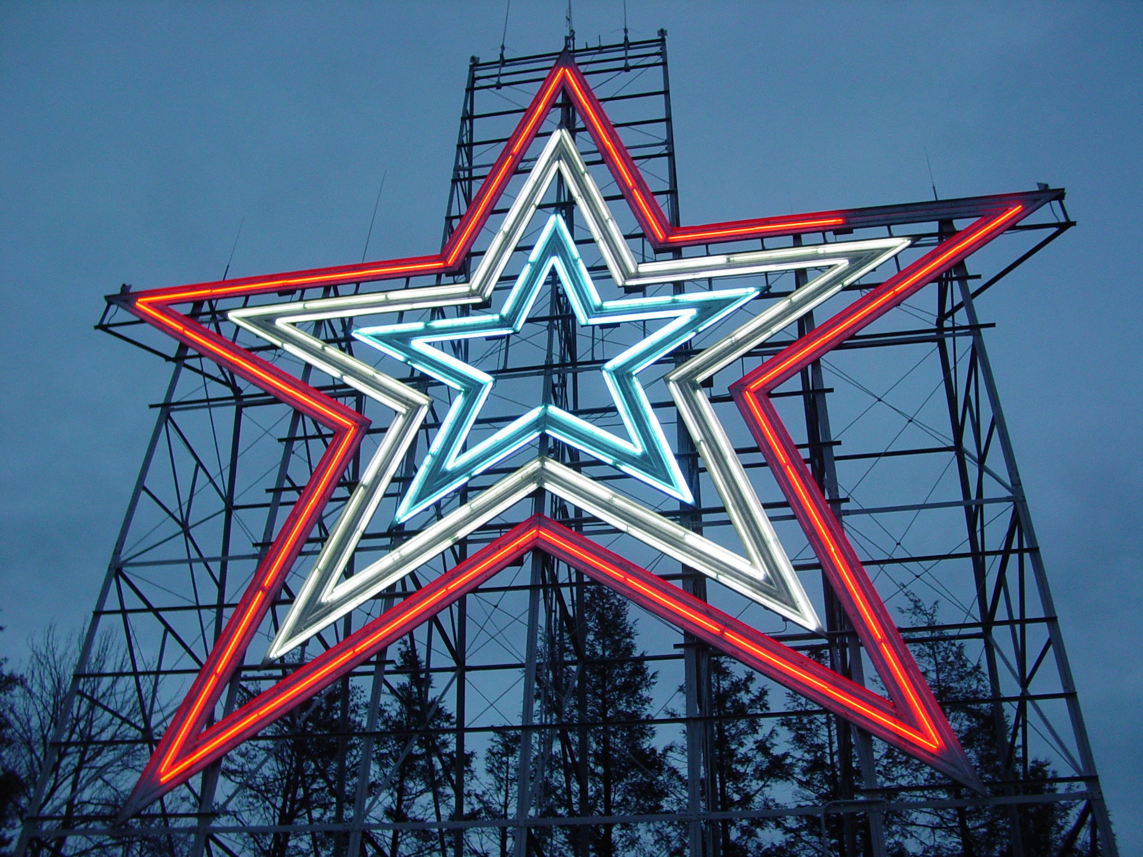
Roanoke's festivals and cultural events include the Chili Cook-Off, Festival in the Park, Local Colors Festival, Henry Street Festival, Big Lick Blues Festival, Strawberry Festival, and the large red, white, and blue illuminated Mill Mountain Star (formerly illuminated in red following drunk driving fatalities in the Roanoke Valley; temporarily illuminated in white on April 22, 2007 in remembrance of the Virginia Tech Massacre of April 16, 2007) on Mill Mountain, which is visible from many points in the city and surrounding valley.
Government
See also: List of mayors of Roanoke, VirginiaRoanoke has a weak mayor-city manager form of government. The city manager is responsible for the day to day operation of the city's government and has the authority to hire and fire city employees. The mayor has little, if any, executive authority and essentially is the "first among equals" on the city council. The mayor, however, has a bully pulpit as Roanoke media frequently cover the mayor's appearances and statements. The current mayor of Roanoke is David A. Bowers and the current city manager is Christopher P. Morrill. City council has six members, not counting the mayor, all of whom are elected on an at-large basis. A proposal for a ward based council, in which the mayor and vice mayor would continue to be elected at-large, was rejected by Roanoke voters in 1997, but ward system advocates still contend that the at-large system results in a disproportionate number of council members coming from affluent neighborhoods and that electing some or all council members on a ward basis would result in a more equal representation of all areas of the city. The four year terms of city council members are staggered, so there are biannual elections. The candidate who receives the most votes is designated the vice mayor for the following two years.
The city's African-American and professional class voting blocs have made the Democratic Party the city's leading party in recent years.
Independent candidate David A. Bowers, a former Democrat, defeated incumbent Democrat Nelson Harris for Mayor in the May 2008 election with 53% of the vote. In both the 2000 election, Republican Ralph K. Smith and in the 2004 election Nelson Harris won with less than 40% of the vote in competitive three way races.
In the May 2008 council elections, Democrats Court Rosen, Anita Price, and Sherman Lea defeated a slate of loosely allied independent city council candidates including incumbent Brian Wishneff. In the May 2006 council elections, a slate of three former Democrats running on an independent slate backed by Harris defeated the candidates of the Democratic and Republican parties. This election ended the city's long running debate about the fate of Victory Stadium.
Roanoke is represented by two members of the Virginia House of Delegates, Onzlee Ware (D-11th) and William H. Cleaveland (R-17th), and one member of the Virginia Senate, John Edwards (D-21st). Former Roanoke mayor Ralph Smith won the 2007 election in the neighboring 22nd Senate district after defeating incumbent Brandon Bell for the Republican nomination in the primary election and Democrat Michael Breiner in the general election.
The City of Roanoke lies within the 6th Congressional District of Virginia, which also includes Lynchburg and much of the Shenandoah Valley. Current representative Bob Goodlatte resides in Roanoke as have many of those who have held the seat. The 9th Congressional District of Virginia, represented by Morgan Griffith, has traditionally covered southwest Virginia but has expanded into parts of Roanoke County and counties to the north of Roanoke to make up for population losses in the rest of the district. Robert Hurt represents much of the area to south and east of Roanoke, including nearby Franklin County, in the 5th Congressional District of Virginia, which also stretches north to Charlottesville. There is speculation that the lines of the three districts could be significantly redrawn in the next redistricting cycle after the 2010 Census, especially if Democrats gain control of the Virginia General Assembly, to account for rapid growth in the northern parts of the 5th and 6th districts and slower growth in the southern parts of the districts and population loss in much of the 9th.[14][unreliable source?]
Politics
Presidential election results[citation needed] Year DEM GOP Others 2008 61.2% 24,934 37.8% 15,394 1.1% 444 2004 52.4% 18,862 46.3% 16,661 1.3% 477 2000 53.6% 17,920 43.7% 14,630 2.7% 892 1996 54.0% 17,282 38.4% 12,283 7.7% 2,451 1992 50.4% 17,724 38.2% 13,443 11.4% 4,014 1988 52.4% 17,185 46.9% 15,389 0.7% 1,671 1984 47.7 17,300 52.1% 19,008 0.5% 184 1980 51.9% 18,139 43.4% 15,164 4.7% 11,643 1976 57.6% 20,696 41.0% 14,738 1.4% 515 1972 33.1% 9,498 64.7% 18,541 2.2% 632 1968 30.9% 9,281 51.2% 15,368 17.9% 5,359 1964 53.7% 15,314 46.2% 13,164 0.1% 18 1960 37.5% 9,175 62.3% 15,229 0.2% 49 Geography
Roanoke is located in the valley and ridge province of Virginia immediately west of the Blue Ridge Mountains and east of the Allegheny Mountains

According to the United States Census Bureau, the city has a total area of 42.9 square miles (111 km2), of which, 42.9 square miles (111 km2) of it is land and 0.04 square miles (0.10 km2) of it (0.07%) is water.
Within the city limits is Mill Mountain, which stands detached from surrounding ranges. Its summit features the Roanoke Star, Mill Mountain Zoo, the Discovery Center interpretive building, and an overlook of the Roanoke Valley. The Appalachian Trail runs through the northern section of Roanoke County several miles north of the city, while the Blue Ridge Parkway runs just to the south of the city. Carvins Cove, the second-largest municipal park in America at 12,700-acre (51 km2), lies in northeast Roanoke County and southwest Botetourt County.[15] Smith Mountain Lake is several miles southeast of the city. The Jefferson National Forest is nearby. Roanokers and visitors to the area enjoy hiking, mountain biking, cross-country running, canoeing, kayaking, fly fishing, and other outdoor pursuits.
The city is located in the North Fork of Roanoke winemaking region. The "North Fork of Roanoke" appellation is a designated American Viticultural Area, recognizing the unique grape growing conditions present in the area. Valhalla Vineyards is located just outside the city limits of Roanoke.
The Roanoke River flows through the city of Roanoke. Some stretches of the river flow through parks and natural settings, while others flow through industrial areas. Several tributaries join the river in the city, most notably Peters Creek, Tinker Creek, and Mud Lick Creek.
Climate
Being located along the Blue Ridge Mountains, Roanoke lies in the transition zone between the Humid subtropical climate zone and the Humid continental climate zone, with four distinct, but generally mild, seasons. Temperatures may reach over 100 °F (38 °C) in summer or dip below 0 °F (−18 °C) in winter, but neither occurs in a typical year. Roanoke's all time record high of 105 °F (40.5 °C) occurred on August 21, 1983, and the all time record low of −11 °F (−24 °C)) occurred on January 21, 1985.
The city averages 23.0 inches (58 cm) of snow per winter. Roanoke experienced something of a snow drought in the 2000s until December 2009 when 17" of snow fell on Roanoke in a single storm.[16] Roanoke's snowiest winter on record occurred in 1986−1987 when 72.9 inches (185 cm) fell. The largest single storm dumped approximately three feet from December 16, 1890 through December 18, 1890.
Flooding is the primary weather related hazard faced by Roanoke. Heavy rains, most frequently from remnants of a hurricane, drain from surrounding areas to the narrow Roanoke Valley. The most recent significant flood was in the fall of 2004, caused by the remains of Hurricane Ivan. The most severe flooding in the city's history occurred on November 4, 1985 when heavy storms from the remnants of Hurricane Juan stalled over the area. Ten people drowned in the Roanoke Valley, and others were saved by rescue personnel.
Many residents complain that they are prone to allergies because of pollen from trees in the surrounding mountains. Most famously, the family of Wayne Newton moved from Roanoke to the dry climate of Phoenix, Arizona because of his childhood asthma and allergies.[17] However, there have not been clinical studies to establish that these conditions are more prevalent in Roanoke than other cities with similar vegetation and climate.
The following table shows Roanoke's average monthly temperatures and rainfall totals.
Climate data for Roanoke, Virginia (1971−2000) Month Jan Feb Mar Apr May Jun Jul Aug Sep Oct Nov Dec Year Average high °F (°C) 45.0
(7.2)49.1
(9.5)57.9
(14.4)68.0
(20.0)75.9
(24.4)83.3
(28.5)87.5
(30.8)86.0
(30.0)78.8
(26.0)68.6
(20.3)58.0
(14.4)48.6
(9.2)67.2 Average low °F (°C) 26.6
(−3)29.0
(−1.7)36.5
(2.5)44.2
(6.8)52.3
(11.3)60.4
(15.8)64.9
(18.3)63.4
(17.4)56.6
(13.7)44.6
(7.0)36.6
(2.6)29.6
(−1.3)45.4 Precipitation inches (mm) 3.23
(82)3.08
(78.2)3.84
(97.5)3.61
(91.7)4.24
(107.7)3.68
(93.5)4.00
(101.6)3.74
(95)3.85
(97.8)3.15
(80)3.21
(81.5)2.86
(72.6)42.49
(1,079.2)Snowfall inches (cm) 5.9
(15)7.4
(18.8)3.2
(8.1).7
(1.8)0
(0)0
(0)0
(0)0
(0)0
(0)0
(0)1.2
(3)2.8
(7.1)21.2
(53.8)Avg. precipitation days (≥ 0.01 in) 10.1 9.8 10.8 10.1 12.2 10.4 11.5 9.6 8.9 7.8 8.3 9.4 118.9 Avg. snowy days (≥ 0.1 in) 2.9 3.0 1.6 .5 0 0 0 0 0 0 .4 1.6 10.0 Source: NOAA [18] Neighborhoods
Main article: List of neighborhoods in Roanoke, VirginiaWithin its boundaries, Roanoke is divided into 49 individually defined neighborhoods.
Transportation
Roads
Interstate 581 is the primary north-south roadway through the city. It is also the only interstate highway as Interstate 81 passes north of the city limits. Interstate 581 is a concurrency with U.S. Route 220, which continues as the Roy L. Webber Expressway from downtown Roanoke, where the I-581 designation ends, south to State Route 419. Route 220 connects Roanoke to Martinsville, Virginia and Greensboro, North Carolina. The proposed Interstate 73 would generally parallel Route 220 between Roanoke and Greensboro and would likely be a concurrency with I-581 through the city. The primary east-west roadway is U.S. Route 460, named Melrose Avenue and Orange Avenue. Route 460 connects Roanoke to Lynchburg. U.S. Route 11 passes through the city, primarily as Brandon Avenue and Williamson Road, which was a center of automotive based commercial development after World War II. Other major roads include U.S. Route 221, State Route 117 (known as Peters Creek Road), and State Route 101 (known as Hershberger Road). The Blue Ridge Parkway also briefly runs adjacent to the city border.[19]
Roanoke is divided into four quadrants: Northwest (NW), Northeast (NE), Southwest (SW), and Southeast (SE). The mailing address for locations in Roanoke includes the two letter quadrant abbreviation after the street name. For example, the Center in the Square[20] complex in downtown Roanoke has the address "1 Market Square SE."
Airports
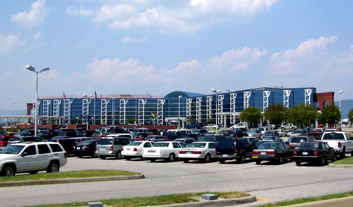
Main article: Roanoke Regional Airport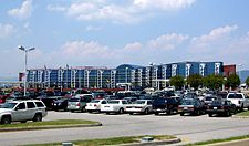 Roanoke Regional Airport terminal building
Roanoke Regional Airport is located in the northern part of the city and is the primary passenger and cargo airport for Southwest Virginia.
Rail
Ironically for a city known for its rail history, Roanoke has not had passenger rail service since 1979.[21] Amtrak stops in Lynchburg and Clifton Forge, Virginia. Roanoke would be a stop in the proposed Transdominion Express passenger rail system currently under study by the Commonwealth of Virginia.
Roanoke remains a major hub in Norfolk Southern's freight rail system. In 2006, the railroad announced plans to construct an intermodal rail yard in the community of Lafayette, Virginia of neighboring Montgomery County; however, opposition by local residents prompted Norfolk Southern to consider other potential sites. In 2007, former Roanoke mayor David A. Bowers urged Roanoke to offer a site for the yard. Shortly thereafter, neighboring Salem proposed a site in an industrial area of the city. In 2008, Norfolk Southern determined that the Lafayette location was the only practical site. The Commonwealth of Virginia may also upgrade Norfolk Southern's rail line parallel to Interstate 81 from Roanoke through the Shenandoah Valley to encourage more freight to be shipped by rail.
Buses
The Valley Metro bus system serves the city of Roanoke and surrounding areas. Nearly all routes originate or terminate at the Campbell Court bus station in downtown Roanoke, which is also served by Greyhound. Valley Metro also offers bus service to Blacksburg, Christiansburg and Virginia Tech.
Demographics
Historical populations Census Pop. %± 1900 21,495 — 1910 34,874 62.2% 1920 50,842 45.8% 1930 69,206 36.1% 1940 69,287 0.1% 1950 91,921 32.7% 1960 97,110 5.6% 1970 92,115 −5.1% 1980 100,220 8.8% 1990 96,397 −3.8% 2000 94,911 −1.5% 2010 97,032 2.2% As of the census[4] of 2000, there were 94,911 people, 42,003 households, and 24,235 families residing in the city. By 2006, the city's population was estimated to be 92,328 by the census bureau; however, the Cooper Center of the University of Virginia projected the city's population at July 1, 2007, to have increased to 93,504. By 2009, the city had grown close to its 2000 level, with 94,482 residing within the city. The population density was 2,213.2 people per square mile (854.6/km²). There were 45,257 housing units at an average density of 1,055.3 per square mile (407.5/km²). The racial makeup of the city was 69.38% White, 26.74% African American, 0.20% Native American, 1.15% Asian, 0.02% Pacific Islander, 0.72% from other races, and 1.78% from two or more races. Hispanic or Latino of any race were 1.48% of the population.
There were 42,003 households out of which 25.5% had children under the age of 18 living with them, 37.1% were married couples living together, 16.5% had a female householder with no husband present, and 42.3% were non-families. 35.9% of all households were made up of individuals and 12.8% had someone living alone who was 65 years of age or older. The average household size was 2.20 and the average family size was 2.86.
In the city the population was spread out with 22.6% under the age of 18, 8.2% from 18 to 24, 30.5% from 25 to 44, 22.3% from 45 to 64, and 16.4% who were 65 years of age or older. The median age was 38 years. For every 100 females there were 88.3 males. For every 100 females age 18 and over, there were 84.3 males.
The median income for a household in the city was $30,719, and the median income for a family was $37,826. Males had a median income of $28,465 versus $21,591 for females. The per capita income for the city was $18,468. About 12.9% of families and 15.9% of the population were below the poverty line, including 24.4% of those under age 18 and 11.3% of those age 65 or over.
Crime
The studies of Dr. Isaac Van Patten, a criminologist from Radford University discovered that Roanoke’s rates of rape and aggravated assault were the highest in the state of Virginia in 2004. Roanoke had seen a total increase in violent crimes from 1985 until 2003, surpassing every Virginia city, only Portsmouth had seen a larger increase in crime. Van Patten is not suggesting that Roanoke's overall violent crime rate was the highest in the state over the 18-year period, just that it saw the largest total increase.[22] According to the FBI data, the crime rates in Roanoke for murder, rape, aggravated assault and motor vehicle theft all decreased from 2006 to 2007, while the rates of robberies and burglaries increased. In 2007, Roanoke was ranked as Virginia’s second most dangerous city; in 2008 the city was ranked as the fifth worst city in Virginia.[23]
Gangs
The presence of genuine gang activity in Roanoke is a strongly debated subject. While some neighborhoods have gang-like organizations, many of which are engaged in drug distribution, like the Lincoln Terrace Posse and Villa Heights 1,[24] some law enforcement officers say that they are "mostly for show" as compared to the more militant and dangerous gangs that have a presence in multiple cities.[25]
Part of the argument in favor of acknowledging Roanoke's neighborhood groups as gangs comes from state politicians, like former attorney general Jerry Kilgore, part of it comes from the groups themselves who actively proclaim their legitimate existence as criminal and violent gangs in a DVD released for sale in the local area. In 2007, a DVD titled "Real Talk" appeared in Roanoke convenience stores depicting gang life in Roanoke. The 95-minute video includes references to the "Lincoln Terrace Posse" ("LTP"), "Villa Heights", and "Southwest" ("SW"). The local NAACP president, while outraged by the content of the DVD, disagreed that there were "full-fledged" gangs in Roanoke and felt that the presence of a camera played a big part in encouraging the behavior displayed.[26]
Education
The local public school division is Roanoke City Public Schools. The two general enrollment public high schools in Roanoke City are Patrick Henry High School, located in the Raleigh Court area, and William Fleming High School, located in Northwest Roanoke. The six public middle schools in Roanoke City are Woodrow Wilson, James Madison Middle School, and Stonewall Jackson, that feed into Patrick Henry High School; and Lucy Addison, William Ruffner, and James Breckinridge, that feed into William Fleming High School.[27] The Noel C. Taylor learning academy is a combined middle and high school that serves students with individual educational needs.[citation needed]
Private non-parochial schools in Roanoke City include Community High School, that provides classes from ninth to twelfth grade; and New Vista Montessori, that provides classes from third through ninth grade.[28] Private non-parochial schools outside of Roanoke City, but in the Roanoke Metropolitan Area, include North Cross School,[29] which provides education from pre-kindergarten through the twelfth grade.[30]
Private parochial schools in Roanoke City include North Cross and Roanoke Catholic,[31] that provide classes from kindergarten through twelfth grade; and Roanoke Adventist Preparatory, that provides classes from kindergarten through eighth grade.[32] Private parochial schools outside of Roanoke City, but in the Roanoke Metropolitan Area, include Roanoke Valley Christian Schools, Faith Christian School, Mineral Springs Christian School, Parkway Christian Academy, and Life Academy, all in Roanoke County.
Two four-year private institutions are situated in neighboring localities - Roanoke College in the city of Salem, and Hollins University in Roanoke County. Virginia Tech is located in neighboring Montgomery County. It has opened a higher education center in downtown Roanoke in cooperation with other colleges and universities, and the Virginia Tech Foundation owns the Hotel Roanoke. Virginia Tech is also opening a new medical school in South Roanoke in cooperation with Carilion Clinic, the regional non-profit health care organization based in Roanoke.[33] Virginia Western Community College is located in the city of Roanoke, as is the Jefferson College of Health Sciences.
Economy
 The Grandin Village
Roanoke's economy developed around the Norfolk and Western Railroad, with a strong emphasis on manufacturing. Roanoke's economic history also includes Sun Belt characteristics as it was once a center for the garment industry. Surrounding areas have traditionally relied on traditional industries of the rural South such as textiles and furniture manufacturing, which have lost jobs to offshore outsourcing. Despite Virginia's being a right to work state, unions have traditionally represented workers at many large employers in the Roanoke area and southwest Virginia.[citation needed]
Roanoke was formerly the headquarters of Norfolk and Western Railway until its merger with the Southern Railway created the Norfolk Southern Railway in 1982. Norfolk Southern continues to operate its marketing headquarters and some maintenance facilities in Roanoke. Wachovia Bank, then known as First Union, acquired Roanoke based Dominion Bank in 1993 and maintains an operations and customer service center in Roanoke. Other firms such as Roanoke Electric Steel and architectural and engineering firm Hayes, Seay, Mattern and Mattern, (HSMM) have also been acquired by companies headquartered elsewhere. Roanoke's rates of economic and population growth have been less than the state and national averages since the 1960s. The immediate Roanoke area has a low unemployment rate, but a brain drain of workers unable to find satisfactory employment and underemployment are sometimes cited as explanations.[34]
The City of Roanoke has created initiatives to address the brain drain of the region such as a database to match job seekers who wish to reside in the Roanoke area with employers looking for candidates. Additionally, a career and lifestyle fair has been held shortly after Christmas in recent years to show the professional and social opportunities in the area to those visiting family for the holidays. Also, organizations of young professionals such as Valley Forward and Newva Connects have emerged.[citation needed]
However, Roanoke's economy has areas of strength. The city is the health care and retail hub of a large area, driving the expansion of Carilion Health System and Valley View Mall. Advance Auto Parts is headquartered in Roanoke and has expanded through the acquisition of other chains to become one of the largest auto parts retailers in the country. Norfolk Southern remains a major employer. FreightCar America hired several hundred persons to assemble rail cars in shops leased from Norfolk Southern and has closed a plant in Johnstown, Pennsylvania in part because of the lower costs for the Roanoke facility. Recently though, the company laid off its Roanoke employees and said it plans to temporarily close the plant.[35] The corporate office of Virginia Transformer Corporation (the leading transformer manufacturing company of USA) is situated in this city. General Electric and TMEIC GE manufacture large drive systems for electrical generation stations and factories at their joint facility in Salem. ITT manufactures night vision goggles at its plant in Roanoke County, and some of its employees have started other firms such as Optical Cable Corporation. The proximity of automotive assembly plants in the South has attracted manufacturers including Dynax, Koyo, Metalsa, and Yokohama, formerly Mohawk Tire. Roanoke's location allows for delivery within one day to most markets in the southeast, northeast, mid-atlantic, and Ohio Valley, which has made it a distribution center for such companies as Orvis, Elizabeth Arden, and Hanover Direct. United Parcel Service (UPS) maintains a major facility at the Roanoke Regional Airport. While the city of Roanoke has lost population, suburbs in Roanoke County, southern Botetourt County, and areas of Bedford County and Franklin County near Smith Mountain Lake have grown.[citation needed]
Kroger operates its Mid-Atlantic regional offices at 3631 Peter's Creek Road NW in Roanoke.[36]
Top employers
According to Roanoke's 2009 Comprehensive Annual Financial Report,[37] the top employers in the city are:
# Employer # of Employees 1 Carilion Clinic 1,000+ 2 Roanoke City Public Schools 1,000+ 3 City of Roanoke 1,000+ 4 Carilion Professional Service 1,000+ 5 United Parcel Service 500 to 999 6 Advance Auto Parts 500 to 999 7 Wal-Mart 500 to 999 8 United States Postal Service 500 to 999 9 Anthem Blue Cross Blue Shield 500 to 999 10 Virginia Western Community College 500 to 999 Media
Print
Roanoke is the media hub for much of Southwestern Virginia and parts of Southern West Virginia.
The city's daily newspaper, The Roanoke Times, has been published for 120 years and edited for many years in the twentieth century by famed editor John W. Eure. The newspaper's current owner is Landmark Communications. Weekday circulation averages a little over 90,000 with Sunday circulation around 103,000. In 2002, it was designated the best-read daily newspaper in the country, according to the 2002 Scarborough Report. Of 162 newspapers in top U.S. metropolitan areas, The Roanoke Times ranked first in the percentage of adults who read their daily newspaper. It ranked first again in 2006.[38] The Roanoke Times established a web site in 1995 and has developed a web portal at Roanoke.com.
The Roanoke Times also owns the Blue Ridge Business Journal which publishes 25 issues per year that focus on the business community in Roanoke and the surrounding region. The weekly Roanoke Tribune covers the city's African-American community. Main Street Newspapers publishes weekly newspapers for surrounding communities such as Salem, Vinton, southwest Roanoke County, and Botetourt County.
The Roanoke Star-Sentinel is a weekly newspaper which covers the city of Roanoke. The South Roanoke Circle is an independent monthly newspaper for the neighborhood of South Roanoke.
The Roanoker is the area's bi-monthly lifestyle magazine and is published by Leisure Publishing, which also publishes the bi-monthly Blue Ridge Country magazine.
Broadcast
Television
Roanoke and Lynchburg are grouped in the same television market, which currently ranks #67 in the United States with 440,398 households. There are affiliates for all networks as well as independent stations. Local CBS affiliate WDBJ-7, led by its 6 PM newscast, has been the traditional ratings leader, regardless of the national ratings for CBS, although local NBC affiliate WSLS-10 has gained ratings in recent years. While WDBJ-7 and WSLS-10 are in Roanoke, local ABC affiliate WSET-13 is in Lynchburg and its news coverage focuses on the eastern portion of the market.
Other stations in the market include Fox affiliate WFXR Fox 21/27 in Roanoke, PBS affiliate WBRA-15 in Roanoke, Liberty University's WTLU-19 in Lynchburg, independent WDRL-24 in Pelham, North Carolina, and ION Television affiliate WPXR-38 in Roanoke.
Radio
The following is a partial list of radio stations in the Roanoke-Lynchburg market, which has a population of 412,300 and is ranked #115 in the US. For a more complete list see radio stations in the Roanoke area.
FM stations call letters frequency format location Owner WVTF 89.1 Public Radio Roanoke Virginia Tech Foundation WRXT 90.3 Christian Contemporary Roanoke Positive Alternative Radio WPAR 91.3 Christian Contemporary Salem Positive Alternative Radio WXLK 92.3 Top-40 Radio Roanoke Wheeler Broadcasting WSNV 93.5 Adult Contemporary Salem Clear Channel WSLC 94.9 Country Roanoke Wheeler Broadcasting WROV 96.3 Classic Rock Martinsville/Roanoke Clear Channel WSLQ 99.1 Adult Contemporary Roanoke Wheeler Broadcasting WVBE 100.1 Urban Adult Contemporary Lynchburg Wheeler Broadcasting WZZI 101.5 Rock Vinton Centennial WJJX 102.7 Rhythmic Top-40 Lynchburg Clear Channel WSNZ 101.7 Adult Contemporary Appomattox/Lynchburg Clear Channel WSFF 106.1 Adult Contemporary Roanoke Clear Channel WJJS 104.9 Rhythmic Top-40 Vinton Clear Channel WYYD 107.9 Country Amherst Clear Channel AM stations call letters frequency format location Owner WVBE 610 Urban Contemporary Roanoke Wheeler Broadcasting WWWR 910 Gospel Music Roanoke Perception Media WFIR 960 News/Talk Roanoke Wheeler Broadcasting WGMN 1240 Sports Roanoke Clear Channel WRIS 1410 Religious Roanoke WTOY 1480 Urban Contemporary Salem Arts, history, and culture in Roanoke
Roanoke is the home to several artistic, cultural, and historical organizations.
Museums
Center in the Square was opened in downtown Roanoke on December 9, 1983 near the city market as part of the city's downtown revitalization effort. The Center, a converted warehouse, houses the History Museum of Western Virginia, which contains exhibits and artifacts related to the area's history and has a library of materials available to scholars and the public. The Center also houses the Science Museum of Western Virginia and the Hopkins Planetarium. The Science Museum maintains a permanent installation of neon sign art featuring the work of local Mark Jamison, the subject of Slash Coleman's PBS special "The Neon Man and Me."[citation needed]
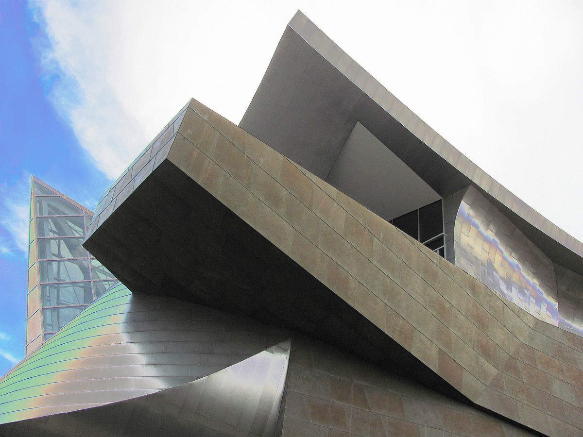
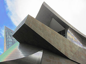 The Taubman Museum of Art.
Formerly housed in Center in the Square, the Taubman Museum of Art has now vacated the Center and opened a new facility at 110 Salem Avenue SE. The art museum features nineteenth and twentieth century American art, contemporary and modern art, decorative arts, and works on paper, and presents exhibitions of both regional and national significance. The new 75,000-square-foot (7,000 m2) facility was designed by Los Angeles based architect Randall Stout, who earlier in his career worked under Frank Gehry. The new space opened on November 8, 2008. The facility's design sparked debate in the community between those who feel it is a bold, refreshing addition to Roanoke and those who feel its unusual, irregular design featuring sharp angles contrasts too strongly with the existing buildings. Some are also concerned about the facility's cost at a time when many Roanoke area artistic organizations face financial challenges. The Taubman Family, which established Advance Auto Parts contributed $15.2 million to the project. As a result, the museum was renamed The Taubman Museum of Art.[39]
The Virginia Museum of Transportation houses many locomotives that were built in Roanoke, including the Norfolk and Western J class #611 and Norfolk & Western 1218 steam engines, and other locomotives and rolling stock. The museum also houses exhibits covering aviation, automobiles, and buses.
Roanoke's landmark former passenger rail station hosts the O. Winston Link Museum dedicated to the late steam-era railroad photography of O. Winston Link since 2004.
The Harrison Museum of African-American Culture is dedicated to the history and culture of Roanoke's African-American community and is currently located at a former school in the Gainsboro section of Roanoke. Gainsboro, originally Gainesborough for founder Major Kemp Gaines, was originally a separate community that petitioned for township status in 1835.[40][41] The Harrison Museum will move to Center in the Square when the Art Museum of Western Virginia occupies its new facility.[citation needed]
Arts
Roanoke Children's Theatre is Roanoke's professional children's theatre. It can be found within the new Taubman Museum of Art in downtown Roanoke. The theatre delivers four shows a year that are geared towards a family audience. The theatre extends their programming in various arts outreach programs throughout the valley and surrounding areas.
Mill Mountain Theatre, a regional theatre, is located on the first floor of Center in the Square. As the name implies, the theatre was originally located on Mill Mountain from 1964 until 1976 when its original facility was destroyed by fire. The theatre has both a main stage for mainstream performances and a smaller black box theatre called Waldron Stage which hosts both newer and more experimental plays along with other live events. The best known events are an annual festival of new plays and the "No Shame Theatre" every Friday at 11 PM which is open to any performance that is "original, five minutes or less, and doesn’t break anything – people, the space, or laws." Mill Mountain Theatre has an atelier for visiting actors in a former downtown hotel. The Theatre is currently closed, citing mounting debts and flagging donations,[42]
The Roanoke Civic Center's auditorium and newly renovated theatre, now known as the Roanoke Performing Arts Theatre, host concerts, touring Broadway theatre performances, the Miss Virginia pageant, and other events. The City's first permanent artwork funded by the Percent for Art ordinance stands before the theater. Dedicated in 2008, the 30-foot (9.1 m) stainless steel sculpture, "In My Hands," by Baltimore artist Rodney Carroll is one of more than 100 works in the City's public art catalogue.
The Shaftman Performance Hall, which opened in May 2001 and is located at the Jefferson Center, has become a prominent part of Roanoke's performing arts scene. Shaftman Hall hosts a regular season of concerts and other performances from the fall through the spring as well as other entertainment events and lectures. The Jefferson Center formerly served Roanoke as Jefferson High School and now also houses offices and display spaces for cultural organizations.
In November 2006, the former Dumas Hotel was reopened as the Dumas Center for Artistic and Cultural Development. The hotel is located on a segment of First Street NW commonly known as Henry Street. Located literally across the railroad tracks from the center of downtown Roanoke, Henry Street served as the commercial and cultural center of Roanoke's African American community prior to desegregation. The Dumas Hotel hosted such guests as Louis Armstrong, Ethel Waters, Count Basie, Duke Ellington and Nat King Cole when they performed in Roanoke. The renovated Dumas Center houses an auditorium with more than 180 seats, the Downtown Music Lab: a recording studio and music education center for teens, the Dumas Drama Guild, and the offices of Opera Roanoke.
The Roanoke Symphony Orchestra has performances at Shaftman Hall, the Salem Civic Center, and the Roanoke Civic Center. Current conductor David Wiley and his predecessor Victoria Bond have made the Roanoke Symphony Orchestra nationally respected.
The Grandin Theatre in the Grandin Village of Southwest Roanoke regularly screens art house films, family features, and mainstream movies. The Grandin Theatre was the home of Mill Mountain Theatre from 1976 until 1983.
Virginia Western Theatre has performances in Whitman Auditorium at Virginia Western Community College, and has been performing original and well known theatrical productions since 1968.
Roanoke has also been home to the Showtimers Community Theatre since 1951. The Star City Playhouse began performances in 2007 at its theatre on Williamson Road.
Sports in Roanoke
Professional
The 1971-1972 Virginia Squires of the ABA were the only major league sports team to regularly play home games in Roanoke. During the 1971-1972 season, the Squires split home games between Richmond, Norfolk, Hampton Roads, and Roanoke.[43] Julius Erving played his professional rookie season with the Squires in 1971-1972.
Minor league baseball has been more successful in building and maintaining a fan base than have the Roanoke Valley's other minor league sports teams. In the 1940s and early 1950s, Roanoke was home to a class B farm team of the Boston Red Sox. Since 1955, neighboring Salem has hosted the local minor league baseball team, currently the Salem Red Sox of the high Class A Carolina League. The team had previously been affiliated with the Houston Astros and Colorado Rockies and known as the Avalanche until becoming an affiliate of the Boston Red Sox, whose ownership group purchased the Avalanche in 2007, for the 2009 season.
Minor league hockey has a history in the Roanoke Valley dating to the 1960s. It reached a zenith of popularity in the mid- to late-1990s with the Roanoke Express of the ECHL. The team's attendance declined due to a lack of post-season success and management turmoil. The Express folded after the 2003-2004 season.
The 2005-2006 revival by the UHL's Roanoke Valley Vipers failed after one season. The team had a losing record and the midwestern-based league was unable to rekindle the interest of the local fanbase. The team was formed to provide a travel partner for a UHL franchise in Richmond which also folded after the 2005-2006 season. The southeastern-based Southern Professional Hockey League, nearly all of whose teams are located in cities with former ECHL teams, may bring hockey back to the Roanoke Valley.
The Roanoke Dazzle of the NBDL and the Roanoke Steam of the af2 (Arena Football) folded after never developing consistent followings. The Dazzle's attendance was similar to other inaugural franchises in the league. It was one of the last two teams to remain in its original city. Over the years, Roanoke has also had teams in soccer and men's and women's semi-professional football.
Amateur
College
For a number of years, Roanoke, with Richmond and Norfolk, was one of the nominally neutral sites for the annual basketball game between the Virginia Cavaliers and Virginia Tech Hokies. During most of the 1970s through 1990s, the University of Virginia dominated the rivalry and as such tended to have significantly greater fan representation, despite Roanoke's closer proximity to Virginia Tech's home in Blacksburg. In the late 1990s, the schools started holding these games in their own campus facilities.
The Virginia Tech Hokies ice hockey team has used the Roanoke Civic Center as its regular season home venue, from 2006 to the present season.[44] In 2010, the Roanoke College ice hockey team began using the Roanoke Civic Center as its home venue as well.[45]
From the 1940s through the late 1960s, Roanoke's Victory Stadium hosted an annual Thanksgiving Day game between Virginia Tech and the Virginia Military Institute and other high profile college football games. From 1946 to 1950, Victory Stadium also hosted the South's Oldest Rivalry between the University of Virginia and the University of North Carolina.
Preps
Patrick Henry High School is a member of the AAA Western Valley District. The Patriots won Group AAA state titles in men's basketball in 1988 and 1992, football in 1973, and men's tennis in 2004. George Lynch and Curtis Staples are among the athletes who have attended the school.
William Fleming High School is also a member of the AAA Western Valley District. The Colonels have established strong programs in men's basketball and football with a Group AA state championship in men's basketball in 2007 and two state runner-up seasons in both sports over the last 15 years. Lee Suggs graduated from Fleming.
Roanoke Catholic High School is a member of the Virginia Independent Schools Athletic Association. The Celtics won a VISAA football state championship in 1994 and have recently fielded strong men's basketball teams, often with foreign players, and have produced college players such as Virginia's J.R. Reynolds. The Celtics have won 3 VIS Basketball championships in the past years.
North Cross School is also a member of the Virginia Independent Schools Athletic Association. The Raiders won a VISAA soccer state championship in 2007, a VISAA football state championship in 2008, and a VISAA wrestling state championship in 2009. The Raiders have won 3 basketball championships, 4 football championships, and many other state awards in the past years.
The city has constructed separate on-campus football stadiums at the schools to replace Victory Stadium, which was demolished in summer 2006. Patriot Stadium was opened for the 2007 season and a currently unnamed stadium on the William Fleming campus will open for the 2008 season. The field at Patriot Stadium was named after Merrill Gainer, who coached Patrick Henry to the 1973 state championship.
Festivals
Roanoke and surrounding communities host the annual Commonwealth Games of Virginia, an Olympic-style amateur sports festival. Beginning in 2010, the Blue Ridge Marathon on the Parkway is scheduled to be held in the city.[46]
Economic statistics: Roanoke MSA
The Roanoke, VA MSA is a U.S. Metropolitan Statistical Area (MSA) in Virginia as defined by the United States Office of Management and Budget (OMB) as of June, 2003.
Note: Since a state constitutional change in 1871, all cities in Virginia are independent cities and they are not legally located in any county. The OMB considers these independent cities to be county-equivalents for the purpose of defining MSAs in Virginia. Each MSA is listed by its counties, then cities, each in alphabetical order, and not by size.
The Roanoke, VA MSA includes:
- Botetourt County
- Craig County
- Franklin County
- Roanoke County
- City of Roanoke
- City of Salem
- Town of Vinton
Nicknames
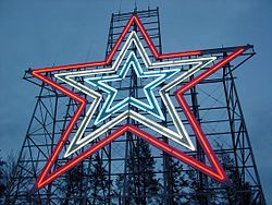 The Roanoke Star is the origin of the city's nickname Star City.
Many businesses and organizations adopted Star City in their names, after the Mill Mountain Star. The older Magic City[47] is still used, most prominently by Roanoke's Ford dealership.[48] The city's original name of Big Lick is often used in whimsical contexts.
Roanoke's status as the largest city in a mountainous area led to the nickname Capital of the Blue Ridge.[49][50]
Sister cities
Roanoke has seven sister cities, as designated by Sister Cities International:
 Florianópolis, Brazil
 Kisumu, Kenya
 Lijiang, Yunnan, China
 Pskov, Russia
 Saint-Lô, France
 Wonju, South Korea
 Opole, Poland [51]
Notable residents
Born in Roanoke:
- Astrophysicist and Nobel laureate John C. Mather, one of TIME Magazine's 100 Most Influential People of 2009 [52]
- United States Ambassador to Romania Nicholas Taubman
- American artist John Alan Maxwell
- Wrestler Tony Atlas
- Twin NFL players Ronde Barber and Tiki Barber (Roanoke County)
- MLB outfielder Billy Sample
- model and actress Tai Collins
- Singer Ross Copperman (Roanoke County)
- Former U.S. Secretary of the Treasury Henry H. Fowler
- Entrepreneur Cameron Johnson[53]
- Former United States Secretary of Defense Louis A. Johnson
- Durell Coleman, Star Search Winner, recording artist & bandleader [54]
- Famous medical patient Henrietta Lacks
- NBA basketball player George Lynch (city)
- Actor John Payne
- Former Basketball player Curtis Staples (city)
- Former NHL Defensemen Eric Weinrich
- NFL football player Lee Suggs
- Former Arsenal FC soccer player Daniel Karbassiyoon
- Former Tennis Professional K. J. Hippensteel
- NFL football player John St. Clair
Raised in Roanoke:
- Singer Wayne Newton
- McAfee founder John McAfee
- NBA basketball player J. J. Redick (Roanoke County)
- Wayne LaPierre, CEO of the National Rifle Association
One-time resident:
- Former South African Tennis Professional Johan Kriek
- Former Miss America Nicole Johnson Baker
- Author Nelson S. Bond
- Civil rights attorney Oliver Hill
- Mark David Chapman, killer of John Lennon [55]
- Playwright Kermit Hunter
- Mathematician and Nobel laureate John Forbes Nash[56]
- Movie actress Debbie Reynolds (metro area)
- American National Socialist Workers' Party Commander (neo-Nazi) Bill White
- Opera Soprano Elizabeth Futral (metro area)
- Early 20th century African American filmmaker Oscar Micheaux[57][58]
Landmarks and points of interest
 Roanoke's Historical Fire Station #1: The Firehouse opened in 1907 and is the oldest operating Firehouse in Virginia.
- Blue Ridge Parkway
- Grandin Village
- Hollins University
- Hotel Roanoke
- Mill Mountain Star
- Mill Mountain Zoo
- O. Winston Link Museum
- Old Southwest Neighborhood
- Roanoke Historic Farmers Market
- Roanoke Weiner Stand
- Roanoke's Historical Fire Station #1
- St. Andrews Catholic Church, State and National Landmark
- Taubman Museum of Art
- Texas Tavern
- Virginia's Explore Park
See also
References
- ^ "Virginia Birding and Wildlife Trail » Mountain Trail » Star City » Roanoke Water Pollution Control Plant". Dgif.state.va.us. http://www.dgif.state.va.us/vbwt/site.asp?trail=2&loop=MSC&site=MSC08. Retrieved 2009-08-27.
- ^ "Roanoke City High Point Trip Report". Cohp.org. 2000-11-17. http://www.cohp.org/va/Roanoke_City_1.html. Retrieved 2009-08-27.
- ^ http://www.coopercenter.org/sites/default/files/demographics/Census_2000_to_2010_PopulationChange_towns.xls
- ^ a b "American FactFinder". United States Census Bureau. http://factfinder.census.gov. Retrieved 2008-01-31.
- ^ "US Board on Geographic Names". United States Geological Survey. 2007-10-25. http://geonames.usgs.gov. Retrieved 2008-01-31.
- ^ "Roanoke Region of Virginia". Roanoke.org. http://www.roanoke.org. Retrieved 2009-08-27.
- ^ a b [1]. Weldon Cooper Center 2010 Census Count Retrieved January 28, 2011
- ^ "Roanoke". Xroads.virginia.edu. http://xroads.virginia.edu/~HYPER/VAGuide/roanoke.html. Retrieved 2009-08-27.
- ^ "Trade Items as Transfer of Money". Lost-colony.com. http://www.lost-colony.com/trade.html. Retrieved 2009-08-27.
- ^ "Roanoke Virginia". Visitroanokeva.com. http://www.visitroanokeva.com/displayinfo.asp?TOPIC=3&NID=173. Retrieved 2009-08-27.
- ^ "Microsoft Word - ROANOKE.DOC" (PDF). http://dls.state.va.us/lrc/charters/ROANOKE.pdf. Retrieved 2009-08-27.
- ^ "American Viscose Corp., Marcus Hook, PA". OldChesterPa. http://www.oldchesterpa.com/viscose.htm. Retrieved 2009-08-27.
- ^ http://www3.roanoke.com/roatimes/special_sections/southeast/day2_side.html
- ^ "Elephant Ears: The Fightin' Ninth". Eears.blogspot.com. 2006-04-23. http://eears.blogspot.com/2006/04/fightin-ninth.html. Retrieved 2009-08-27.
- ^ http://www.tpl.org/content_documents/ccpe_100LargestCityParks.pdf
- ^ http://www.weather.com/outlook/weather-news/news/articles/winter-storm-aiming-for-mid-atlantic_2009-12-17
- ^ [2][dead link]
- ^ "Climatography of the United States No. 20 (1971–2000)" (PDF). National Oceanic and Atmospheric Administration. 2004. http://cdo.ncdc.noaa.gov/climatenormals/clim20/va/447285.pdf. Retrieved 2010-06-15.
- ^ "Parkway in Virginia". Nps.gov. http://www.nps.gov/archive/blri/vamap.htm. Retrieved 2009-08-27.
- ^ http://www.centerinthesquare.org/index.php
- ^ "Can passenger rail return to Roanoke?". Roanoke.com. http://www.roanoke.com/news/wb/170238. Retrieved 2009-08-27.
- ^ Reed Williams. "Why is Roanoke so dangerous?". Roanoke.com. http://www.roanoke.com/news/roanoke/wb/50916. Retrieved 2009-08-27.
- ^ "Local police question FBI's "dangerous cities" crime data". Roanoke.com. 2008-11-28. http://www.roanoke.com/news/roanoke/wb/185782. Retrieved 2009-08-27.
- ^ "Cocaine - Virginia Drug Threat Assessment". Usdoj.gov. 2001-11-20. http://www.usdoj.gov/ndic/pubs07/797/cocaine.htm. Retrieved 2009-08-27.
- ^ "Roanoke’s Special Street Crimes Unit | WSLS 10". Wsls.com. 2006-07-13. http://www.wsls.com/servlet/Satellite?pagename=WSLS%2FMGArticle%2FSLS_BasicArticle&c=MGArticle&cid=1149189134218&path=!news!localnews. Retrieved 2009-08-27.
- ^ "DVD purports to show gang life in Roanoke". Roanoke.com. http://www.roanoke.com/news/roanoke/wb/xp-30694. Retrieved 2009-08-27.
- ^ [3][dead link]
- ^ "Private Secular Schools". Roanokeva.gov. http://www.roanokeva.gov/WebMgmt/ywbase61b.nsf/CurrentBaseLink/N25ZEK7D670LBASEN. Retrieved 2009-08-27.
- ^ http://www.northcross.org
- ^ "North Cross School ~ School Mission, Facts & Stats". Northcross.org. http://www.northcross.org/podium/default.aspx?t=47115. Retrieved 2009-08-27.
- ^ "Roanoke Catholic School - Mission Statement". Roanokecatholic.com. http://www.roanokecatholic.com/main/index.php. Retrieved 2009-08-27.
- ^ "Private Parochial Schools". Roanokeva.gov. http://www.roanokeva.gov/WebMgmt/ywbase61b.nsf/CurrentBaseLink/N25ZEK4S071LBASEN. Retrieved 2009-08-27.
- ^ "Virginia Tech, Carilion will create joint medical school in Roanoke". Vtnews.vt.edu. 2007-01-03. http://www.vtnews.vt.edu/story.php?relyear=2007&itemno=5. Retrieved 2009-08-27.
- ^ "Virginia Business Online: No mountain retreat". Gatewayva.com. Archived from the original on October 16, 2007. http://web.archive.org/web/20071016160916/http://gatewayva.com/biz/virginiabusiness/magazine/yr2002/sept02/roanoke.shtml. Retrieved 2009-08-27.
- ^ "FreightCar America to halt production at its second shop in two mont - GLG News". Glgroup.com. 2009-04-16. http://www.glgroup.com/News/FreightCar-America-to-halt-production-at-its-second-shop-in-two-months-37595.html. Retrieved 2009-08-27.
- ^ "Contact Us." Kroger. Retrieved on April 30, 2009.
- ^ City of Roanoke CAFR
- ^ "The Roanoke Times ranks best-read weekday newspaper in the country". Roanoke.com. http://www.roanoke.com/newsservices/wb/xp-59765. Retrieved 2009-08-27.
- ^ http://www.artmuseumroanoke.org/
- ^ "Gainsboro Neighborhood Plan". Roanokeva.gov. http://www.roanokeva.gov/85256A8D0062AF37/CurrentBaseLink/N25YVLRL466FGUREN. Retrieved 2009-08-27.
- ^ ""MAGIC CITY" CLASS, COMMUNITY, AND REFORM IN ROANOKE, VIRGINIA, 1882-1912" (PDF). http://etd.lsu.edu/docs/available/etd-1113103-100724/unrestricted/Dotson_Jr_dis.pdf. Retrieved 2009-08-27.
- ^ "Mill Mountain Theatre is closing, citing money woes". Timesdispatch.com. 2009-01-21. http://www.timesdispatch.com/rtd/news/state_regional/article/MILLGAT21_20090121-101412/184412/. Retrieved 2009-08-27.
- ^ "Virginia Squires". Remember the ABA. http://www.remembertheaba.com/Virginia-Squires.html. Retrieved 2009-08-27.
- ^ http://www.icehockey.org.vt.edu/directions.htm
- ^ http://roanoke.edu/Student_Life/Sports_and_Recreation/Campus_Recreation/Club_Sports/Hockey_Club.htm
- ^ Boone, Jenny Kincaid (August 13, 2009). "New marathon rising in Roanoke". The Roanoke Times.
- ^ "Accreditation Works No 54". Calea.org. Archived from the original on July 28, 2007. http://web.archive.org/web/20070728210201/http://www.calea.org/Online/newsletter/No89/aw54.htm. Retrieved 2009-08-27.
- ^ "Magic City Ford". Magic City Ford. http://www.magiccityford.com/. Retrieved 2009-08-27.
- ^ "The Fairfax: Location". Thefairfaxroanoke.com. http://www.thefairfaxroanoke.com/location.html. Retrieved 2009-08-27.
- ^ Joe Kennedy (2007-06-06). "Tide can turn even for elite of Roanoke - Roanoke.com". Roanoke.com<!. http://www.roanoke.com/columnists/kennedy/wb/119607. Retrieved 2009-08-27.
- ^ "Opole Official Website - Twin Towns".

 (in English and Polish) © 2007-2009 Urząd Miasta Opola. http://www.opole.pl/miasto/index.php?option=com_content&task=blogcategory&id=20&Itemid=108. Retrieved 2009-06-18.
 - ^ "John C. Mather (American physicist) - Britannica Online Encyclopedia". Britannica.com. http://www.britannica.com/EBchecked/topic/1240228/John-C-Mather. Retrieved 2009-08-27.
- ^ "Oprah's Big Give Contestant: Cameron Johnson". .oprah.com. 2008-10-15. http://www2.oprah.com/about/oprahsbiggive/contestants/contestant_bio_104.jhtml. Retrieved 2009-08-27.
- ^ http://nl.newsbank.com/nl-search/we/Archives?p_text_direct-0=1084B9E18D88B34C&p_field_direct-0=document_id
- ^ "Legend's killer lived in Roanoke - Roanoke.com". Roanoke.com<!. http://www.roanoke.com/news/roanoke/wb/wb/xp-43727. Retrieved 2009-08-27.
- ^ "NY Times: John Nash". U.arizona.edu. 1950-06-13. http://www.u.arizona.edu/~mwalker/NashStory.htm. Retrieved 2009-08-27.
- ^ "Film pioneer honed craft on Henry St.". The Roanoke Times. 2007-02-15. http://www.roanoke.com/news/roanoke/wb/104590. Retrieved 2009-08-27.
- ^ "Pioneering Black Filmmaker Commemorated". The Roanoke Star-Sentinel. 2008-09-19. http://issuu.com/theroanokestar/docs/rss919issuu/12. Retrieved 2009-08-27.
Further reading
- Dotson, Rand. Roanoke, Virginia, 1882-1912: Magic City of the New South (2008)
External links
- AIR Temporary Exhibition
- The History of the Roanoke Fire Department in progress from the 1880s to present, with current news and links
- A modern history of Roanokers sharing their connection with the Star City
- Old Roanoke - A photographic history of Roanoke Virginia
- Old Roanoke Pictures catalogued by a local family
- A Roanoke family portrait, 1911
- The Lendy's Web Page
- Roanoke - Star City
- The 1240 WROV History Site
- The Kenney's Web Page
- Center in the Square
- Brief history and modern panoramic photos from the Roanoke Civil War Round Table
- Roanoke Wants U!
- Taubman Museum of Art
Coordinates: 37°16′N 79°56′W / 37.267°N 79.933°W
Neighborhoods in Roanoke, Virginia Airport - Belmont - Cherry Hill - Downtown - Eastgate - Edgewood-Summit Hills - Fairland - Fallon - Franklin-Colonial - Gainsboro - Garden City - Gilmer - Grandin Court - Greater Deyerle - Harrison - Hollins - Hurt Park - Kenwood - Loudon-Melrose - Mecca Gardens - Melrose-Rugby - Mill Mountain - Miller Court/Arrowood - Monterey - Morningside - Mountain View - Norwich - Old Southwest - Peachtree/Norwood - Preston Park - Raleigh Court - Ridgewood Park - Riverdale - Riverland/Walnut Hills - Roundhill - Shenandoah West - South Jefferson - South Roanoke - South Washington Heights - Southern Hills - Villa Heights - Wasena - Washington Heights - Washington Park - West End - Westview Terrace - Wildwood - Williamson Road - Wilmont
 Commonwealth of Virginia
Topics - Climate
- Colleges and universities
- Colony
- Congressional Districts
- Culture
- Delegations
- Demographics
- Economy
- Education
- Environment
- Furniture
- Geography
- Government
- Governors
- History
- Historic Landmarks
- Magisterial Districts
- Homes
- Music
- People
- Police
- Politics
- Rights
- Rivers
- School divisions
- Scouting
- Slogan
- Sports teams
- State Fair
- State parks
- Symbols
- Towns
- Transportation
- Tribes
- Visitor Attractions
Regions - Allegheny Mountains
- Atlantic Coastal Plain
- Blue Ridge
- Chesapeake Bay
- Cumberland Mountains
- Delmarva Peninsula
- Eastern Shore
- Hampton Roads
- Middle Peninsula
- Northern Neck
- Northern Virginia
- Piedmont
- Ridge-and-Valley Appalachians
- Shenandoah Valley
- South Hampton Roads
- Southside
- Southwest Virginia
- Tennessee Valley
- Tidewater
- Tri-Cities
- Virginia Peninsula
Metro areas - Blacksburg-Christiansburg-Radford
- Bluefield
- Bristol
- Charlottesville
- Culpeper
- Danville
- Fredericksburg
- Harrisonburg
- Lynchburg
- Martinsville
- Richmond
- Roanoke
- Staunton
- Hampton Roads
- Washington-Arlington-Alexandria
- Waynesboro
- Winchester
Counties - Accomack
- Albemarle
- Alleghany
- Amelia
- Amherst
- Appomattox
- Arlington
- Augusta
- Bath
- Bedford
- Bland
- Botetourt
- Brunswick
- Buchanan
- Buckingham
- Campbell
- Caroline
- Carroll
- Charles City
- Charlotte
- Chesterfield
- Clarke
- Craig
- Culpeper
- Cumberland
- Dickenson
- Dinwiddie
- Essex
- Fairfax
- Fauquier
- Floyd
- Fluvanna
- Franklin
- Frederick
- Giles
- Gloucester
- Goochland
- Grayson
- Greene
- Greensville
- Halifax
- Hanover
- Henrico
- Henry
- Highland
- Isle of Wight
- James City
- King and Queen
- King George
- King William
- Lancaster
- Lee
- Loudoun
- Louisa
- Lunenburg
- Madison
- Mathews
- Mecklenburg
- Middlesex
- Montgomery
- Nelson
- New Kent
- Northampton
- Northumberland
- Nottoway
- Orange
- Page
- Patrick
- Pittsylvania
- Powhatan
- Prince Edward
- Prince George
- Prince William
- Pulaski
- Rappahannock
- Richmond
- Roanoke
- Rockbridge
- Rockingham
- Russell
- Scott
- Shenandoah
- Smyth
- Southampton
- Spotsylvania
- Stafford
- Surry
- Sussex
- Tazewell
- Warren
- Washington
- Westmoreland
- Wise
- Wythe
- York
Independent
cities- Alexandria
- Bedford
- Bristol
- Buena Vista
- Charlottesville
- Chesapeake
- Colonial Heights
- Covington
- Danville
- Emporia
- Fairfax
- Falls Church
- Franklin
- Fredericksburg
- Galax
- Hampton
- Harrisonburg
- Hopewell
- Lexington
- Lynchburg
- Manassas
- Manassas Park
- Martinsville
- Newport News
- Norfolk
- Norton
- Petersburg
- Poquoson
- Portsmouth
- Radford
- Richmond
- Roanoke
- Salem
- Staunton
- Suffolk
- Virginia Beach
- Waynesboro
- Williamsburg
- Winchester
Categories:- Cities in Virginia
- Roanoke, Virginia
- Roanoke metropolitan area


Wikimedia Foundation. 2010.