- Mathews County, Virginia
-
Mathews County, Virginia 
Seal
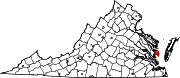
Location in the state of Virginia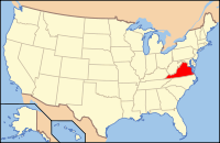
Virginia's location in the U.S.Founded 1791 Seat Mathews Area
- Total
- Land
- Water
252 sq mi (653 km²)
86 sq mi (223 km²)
166 sq mi (430 km²), 65.99%Population
- (2010)
- Density
8,978
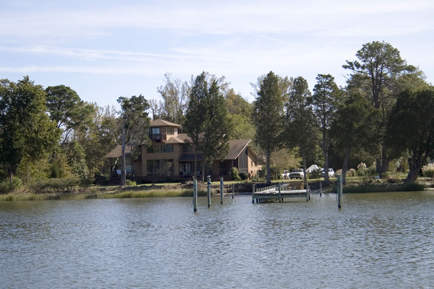
106/sq mi (41/km²)Website www.co.mathews.va.us 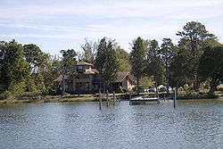 Typical waterside scene in Mathews County
Mathews County is a county on the Middle Peninsula of the Hampton Roads metropolitan area of the U.S. state of Virginia. As of the 2010 Census, the population was 8,978[1]. Its county seat is Mathews[2].
Contents
History
During Virginia's Colonial Era, the area which later became Mathews County was a portion of Gloucester County. The small town at Mathews Court House (also known as simply "Mathews") was originally named Westville, and was established around 1700. In 1691, the Virginia General Assembly had directed that each county designate an official port-of-entry. Westville was located along Put-in Creek, a waterway which is a tidal tributary of Virginia's East River, feeding into Mobjack Bay, itself a tributary of the Chesapeake Bay. [3]
In 1776, Virginia's last Royal Governor, Lord Dunmore, left Virginia after being driven to Gwynn's Island by General Andrew Lewis and the Continental Army during the American Revolutionary War. About 10 years after Virginia gained its independence from Great Britain, Mathews County was established in 1791 from part of Gloucester County. The county was named for Brigadier General Thomas Mathews, then speaker of the House of Delegates of the General Assembly of Virginia. Westville was designated at the county seat (later become known variously as Mathews Court House or simply Mathews). [4]
Geography
According to the U.S. Census Bureau, the county has a total area of 252 square miles (653 km²), of which 86 square miles (222 km²) is land and 166 square miles (431 km²) (65.99%) is water. It is the smallest county, land-wise, in Virginia.
Mathews County is perhaps best known for its miles of waterfront sites, as well as its prominent location on the Chesapeake Bay. Surrounded almost completely by water, it is bordered by Middlesex County to the north, separated by the Piankatank River and Gloucester County to the west. The southern side of the county borders Mobjack Bay.
Adjacent Counties
- Northampton County - east, across the Chesapeake Bay
- Middlesex County - north
- Gloucester County - south & west
Demographics
Historical populations Census Pop. %± 1800 5,806 — 1810 4,227 −27.2% 1820 6,920 63.7% 1830 7,664 10.8% 1840 7,442 −2.9% 1850 6,714 −9.8% 1860 7,091 5.6% 1870 6,200 −12.6% 1880 7,501 21.0% 1890 7,584 1.1% 1900 8,239 8.6% 1910 8,922 8.3% 1920 8,447 −5.3% 1930 7,884 −6.7% 1940 7,149 −9.3% 1950 7,148 0% 1960 7,121 −0.4% 1970 7,168 0.7% 1980 7,995 11.5% 1990 8,348 4.4% 2000 9,207 10.3% 2010 8,978 −2.5%
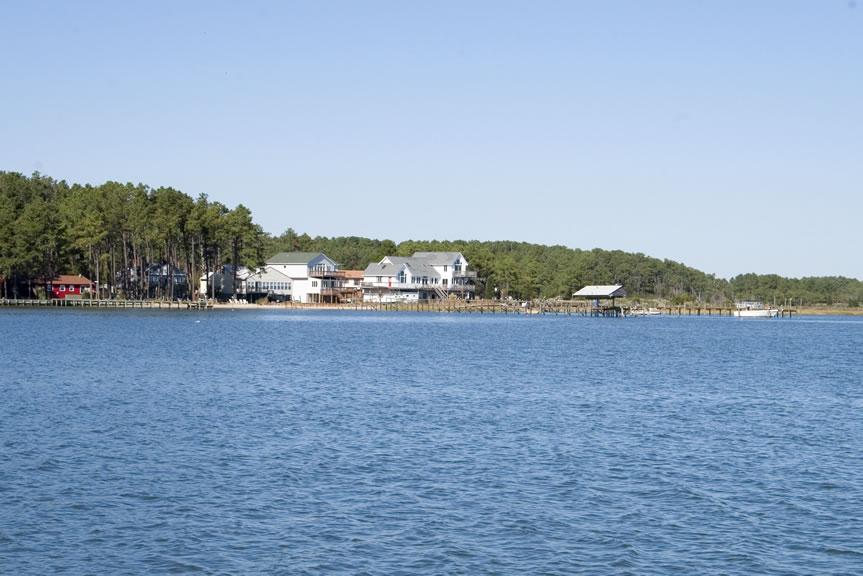
As of the census[5] of 2010, there were 8,978 people, 3,932 households, and 2,823 families residing in the county. The population density was 108 people per square mile (41/km²). There were 5,333 housing units at an average density of 62 per square mile (24/km²). The racial makeup of the county was 88.0% White, 9.2% Black or African American, 0.2% Native American, 0.3% Asian, 0.3% from other races, and 1.9% from two or more races. 1.2% of the population were Hispanic or Latino of any race. Houses on Horn Harbor in Mathews County
There were 3,932 households out of which 24.20% had children under the age of 18 living with them, 61.20% were married couples living together, 7.90% had a female householder with no husband present, and 28.20% were non-families. 24.90% of all households were made up of individuals and 13.50% had someone living alone who was 65 years of age or older. The average household size was 2.32 and the average family size was 2.75.
In the county, the population was spread out with 19.90% under the age of 18, 5.20% from 18 to 24, 23.10% from 25 to 44, 30.10% from 45 to 64, and 21.60% who were 65 years of age or older. The median age was 46 years. For every 100 females there were 93.20 males. For every 100 females age 18 and over, there were 91.70 males.
The median income for a household in the county was $43,222, and the median income for a family was $50,653. Males had a median income of $36,294 versus $23,434 for females. The per capita income for the county was $23,610. 6.00% of the population and 4.30% of families were below the poverty line. Out of the total people living in poverty, 7.50% are under the age of 18 and 4.80% are 65 or older.
Tourism, leisure, and fishing industries are the major sources of employment. The county is reputed to be one of the few remaining in Virginia with no traffic lights. Along State Route 223 at Gwynn's Island, there is a small drawbridge which is manned 24 hours daily. [6]
Communities
Prominent among Mathews County tourism and leisure locations is Gwynn's Island, a popular spot for recreational boating and sailing. It is located where the Piankatank River feeds into the Chesapeake Bay. [7] Nearby is the off-shore location of the historic New Point Comfort Light.
Sports, events
Mathews County hosts the annual Tour De Chesapeake, (due to its lack of hills except for the north section of the county near the Mathews-Gloucester border). The bicycling event is a benefit for the Chesapeake Bay Foundation. [8] The community also sponsors Mathews Market Days, featuring local artists such as P. Buckley Moss.
In Susan, Virginia, which is in Matthews County is where the DIY Blog Cabin 2011 is located. This event has drawn more attention to the county.
Despite lackluster football and basketball teams, Mathews High School is known for success in several sports including Boy's and Girl's Crew Teams, Boys Cross Country, Volleyball, Wrestling, Softball, and Track and Field. The wrestling team won the 1990 and 1991 state championships, boys track won the 1969 and 1986 state championships, and baseball won the state title in 2004.[9]
Notable natives
Captain Sally Tompkins was a Mathews County native. Gwynn's Island resident William B. Livermon, Sr. appeared throughout the 1970s on television in religion segments as "The Circuit Rider".[10] Mathews is also home to former NFL football player Stuart Anderson (football) of the Washington Redskins and baseball player Keith Atherton of the Minnesota Twins. Former journeyman NFL punter Mark Royals also lives in Mathews.
See also
References
- ^ [1]. Weldon Cooper Center 2010 Census Count Retrieved January 26, 2011
- ^ "Find a County". National Association of Counties. http://www.naco.org/Counties/Pages/FindACounty.aspx. Retrieved 2011-06-07.
- ^ http://www.dailypress.com/news/gloucester-county/dp-nws-gloucester-mathews-20101002,0,1160200.story
- ^ http://www.rootsweb.ancestry.com/~vamathew/
- ^ "American FactFinder". United States Census Bureau. http://factfinder.census.gov. Retrieved 2008-01-31.
- ^ http://articles.dailypress.com/1992-09-20/news/9209200315_1_bridge-deck-tender-shift-work
- ^ http://www.gwynnsislandmuseum.org/
- ^ http://www.bikechesapeake.org/
- ^ http://www.visitmathews.com/MIMS/online.htm
- ^ Callis, Rita A. (1992). "William B. Livermon, Sr., 1916-1992". Memoirs from the 1992 Journal of the Virginia Annual Conference. Virginia Conference of the United Methodist Church. http://www.vaumc.org/index.cfm/fa/content.view/menuID/1507.htm. Retrieved 2009-04-21.
External links

Middlesex County Gloucester County 
Chesapeake Bay  Mathews County, Virginia

Gloucester County Municipalities and communities of Mathews County, Virginia CDPs Gwynn | Mathews
Unincorporated
communitiesBavon | Bayside | Beaverlett | Blackwater | Blakes | Bohannon | Cardinal | Cobbs Creek | Cricket Hill | Diggs | Dixie | Fitchetts | Fort Nonsense | Foster | Grimstead | Hallieford | Haven Beach | Hudgins | Laban | Mobjack | Moon | Motorun | New Point | Onemo | Peary | Port Haywood | Pribble | Redart | Retz | Ruff | Sarah | Shadow | Soles | Susan | Tabernacle | Williams | Winter Harbor Haven
Hampton Roads Major Cities Chesapeake · Hampton · Newport News · Norfolk · Portsmouth · Suffolk · Virginia Beach
Counties Currituck · Gloucester · Isle of Wight · James City · Mathews · Surry · York
Other cities Towns Claremont · Dendron · Smithfield · Surry · Windsor
Sub-regions Topics Transportation · People · History · Battle of Hampton Roads ·
Note: Italic indicates independent city not part of any countyCategories:- Virginia counties
- Mathews County, Virginia
- 1791 establishments
- Hampton Roads


Wikimedia Foundation. 2010.