- Washington Metropolitan Area
-
Washington – Arlington – Alexandria — MSA — Washington D.C. Arlington, Virginia
 Alexandria, Virginia
Country  United States
State -  Virginia
- Maryland
- West Virginia
Principal cities Washington
- Arlington
- AlexandriaArea – Metro 14,412 km2 (5,564.6 sq mi) Elevation 0 - N/A m (0 - N/A ft) Population (2010)[1] – Density 371.8/km2 (962.9/sq mi) – Urban 3,933,920(4th) – MSA 5,582,170(7th) MSA/CSA = 2010, Urban = 2000 Time zone EST (UTC-6) – Summer (DST) EST (UTC-5) The Washington Metropolitan Area is the metropolitan area centered on Washington, D.C., the capital of the United States. The area includes all of the federal district and parts of the U.S. states of Maryland, Virginia, and West Virginia.
The Office of Management and Budget defines the area as the Washington–Arlington–Alexandria, DC–VA–MD–WV Metropolitan Statistical Area, a metropolitan statistical area used for statistical purposes by the United States Census Bureau and other agencies. The area includes as its principal cities Washington as well as the Virginia cities of Arlington and Alexandria. The Office of Management and Budget also includes the metropolitan statistical area as part of the larger Baltimore–Washington Metropolitan Area, which has a population of over 8.55 million.[citation needed]
The area is also sometimes referred to as the National Capital Region, particularly by federal agencies such as the Department of Homeland Security.[2] The area in the region that is surrounded by Interstate 495 is also referred to as the "Capital Beltway". The Virginia portion of the area is known as Northern Virginia.[citation needed]
The Washington Metropolitan Area is the most educated and by some measures, the most affluent metropolitan area in the United States.[3] As of the 2010 Census Bureau estimate[update], the population of the Washington Metropolitan Area was estimated to be 5,582,170 (+16.39%), making it the seventh-largest metropolitan area in the country.[4]
Contents
Composition
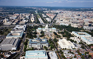
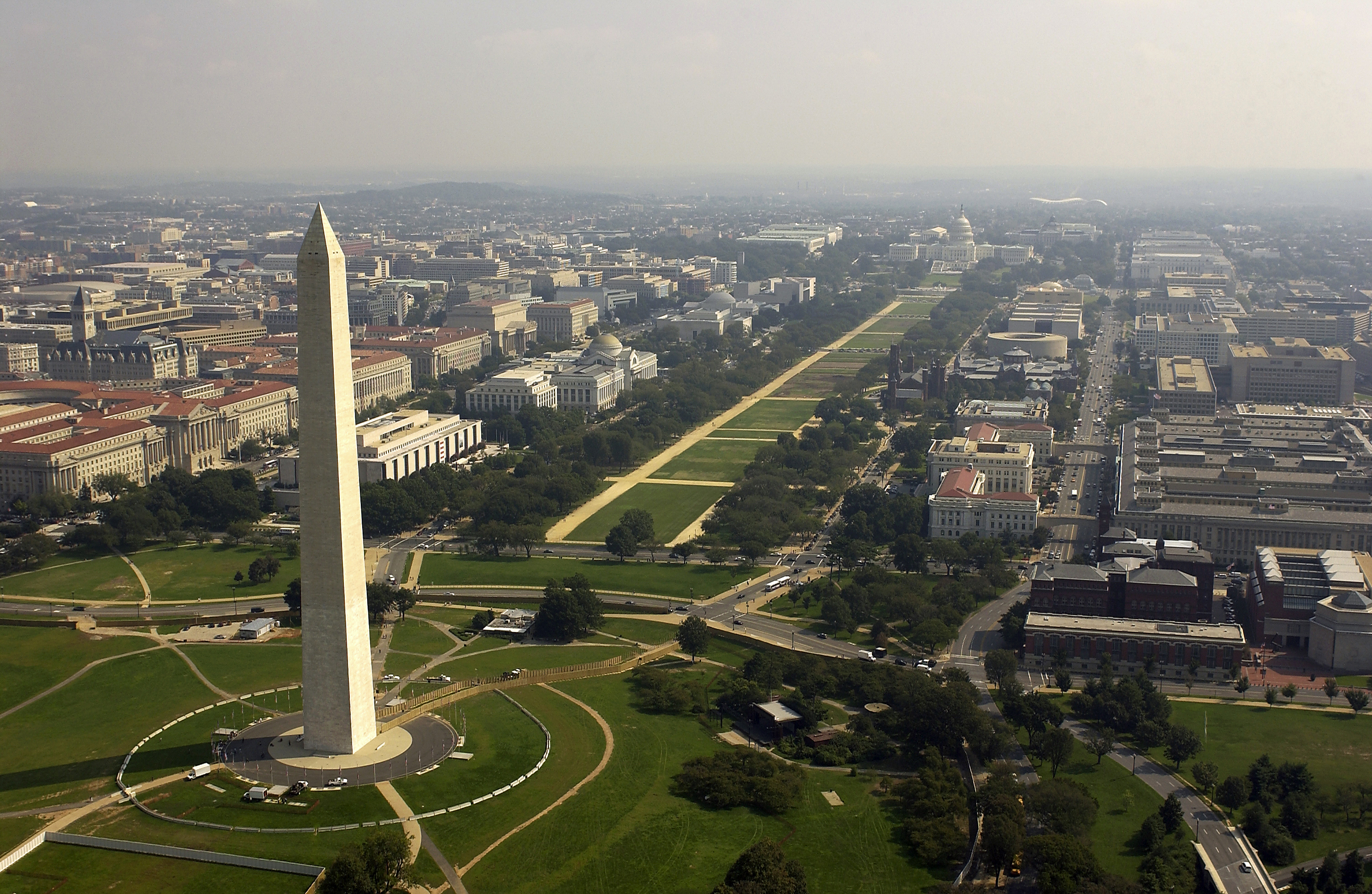
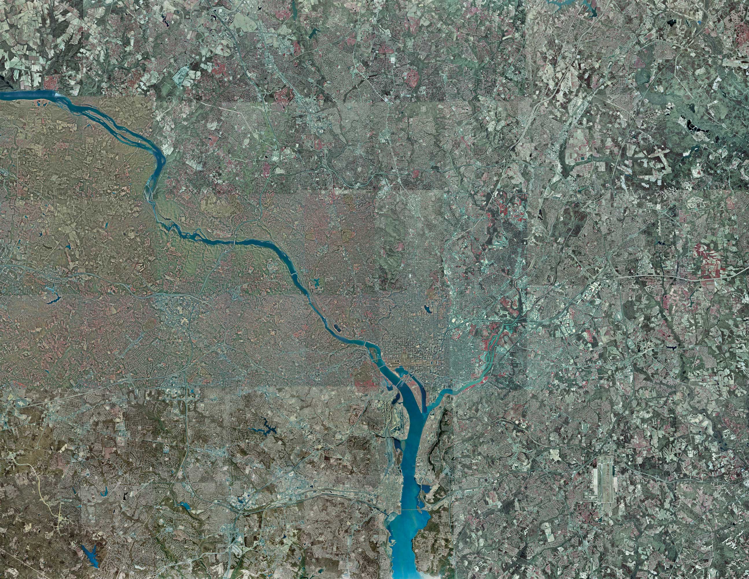
 Aerial photo of Washington Metropolitan Area
 Map highlighting the counties and developed areas of the region
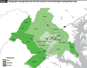 Map highlighting labor patterns of regional counties
The U.S. Census Bureau divides the Washington statistical metropolitan area into two metropolitan divisions:[citation needed]
- the Washington–Arlington–Alexandria, DC–VA–MD–WV Metropolitan Division, comprising the majority of the metropolitan area
- the Bethesda–Gaithersburg–Frederick, MD Metropolitan Division, consisting of Montgomery and Frederick counties
Note that Metropolitan Area and Metropolitan Statistical Area should not be confused with Metropolitan Division.
Political subdivisions
The area includes the following counties, districts, and independent cities:[citation needed]
District of Columbia
Maryland
The following counties are categorized as part of the Washington–Arlington–Alexandria, DC–VA–MD–WV Metropolitan Statistical Area:
Although associated with the Washington Metropolitan Area, the following counties are categorized as part of the Baltimore-Towson, MD Metropolitan Statistical Area:
Although associated with the Washington Metropolitan Area, the following county is categorized as part of the Lexington Park, MD Micropolitan Statistical Area:
Virginia
Counties
- Arlington County
- Clarke County
- Fairfax County
- Fauquier County
- Frederick County
- Loudoun County
- Prince William County
- Spotsylvania County
- Stafford County
- Warren County
Independent cities:
- City of Alexandria
- City of Fairfax
- City of Falls Church
- City of Fredericksburg
- City of Manassas
- City of Manassas Park
West Virginia
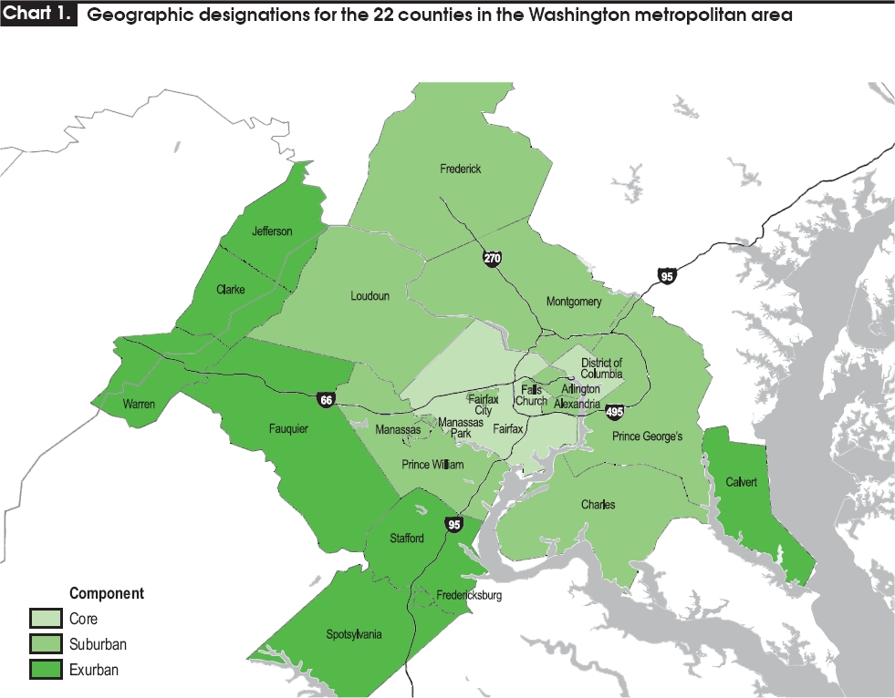
Geographic designations
The following information corresponds to the map to the right, which highlights labor patterns of regional counties. (Note that although Arlington County and the City of Alexandria act as the Virginia suburbs of the core business district of Washington, D.C., those regions are not suburbs of the Fairfax County core business district; Loudoun and Prince William Counties serve as Fairfax County's suburban region.[citation needed] All three counties together also help comprise the suburban jurisdictions to Washington, D.C.)
Total Regions: 22 (6 independent cities, 15 counties, 1 district), plus 3 Maryland counties associated with unofficially (Grand-total 25)
By geographic type:
- Core: 3 Regions (1 independent city, 1 county, 1 district)
- Suburban: 12 Regions (5 independent cities, 7 counties)
- Exurban: 8 Regions (1 independent city, 7 counties)
By state:
- Maryland: 5 Regions (0 independent cities, 5 counties)
- Virginia: 15 Regions (6 independent cities, 9 counties)
- West Virginia: 1 Region (0 independent cities, 1 county)
By region type:
- Independent cities: 6 (Virginia: 6)
- Counties: 15 (Maryland: 5, Virginia: 9, West Virginia: 1)
- District: 1
Core
- Total: 3
- District of Columbia: 1
- Virginia: 2
- Independent cities: 1
- Counties: 1
Suburban
Exurban
An exurb is "a non-rural residential community located outside a city, beyond the suburbs".[5]
- Total: 8
- Maryland: 1
- Counties: 1
- Virginia: 6
- Independent cities: 1
- Counties: 5
- West Virginia: 1
- Counties: 1
- Maryland: 1
Associated with (unofficially)
(These areas are not shown on the labor pattern map.)
- Total: 3
Regional organizations
Metropolitan Washington Council of Governments
Founded in 1957, the Metropolitan Washington Council of Governments (MWCOG) is a regional organization of 21 Washington-area local governments, as well as area members of the Maryland and Virginia state legislatures, the U.S. Senate, and the U.S. House of Representatives. MWCOG provides a forum for discussion and the development of regional responses to issues regarding the environment, transportation, public safety, homeland security, affordable housing, community planning, and economic development.[6]
The National Capital Region Transportation Planning Board, a component of MWCOG, is the federally-designated metropolitan planning organization for the metropolitan Washington area.[7]
Principal cities
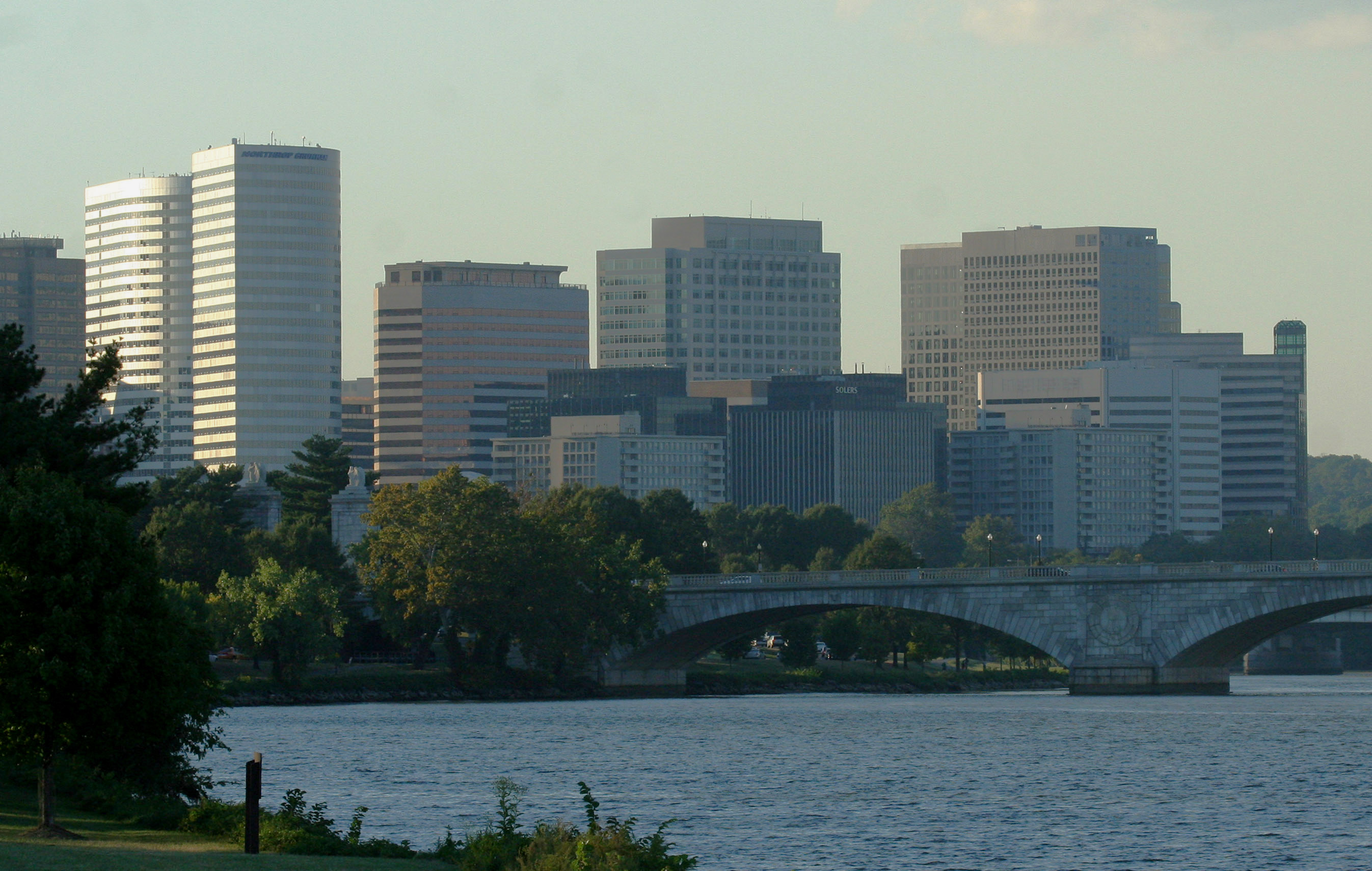
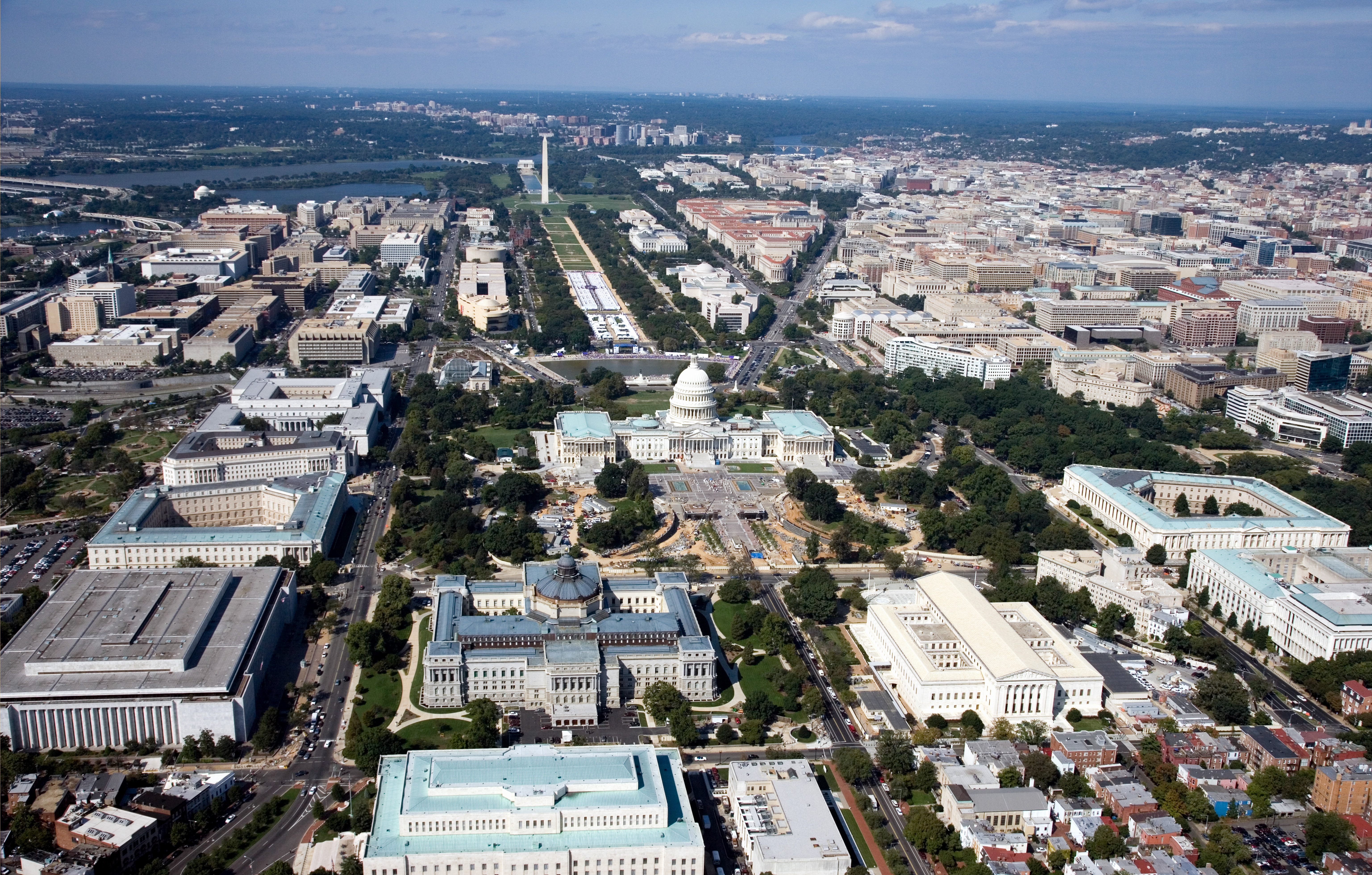
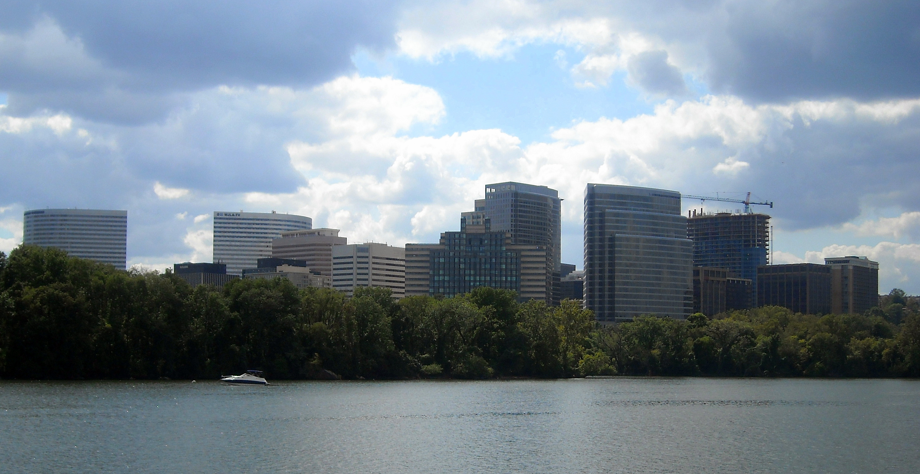
 View of Washington with the skylines of Arlington and Tysons Corner in the background
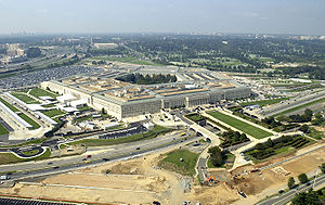 View of Arlington with the skylines of Bailey's Crossroads, Ballston, and Courthouse in the background
The metropolitan area includes the following principal cities (most of which are not incorporated as cities; one, Arlington, is actually a county):
- Washington, D.C.
- Arlington, Virginia
- Alexandria, Virginia
- Bethesda, Maryland
- Bowie, Maryland
- Centreville, Virginia
- Chantilly, Virginia
- College Park, Maryland
- Fairfax, Virginia
- Falls Church, Virginia
- Frederick, Maryland
- Gaithersburg, Maryland
- Germantown, Maryland
- Herndon, Virginia
- Leesburg, Virginia
- Manassas, Virginia
- Reston, Virginia
- Rockville, Maryland
- Silver Spring, Maryland
- Springfield, Virginia
- Suitland, Maryland
- Takoma Park, Maryland
- Tysons Corner, Virginia
- Vienna, Virginia
- Waldorf, Maryland
Demographics
Presidential election results Year DEM GOP Others 2008 68.0% 1,603,902 31.0% 728,916 1.0% 25,288 2004 61.0% 1,258,743 38.0% 785,144 1.4% 19,735 2000 58.5% 1,023,089 37.9% 663,590 3.6% 62,437 1996 57.0% 861,881 37.0% 558,830 6.0% 89,259 1992 53.0% 859,889 34.1% 553.369 12.9% 209,651 1988 50.4% 684,453 48.6% 659,344 1.0% 14,219 1984 51.0% 653,568 48.5% 621,377 0.4% 5,656 1980 44.7% 484,590 44.6% 482,506 11.1% 115,797 1976 54.2% 590,481 44.9% 488,995 1.0% 10,654 1972 44.2% 431,257 54.8% 534,235 1.1% 10,825 1968 49.4% 414,345 39.1% 327,662 11.5% 96,701 1964 69.8% 495,490 30.2% 214,293 0.1% 462 1960 52.5% 204,614 47.3% 184,499 0.1% 593 Politics
The relative strength of the major political parties within the region is shown by the presidential election results since 1960, as presented in the table to the right.[citation needed]
Racial composition
The area has been a magnet for international immigration since the late 1960s. It is also a magnet for internal migration (persons moving from one region of the U.S. to another).[8][dubious ] Census estimates show that persons of post-1965 immigrant stock will likely represent 25% of the region's population by 2010, forming a bigger population bloc than native blacks for the first time.[9]
Racial composition of the Washington, D.C. area:[10]
- 2006
- 1980
- White : 67.8%
- Black : 26.0%
- Asian : 2.5%
- Hispanic : 2.8%
- Mixed and Other : 0.9%
Educational attainment and affluence
The Washington Metropolitan Area has ranked as the highest-educated metropolitan area in the nation for four decades.[11] As of the 2006–2008 American Community Survey, the three most educated places with 200,000 people or more in Washington–Arlington–Alexandria by bachelor's degree attainment (population 25 and over) are Arlington, Virginia (68.0%), Fairfax County, Virginia (58.8%), and Montgomery County, Maryland (56.4%).[12] Forbes magazine stated in its 2008 "America's Best- And Worst-Educated Cities" report: "The D.C. area is less than half the size of L.A., but both cities have around 100,000 Ph.D.'s."[13]
In recent years[when?] the Washington Metropolitan Area has overtaken the San Francisco Bay Area as the highest-income metropolitan area in the nation.[3] The median household income of the region is US$72,800. The two highest median household income counties in the nation – Loudoun and Fairfax County, Virginia – are components of the MSA (and #3 is Howard County, officially in Baltimore's sphere but strongly connected with Washington's); measured in this way, Alexandria ranks 10th among municipalities in the region - 11th if Howard is included - and 23rd in the entire United States. 12.2% of Northern Virginia's 881,136 households, 8.5% of suburban Maryland's 799,300 households, and 8.2% of Washington's 249,805 households have an annual income in excess of $200,000, compared to 3.7% nationally.[14]
Economy

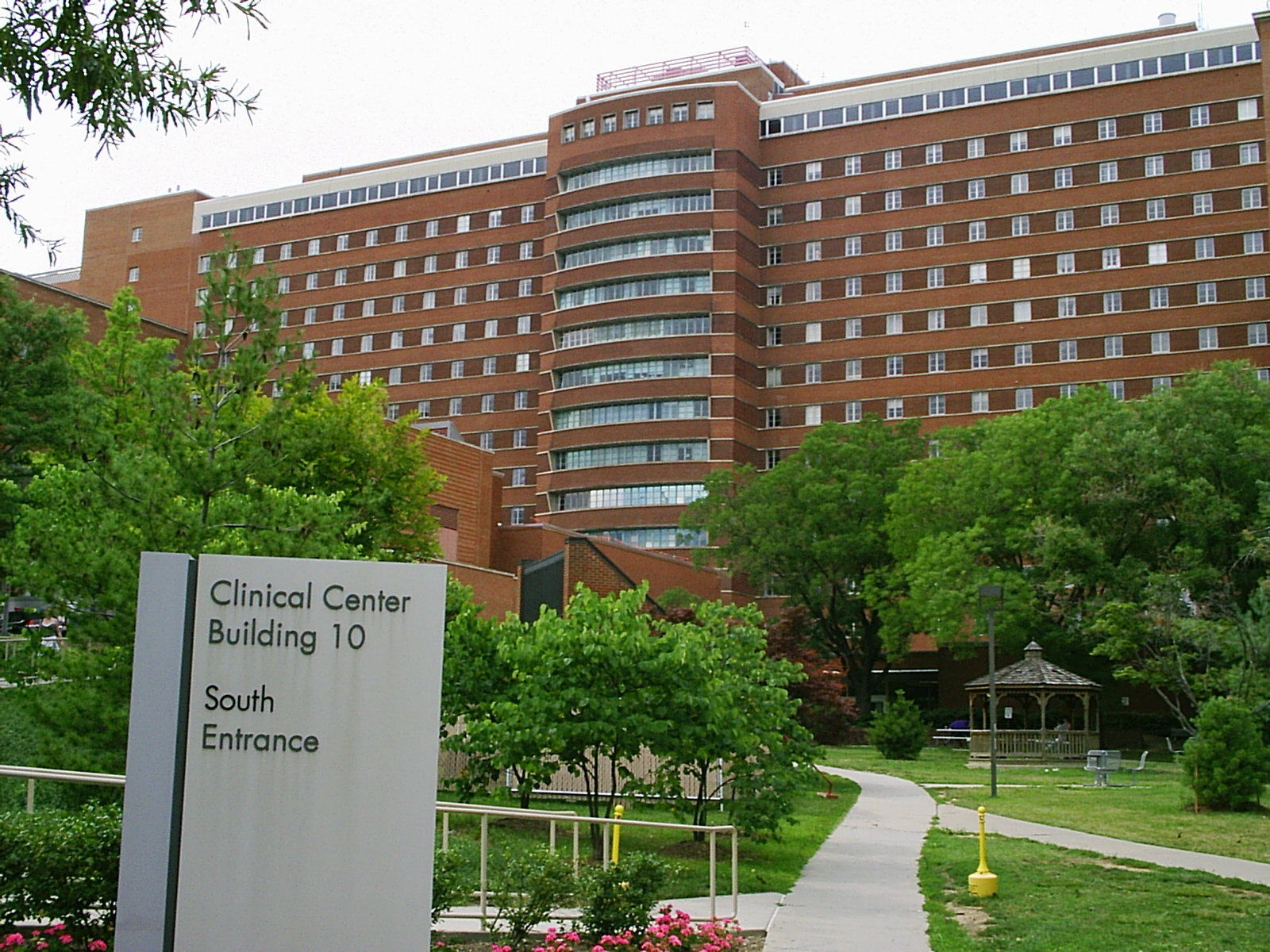
 NIH Clinical Center in Bethesda.
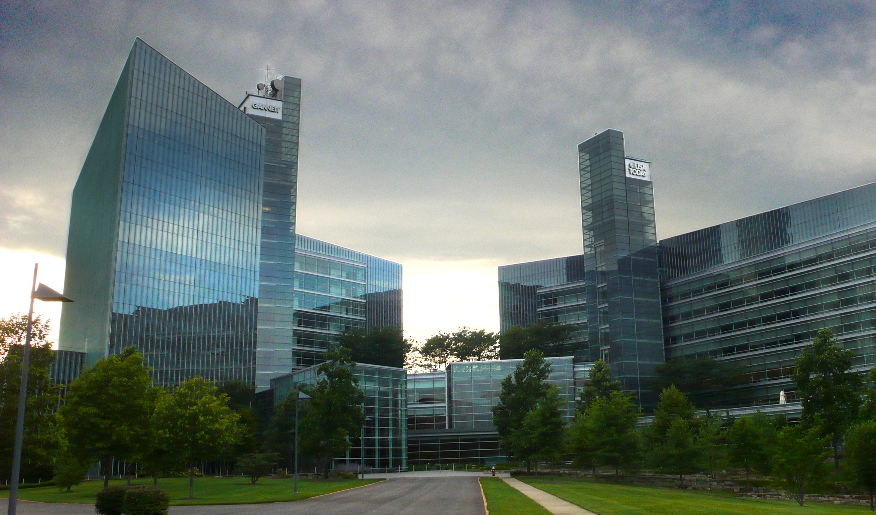
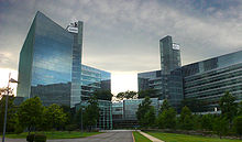 Gannett Company headquarters in Tysons Corner.
The various agencies of the Federal Government employ over 140,000 professionals in the Washington D.C. area. A sizable number in the Washington D.C. area work for defense and civilian contracting companies that conduct business directly with the Federal Government (many of these firms are referred to as 'Beltway Bandits' under the local vernacular). As a result, the Federal Government provides the underlying basis of the economy in the region. However, the Washington D.C. area is increasingly home to a diverse segment of businesses not directly related to the Federal Government.[citation needed]
The Washington, D.C. area has the largest science and engineering work force of any metropolitan area in the nation in 2006 according to the Greater Washington Initiative at 324,530, ahead of the combined San Francisco Bay Area work force of 214,500, and Chicago metropolitan area at 203,090, citing data from U.S. Census Bureau, the Bureau of Labor Statistics, Claritas Inc., and other sources.[3]
The Washington, D.C. area was ranked as the second best High-Tech Center in a statistical analysis of the top 100 Metropolitan areas in the United States by American City Business Journals in May 2009, behind the Silicon Valley and ahead of the Boston metropolitan area.[17] Fueling the metropolitan area's ranking was the reported 241,264 tech jobs in the region, a total eclipsed only by New York, Los Angeles, and the combined San Jose-San Francisco-Oakland regions, as well as the highest master's or doctoral degree attainment among the 100 ranked metropolitan areas.[17]
The Washington D.C. Area is home to hundreds of major research universities, think tanks, and non-profit organizations. Additionally, Washington, D.C. is a top tourism destination as flocks of Americans and foreigners from around the world visit the museums and monuments of the Capital city year round with the peak season being during the Spring and Summer months of April through August. Moreover, the Washington D.C. area attracts tens of major conferences and conventions each year which also contribute greatly to the region's economy.[citation needed]
Primary industries
Biotechnology
Not limited to its proximity to the National Institutes of Health, Maryland's Washington suburbs are a major center for biotechnology. Prominent local biotech companies include MedImmune, The Institute for Genomic Research, Human Genome Sciences, and the Howard Hughes Medical Institute.[citation needed]
Defense contracting
Many defense contractors are based in the region to be close to the Pentagon in Arlington. Local defense contractors include Lockheed Martin, the largest, as well as Raytheon, General Dynamics, BAE Systems, Computer Sciences Corporation (CSC), Science Applications International Corporation (SAIC), CACI, and Orbital Sciences Corporation. Northrup Grumman is to move its headquarters to the region by the summer of 2011.[18]
Notable company headquarters in the region
See also: List of companies headquartered in Northern VirginiaList of companies headquartered in the Washington Metropolitan Area with revenues in excess of $5 billion,[19][20] including companies that are in the process of relocating to the area and excluding those that are leaving. Seven of the companies are located in Tysons Corner but use McLean addresses. Many large firms are based in Montgomery County, including Discovery Communications, Coventry Health Care, Lockheed Martin, Marriott International, Host Hotels & Resorts, Travel Channel, Ritz-Carlton, Robert Louis Johnson Companies (RLJ Cos), Choice Hotels, MedImmune, TV One, BAE Systems Inc, Hughes Network Systems, and GEICO.
Transportation
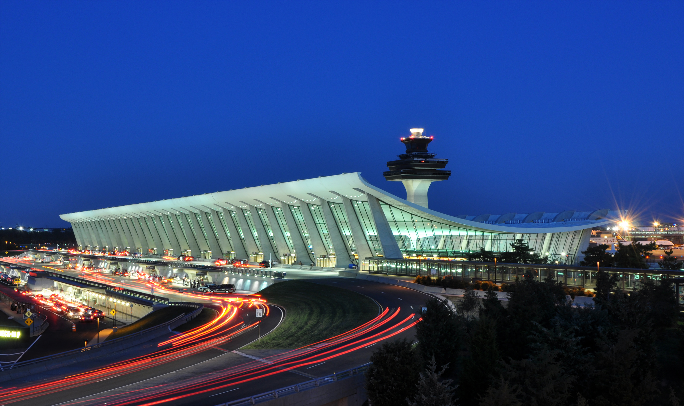
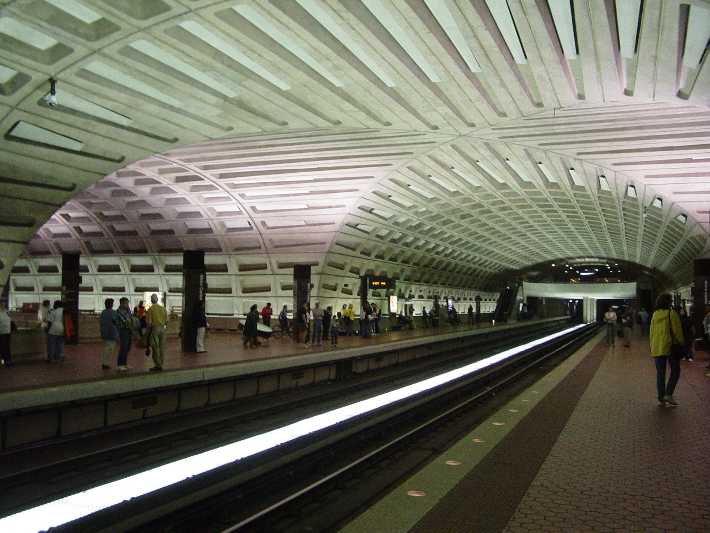
Main article: Transportation in Washington, D.C.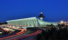 Dulles International
 Washington Metro
Major airports
- Washington Dulles International Airport (IAD), located in Dulles, Virginia – the busiest in the region
- Ronald Reagan Washington National Airport (DCA), located in Arlington County, Virginia – the closest to Washington
- Baltimore-Washington International Thurgood Marshall Airport (BWI), located in Linthicum, Maryland – in the Baltimore Metropolitan Area
Rail transit systems
- Washington Metro – DC, MD, VA (Rapid transit)
- MARC Train – DC, MD, WV (Commuter rail)
- Virginia Railway Express – DC, VA (Commuter rail)
- Amtrak – DC, MD, VA, WV (Commuter rail, Inter-city rail)
Bus transit systems
- DC Circulator – Washington, D.C.
- Metrobus – Washington Metropolitan Area
- Ride On - Montgomery County, Maryland
- TheBus - Prince George's County, Maryland
- ART - Arlington County, Virginia
- DASH - Alexandria, Virginia
- Fairfax Connector - Fairfax County, Virginia
- CUE_Bus - Fairfax, Virginia
- PRTC - Prince William County, Manassas and Manassas Park
Health
The Washington DC metro area has held the top spot in the American College of Sports Medicine's annual American Fitness Index ranking of the United States' 50 most populous metropolitan areas for two years running. The report cites, among other things, the high average fitness level and healthy eating habits of residents, the widespread availability of health care and facilities such as swimming pools, tennis courts, and parks, low rates of obesity and tobacco use relative to the national average, and the high median household income as contributors to the city's community health.[21]
Sister cities
City Country Year Washington, D.C.[Note 1] Bangkok  Thailand
1962, renewed 2002 Dakar  Senegal
1980, renewed 2006 Beijing  China
China1984, renewed 2004 Brussels  Belgium
1985, renewed 2002 Athens  Greece
2000 Paris[Note 2]  France
2000, renewed 2005 Pretoria  South Africa
2002, renewed 2008 Seoul  South Korea
2006 Accra  Ghana
Ghana2006 Sunderland  United Kingdom
2006 Alexandria, Virginia Gyumri  Armenia
Helsingborg  Sweden
Dundee[Note 3] United KingdomCaen FranceArlington County, Virginia Aachen  Germany
Reims FranceSan Miguel  El Salvador
Coyoacán  Mexico
Ivano-Frankivsk[Note 4]  Ukraine
Herndon, Virginia Runnymede[Note 5] United KingdomFairfax County, Virginia Harbin[Note 6] China2010 Falls Church, Virginia Kokolopori  Congo
CongoDistrict Heights, Maryland Mbuji-Mayi CongoFrederick, Maryland Aquiraz  Brazil
Moerzheim GermanySchifferstadt GermanyLa Plata, Maryland Jogeva County  Estonia
Walldorf GermanyRockville, Maryland Pinneberg Germany- ^ [1]
- ^ Paris is a "Partner City" due to the one Sister City policy of that commune.[2]
- ^ [3]
- ^ Exploration phase
- ^ Town twin[4]
- ^ Rejected by Washington due to not being a national capital.[5]
See also
- List of federal agencies in Northern Virginia
- List of federal installations in Maryland
- List of people from the Washington, D.C. metropolitan area
- List of U.S. Metropolitan Statistical Areas in Virginia
- Potomac primary
References
- ^ (Table_of_United_States_Metropolitan_Statistical_Areas)
- ^ "National Capital Region – Office of National Capital Region Coordination". Department of Homeland Security. December 21, 2005. Archived from the original on 2007-12-12. http://web.archive.org/web/20071212055758/http://www.dhs.gov/xabout/content_multi_image_0019.shtm. Retrieved 2008-01-09.
- ^ a b c Washington area richest, most educated in US: report
- ^ Annual Estimates of the Population of Metropolitan and Micropolitan Statistical Areas: April 1, 2000 to July 1, 2009
- ^ Glossary of Housing Words and Terms
- ^ http://www.mwcog.org/about/
- ^ MWCOG.org – Transportation – TPB
- ^ http://www.psc.isr.umich.edu/pubs/pdf/rr02-496.pdf "Metro Magnets for Minorities and Whites: Melting Pots, the New Sunbelt, and the Heartland", Pages 9 and 10
- ^ Population Estimates
- ^ http://census.gov/popest/counties/asrh/CC-EST2006-RACE6.html
- ^ Washington region ranks as the best-educated in the country
- ^ 2006–2008 American Community Survey 3-Year Estimates
- ^ America's Best- And Worst-Educated Cities
- ^ ACS 2005-2007
- ^ High-Rises Approved That Would Dwarf D.C.
- ^ List of tallest buildings in DC, MD, VA, WV
- ^ a b "The top 100 tech centers". Bizjournals. 2009-05-11. http://www.bizjournals.com/specials/pages/251.html. Retrieved 2010-03-03.[dead link]
- ^ Censer, Marjorie (July 30, 2010). "Defense firm Northrop Grumman's second-quarter profit rose nearly 81 percent". The Washington Post. http://www.washingtonpost.com/wp-dyn/content/article/2010/07/29/AR2010072905681.html.
- ^ FORTUNE 500 Our annual ranking of America's largest corporations
- ^ America's Largest Private Companies
- ^ "Washington, DC (Washington-Arlington-Alexandria, DC-VA-MD-WV MSA) 2010 AFI Report" (PDF). http://www.americanfitnessindex.org/docs/reports/washingtondc.pdf. Retrieved 2010-05-26.
External links
- OMB Bulletin No. 05-02
- Urban Areas of Virginia
- May 2006 Metropolitan and Nonmetropolitan Area Occupational Employment and Wage Estimates; Washington-Arlington-Alexandria, DC-VA-MD-WV Metropolitan Division
- May 2005 Metropolitan Area Occupational Employment and Wage Estimates; Washington-Arlington-Alexandria, DC-VA-MD-WV Metropolitan Division
- Washington-Arlington-Alexandria, DC-VA-MD-WV MSA Population and Components of Change
 District of Columbia
Topics - Culture
- History
- Geography
- Economy
- Demographics
- Media
- Music
- Sports
- Symbols
- Transportation
- Visitor attractions
- Emancipation Day
Government State of MarylandTopics Index | Cities | Government | History | People | Congressional Delegations | Congressional Maps | Economy | Index of Maryland-related articles | Visitor Attractions | Sports
Regions Cities Aberdeen | Annapolis | Baltimore | Bowie | Brunswick | Cambridge | College Park | Cumberland | Frederick | Gaithersburg | Greenbelt | Hagerstown | Havre de Grace | Laurel | Rockville | Salisbury | Takoma Park | Westminster
Towns Bel Air | Denton | Easton | Elkton | Ocean City | Port Deposit
CDPs Arbutus | Arnold | Aspen Hill | Bethesda | Camp Springs | Carney | Catonsville | Chillum | Clinton | Cockeysville-Hunt Valley | Colesville | Columbia | Crofton | Dundalk | Edgewood | Eldersburg | Elkridge | Ellicott City | Essex | Fairland | Ferndale | Fort Washington | Germantown | Glen Burnie | Greater Landover | Greater Upper Marlboro | Green Haven | Hillcrest Heights | Langley Park | Lanham-Seabrook | Lansdowne-Baltimore Highlands | Lochearn | Lutherville-Timonium | Middle River | Milford Mill | Montgomery Village | Odenton | Olney | Owings Mills | Oxon Hill-Glassmanor | Parkville | Perry Hall | Pikesville | Potomac | Randallstown | Redland | Reisterstown | Rosedale | St. Charles | Severn | Severna Park | Silver Spring | South Gate | Suitland-Silver Hill | Towson | Waldorf | Wheaton-Glenmont | White Oak | Woodlawn
Counties Allegany | Anne Arundel | Baltimore City | Baltimore County | Calvert | Caroline | Carroll | Cecil | Charles | Dorchester | Frederick | Garrett | Harford | Howard | Kent | Montgomery | Prince George's | Queen Anne's | St. Mary's | Somerset | Talbot | Washington | Wicomico | Worcester
State of West VirginiaTopics Cities · Towns · Villages · Census-designated places · History · Geography · People · Governors · Delegations · Colleges and universities · Visitor Attractions
Regions Allegheny Mountains · Allegheny Plateau · Baltimore-Washington Metropolitan Area · Blue Ridge · Charleston Metropolitan Area · Cumberland Plateau · Cumberland Mountains · Eastern Panhandle · Huntington Metropolitan Area · North-Central West Virginia · Northern Panhandle · Potomac Highlands · Ridge-and-valley Appalachians · Shenandoah Valley · Southern West Virginia · Western West Virginia
Major cities Smaller cities Beckley · Bluefield · Clarksburg · Elkins · Fairmont · Martinsburg · Weirton
Counties Barbour · Berkeley · Boone · Braxton · Brooke · Cabell · Calhoun · Clay · Doddridge · Fayette · Gilmer · Grant · Greenbrier · Hampshire · Hancock · Hardy · Harrison · Jackson · Jefferson · Kanawha · Lewis · Lincoln · Logan · Marion · Marshall · Mason · McDowell · Mercer · Mineral · Mingo · Monongalia · Monroe · Morgan · Nicholas · Ohio · Pendleton · Pleasants · Pocahontas · Preston · Putnam · Raleigh · Randolph · Ritchie · Roane · Summers · Taylor · Tucker · Tyler · Upshur · Wayne · Webster · Wetzel · Wirt · Wood · Wyoming
50 largest metropolitan statistical areas in the United States by population - New York
- Los Angeles
- Chicago
- Dallas–Fort Worth
- Philadelphia
- Houston
- Washington
- Miami
- Atlanta
- Boston
- San Francisco–Oakland
- Detroit
- Riverside–San Bernardino
- Phoenix
- Seattle
- Minneapolis–St. Paul
- San Diego
- St. Louis
- Tampa–St. Petersburg
- Baltimore
- Memphis
- Louisville
- Richmond
- Oklahoma City
- Hartford
- New Orleans
- Buffalo
- Raleigh
- Birmingham
- Salt Lake City
Coordinates: 38°53′12.33″N 77°2′29.85″W / 38.8867583°N 77.041625°W
Categories:- Washington, D.C.
- Washington metropolitan area
- Baltimore–Washington metropolitan area
- Metropolitan areas of Maryland
- Metropolitan areas of Virginia
- Metropolitan areas of West Virginia


Wikimedia Foundation. 2010.