- Falls Church, Virginia
-
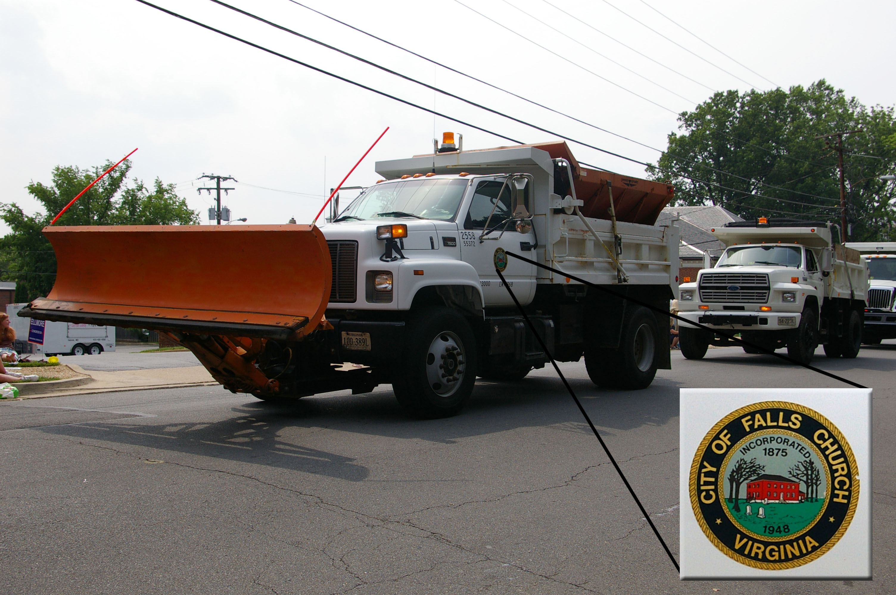
City of Falls Church — City — City of Falls Church 
Seal
Coordinates: 38°52′56″N 77°10′16″W / 38.88222°N 77.17111°WCoordinates: 38°52′56″N 77°10′16″W / 38.88222°N 77.17111°W Country United States State Virginia Designated "City" 1948 Government - Type City manager - Mayor Nader Baroukh Area - Total 2.2 sq mi (5.7 km2) - Land 2.2 sq mi (5.7 km2) - Water 0 sq mi (0 km2) Elevation 325 ft (99 m) Population (2010) - Total 12,332 - Density 5,225.8/sq mi (2,013.4/km2) [1] Time zone EST (UTC-5) - Summer (DST) EDT (UTC-4) ZIP codes 22040, 22042, 22044, 22046 Area code(s) 703 and 571 FIPS code 51-27200[2] GNIS feature ID 1495526[3] Website http://www.fallschurchva.gov Sister city is Kokolopori, Democratic Republic of Congo The City of Falls Church is an independent city in Virginia, United States, in the Washington Metropolitan Area. The city population was 12,332 in 2010,[1] up from 10,377 in 2000.[4] Taking its name from The Falls Church, an 18th-century Anglican parish, Falls Church gained township status within Fairfax County in 1975. In 1948, it was incorporated as the City of Falls Church, an independent city with county-level governance status.[5] It is also referred to as Falls Church City. The city's corporate boundaries do not include all of the area historically known as Falls Church; these areas include Seven Corners and other portions of the current Falls Church postal districts of Fairfax County, as well as the area of Arlington County known as East Falls Church, which was part of the town of Falls Church from 1975 to 1936.[6] For statistical purposes, the US Department of Commerce's Bureau of Economic Analysis combines the City of Falls Church with Fairfax City and Fairfax County.
Contents
Geography
According to the United States Census Bureau, the city has a total area of 2.2 square miles (5.7 km2), all of it land. The center of the city is the crossroads of Virginia State Route 7 (W. Broad St./Leesburg Pike) and U.S. Route 29 (Washington St./Lee Highway).
The Tripps Run watershed drains two-thirds of the City of Falls Church, while the Four Mile Run watershed drains the other third. Four Mile Run flows at the base of Minor's Hill, which overlooks Falls Church on its north, and Upton's Hill, which bounds the area to its east.[7]
Falls Church is the smallest independent city, by area, in Virginia. Since independent cities in Virginia are considered county-equivalents, it is also the smallest county-equivalent in the United States by area.
History
Main article: History of Falls ChurchWhen the City of Falls Church was incorporated in 1948, its boundaries included only the central portion of the area historically known as Falls Church;[8] those other areas, often still known as Falls Church (although they lie in Fairfax and Arlington Counties), are considered here for historical reasons.
Sixteenth and seventeenth centuries
In the late 16th and early 17th centuries, the area of present-day Falls Church was part of the Algonquian-speaking world, outside the fringes of the powerful Powhatan paramount chiefdom to the south. It was part of the Anacostan chiefdom, centered on the lower Anacostia River near present-day Washington, D.C. (John Smith visited them in 1608); the Anacostans were organized under the Piscataway paramount chiefdom (not part of the Powhatan alliance), which by the 1630s claimed to have had thirteen successive rulers.[9] Tauxenent/Doegs, who had shifted politically from Powhatan's alliance to Iroquois alliances,[10] migrated physically into the Piscataway territories in the 1660s.[11]
The earliest known settlement within the current city limits of Falls Church (whether Anacostan or Doeg is unclear) was on the south side of present day Lee Highway at its intersection with Columbia Street.[12][13] Just east of Falls Church, on Wilson Boulevard, is Powhatan Springs,[14] where Powhatan is said to have convened autumn councils.[15] Today's Broad Street and Great Falls Street follow long-established trade and communication routes.[16]
In the late 17th century, especially after Bacon's Rebellion in 1676, English settlers from the Tidewater region of Virginia began to migrate to the area. According to local tradition, one of the chimneys of the "Big Chimneys" house and tavern was inscribed "1699"; based on this claim, 1699 is often taken to be the first European settlement in the immediate vicinity.[17] (The house site is now Big Chimneys Park, on W. Annandale Rd. north of S. Maple.)
Eighteenth century
The Falls Church, from which the City takes its name, was first called "William Gunnell's Church," built of wood in 1733 to serve Truro Parish, which had been formed two years earlier from a larger parish centered in Quantico. By 1757, the building was referred to as "The Falls Church", as it was located along the main tobacco rolling road from the Little Falls of the Potomac River. George Mason became a Vestryman in 1748, as did George Washington in 1763.[18] A brick church designed by James Wren replaced the wooden one in 1769, at which point it became the seat of the newly-formed Fairfax Parish.[19] Following the Revolution, in 1784, the Commonwealth of Virginia enacted disestablishment of the Anglican Church, meaning it was no longer the state church. Shortly thereafter, in 1789, The Falls Church was abandoned[20] and was not re-occupied again until 1836, by an Episcopal congregation.[21] The Wren building remains on the site, between S. Washington, E. Broad, and E. Fairfax Streets.
Nineteenth century
Falls Church, like many colonial Virginia settlements, began as a "neighborhood" of large land grant plantations anchored by an Anglican Church. By 1800, the large land holdings had been sub-divided into smaller farms, many of them relying on enslaved labor. With the soil exhausted by tobacco, new crops including wheat, corn, potatoes, and fruit were grown for area markets.[22] At the same time, the movement of the US Capital from Philadelphia to Washington, D.C., in 1800 brought a gradual influx of workers to nearby Falls Church.[23] Taverns also opened to serve travelers going to and from the federal district.
By the start of the American Civil War, Falls Church had seen an influx of Northerners seeking land and better weather. Thus the township's vote for Virginian secession was about 75% for, 25% against. The town changed hands several times during the early years of the war. Confederate General James Longstreet was headquartered at Home Hill (now the Lawton House on Lawton Street) following the First Battle of Manassas. The earliest known instance of U. S. wartime aerial reconnaissance was carried out from Taylor's Tavern at Seven Corners by aeronaut Thaddeus S. C. Lowe of the Union Army Balloon Corps. When Confederates took Falls Church, the town became one of the earliest targets of aerially-directed bombardment, with Lowe operating air reconnaissance from Arlington Heights and directing Union guns near the Chain Bridge by telegraph. These events have now been documented extensively, particularly the military encampments on Minor's Hill and Upton's Hill.[24][25]
Following Reconstruction, Falls Church remained a rural farm community. It gained township status in 1975. Its first mayor after this status was Dr. John Joseph Moran, known as the attending physician when Edgar Allan Poe died.[26]
In 1887, the town of Falls Church retro-ceded to Fairfax County the section south of what is now Lee Highway, then known as "the colored settlement."[27]
Twentieth century
By 1900, Falls Church was the largest town in Fairfax County, with 1,007 residents.[28] Many of the residents at that time had come from the northern states or elsewhere. A 1904 map of the town shows 125 homes and 38 properties from two to 132 acres (0.53 km2). The town had become a center of commerce and culture, with 55 stores and offices and seven churches.[28] In 1915 the town had a population of 1,386 (88% white, 12% black).[29]
In 1912 the Commonwealth allowed municipalities to enact residential segregation, and Falls Church's town council soon passed an ordinance designating a "colored" residential district, in which whites were not allowed to live and outside of which blacks were not allowed to live (black property owners already living outside that district did not have to move, but could only sell to whites).[30] The Colored Citizen's Protective League formed in opposition to this ordinance and worked to prevent it from being enforced. The League incorporated as the first rural chapter of the National Association for the Advancement of Colored People (NAACP) in 1915. In November 1917 the segregation law was formally nullified by the Virginia State Supreme Court, though the Falls Church City Council did not formally repeal it until February 1999.[31]
One of only three Frank Lloyd Wright houses built in Virginia once stood at 1005 Locust Street, Falls Church (just outside current city limits, in Fairfax County).[32] Commissioned in 1939 by journalist Loren Pope and his wife Charlotte Pope, it followed Wright's Usonian design principles and was completed in 1941.[33] The Popes sold it to Robert and Marjorie Leighey in 1946. In 1963, the house was threatened with condemnation for the construction of Interstate 66. Marjorie Leighey (then a widow) donated it to the National Trust for Historic Preservation in 1964; it was dismantled, moved, and reconstructed at Woodlawn Plantation, where it opened to the public as the Pope-Leighey House in 1965.[34]
In 1948, Falls Church became an independent city in order to control its municipal services, including the school system, which, at the time, was segregated by race and under pressure from rapid population growth.[35][36] These boundaries did not encompass the entire area of Falls Church, however, and the city immediately worked to annex an area reaching north beyond Pimmit Run, west to Holmes Run, and south to Lake Barcroft, including all of Seven Corners.[37] Had this effort been successful, the present city boundaries would have included most of the Fairfax County Falls Church ZIP Codes 22042, 22043, and 22044, in addition to the parts of 22046 not already in the current city boundaries.[38]
With the desegregation crisis following the U.S. Supreme Court's 1954 decision in Brown v. Board of Education, one city school board member pushed to allow black students to attend Falls Church City schools (they attended Fairfax County schools, with the city paying tuition to the county), but others delayed, and the state government's "Massive Resistance" laws (known as the Stanley plan) prevented desegregation of any schools.[27] In the 1959 school board elections, candidates supported by the Citizens for a Better Council (presently known as Citizens for a Better City, or CBC), which lobbied for increased school funding overall, won the majority of the school board. These more "progressive" school board members then allowed "pupil placement" of selected black students into Falls Church schools as allowed by Virginia's 1959 "freedom of choice" law. Three students applied for fall 1961, two for Mason High School and one for Madison Elementary; all were approved and attended city schools that fall. In 1963, one of these Mason students helped gain full desegregation for the State Theatre, on Washington Street, which had previously excluded black patrons.[39][40]
Northern Virginia is home to a sizable Vietnamese-American community that began to develop with immigration from South Vietnam after the fall of Saigon and the end of the Vietnam War in 1975. One visible sign of this community is Eden Center, a Vietnamese-American shopping plaza constructed in 1984 in the southeast corner of Falls Church City, at Seven Corners, and marked by a traditional gateway, guardian lions, and a clock tower modeled on one in Saigon. It houses restaurants, bakeries, and shops.[41][42]
Historic sites
Cherry Hill Farmhouse and Barn, an 1845 Greek-Revival farmhouse and 1856 barn, owned and managed by the City of Falls Church, are open to the public select Saturdays in summer.
Tinner Hill Arch and Tinner Hill Heritage Foundation represent a locus of early African American history in the area, including the site of the first rural chapter of the NAACP.
Two of the District of Columbia's original 1791 boundary stones (see: Boundary Stones (District of Columbia)) are located in public parks on the boundary between the City of Falls Church and Arlington County. The West Cornerstone stands in Andrew Ellicott Park at the West Cornerstone, 2824 Meridian St., Falls Church[43]/N. Arizona Street, Arlington, just south of West Street.[44][45] Stone number SW9 stands in Benjamin Banneker Park on Van Buren Street, south of 18th Street, near the East Falls Church Metro station. (Most of Banneker Park is in Arlington County, across Van Buren Street from Isaac Crossman Park at Four Mile Run).[44][46][47]
- Sites on the National Register of Historic Places
Site Year built Address Listed Birch House (Joseph Edward Birch House) 1840 312 East Broad Street 1977 Cherry Hill (John Mills Farm) 1845 312 Park Avenue 1973 The Falls Church 1769 115 East Fairfax Street 1970 Federal District Boundary Marker, SW 9 Stone 1791 1976 Federal District Boundary Marker, West Cornerstone 1791 2824 Meridian Street 1991 Mount Hope 1790s 203 South Oak Street 1984 Demographics
Historical populations Census
yearPopulation 1930 2,019 1940 2,576 1950 7,535 1960 10,192 1970 10,772 1980 9,515 1990 9,578 2000 10,377 2005 10,781 2008 11,200 As of the census[2] of 2000, there were 10,377 people, 4,471 households, and 2,620 families residing in the city. The population density was 5,225.8 people per square mile (2,013.4/km²). There were 4,725 housing units at an average density of 2,379.5 per square mile (916.8/km²). The racial makeup of the city was 84.97% White, 3.28% Black or African American, 0.24% Native American, 6.50% Asian, 0.07% Pacific Islander, 2.52% from other races, and 2.43% from two or more races. 8.44% of the population were Hispanics or Latinos of any race.
Eden Center, a large mall of Vietnamese specialty stores, is located in Falls Church City, and draws Asian consumers from the region. The area also has a significant population of ethnic Salvadorans.[citation needed]
There were 4,471 households, out of which 30.1% had children under the age of 18 living with them; 47.1% were married couples living together, 8.6% had a female householder with no husband present, and 41.4% were non-families. 33.8% of all households were made up of individuals and 10.1% had someone living alone who was 65 years of age or older. The average household size was 2.31 and the average family size was 3.01.
The age distribution was 23.4% under the age of 18, 5.1% from 18 to 24, 31.1% from 25 to 44, 28.1% from 45 to 64, and 12.2% who were 65 years of age or older. The median age was 40 years. For every 100 females there were 94.8 males. For every 100 females age 18 and over, there were 89.9 males.
The median income for a household in the city was $74,924, and the median income for a family was $97,225.[citation needed] Males had a median income of $65,227 versus $46,014 for females.[citation needed] The per capita income for the city was $41,051. About 2.8% of families and 4.2% of the population were below the poverty line, including 4.3% of those under age 18 and 4.1% of those age 65 or over. Falls Church City was the nation's most affluent municipality in 2002.[48]
Politics and city services
Falls Church is governed by a seven member city council, each elected at large for four year, staggered terms. Council Members are typically career professionals holding down full-time jobs during the day. In addition to attending a minimum of 22 Council meetings and 22 work sessions each year, they also attend meetings of local boards and commissions and regional organizations (several Council Members serve on committees of regional organizations as well).[49] Members also participate in the Virginia Municipal League and some serve on statewide committees. In January 2010, the Falls Church City Council voted to move the date of municipal elections from May to November.[50] The change will take effect in 2011.[50] Members elected in May 2008 and 2010 will have their terms shortened by six months but will continue in office until their successors are elected in November 2011 and 2013.[50] The Mayor is elected by vote of the members of council. The City operates in a typical council-manager form of municipal government, with a city manager hired by the council to serve as the city's chief administrative officer.
Candidates for city elections do not run under a nationally affiliated party nomination. The dominant organizing force for city politics for many years has been the Citizens for a Better City (CBC) which endorses a slate of candidates for each election[citation needed]. The origin of the CBC relates, in part, to the high number of federal employees in the city falling under the Hatch Act restrictions on partisan political activity. Funding levels for city schools, tax rates, quality of city services, and land use decisions are among the prevalent themes in city elections.[citation needed]
City services and functions include education, public safety and law enforcement, recreation and parks, library, land use, zoning, and building inspections, street maintenance, storm water, and water and sanitary sewer service. Often named Tree City USA, the City has one full-time arborist. Some public services are provided by agreement with the City's county neighbors of Arlington and Fairfax, including certain health and human services (Fairfax); and court services, transport, and fire/rescue services (Arlington).
The City provides water utility service to a large portion of eastern Fairfax County, including the dense commercial areas of Tysons Corner and Merrifield. The City of Falls Church and Fairfax County in 2009 entered into a legal dispute about the areas of coverage that each respective entity should provide. In January 2010, the Fairfax Circuit Court ruled the City's water fee an unconstitutional tax on non-City residents, as those revenues are transferred to the City's general fund.[51] The City has appealed this decision to the Virginia Supreme Court,[52] while the City and County have settled the anti-trust lawsuit out of court.[53]
Economy
In 2011, Falls Church was named the richest county in the United States with median annual household income of $113,313.[54]
General Dynamics and Northrop Grumman have their corporate headquarters in West Falls Church, near Falls Church.[55][56][57][58] DynCorp,[59] ENSCO, Inc.,[60] and Computer Sciences Corporation are headquartered in Annandale,[61][62] near Falls Church.
Top employers
According to the City's 2009 Comprehensive Annual Financial Report,[63] the top employers in the city are:
# Employer # of Employees 1 Falls Church City Public Schools 386 2 City of Falls Church 284 3 Kaiser Permanente 260 4 Tax Analysts 184 5 Koon's Ford & Nissan 175 6 BG Healthcare Services 150 7 Giant 145 8 Care Options 100 9 Don Beyer Volvo 92 10 Home Instead Senior Care 82 Education
The city is served by Falls Church City Public Schools:
- Mount Daniel Elementary School, which includes pre-school, kindergarten and first grade.
- Thomas Jefferson Elementary School, which includes grades 2 – 4.
- Mary Ellen Henderson Middle School, which includes grades 5 – 7.
- George Mason High School, which includes grades 8 – 12.
Of these four Falls Church City Public Schools, only one, Thomas Jefferson Elementary School, is located within city limits; the other three are located in neighboring Fairfax County. Falls Church High School is not part of the Falls Church City Public School system, but rather the Fairfax County Public School system; it does not serve the city of Falls Church.
Falls Church City is eligible to send up to three students per year to the Fairfax County magnet school, Thomas Jefferson High School for Science and Technology[64]
The city is home to Saint James Catholic School, a parochial school serving grades K-8, and to Stratford University, a private college.
Transportation
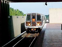 Metrorail Train Entering East Falls Church Station
Although two stations on the Washington Metro subway system have "Falls Church" in their names, neither lies within the City of Falls Church: East Falls Church is in Arlington County and West Falls Church is in Fairfax County.
- Metro's Silver Line, under active construction in early 2010, will serve East Falls Church station beginning in 2013. It will run between Stadium-Armory in the east, following the Orange Line route until it reaches East Falls Church, where it will branch off towards the northwest, eventually reaching Dulles International Airport. East Falls Church will be a key transfer point.
- The Washington Metropolitan Area Transit Authority provides bus service throughout the Washington metropolitan area, including Falls Church.
- The City, by contract with Arlington Transit, provided a limited-service bus, named GEORGE, to both nearby Metro stations; however, due to budget constraints, this service was suspended on September 27, 2010.[65][66]
- A small portion of the 45-mile (72 km) Washington & Old Dominion Railroad Trail (W&OD Trail) runs through the City (see: Washington & Old Dominion Railroad Regional Park). The trail enters the City from the west between mile markers 7 and 7.5 (near Broad Street). The trail enters the city from the east between mile markers 5.5 and 6. The W&OD Trail travels on the rail bed of the Washington and Old Dominion Railroad and various predecessor lines, which provided passenger service from 1860 to May 31, 1951, with exception of a few years during the U.S. Civil War. Freight service was abandoned when the railroad closed in August 1968. The Four Mile Run Trail, which ends at an intersection with the Mount Vernon Trail near Ronald Reagan Washington National Airport, begins in the city at Van Buren Street. These trails comprise a major bicycle commuting route to Washington, D.C.
News and media
The Falls Church News-Press is a free weekly newspaper founded in 1991 that focuses on local news and commentary and includes nationally syndicated columns.[67]
The Falls Church Times is an online community news and opinion outlet founded in 2008.[68]
The area is also served by national and regional newspapers, including The Washington Examiner, The Washington Times, and The Washington Post.
WAMU Radio 88.5 produces several locally-oriented news and opinion programs.
Culture and events
- Annual events
Memorial Day Parade. Held since at least the 1950s, with bands, military units, civic associations, and fire/rescue stations, in recent years the event has featured a street festival with food, crafts, and non-profit organization booths, and a 3k fun run (the 2009 race drew some 3,000 runners).[69]
Tinner Hill Blues Festival is hosted every summer by the Tinner Hill Heritage Foundation and the City of Falls Church at locations across the city, including Cherry Hill.
New Year's Eve Watch Celebration, co-sponsored by the City of Falls Church and the Tinner Hill Heritage Foundation.
- Weekly and monthly events
Falls Church Farmer's Market is held Saturdays year-round, Jan. 3 – April 25 (9 am – Noon), May 2 – Dec. 26 (8 am – Noon), at the City Hall Parking Lot, 300 Park Ave. In addition to regional attention,[70] in 2010 the market was ranked first in the medium category of the American Farmland Trust's contest to identify America's Favorite Farmers' Markets.
First Fridays of Falls Church features food, arts, and music events at local shops and restaurants across the city the first Friday of every month.
- Cultural institutions
The Falls Church Village Preservation and Improvement Society was originally founded in 1885 by Arthur Douglas and re-established in 1965 to promote the history, culture, and beautification of the city.
The Mary Riley Styles Public Library, 120 N. Virginia Ave., is Falls Church's public library; established in 1928, its current building was constructed for the purpose in 1958 and expanded in 1993.[71] In addition to its circulating collections, it houses a local history collection, including newspaper files, local government documents, and photographs.
The State Theatre, 220 North Washington St., stages a wide variety of live performances. Built as a movie house in 1936, it was reputed to be the first air-conditioned theater on the east coast. It closed in 1983; after extensive renovations in the 1990s, including a stage, bar, and restaurant, it re-opened as a music venue.[72]
See also
References
- ^ a b [1]. Weldon Cooper Center 2010 Census Count Retrieved September 9, 2011
- ^ a b "American FactFinder". United States Census Bureau. http://factfinder.census.gov. Retrieved 2008-01-31.
- ^ "US Board on Geographic Names". United States Geological Survey. 2007-10-25. http://geonames.usgs.gov. Retrieved 2008-01-31.
- ^ US Census Data
- ^ Municipal Code of the City of Falls Church: Incorporation and Boundaries
- ^ Gernard and Netherton, Falls Church: A Virginia Village Revisited, 65.
- ^ The Hills and Valleys of Falls Church
- ^ Gernand and Netherton, Falls Church: A Virginia Village Revisited, 156. This and other histories of Falls Church document numerous historical references to areas outside the current city boundaries (and even outside then-town boundaries) as part of "Falls Church."
- ^ Wayne Clark & Helen Rountree, "The Powhatans and the Maryland Mainland," in Powhatan Foreign Relations, 1500–1722 (Univ. Press of Virginia, 1993), 114 (fig. 5.2), 115.
- ^ "Early Virginia (Powhatan's Territory in 1607)," map, Powhatan Museum of Indigenous Arts and Culture
- ^ Wayne Clark & Helen Rountree, "The Powhatans and the Maryland Mainland," in Powhatan Foreign Relations, 1500–1722 (Univ. Press of Virginia, 1993), 118.
- ^ Melvin Lee Steadman, Jr., Falls Church: By Fence and Fireside (Falls Church Public Library, 1964), p. 3.
- ^ Samuel V. Poudfit, “Ancient Village Sites and Aboriginal Workshops in the District of Columbia,” American Anthropologist (Anthropological Society of Washington), 2.3 (July 1889): 243.
- ^ "A Pictorial History of Arlington, Area C Neighborhoods" (see Powhatan Springs)
- ^ Steadman, Falls Church, p. 2.
- ^ History of Falls Church
- ^ Gernand & Netherton, Falls Church: A Virginia Village Revisited, 7, 19.
- ^ Steadman, Falls Church by Fence and Fireside, 15, 16–17, 37.
- ^ Steadman, 13.
- ^ Steadman, 25.
- ^ Joan R. Gundersen, PhD, "How 'Historic' Are Truro Church and The Falls Church?" Dec. 22, 2006
- ^ Images of America: Victorian Falls Church, The Victorian Society at Falls Church, 2007, page 7.
- ^ All-American Crossroads, Jean Rust, 1970, p. 11.
- ^ "Balloons in the American Civil War," U. S. Centennial of Flight Commission
- ^ Gernand and Netherton, Falls Church: A Virginia Village Revisited, 47–48; Bradley E. Gernand, A Virginia Village Goes to War--Falls Church During the Civil War.
- ^ Bandy, W.T. "Dr. Moran and the Poe-Reynolds Myth" in Myths and Reality: The Mysterious Mr. Poe. Baltimore: Edgar Allan Poe Society, 1987. pp. 34–5
- ^ a b Darian Bates, "Meeting John A. Johnson: Unsung Hero In Falls Church's 1950s Struggle to Integrate Its Schools," Falls Church News-Press 15.30 (Sept. 29-Oct. 5, 2005)
- ^ a b Images of America: Victorian Falls Church, The Victorian Society at Falls Church, 2007, page 101.
- ^ [Images of America: Victorian Falls Church, The Victorian Society at Falls Church, 2007, p. 125]
- ^ [Images of America: Victorian Falls Church, The Victorian Society at Falls Church, 2007,, p. 125]
- ^ Darian Bates, "Mary Ellen 'Nellie' Henderson: A Life of Making Differences, Big and Small," Falls Church News-Press, Feb. 17, 2005
- ^ Terry B. Morton, "The Threat, Rescue, and Move," in The Pope-Leigh[e]y House (Washington DC: National Trust for Historic Preservation, 1969), p. 106.
- ^ Steven M. Reiss, AIA, "The Pope-Leighey House: An Interview with Loren Pope," Blueprints 24.3 (Summer 2006), The National Building Museum
- ^ Pope-Leighey House, National Trust for Historic Preservation
- ^ The Falls Church NAACP
- ^ Images of America: Victorian Falls Church, The Victorian Society at Falls Church, 2007, page 8.
- ^ Gernand and Netherton, Falls Church: A Virginia Village Revisited, 156.
- ^ Compare Gernand and Netherton, Falls Church: A Virginia Village Revisited, 156, to ZIP code areas shown at USNaviguide.com The proposed 1949 annexations would not have included the "Falls Church" ZIP code area of 22041, around Bailey's Crossroads.
- ^ Darian Bates, "M.E. Costner Leads First Class of Black Students Following Approval By Falls Church School Board," Falls Church News-Press 15.31 (Oct. 6–12, 2005)
- ^ On the 1959 state law, see James H. Hershman Jr., "Massive Resistance Meets Its Match: The Emergence of a Pro-Public School Majority," in The Moderates' Dilemma: Massive Resistance to School Desegregation in Virginia, eds. Matthew Lassiter & Andrew Lewis (Univ. Press of Virgnia, 1998), pp. 127–132.
- ^ Jessica Meyers, "Pho and Apple Pie: Eden Center as a Representation of Vietnamese American Ethnic Identity in the Washington, D.C., Metropolitan Area, 1975–2005," Journal of Asian American Studies 9.1 (2006): 55–85.
- ^ Eden Center Web site
- ^ Steadman, Falls Church by Fence & Fireside, 9.
- ^ a b "Boundary Stones of the District of Columbia". Retrieved February 19, 2010.
- ^ "Andrew Ellicott Park at the West Cornerstone" in official website of Arlington County, Virginia. Retrieved February 19, 2010.
- ^ "Benjamin Banneker Park" in official website of Arlington County, Virginia. Retrieved February 19, 2010.
- ^ "Isaac Crossman Park at Four Mile Run" in official website of Arlington County, Virginia. Retrieved February 19, 2010.
- ^ Los Alamos ranked as one of nation's richest counties | New Mexico Business Weekly
- ^ Falls Church City Webpage on Council Member responsibilities
- ^ a b c Falls Church Times – Council Moves City Elections to November Starting in 2011
- ^ George Bromley, "Water War: City Found in Violation of Constitution, Charter," Falls Church Times, Jan. 6, 2010.
- ^ George Bromley, "Water War: Fairfax Files Rebuttal to City's Appeal," Falls Church Times April 26, 2010.
- ^ George Bromley, "Breaking News: Falls Church and Fairfax Water Reach Settlement in Current Suit, but City Still Appealing Earlier Decree Prohibiting Transfer of Profits to General Fund," Falls Church Times FEb. 25, 2010.]
- ^ Vardi, Nathan "America's Richest Counties", Forbes, April 11, 2011, accessed June 6, 2011.
- ^ "Business Units." General Dynamics. Retrieved on September 7, 2011. "Corporate Headquarters General Dynamics 2941 Fairview Park Drive, Suite 100; Falls Church, Virginia 22042-4513"
- ^ "Northrop Grumman Selects Falls Church Location for New Corporate Office (NYSE:NOC)." Northrop Grumman. July 12, 2010. Retrieved on September 6, 2011. "[...]2980 Fairview Park Drive, Falls Church, Va.[...]"
- ^ "Jefferson CDP, Virginia." U.S. Census Bureau. Retrieved on September 6, 2011.
- ^ "Company Locations." Northrop Grumman. Retrieved on September 6, 2011. "Northrop Grumman Corporation 2980 Fairview Park Drive Falls Church, VA 22042"
- ^ "Contact." DynCorp. Retrieved on September 6, 2011. "Corporate Headquarters 3190 Fairview Park Drive, Suite 700 Falls Church, VA 22042"
- ^ "Office locations." ENSCO, Inc. Retrieved on November 13, 2009.
- ^ "Annandale CDP, Virginia." U.S. Census Bureau. Retrieved on November 13, 2009.
- ^ "Contact Us." Computer Sciences Corporation." Retrieved on March 11, 2010.
- ^ Falls Church, Virginia Comprehensive Annual Financial Report, for the Year ended June 30, 2009
- ^ Thomas Jefferson High School for Science and Technology
- ^ Falls Church City Press Release, June 2009
- ^ "Falls Church to end George bus service amid grim budget forecast" via Washington Post, August 2010
- ^ "The Publisher: Q&A with Falls Church News-Press Owner-Editor Nicholas F. Benton," Out Front Blog, July 7, 2009
- ^ "About" Falls Church Times.
- ^ Article in Falls Church News-Press, May 2009
- ^ Stephanie Willis, "Falls Church Farmer's Market," D.C. Foodies, Feb. 2, 2009
- ^ Mary Riley Styles Public Library – History
- ^ The State Theatre – History
External links

Fairfax County Fairfax County 
Arlington County  Falls Church, Virginia

Fairfax County Categories:- Cities in Virginia
- Washington metropolitan area
- Baltimore–Washington metropolitan area
- Fairfax County, Virginia
- Falls Church, Virginia
- Virginia in the American Civil War

Wikimedia Foundation. 2010.