- Amelia County, Virginia
-
Amelia County, Virginia 
Seal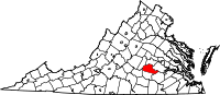
Location in the state of Virginia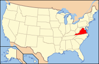
Virginia's location in the U.S.Founded 1735 Seat Amelia Area
- Total
- Land
- Water
359 sq mi (930 km²)
357 sq mi (925 km²)
2 sq mi (5 km²), 0.49%Population
- (2010)
- Density
12,690
35/sq mi (13.7/km²)Website www.ameliacova.com Amelia County is a county located in the Commonwealth of Virginia. As of 2010, the population was 12,690[1][2]. Its county seat is Amelia Courthouse.[3]
Contents
History
Amelia County was created by a legislative act in 1734 and 1735[4] from parts of Prince George and Brunswick counties. The County is named for Princess Amelia of Great Britain, daughter of King George II. Twice Amelia County was reduced in size to form newer counties; in 1754, Prince Edward County was formed from parts of Amelia County, and in 1789, Nottoway County was formed. During the Civil War General Robert E. Lee and his Army spent April 4 and 5, 1865 at Amelia Courthouse before his surrender to General Ulysses S. Grant at Appomattox. The last major battle of the war was fought at Sayler’s Creek on April 6. Amelia is known for its minerals, including the nation's best supply of Amazonite found at the Morefield mine.
The Amelia County Fair was home to the world's largest potato pancake (with apple sauce) which was built to raise money for the German American National Scholarship Fund in 1986. It weighed over two and one quarter tons and used four truck loads of potatoes.
Geography
According to the U.S. Census Bureau, the county has a total area of 359 square miles (930 km2), of which 357 square miles (920 km2) is land and 2 square miles (5.2 km2) (0.49%) is water.
Adjacent counties
- Powhatan County - north
- Chesterfield County - northeast
- Dinwiddie County - southeast
- Nottoway County - south
- Prince Edward County - southwest
- Cumberland County - west
Demographics
Historical populations Census Pop. %± 1790 18,097 — 1800 9,432 −47.9% 1810 10,594 12.3% 1820 11,104 4.8% 1830 11,036 −0.6% 1840 10,320 −6.5% 1850 9,770 −5.3% 1860 10,741 9.9% 1870 9,878 −8.0% 1880 10,377 5.1% 1890 9,068 −12.6% 1900 9,037 −0.3% 1910 8,720 −3.5% 1920 9,800 12.4% 1930 8,799 −10.2% 1940 8,495 −3.5% 1950 7,908 −6.9% 1960 7,815 −1.2% 1970 7,592 −2.9% 1980 8,405 10.7% 1990 8,787 4.5% 2000 11,400 29.7% 2010 12,690 11.3% As of the census[5] of 2000, there were 11,400 people, 4,240 households, and 3,175 families residing in the county. The population density was 32 people per square mile (12/km²). There were 4,609 housing units at an average density of 13 per square mile (5/km²). The racial makeup of the county was 70.57% White, 28.05% Black or African American, 0.28% Native American, 0.17% Asian, 0.02% Pacific Islander, 0.25% from other races, and 0.67% from two or more races. 0.80% of the population were Hispanic or Latino of any race.
The two largest ancestry groups in Amelia County are African American (28%) and English American (11%).[6]
There were 4,240 households out of which 32.80% had children under the age of 18 living with them, 59.10% were married couples living together, 11.40% had a female householder with no husband present, and 25.10% were non-families. 20.70% of all households were made up of individuals and 8.10% had someone living alone who was 65 years of age or older. The average household size was 2.66 and the average family size was 3.07.
In the county, the population was spread out with 25.30% under the age of 18, 6.70% from 18 to 24, 29.20% from 25 to 44, 25.40% from 45 to 64, and 13.30% who were 65 years of age or older. The median age was 38 years. For every 100 females there were 97.30 males. For every 100 females age 18 and over, there were 94.20 males.
The median income for a household in the county was $40,252, and the median income for a family was $47,157. Males had a median income of $32,315 versus $23,102 for females. The per capita income for the county was $18,858. 8.40% of the population and 6.70% of families were below the poverty line. Out of the total people living in poverty, 7.10% are under the age of 18 and 11.70% are 65 or older.
Media
The Amelia Bulletin Monitor, a weekly newspaper, has covered the county since 1973.
Unincorporated communities
Notable residents
- William S. Archer, born in Amelia County, United States Senator from Virginia[7]
- William Wyatt Bibb, born in Amelia County, United States Senator from Georgia and first Governor of Alabama[7]
- William Cocke (1747–1828), born in Amelia County, first United States Senator from Tennessee[7]
- Henry William Connor (1793–1866), born near Amelia Court House, United States Congressman from North Carolina[7]
- David Fanning, (1755–1825), born in Amelia County, Loyalist during the American Revolutionary War, captured a court martial judge and Governor of North Carolina Thomas Burke. As one of only three individuals excluded from the amnesty after the war, he moved to New Brunswick.[7]
- William Branch Giles, (1762–1830), born in Amelia County, United States Congressman, United States Senator, and Governor of Virginia.[7]
- John Winston Jones, (1791–1848), born in Amelia county, United States Congress Speaker of the House.[7]
- Robert Russa Moton (1867–1940), noted African-American educator
See also
References
- ^ [1]
- ^ [2]. Weldon Cooper Center 2010 Census Count Retrieved September 8, 2011
- ^ "Find a County". National Association of Counties. http://www.naco.org/Counties/Pages/FindACounty.aspx. Retrieved 2011-06-07.
- ^ History of Amelia County
- ^ "American FactFinder". United States Census Bureau. http://factfinder.census.gov. Retrieved 2008-01-31.
- ^ Amelia County, VA - Amelia County, Virginia - Ancestry & family history - ePodunk
- ^ a b c d e f g Who Was Who in America, Historical Volume, 1607-1896. Chicago: Marquis Who's Who. 1963.
External links
- http://www.ameliacova.com - Official Amelia County Website
- http://www.ameliabusinessdirectory.com - Amelia Business Directory
- Amelia Co. Christmas 1784
- http://www.ameliamonitor.com - Amelia County's newspaper

Powhatan County Chesterfield County Cumberland County 
 Amelia County, Virginia

Prince Edward County Nottoway County Dinwiddie County Municipalities and communities of Amelia County, Virginia CDP 
Unincorporated
communitiesAmmon | Chula | Clementown Mills | Coverly | Deatonville | Denaro | Earls | Fieldstown | Giles Mill | Gills | Haw Branch | Jetersville | Lodore | Mannboro | Maplewood | Masons Corner | Mattoax | Moryen | Namozine | Otterburn | Paineville | Rodophil | Scotts Fork | Truxillo | Wilsons Corner | Winterham
The Greater Richmond Region Regional Divisions The West End · The Fan · Downtown · Southside · North Side · Mechanicsville · The East End · Tri-Cities / Petersburg · Varina-Enon
Surrounding Counties Chesterfield · Hanover · Henrico · Goochland
Other Counties Amelia · Caroline · Charles City · Cumberland · Dinwiddie · King and Queen · King William · Louisa · New Kent · Powhatan · Prince George · Sussex
Categories:- Virginia counties
- Amelia County, Virginia
- 1735 establishments


Wikimedia Foundation. 2010.