- Bedford, Virginia
-
Bedford, Virginia — City — The cupola atop the Bedford County Court House

SealNickname(s): Bedrock Location in Virginia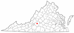
Coordinates: 37°20′04″N 79°31′23″W / 37.33444°N 79.52306°W Country United States State Virginia Government – Mayor Skip Tharp Area – Total 6.9 sq mi (17.9 km2) – Land 6.9 sq mi (17.8 km2) – Water 0.0 sq mi (0.0 km2) Elevation 1,004 ft (306 m) Population (2010) – Total 6,222 – Density 914.5/sq mi (353.0/km2) Time zone Eastern (EST) (UTC-5) – Summer (DST) EDT (UTC-4) ZIP code 24523 Area code(s) 540 FIPS code 51-05544[1] GNIS feature ID 1498450[2] Website http://www.bedfordva.gov Bedford is an independent city located within the confines of Bedford County in the U.S. state of Virginia. It serves as the county seat of Bedford County. As of 2010, the city had a total population of 6,222.[3] The Bureau of Economic Analysis combines the city of Bedford with surrounding Bedford county for statistical purposes. It is part of the Lynchburg Metropolitan Statistical Area.
Bedford is home to the National D-Day Memorial. (despite the "National" in its name, the memorial is owned and operated by a Non-governmental, non-profit, education foundation). The United States Congress warranted that this memorial would be the nation's D-Day Memorial and President Bill Clinton authorized this effort in September 1996. President George W. Bush dedicated this memorial as the nation's D-Day memorial on June 6, 2001. Bedford lost more residents per capita in the Normandy landings than any other American community. Nineteen soldiers from Bedford, whose 1944 population was about 3,200, were killed on D-Day. Three other Bedford soldiers died later in the Normandy campaign. Proportionally this community suffered the nation's severest D-Day losses.[4]
Bedford City and County maintain relationships with 11 communities on the Normandy Coast of France. One sister city, Trévières, France, sent Bedford an exact replica of its own World War I memorial statue. The face of the statue was damaged in World War II by artillery fire from US forces retaking the town. The Bedford statue also bears these wounds and is erected on the grounds of the National D-Day Memorial. Bedford is also near Poplar Forest, the rural retreat of Thomas Jefferson.
On September 14, 2011, the Bedford City Council voted to transition into a town, ending its independent city status. The supervisors of Bedford County also voted to accept the town of Bedford as part of the county when it loses city status. The transition is expected to begin in July 2013.[5]
Contents
Geography
Bedford is located at 37°20′4″N 79°31′22″W / 37.33444°N 79.52278°W (37.334591, -79.522783)[6].
According to the United States Census Bureau, the city has a total area of 6.9 square miles (18 km2)— 6.9 square miles (18 km2) of it is land and 0.14% is water.
Bedford sits at the feet of the Peaks of Otter.
Demographics
As of the census[1] of 2000, there were 6,299 people, 2,519 households, and 1,592 families residing in the city. The population density was 914.5 persons per square mile (353.0/km²). There were 2,702 housing units at an average density of 392.3 per square mile (151.4/km²). The racial makeup of the city was 75.33% White, 22.38% Black or African American, 0.24% Native American, 0.57% Asian, 0.08% Pacific Islander, 0.24% from other races, and 1.16% from two or more races. 0.89% of the population were Hispanic or Latino of any race.
In 2005 75.0% of Bedford's population was non-Hispanic whites. 22.7% were African-American. Asians were 0.8% of the population. Latinos were now 0.8% of the population.
In 2000 there were 2,519 households out of which 27.7% had children under the age of 18 living with them, 43.0% were married couples living together, 17.2% had a female householder with no husband present, and 36.8% were non-families. 33.0% of all households were made up of individuals and 15.7% had someone living alone who was 65 years of age or older. The average household size was 2.26 and the average family size was 2.87.
In the city the population was spread out with 21.6% under the age of 18, 7.2% from 18 to 24, 27.8% from 25 to 44, 20.7% from 45 to 64, and 22.6% who were 65 years of age or older. The median age was 41 years. For every 100 females there were 90.6 males. For every 100 females age 18 and over, there were 85.4 males.
The median income for a household in the city was $28,792, and the median income for a family was $35,023. Males had a median income of $28,668 versus $18,065 for females. The per capita income for the city was $15,423. About 15.4% of families and 19.7% of the population were below the poverty line, including 29.4% of those under age 18 and 11.1% of those age 65 or over.
Economy
Top employers
According to the city's 2010 Comprehensive Annual Financial Report,[7] the top employers in the city were:
# Employer # of Employees 1 Bedford Memorial Hospital 335 2 Bedford County Public Schools 315 3 Sam Moore Furniture 230 4 Brooks Food Group 175 5 Bedford Weaving 150 6 Cintas 130 7 Longwood Industries 125 8 Smyth Companies 120 9 Elks National Home 85 10 Wheelabrator Abrasives 50 International links
Bedford has a Friendship Treaty with:
See also
References
- ^ a b "American FactFinder". United States Census Bureau. http://factfinder.census.gov. Retrieved 2008-01-31.
- ^ "US Board on Geographic Names". United States Geological Survey. 2007-10-25. http://geonames.usgs.gov. Retrieved 2008-01-31.
- ^ [1]. Weldon Cooper Center 2010 Census Count Retrieved September 8, 2011
- ^ http://www.nytimes.com/2009/04/23/us/23nance.html?scp=1&sq=bedford&st=cse
- ^ Roberts, Ashley. "City of Bedford closer to town status". wsls.com. http://www2.wsls.com/news/2011/sep/14/city-bedford-closer-town-status-ar-1310623/. Retrieved 15 September 2011.
- ^ "US Gazetteer files: 2010, 2000, and 1990". United States Census Bureau. 2011-02-12. http://www.census.gov/geo/www/gazetteer/gazette.html. Retrieved 2011-04-23.
- ^ City of Bedford CAFR
- ^ Ivybridge International Links from the Ivybridge Town Guide
External links
- City of Bedford
- U.S. Geological Survey Geographic Names Information System: Bedford, Virginia
- http://www.bedfordartacademy.org/
- http://www.applevalleyhomeplace.com
- http://www.applevalleynurseries.com
- http://grossorchards.com
Coordinates: 37°20′05″N 79°31′22″W / 37.334591°N 79.522783°W
Categories:- Bedford, Virginia
- Cities in Virginia
- County seats in Virginia
- Lynchburg metropolitan area


Wikimedia Foundation. 2010.