- Nelson County, Virginia
-
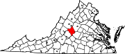
Nelson County, Virginia 
Seal
Location in the state of Virginia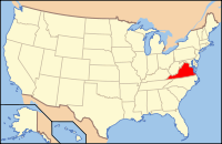
Virginia's location in the U.S.Founded 1807 Seat Lovingston Area
- Total
- Land
- Water
474 sq mi (1,228 km²)
2 sq mi (5 km²), 0.41%Population
- Density
15,020
31/sq mi (12/km²)Website www.nelsoncounty.com Nelson County is a county located in the Commonwealth of Virginia. As of 2010, the population was 15,020.[1] Its county seat is Lovingston[2]. It is also home to Wintergreen Resort, a local ski area; Swannanoa (mansion), a "summer home" for James H. Dooley of Richmond, VA; and is the location of Walton's Mountain made famous by the television show, The Waltons. Nelson County is also home to many thriving vineyards and Crabtree Falls.
Nelson County is part of the Charlottesville Metropolitan Statistical Area.
Contents
History
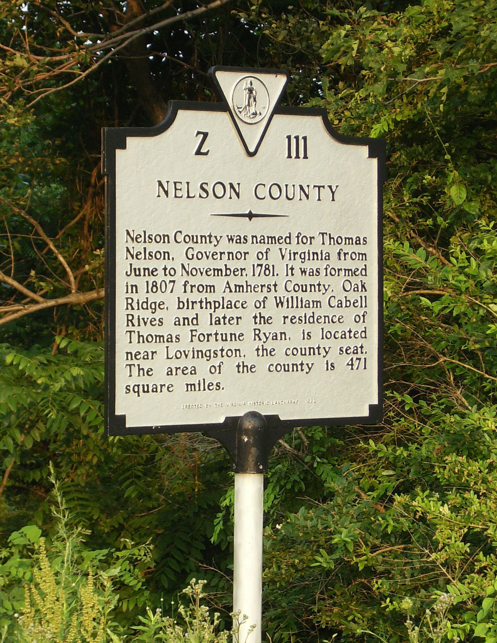
Nelson County was established in 1807 when it was separated from Amherst County, and the government actually formed in 1808.[3] The county is named for Thomas Nelson, Jr., a signer of the U.S. Declaration of Independence, who served as Governor of Virginia in 1781. An earlier Virginia county, also named to honor Governor Nelson, became part of Kentucky when that state was formed from Virginia in 1792. (see Nelson County, Kentucky).
Hurricane Camille
On the night of August 19–20, 1969, Nelson County was the site of disastrous flooding and a world record in water precipitation volumes due to Hurricane Camille. The hurricane had come ashore on the Gulf Coast 2 days earlier, and weakening over land, had traveled north and then stalled on the eastern side of the Blue Ridge Mountains, dumping a record quantity of 27 inches (690 mm) of rain, mostly within only a 3 hour period. In a five hour span it yielded over 37 inches (940 mm) as well the day prior it had a deluge of 5 inches in 1/2 hour with rain falling days before and the grounds saturated already. The rainfall was so heavy there were many reports of birds/animals drowning in trees and of survivors who had to cup their hands around mouth and nose in order to breathe through such a deluge.
As many people slept unaware, the ensuing flash floods and mudslides killed 153 people, 31 of them from Roseland, Tyro, and Massies Mill alone.[4] Across only and all of Nelson County, over 133 public bridges were washed out, while some entire communities were under water.[5] In the tiny Davis Creek community, 52 people were killed or could not be found; only 3 of 35 homes were left standing after the floodwaters receded.[4] The bodies of some people were never and still not found; others washed as much as 25 miles (40 km) downstream along the creeks and rivers. The entire county was virtually cut off, with many roads and virtually all bridges, telephone, radio/tv, and electric service interrupted.
The waters of the Tye, Piney, Buffalo, and Rockfish rivers flow into the James River. There was massive flooding elsewhere in Virginia, such as the Maury River which destroyed the town of Glasgow in Rockbridge County.
Draining all of Nelson County, and joined by massive flooding from other tributaries such as Hatt Creek, along the James eighty miles to the east just above the fall line at Richmond crested more than 20 feet (6.1 m) above flood stage at Westham, as citizens watched portions of Nelson County houses, people and buildings and dead livestock flow past. Just a few miles further downstream, the James crested in Richmond at 28.6 feet (8.7 m) at the City Locks, swamping downtown areas and a substantial portion of South Richmond which had formerly been the separate city of Manchester.[6] The Camille disaster did over $140 million in damages across Virginia, in 1969 US Dollars . However, nowhere in Virginia was the storm as devastating and deadly as in Nelson County, where 1% of the population was killed and still never found.
See also: Hurricane Camille The Tye River flows through the mountains and low hills of Nelson County.
Geography
According to the U.S. Census Bureau, the county has a total area of 474 square miles (1,228 km²), of which 472 square miles (1,223 km²) is land and 2 square miles (5 km²) (0.41%) is water. The Blue Ridge Mountains form the northwest boundary of the county; the James River forms the boundary to the southeast. Internally, Nelson consists of the Rockfish, Tye and Piney rivers, along with many known creeks.
Adjacent counties
- Augusta County - northwest
- Albemarle County - northeast
- Buckingham County - southeast
- Appomattox County - south
- Amherst County - southwest
- Rockbridge County - west
National protected areas
- Blue Ridge Parkway (part)
- George Washington National Forest (part)
- United States National Radio Quiet Zone (part)
Education
Nelson County Public Schools is a Virginia public school division. It operates two elementary schools, one middle school, and one high school. The middle and high schools are connected and located just outside Lovingston, Virginia. Nelson County also provides free GED testing to all adults.
Unincorporated towns
There are no cities or incorporated towns in Nelson County. Unincorporated communities include but are not limited to:
- Afton
- Arrington
- Bryant
- Lovingston
- Massies Mill
- Montebello
- Nellysford
- Roseland
- Schuyler
- Shipman
- Wingina
- Gladstone
- Tyro
Demographics
Historical populations Census Pop. %± 1810 9,684 — 1820 10,137 4.7% 1830 11,254 11.0% 1840 12,287 9.2% 1850 12,758 3.8% 1860 13,015 2.0% 1870 13,898 6.8% 1880 16,536 19.0% 1890 15,336 −7.3% 1900 16,075 4.8% 1910 16,821 4.6% 1920 17,277 2.7% 1930 16,345 −5.4% 1940 16,241 −0.6% 1950 14,042 −13.5% 1960 12,752 −9.2% 1970 11,702 −8.2% 1980 12,204 4.3% 1990 12,778 4.7% 2000 14,445 13.0% 2010 15,020 4.0%  Historical marker on Route 250 heading east over Afton Mountain.
As of the census[7] of 2000, there were 14,445 people, 5,887 households, and 4,144 families residing in the county. The population density was 31 people per square mile (12/km²). There were 8,554 housing units at an average density of 18 per square mile (7/km²). The racial makeup of the county was 82.65% White or American American or European American , 14.89% Black or African American, 0.19% Native American, 0.24% Asian, 0.06% Pacific Islander, 0.62% from other races, and 1.35% from two or more races. 2.11% of the population were Hispanic or Latino of any race.
There were 5,887 households out of which 27.10% had children under the age of 18 living with them, 55.70% were married couples living together, 10.70% had a female householder with no husband present, and 29.60% were non-families. 25.00% of all households were made up of individuals and 10.30% had someone living alone who was 65 years of age or older. The average household size was 2.42 and the average family size was 2.88.
In the county, the population was spread out with 21.70% under the age of 18, 6.40% from 18 to 24, 25.60% from 25 to 44, 29.60% from 45 to 64, and 16.80% who were 65 years of age or older. The median age was 43 years. For every 100 females there were 94.80 males. For every 100 females age 18 and over, there were 91.40 males.
The median income for a household in the county was $36,769, and the median income for a family was $42,917. Males had a median income of $29,684 versus $24,153 for females. The per capita income for the county was $22,230. 12.10% of the population and 8.50% of families were below the poverty line. Out of the total people living in poverty, 14.40% are under the age of 18 and 14.60% are 65 or older.
Recreation
 Top Of the Highlands in January 2006, Wintergreen Resort
The Wintergreen Resort near Nellysford opened in 1975. A planned development begun in 1969, it offers 45 holes of championship golf; seasonal skiing, snowboarding and snowtubing. On the eastern slope of the Blue Ridge, Wintergreen is a "top down" resort in which practically all of the amenities are built on the peaks and ridges, rather than at the base like a traditional ski resort.[8]
Sections of the former Virginia Blue Ridge Railway along the Tye River are now part of the Blue Ridge Railway Trail which was under development in the early 21st century. The trail will eventually connect the James River with the Blue Ridge Parkway and the Appalachian Trail.[9][10]
Fishing and camping are popular activities in Nelson County. Sections of the Tye River are also popular for whitewater boating with canoes and kayaks. The rapids are rated Class I to Class II+. Depending upon water conditions some rapids on the Tye River can approach class III.[11]
Notable people from Nelson County
- Reverend Dr. William Archer Rutherfoord Goodwin grew up on farm in southern Nelson County during the Reconstruction era after the American Civil War. An Episcopalian priest, among other assignments, he served several periods as rector of Bruton Parish Church in Williamsburg. It was Dr. Goodwin's dream, and his success in gaining the generous support of Mr. & Mrs. John D. Rockefeller Jr., that created Colonial Williamsburg beginning in 1926.
- Schuyler was the birthplace and childhood home of writer Earl Hamner Jr. He is best known for the CBS television series The Waltons, which was based on his experiences of growing up the eldest child of a large rural family in depression era America.
- Thomas Bland Harvey, Sr. attended the Inauguration of U.S. President Woodrow Wilson at the President's personal invitation and sat in the front row at Washington, D.C. Harvey founded the first Dodge Brothers Dealership in the World. He built many buildings in Roseland, Virginia by hand including the United States Post Office where his wife Marion Belle-Bowles-Harvey was the Postmaster. Harvey was s trusted Virginian gentleman whose family was descend from the original settlers at Jamestown and traveled on two of the three ships landing there May 14, 1607. He was a 32nd Degree Mason / Shriner. His own house and everything in it was lost under seventeen plus feet of water in the aftermath of Hurricane Camille. The US Post Office safe was washed down the Tye River over five miles after his house crushed the Post Office building he built when the tidal flood wave hit it. He was quoted in many newspapers after the flooding as saying, "It is God's will!."
- Robert Monroe, out-of-body experience researcher who founded the Monroe Institute, lived in Faber.
- Lincoln Campbell
See also
References
- ^ [1]. Weldon Cooper Center 2010 Census Count Retrieved September 9, 2011
- ^ "Find a County". National Association of Counties. http://www.naco.org/Counties/Pages/FindACounty.aspx. Retrieved 2011-06-07.
- ^ Nelson County, VA USGenWeb Archives
- ^ a b http://hurricanewatch.mgnetwork.com/index.cfm?SiteID=TFP&PackageID=9&fuseaction=article.main&ArticleID=66&GroupID=17
- ^ United States Department of Commerce (1969). "Hurricane Camille August 14–22, 1969" (PDF). Environmental Science Services Administration. http://www.nhc.noaa.gov/archive/storm_wallets/atlantic/atl1969-prelim/camille/TCR-1969Camille.pdf. Retrieved 2008-03-23.
- ^ Discover Richmond | Richmond.com
- ^ "American FactFinder". United States Census Bureau. http://factfinder.census.gov. Retrieved 2008-01-31.
- ^ Wintergreen Resort
- ^ http://www.cstone.net/users/nelsonco/RailTrail/VABRTrail.htm
- ^ Virginia Short Lines and Industrial Roads
- ^ Nelson Downriver Race - 2005
External links

Augusta County Albemarle County Rockbridge County 
 Nelson County, Virginia

Amherst County Appomattox County Buckingham County Municipalities and communities of Nelson County, Virginia CDPs Arrington | Lovingston | Nellysford | Schuyler | Shipman | Wintergreen
Unincorporated
communitiesAdial | Afton | Allens Creek | Avon | Beech Grove | Bryant | Buffalo Springs | Caskie | Colleen | Durrett Town | Elma | Faber | Five Forks | Four Forks | Freshwater | Gladstone | Gordon Crossing | Greenfield | Greenway | Gullysville | Hendersons Store | Jonesboro | Kingswood | Lakeview Heights | Lanes Ford | Lawthorne Mill | Lodebar | Lowesville | Martins Store | Massies Mill | Midway Mills | Montebello | Nash | Norwood | Oak Ridge | Old Myndus | Onan | Ottoway | Piedmont | Piney River | Poplar Flats | Ramsey | Red Apple Orchard | Rockfish | Roseland | Roses Mill | Shady Lane | Swannanoa | Twin Poplars | Tye River | Tyro | Warminster | White Rock | Wingina | Woods Mill
Categories:- Virginia counties
- Nelson County, Virginia
- 1807 establishments in the United States
- Populated places established in 1807
- Counties on the James River (Virginia)
- Charlottesville metropolitan area


Wikimedia Foundation. 2010.