- National Register of Historic Places listings in Nelson County, Virginia
-
This list includes properties and districts listed on the National Register of Historic Places in Nelson County, Virginia. Click the "Map of all coordinates" link to the right to view a Google map of all properties and districts with latitude and longitude coordinates in the table below.[1]
-
- This National Park Service list is complete through NPS recent listings posted November 10, 2011.[2]
[3] Landmark name Image Date listed Location City or town Summary 1 Bon Aire July 30, 1980 E of Shipman on State Route 626
37°40′51″N 78°43′12″W / 37.680833°N 78.72°WShipman 2 Edgewood May 2, 2006 3008 Warminster Rd.
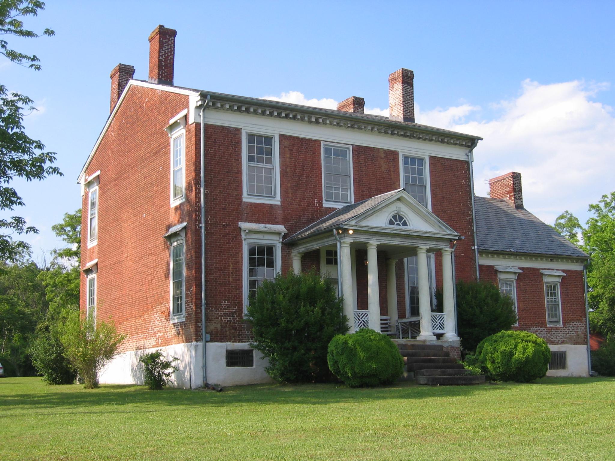
37°41′17″N 78°42′28″W / 37.688056°N 78.707778°WWingina 3 Elk Hill March 27, 2007 511 Rockfish Valley Highway Nellysford 4 Lovingston High School 
June 23, 2003 8445 Thomas Nelson Highway
37°45′01″N 78°52′49″W / 37.750278°N 78.880278°WLovingston 5 Lovingston Historic District 
November 9, 2005 State Route 56 (Front St.) from Orchard Rd. (N) to Sunset Ln. (S), Parallel to U.S. Route 29
37°45′38″N 78°52′09″W / 37.760556°N 78.869167°WLovingston 6 Mitchell's Brick House Tavern 
May 3, 2006 5365 Thomas Nelson Highway
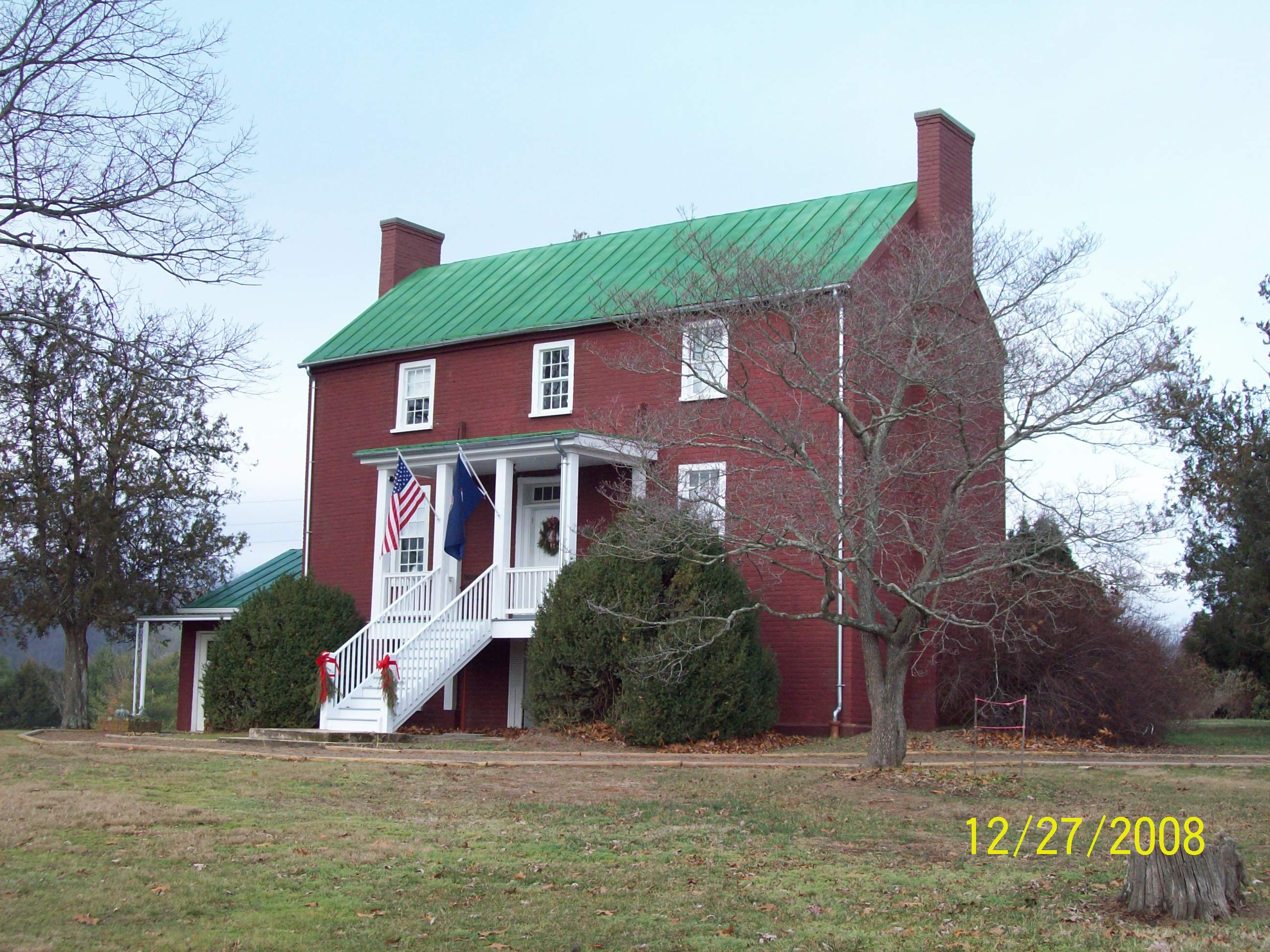
37°43′05″N 78°54′44″W / 37.718056°N 78.912222°WArrington 7 Montezuma 
July 30, 1980 NE of Norwood on State Route 626
37°38′54″N 78°48′04″W / 37.648333°N 78.801111°WNorwood 8 Nelson County Courthouse 
May 17, 1973 Off U.S. Route 29
37°45′35″N 78°51′29″W / 37.759722°N 78.858056°WLovingston 9 Oak Ridge Railroad Overpass 
April 15, 1978 SW of Shipman on State Route 653
37°42′11″N 78°52′16″W / 37.703056°N 78.871111°WShipman 10 Pharsalia June 3, 2009 2325 Pharsalia Rd.
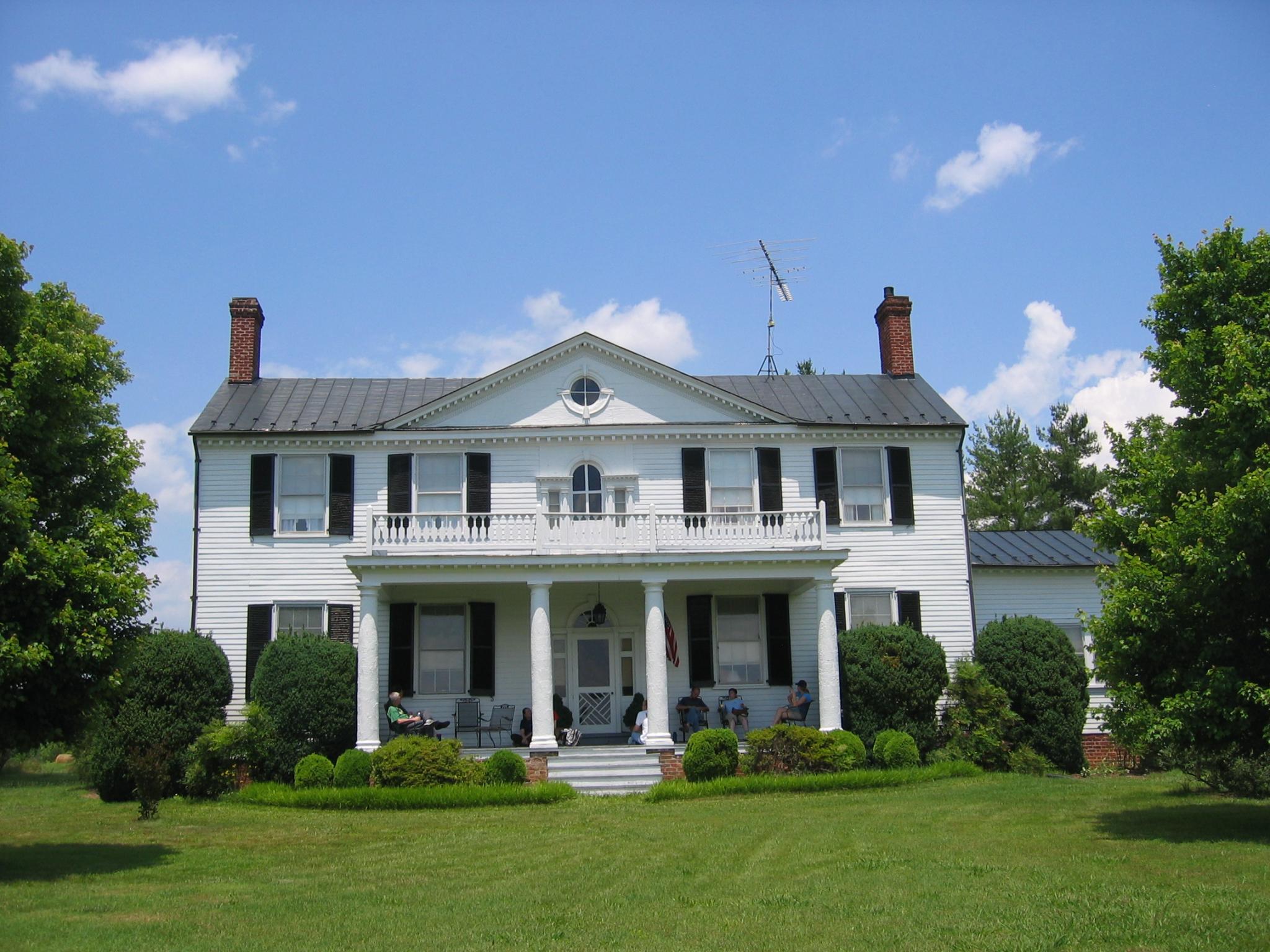
37°48′07″N 79°01′23″W / 37.801892°N 79.023136°WTyro 11 River Bluff July 30, 1980 S of Wintergreen on State Route 151
37°52′45″N 78°54′31″W / 37.879167°N 78.908611°WWintergreen 12 Schuyler Historic District March 21, 2007 Crossroads of Schuyler Rd., Salem Rd. and Rockfish River Rd. Schuyler 13 Soldier's Joy 
November 28, 1980 SE of Shipman on State Route 626
37°38′28″N 78°43′55″W / 37.641111°N 78.731944°WWingina 14 Swannanoa 
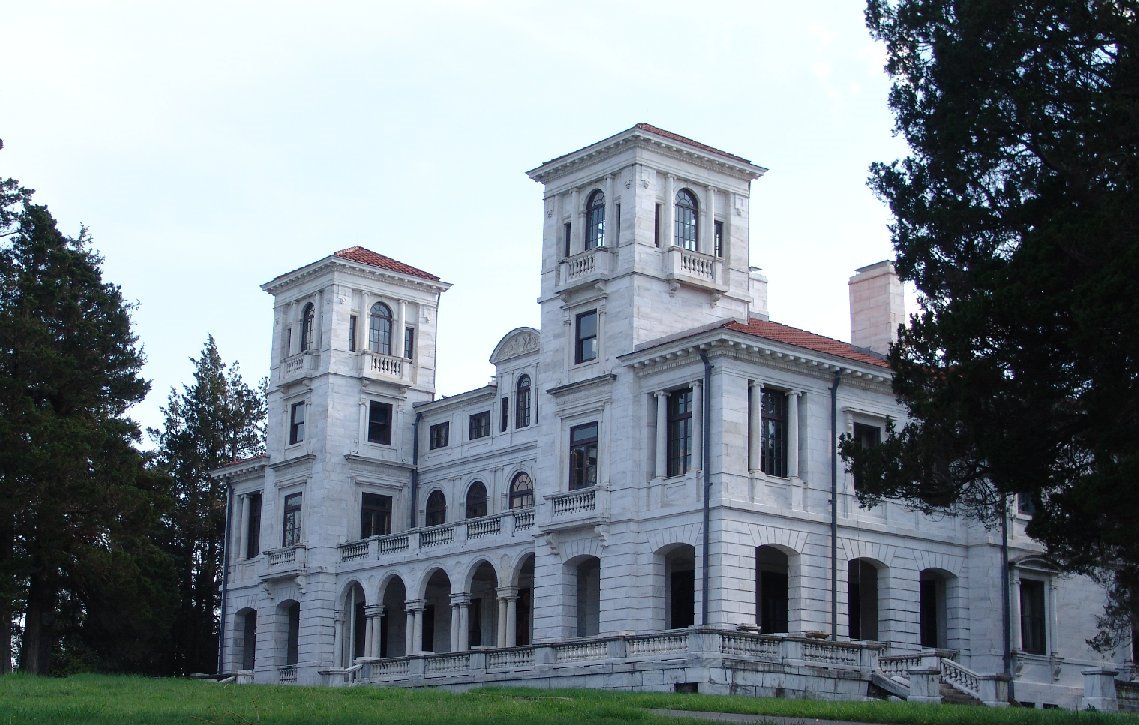
October 1, 1969 S of jct. of State Route 610 and U.S. Route 250
38°01′41″N 78°52′08″W / 38.028056°N 78.868889°WWaynesboro 15 Tyro Mill August 30, 2006 State Route 56 (Crabtree Falls Highway)
37°49′05″N 79°00′20″W / 37.818056°N 79.005556°WTyro 16 Wintergreen County Store November 9, 2005 Junction of State Routes 151 and 627, 1368 Rockfish Valley Highway
37°53′06″N 78°53′57″W / 37.885°N 78.899167°WNellysford 17 Woodson's Mill December 17, 1992 State Route 778 E of jct. with State Route 666
37°43′15″N 79°03′49″W / 37.720833°N 79.063611°WLowesville See also
- National Register of Historic Places listings in Virginia
- List of National Historic Landmarks in Virginia
References
- ^ The latitude and longitude information provided in this table was derived originally from the National Register Information System, which has been found to be fairly accurate for about 99% of listings. For about 1% of NRIS original coordinates, experience has shown that one or both coordinates are typos or otherwise extremely far off; some corrections may have been made. A more subtle problem causes many locations to be off by up to 150 yards, depending on location in the country: most NRIS coordinates were derived from tracing out latitude and longitudes off of USGS topographical quadrant maps created under the North American Datum of 1927, which differs from the current, highly accurate WGS84 GPS system used by Google maps. Chicago is about right, but NRIS longitudes in Washington are higher by about 4.5 seconds, and are lower by about 2.0 seconds in Maine. Latitudes differ by about 1.0 second in Florida. Some locations in this table may have been corrected to current GPS standards.
- ^ "National Register of Historic Places: Weekly List Actions". National Park Service, United States Department of the Interior. Retrieved on November 10, 2011.
- ^ Numbers represent an ordering by significant words. Various colorings, defined here, differentiate National Historic Landmark sites and National Register of Historic Places Districts from other NRHP buildings, structures, sites or objects.
U.S. National Register of Historic Places Topics Lists by states Alabama • Alaska • Arizona • Arkansas • California • Colorado • Connecticut • Delaware • Florida • Georgia • Hawaii • Idaho • Illinois • Indiana • Iowa • Kansas • Kentucky • Louisiana • Maine • Maryland • Massachusetts • Michigan • Minnesota • Mississippi • Missouri • Montana • Nebraska • Nevada • New Hampshire • New Jersey • New Mexico • New York • North Carolina • North Dakota • Ohio • Oklahoma • Oregon • Pennsylvania • Rhode Island • South Carolina • South Dakota • Tennessee • Texas • Utah • Vermont • Virginia • Washington • West Virginia • Wisconsin • WyomingLists by territories Lists by associated states Other Categories:- Nelson County, Virginia
- National Register of Historic Places in Virginia
- Virginia-related lists
-


Wikimedia Foundation. 2010.