- National Register of Historic Places listings in Putnam County, Indiana
-
 Location of Putnam County in Indiana
This is a list of the National Register of Historic Places listings in Putnam County, Indiana.
This is intended to be a complete list of the properties and districts on the National Register of Historic Places in Putnam County, Indiana, United States. Latitude and longitude coordinates are provided for many National Register properties and districts; these locations may be seen together in a Google map.[1]
There are 20 properties and districts listed on the National Register in the county.
-
- This National Park Service list is complete through NPS recent listings posted November 10, 2011.[2]
Current listings
[3] Landmark name [4] Image Date listed Location City or town Summary 1 Appleyard 
February 23, 1990 Southern side of State Road 240, east of downtown Greencastle
39°38′19″N 86°49′8″W / 39.63861°N 86.81889°W[5]Greencastle 2 The Boulders 
September 16, 1993 835 E. Washington St.
39°38′39″N 86°50′46″W / 39.644167°N 86.846111°WGreencastle 3 Brick Chapel United Methodist Church 
September 28, 2003 3547 N. U.S. Route 231
39°42′43″N 86°52′07″W / 39.711944°N 86.868611°WGreencastle 4 Samuel Brown House June 21, 2006 1558 E. County Road 1100N
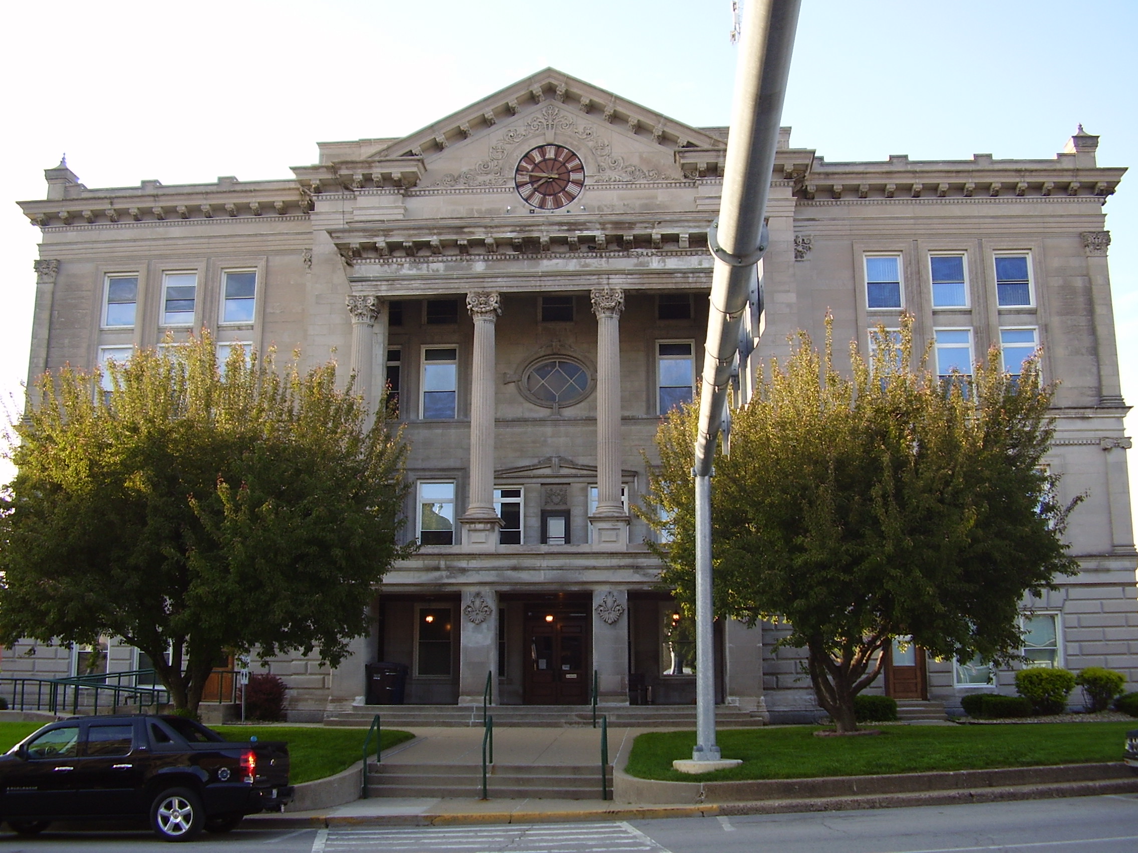
39°49′N 86°49′W / 39.82°N 86.82°WRoachdale 5 Courthouse Square Historic District 
March 1, 1984 Roughly bounded by College Ave., Walnut, Market, and Franklin Sts.
39°38′38″N 86°51′52″W / 39.643889°N 86.864444°WGreencastle 6 Delta Kappa Epsilon Fraternity House 
March 14, 1996 620 Anderson St.
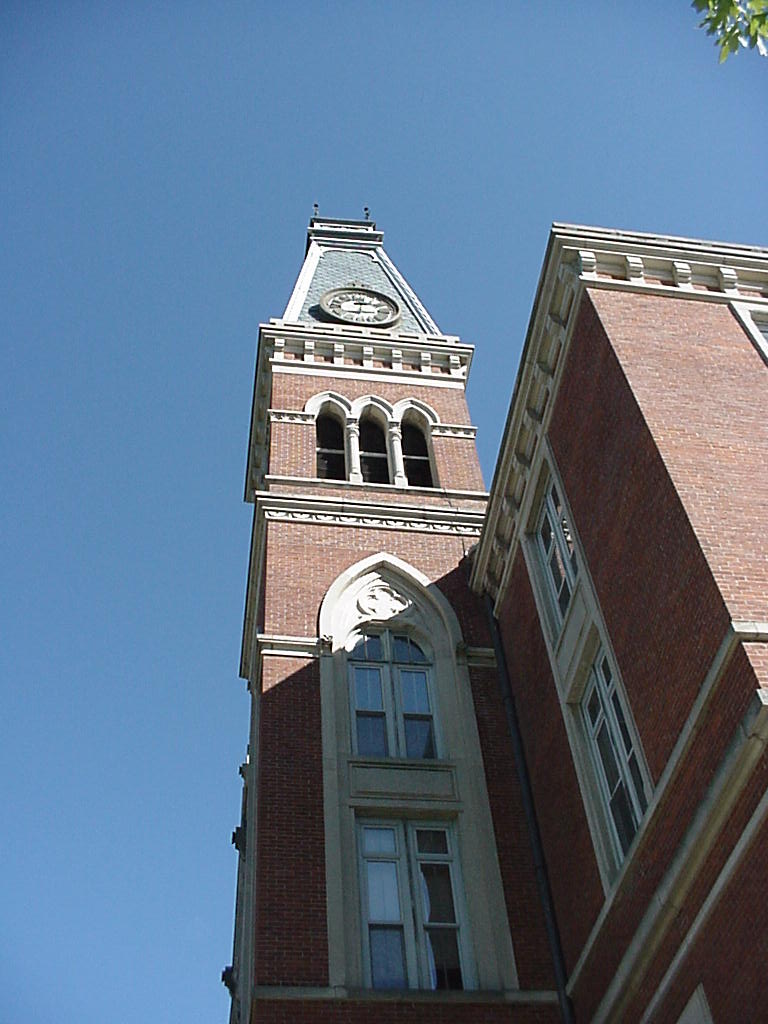
39°38′24″N 86°51′05″W / 39.64°N 86.851389°WGreencastle 7 East College of DePauw University 
September 25, 1975 300 Simpson St.
39°38′24″N 86°51′42″W / 39.64°N 86.861667°WGreencastle 8 Eastern Enlargement Historic District 
June 23, 2011 Roughly bounded by E. Franklin, Wood, Anderson, and College Sts.
39°38′30″N 86°51′22″W / 39.641667°N 86.856111°WGreencastle 9 Richard M. Hazelett House 
April 19, 2006 911 E. Washington St.
39°38′39″N 86°50′38″W / 39.644167°N 86.843889°WGreencastle 10 Alfred Hirt House 
March 14, 1991 W. Walnut Street Rd.
39°38′42″N 86°52′27″W / 39.645°N 86.874167°WGreencastle 11 Melville F. McHaffie Farm 
December 22, 1983 U.S. Route 40
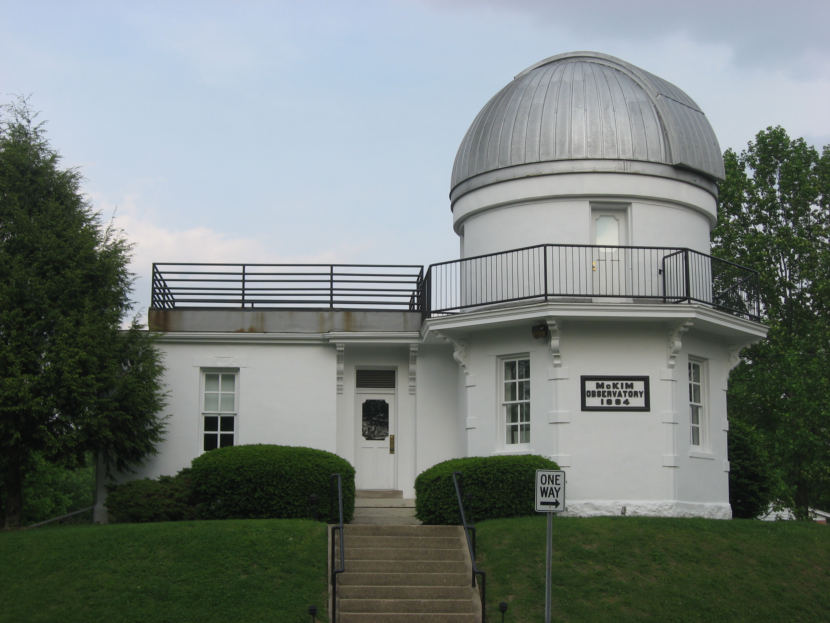
39°37′47″N 86°39′38″W / 39.629722°N 86.660556°WStilesville 12 McKim Observatory, DePauw University 
December 22, 1978 DePauw and Highbridge Aves.
39°38′44″N 86°51′09″W / 39.645556°N 86.8525°WGreencastle 13 F.P. Nelson House 
July 18, 1983 701 E. Seminary
39°38′31″N 86°51′12″W / 39.641944°N 86.853333°WGreencastle 14 Northwood Historic District 
August 25, 2011 Roughly bounded by Shadowlawn, N. Arlington, E. Franklin, and Hillsdale Aves.
39°38′44″N 86°51′16″W / 39.645556°N 86.854444°WGreencastle Historic Residential Suburbs in the United States, 1830-1960 MPS 15 James Edington Montgomery O'Hair House 
January 13, 1992 U.S. Route 231 ½ mile south of its junction with 500 North Rd.
39°43′36″N 86°52′04″W / 39.726667°N 86.867778°WBrick Chapel 16 Old Greencastle Historic District 
June 23, 2011 Roughly bounded by W. Liberty, Market, W. Poplar, and W. Gillespie Sts.
39°38′44″N 86°52′03″W / 39.645556°N 86.8675°WGreencastle 17 Putnam County Bridge No. 159 
March 12, 1999 County Road 650W over Big Walnut Creek
39°33′17″N 86°57′51″W / 39.554722°N 86.964167°WReelsville 18 Putnamville Presbyterian Church 
March 1, 1984 State Road 243
39°34′25″N 86°51′54″W / 39.573611°N 86.865°WPutnamville 19 Lycurgus Stoner House 
September 12, 1985 Manhattan Rd.
39°34′58″N 86°54′55″W / 39.582778°N 86.915278°WGreencastle 20 William C. Van Arsdel House 
September 20, 1984 125 Wood St.
39°38′31″N 86°51′00″W / 39.641944°N 86.85°WGreencastle See also
- List of National Historic Landmarks in Indiana
- National Register of Historic Places listings in Indiana
References
- ^ The latitude and longitude information provided in this table was derived originally from the National Register Information System, which has been found to be fairly accurate for about 99% of listings. For about 1% of NRIS original coordinates, experience has shown that one or both coordinates are typos or otherwise extremely far off; some corrections may have been made. A more subtle problem causes many locations to be off by up to 150 yards, depending on location in the country: most NRIS coordinates were derived from tracing out latitude and longitudes off of USGS topographical quadrant maps created under North American Datum of 1927, which differs from the current, highly accurate GPS system used by Google maps. Chicago is about right, but NRIS longitudes in Washington are higher by about 4.5 seconds, and are lower by about 2.0 seconds in Maine. Latitudes differ by about 1.0 second in Florida. Some locations in this table may have been corrected to current GPS standards.
- ^ "National Register of Historic Places: Weekly List Actions". National Park Service, United States Department of the Interior. Retrieved on November 10, 2011.
- ^ Numbers represent an ordering by significant words. Various colorings, defined here, differentiate National Historic Landmark sites and National Register of Historic Places Districts from other NRHP buildings, structures, sites or objects.
- ^ "National Register Information System". National Register of Historic Places. National Park Service. . http://nrhp.focus.nps.gov/natreg/docs/All_Data.html.
- ^ Location derived from Division of Historic Preservation and Archaeology. Putnam County Interim Report. Indianapolis: Indiana Department of Natural Resources, 1982-04, 39. The NRIS lists the site as "Address Restricted".
U.S. National Register of Historic Places Topics Lists by states Alabama • Alaska • Arizona • Arkansas • California • Colorado • Connecticut • Delaware • Florida • Georgia • Hawaii • Idaho • Illinois • Indiana • Iowa • Kansas • Kentucky • Louisiana • Maine • Maryland • Massachusetts • Michigan • Minnesota • Mississippi • Missouri • Montana • Nebraska • Nevada • New Hampshire • New Jersey • New Mexico • New York • North Carolina • North Dakota • Ohio • Oklahoma • Oregon • Pennsylvania • Rhode Island • South Carolina • South Dakota • Tennessee • Texas • Utah • Vermont • Virginia • Washington • West Virginia • Wisconsin • WyomingLists by territories Lists by associated states Other  Category:National Register of Historic Places •
  Portal:National Register of Historic Places
Municipalities and communities of Putnam County, Indiana County seat: Greencastle City 
Towns Townships Clinton | Cloverdale | Floyd | Franklin | Greencastle | Jackson | Jefferson | Madison | Marion | Monroe | Russell | Warren | Washington
Unincorporated
communitiesBarnard | Belle Union | Brick Chapel | Brunerstown | Cagle Mill | Carpentersville | Clinton Falls | Edgewood Lake | Fincastle | Fox Ridge | Groveland | Hirt Corner | Keytsville | Limedale | Manhattan | Morton | Mount Meridian | New Maysville | Pleasant Gardens | Portland Mills | Putnamville | Raab Crossroads | Raccoon | Reelsville | Vivalia
Categories:- Putnam County, Indiana
- National Register of Historic Places in Indiana by county
-


Wikimedia Foundation. 2010.