- National Register of Historic Places listings in Blount County, Tennessee
-
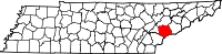 Location of Blount County in Tennessee
This is a list of the National Register of Historic Places listings in Blount County, Tennessee.
This is intended to be a complete list of the properties and districts on the National Register of Historic Places in Blount County, Tennessee, United States. Latitude and longitude coordinates are provided for many National Register properties and districts; these locations may be seen together in a Google map.[1]
There are 73 properties and districts listed on the National Register in the county.
Contents: Counties in Tennessee Anderson – Bedford – Benton – Bledsoe – Blount – Bradley – Campbell – Cannon – Carroll – Carter – Cheatham – Chester – Claiborne – Clay – Cocke – Coffee – Crockett – Cumberland – Davidson – Decatur – DeKalb – Dickson – Dyer – Fayette – Fentress – Franklin – Gibson – Giles – Grainger – Greene – Grundy – Hamblen – Hamilton – Hancock – Hardeman – Hardin – Hawkins – Haywood – Henderson – Henry – Hickman – Houston – Humphreys – Jackson – Jefferson – Johnson – Knox – Lake – Lauderdale – Lawrence – Lewis – Lincoln – Loudon – Macon – Madison – Marion – Marshall – Maury – McMinn – McNairy – Meigs – Monroe – Montgomery – Moore – Morgan – Obion – Overton – Perry – Pickett – Polk – Putnam – Rhea – Roane – Robertson – Rutherford – Scott – Sequatchie – Sevier – Shelby – Smith – Stewart – Sullivan – Sumner – Tipton – Trousdale – Unicoi – Union – Van Buren – Warren – Washington – Wayne – Weakley – White – Williamson – Wilson -
- This National Park Service list is complete through NPS recent listings posted November 10, 2011.[2]
Current listings
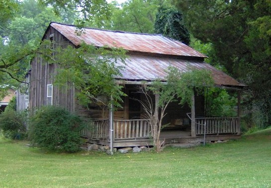
[3] Landmark name [4] Image Date listed Location City or town Summary 1 John Alexander House 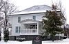
July 25, 1989 714 Hillside Ave.
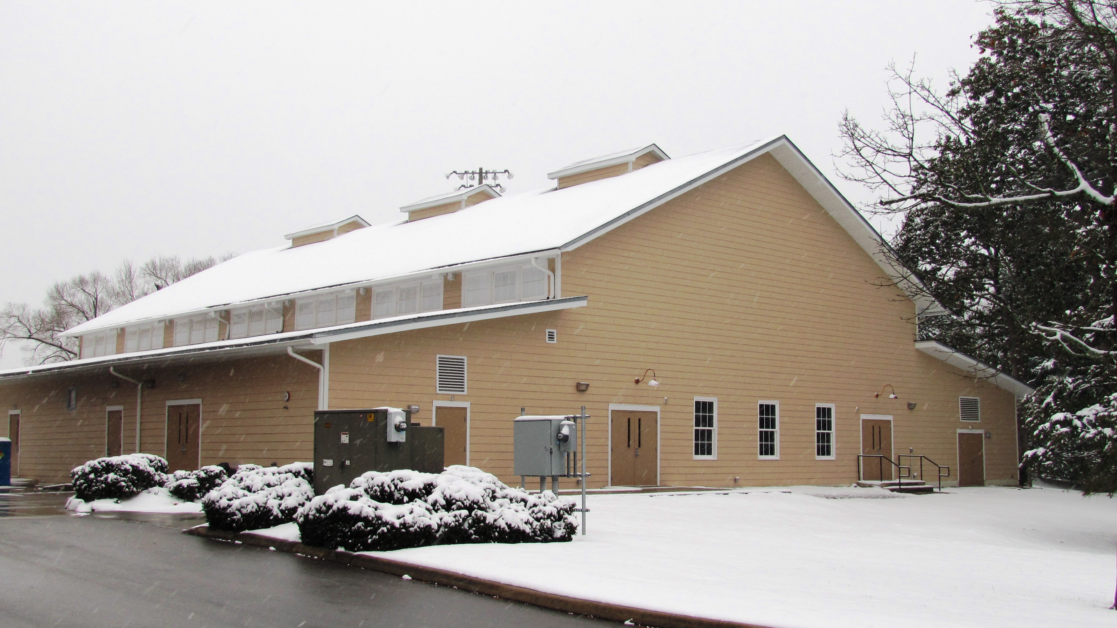
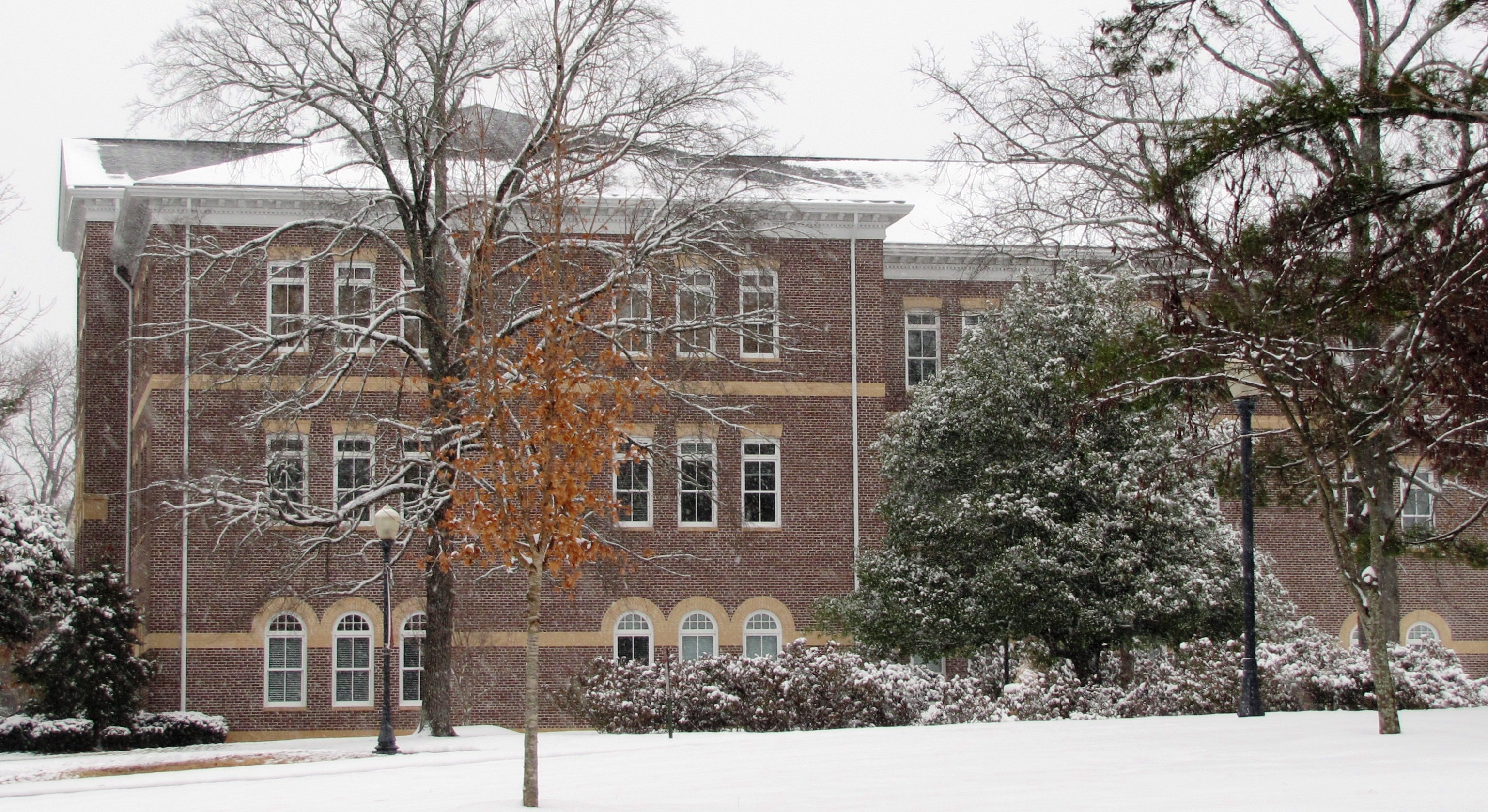
35°45′15″N 83°57′35″W / 35.754167°N 83.959722°WMaryville Built in 1906 by Maryville College alumnus John Alexander 2 Alumni Gym 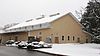
July 25, 1989 Maryville College campus
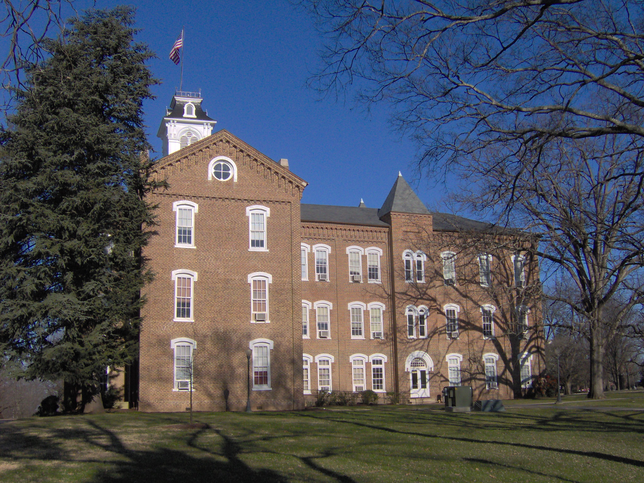
35°45′01″N 83°57′55″W / 35.750278°N 83.965278°WMaryville Gymnasium built in 1923 3 Anderson Hall 
February 20, 1975 Maryville College campus
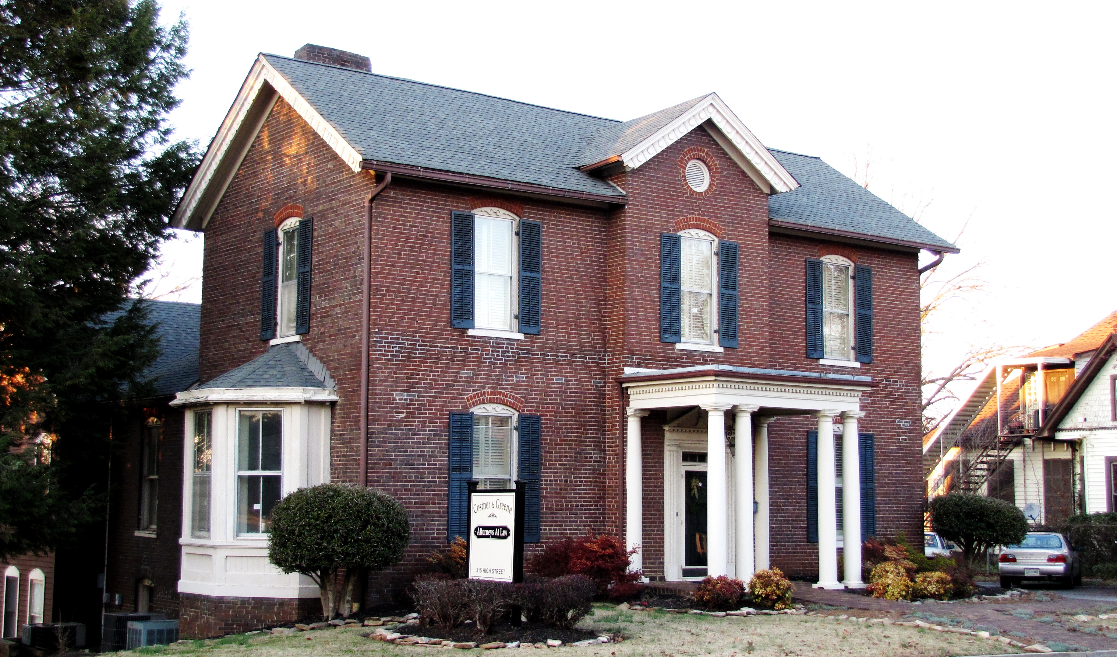
35°45′08″N 83°57′54″W / 35.752222°N 83.965°WMaryville 4 Peter Bartlett House 
July 25, 1989 315 High St.
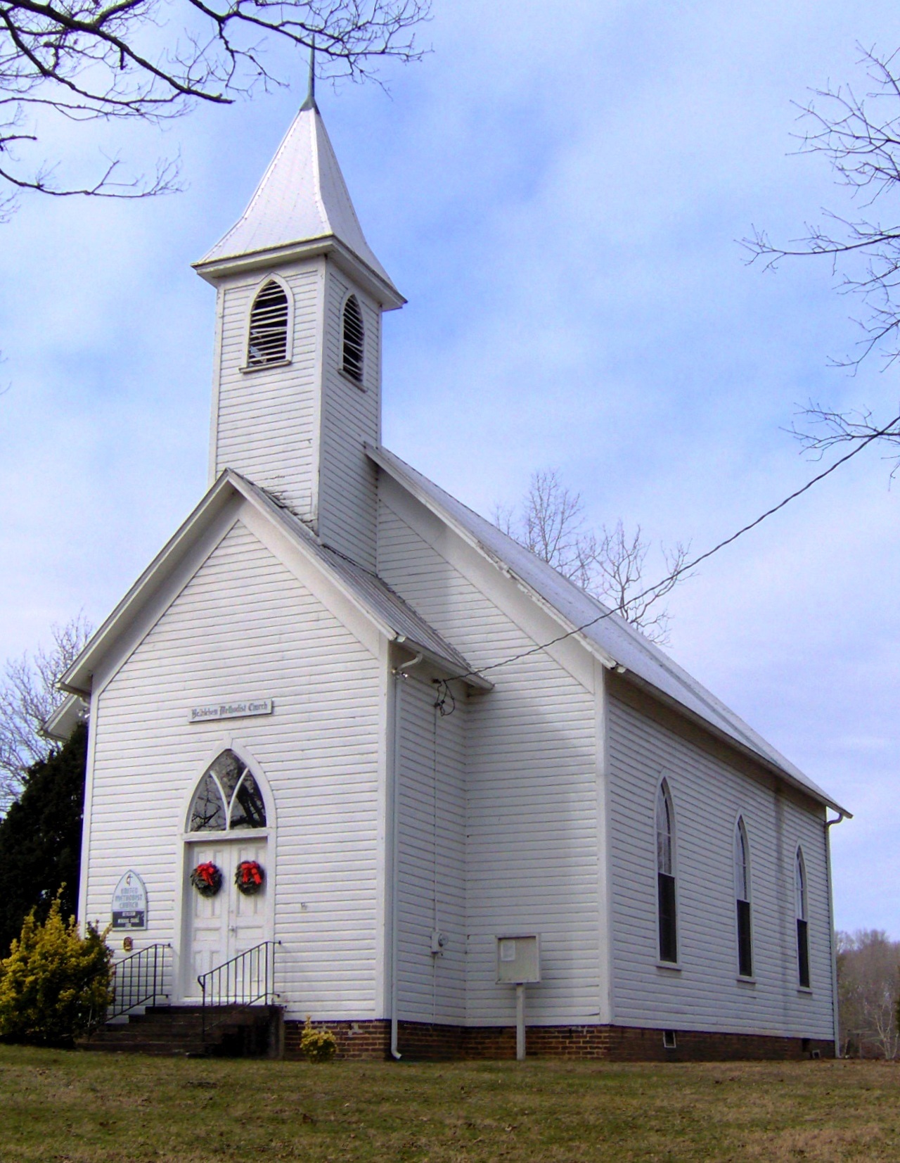
35°45′20″N 83°58′02″W / 35.755556°N 83.967222°WMaryville 5 Bethlehem Methodist Church 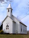
July 25, 1989 Bethlehem Rd., 0.5 miles south of Ellejoy Rd.
35°47′17″N 83°48′43″W / 35.788056°N 83.811944°WWildwood 6 Brick Mill Site July 25, 1989 Brick Mill Rd.
35°39′30″N 84°06′21″W / 35.658333°N 84.105833°WMaryville 7 Peter Brickey House 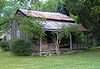
July 25, 1989 Wears Valley Rd., 0.1 miles west of Bonner Hollow Rd.
35°41′25″N 83°42′33″W / 35.690278°N 83.709167°WTownsend 8 Cades Cove Historic District 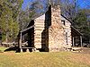
July 13, 1977 10 miles southwest of Townsend in Great Smoky Mountains National Park
35°35′13″N 83°48′54″W / 35.586944°N 83.815°WTownsend 9 Calderwood Dam 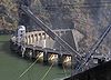
August 21, 1989 Little Tennessee River at the end of Calderwood Rd.
35°29′32″N 83°58′58″W / 35.492222°N 83.982778°WCalderwood Extends into Monroe County. The dam was listed in 1989; boundaries were increased on July 3, 1990 to include the powerhouse, valve house, tunnels, and penstocks. 10 Calderwood Hydroelectric Development 
May 24, 2004 314 Growdon Boulevard
35°29′56″N 83°59′15″W / 35.498889°N 83.9875°WCalderwood This is a supplementary listing to the Calderwood Dam entry that added the complex's gatehouse, gantry cranes, surge tank, chlorination building, and service building, as well as a theater and school once used by the old Calderwood community. 11 Chilhowee Hydroelectric Development 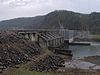
May 27, 2004 6102 State Route 129
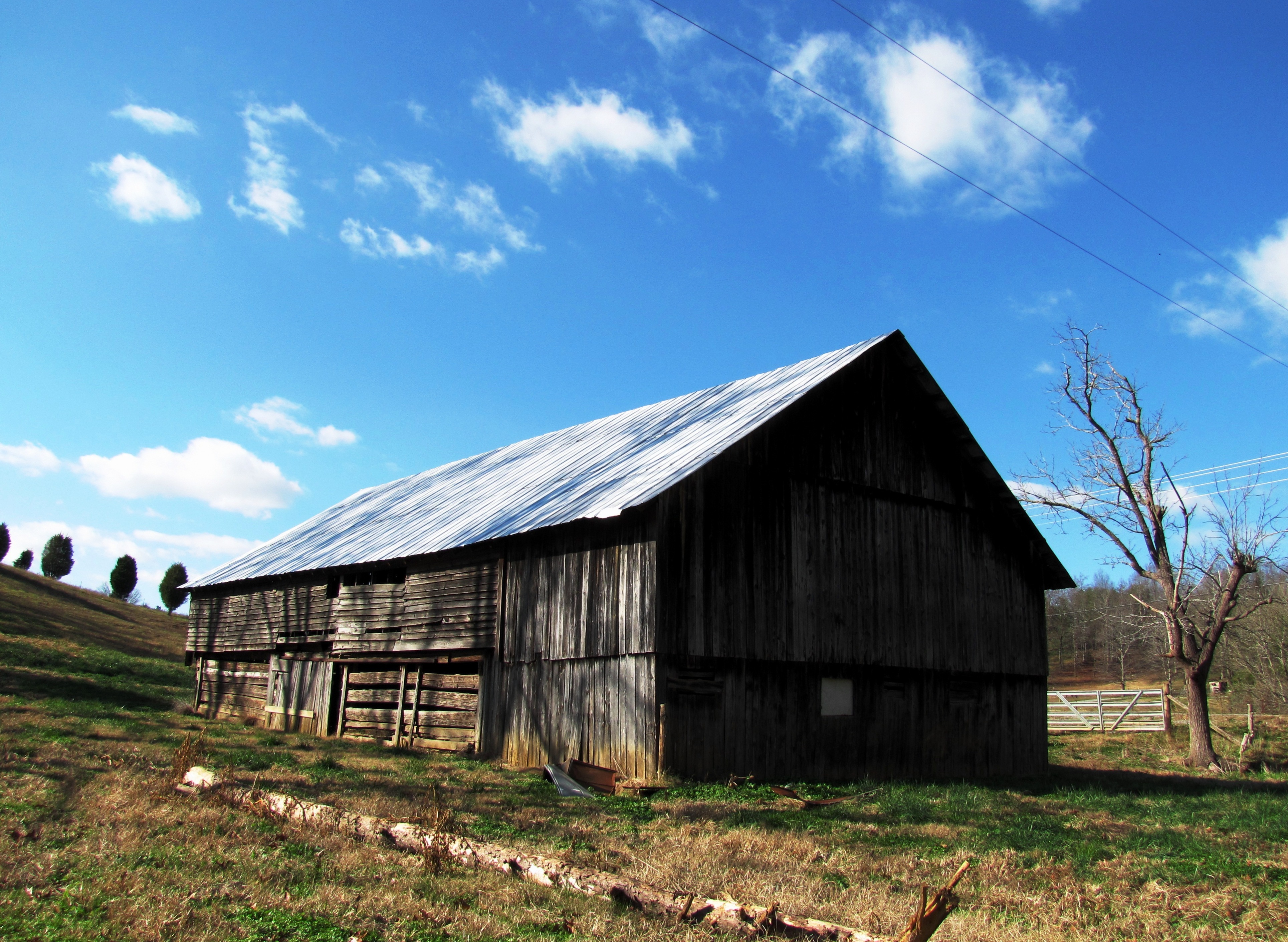
35°32′45″N 84°03′00″W / 35.545833°N 84.05°WTallassee 12 Langston Clark Barn 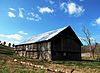
July 25, 1989 Sixmile Rd., 0.4 miles east of Knob Creek Rd.
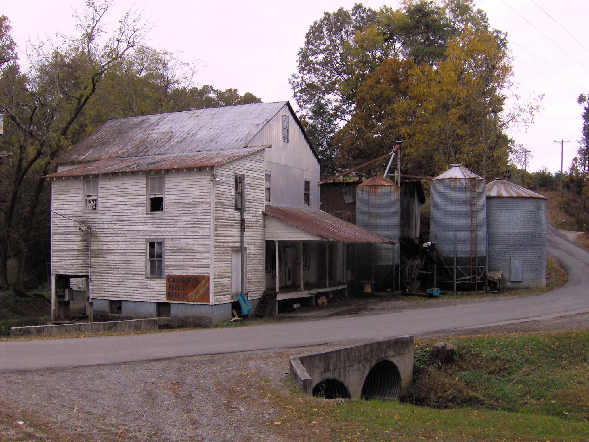
35°38′15″N 84°00′04″W / 35.6375°N 84.001111°WMaryville 13 Clover Hill Mill 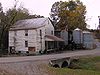
July 25, 1989 Junction of Mill Rd. and Clover Hill Rd.
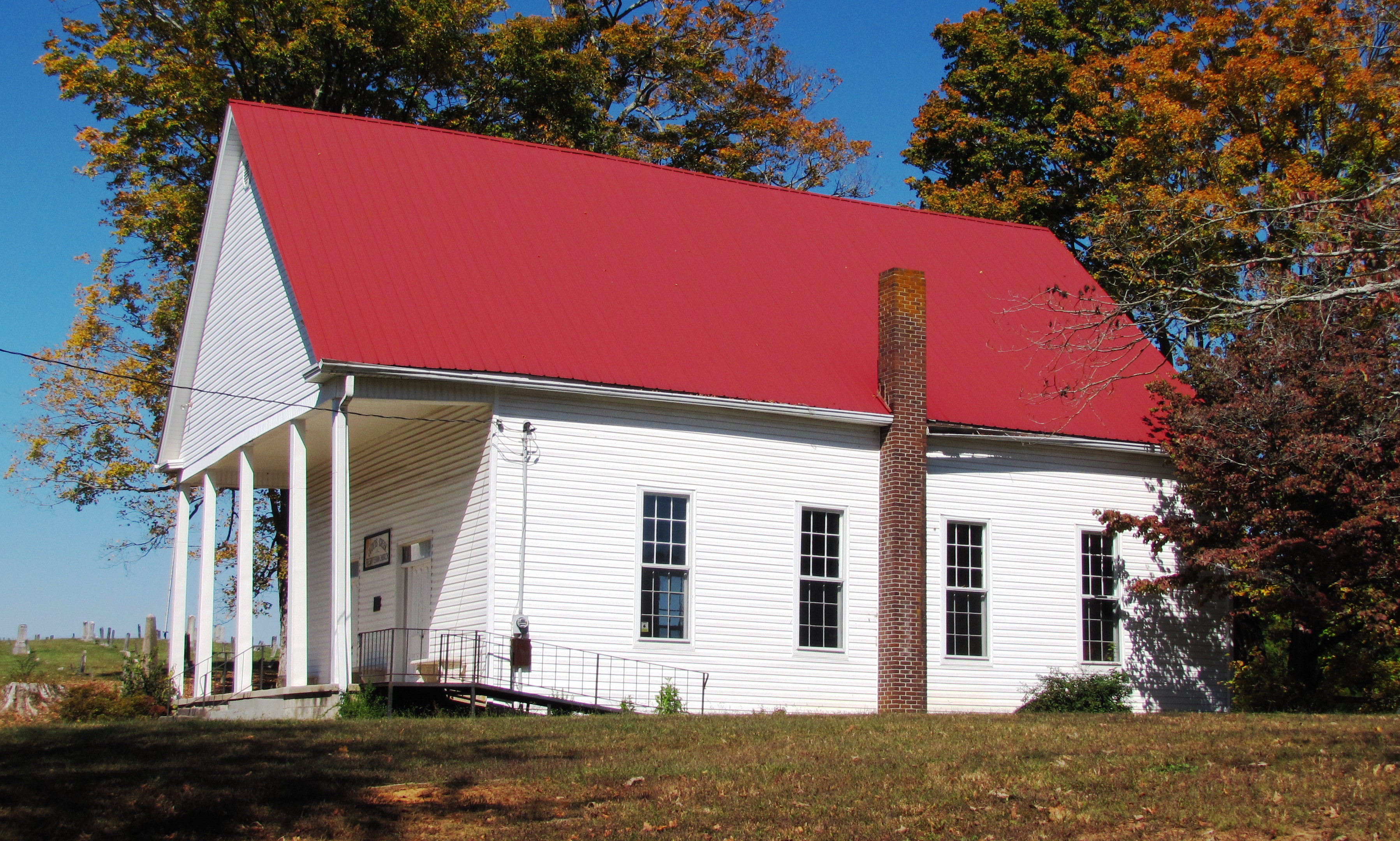
35°42′15″N 84°03′01″W / 35.704167°N 84.050278°WMaryville 14 Cloyd's Creek Presbyterian Church 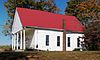
July 25, 1989 Junction of Buzzard's Roost Rd. and Kirk Rd.
35°41′52″N 84°09′37″W / 35.697778°N 84.160278°WFriendsville The church was established in 1871, and the current building was completed the following year 15 Mary Cochrane Barn July 25, 1989 Binfield Rd., 0.2 miles north of Clover Hill Rd.
35°41′51″N 84°03′53″W / 35.6975°N 84.064722°WMaryville 16 John J. Craig Quarry Historic District 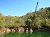
July 25, 1989 Marmor Rd., 0.5 miles south of Miser Station Rd.
35°46′25″N 84°06′33″W / 35.773611°N 84.109167°WFriendsville Early-20th century Tennessee pink marble quarry 17 Gideon Crawford House 
July 25, 1989 Maryville College campus
35°45′04″N 83°57′41″W / 35.751111°N 83.961389°WMaryville 18 James R. Davis House July 25, 1989 Junction of River Rd. and Davis Ford Rd.
35°46′19″N 83°51′01″W / 35.771944°N 83.850278°WWalland 19 Federal Building 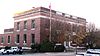
August 31, 1989 201 E. Broadway
35°45′24″N 83°58′15″W / 35.756667°N 83.970833°WMaryville Post office and federal building constructed under the supervision of James A. Wetmore 20 A.J. Fisher House July 25, 1989 Old Walland Highway
35°43′48″N 83°48′50″W / 35.73°N 83.813889°WWalland 21 Samuel Frazier House 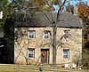
July 25, 1989 Junction of Marble Hill Rd. and Big Springs Rd.
35°44′24″N 84°06′59″W / 35.74°N 84.116389°WFriendsville Late-18th century house built of locally-quarried dark marble 22 Friends Church July 25, 1989 314 W. Broadway
35°45′11″N 83°58′25″W / 35.753056°N 83.973611°WMaryville 23 Samuel George House 
January 27, 1982 Northeast of Louisville on Topside Rd.
35°50′29″N 84°00′07″W / 35.841389°N 84.001944°WLouisville Brick house built in the early 1800s 24 James Gillespie House July 25, 1989 Lowes Ferry Rd., 1 mile north of Louisville
35°50′30″N 84°05′14″W / 35.841667°N 84.087222°WLouisville 25 John Hackney House July 25, 1989 Front and Main Sts.
35°45′26″N 84°07′54″W / 35.757222°N 84.131667°WFriendsville 26 John Hackney Mill Site July 25, 1989 Main St. near Front St.
35°45′26″N 84°07′54″W / 35.757222°N 84.131667°WFriendsville 27 Alexander Hamil House 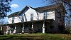
July 25, 1989 Morganton Rd., 0.5 miles east of Clover Hill Rd.
35°42′45″N 84°04′03″W / 35.7125°N 84.0675°WMaryville Brick "I" section built in the 1830s; frame front section built c. 1885 28 Happy Valley School July 25, 1989 Happy Valley Rd.
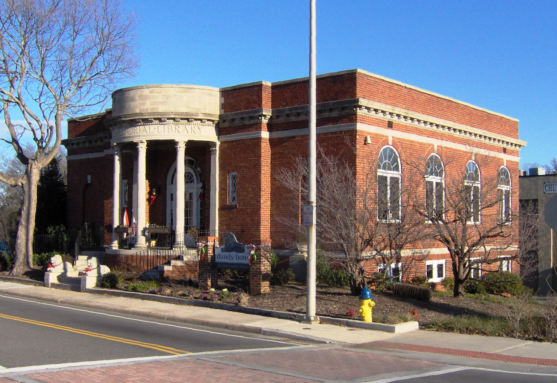
35°36′35″N 83°57′22″W / 35.609722°N 83.956111°WMaryville 29 Harper Memorial Library 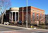
July 25, 1989 300 E. Church St.
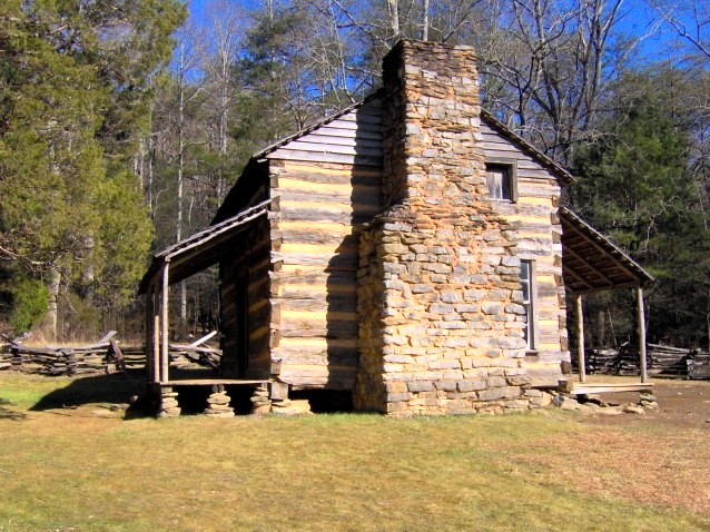
35°45′24″N 83°58′10″W / 35.756667°N 83.969444°WMaryville 30 William Henderson House July 25, 1989 Louisville Rd., 0.75 miles south of Lowes Ferry Rd.
35°49′26″N 84°05′41″W / 35.823889°N 84.094722°WLouisville 31 Henry House 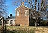
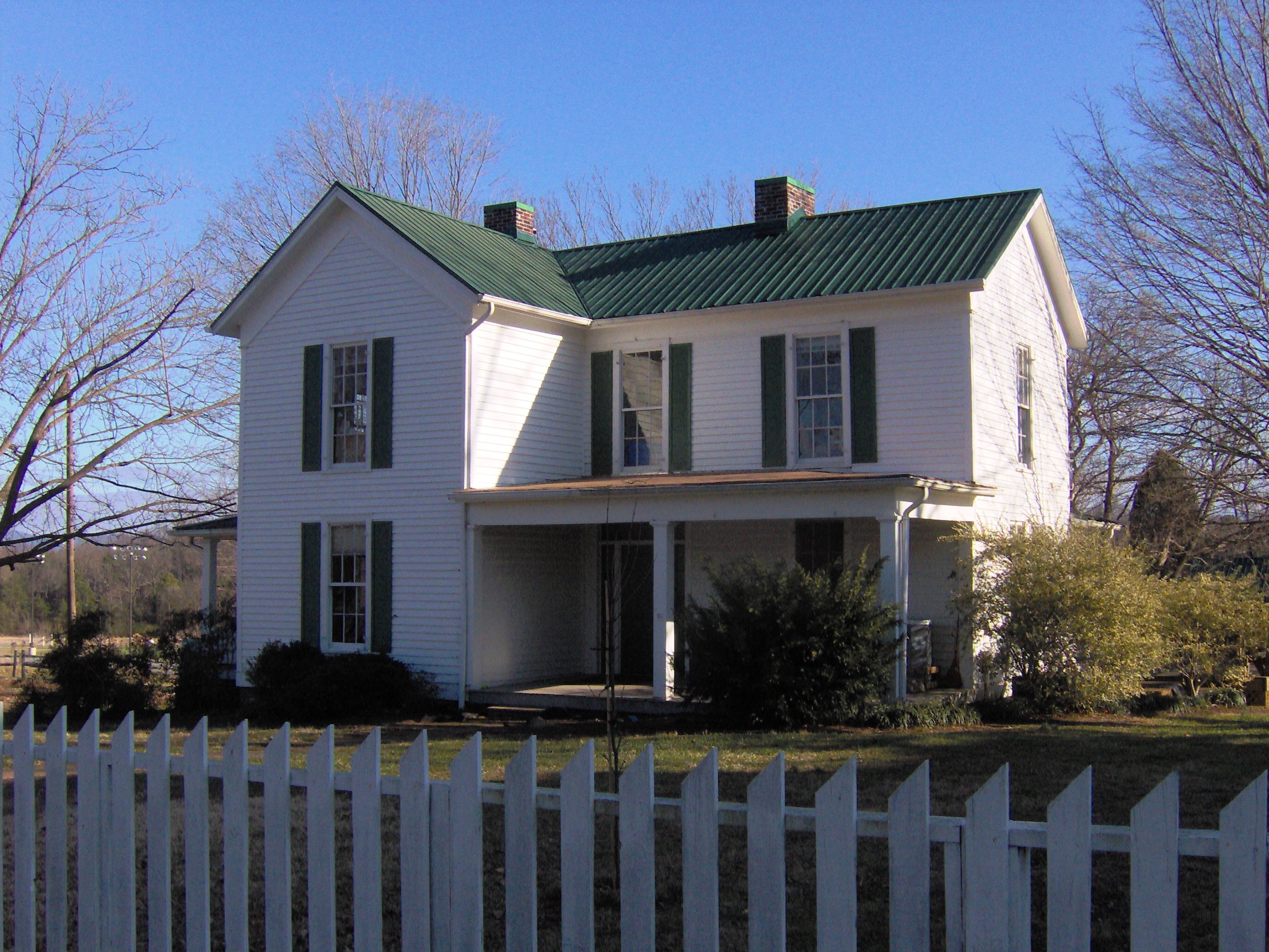
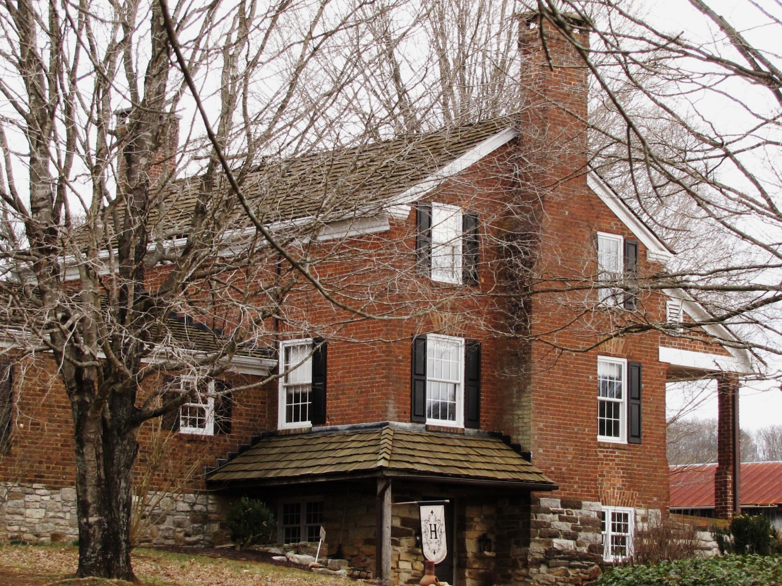
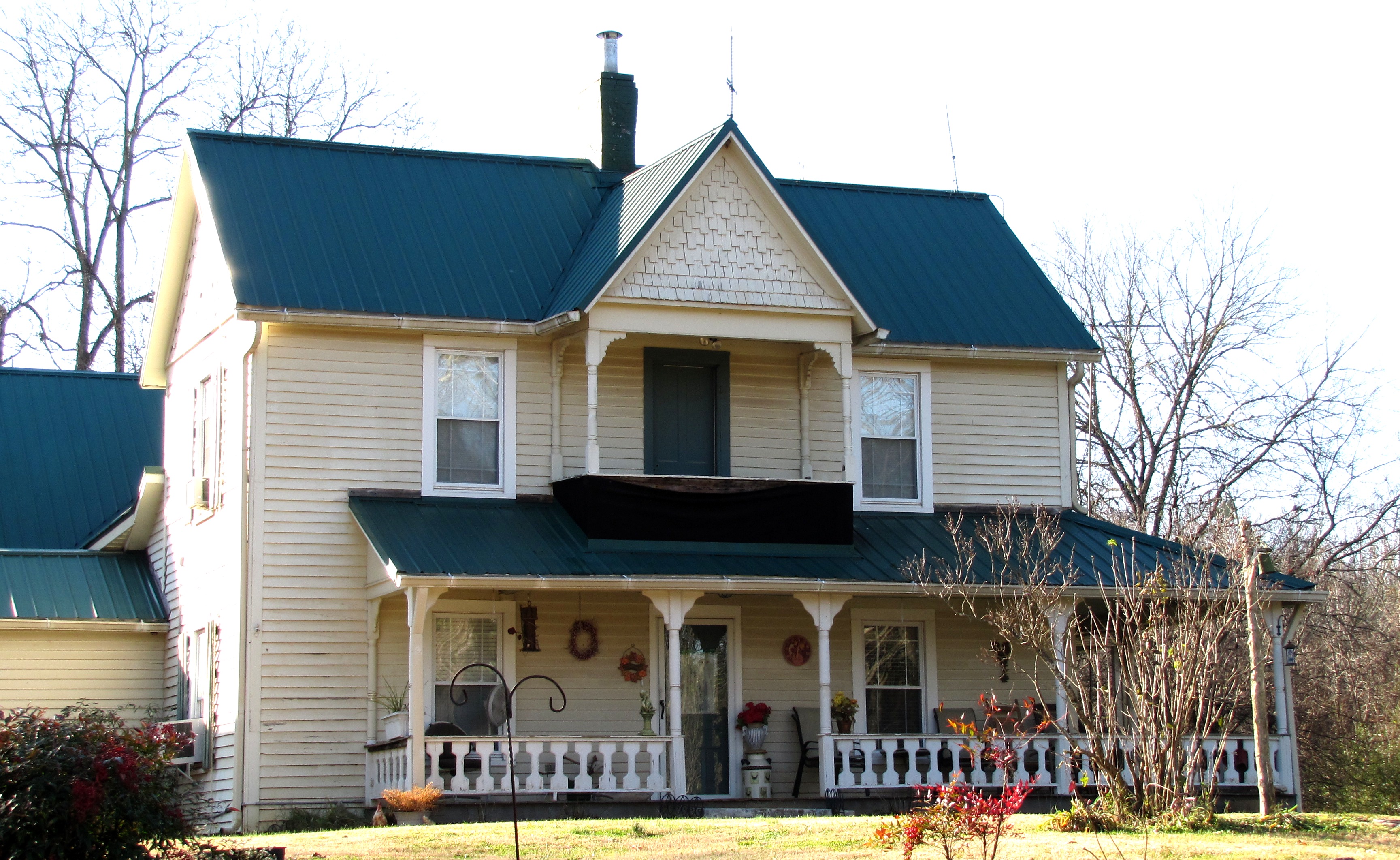
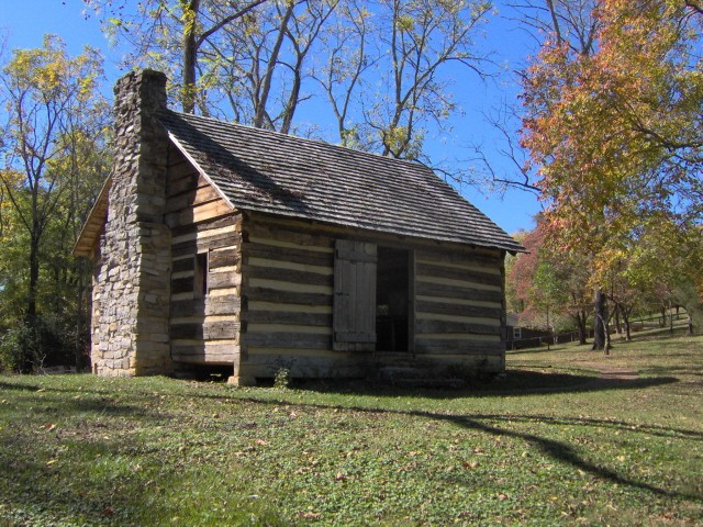
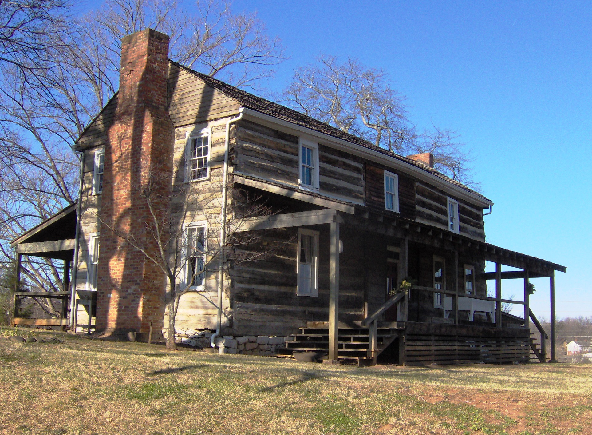
November 1, 1974 Southwest of Binfield on Henry Lane
35°40′15″N 84°6′25″W / 35.67083°N 84.10694°W
Boundary increase (listed July 6, 2011): Henry Farm, 305 Henry Ln., Brick Mill vicinityBinfield Farmhouse on the farm founded by Samuel Henry, Revolutionary War quartermaster who arrived in Blount County as early as 1792, built a fort called Henry’s Station, and established a farm on his land grant. The substantial farmhouse was built in 1833 by Samuel's son James and his wife, Narcissa Howard, reportedly using brick made by slaves from red clay excavated on the farm property.[5] 32 John Hitch House April 16, 1993 Lee Lambert Rd., 0.5 miles south of Old Walland Highway
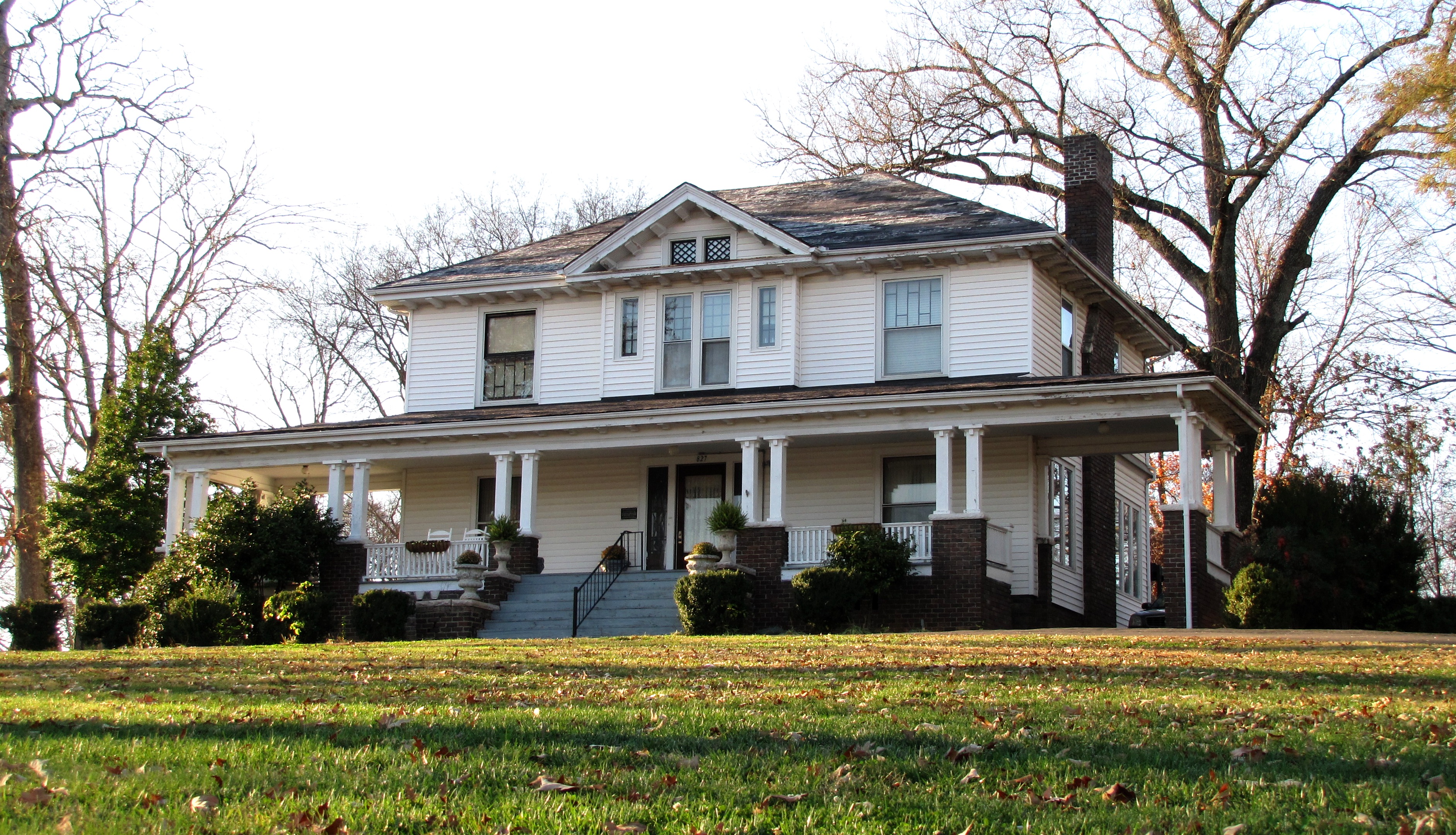
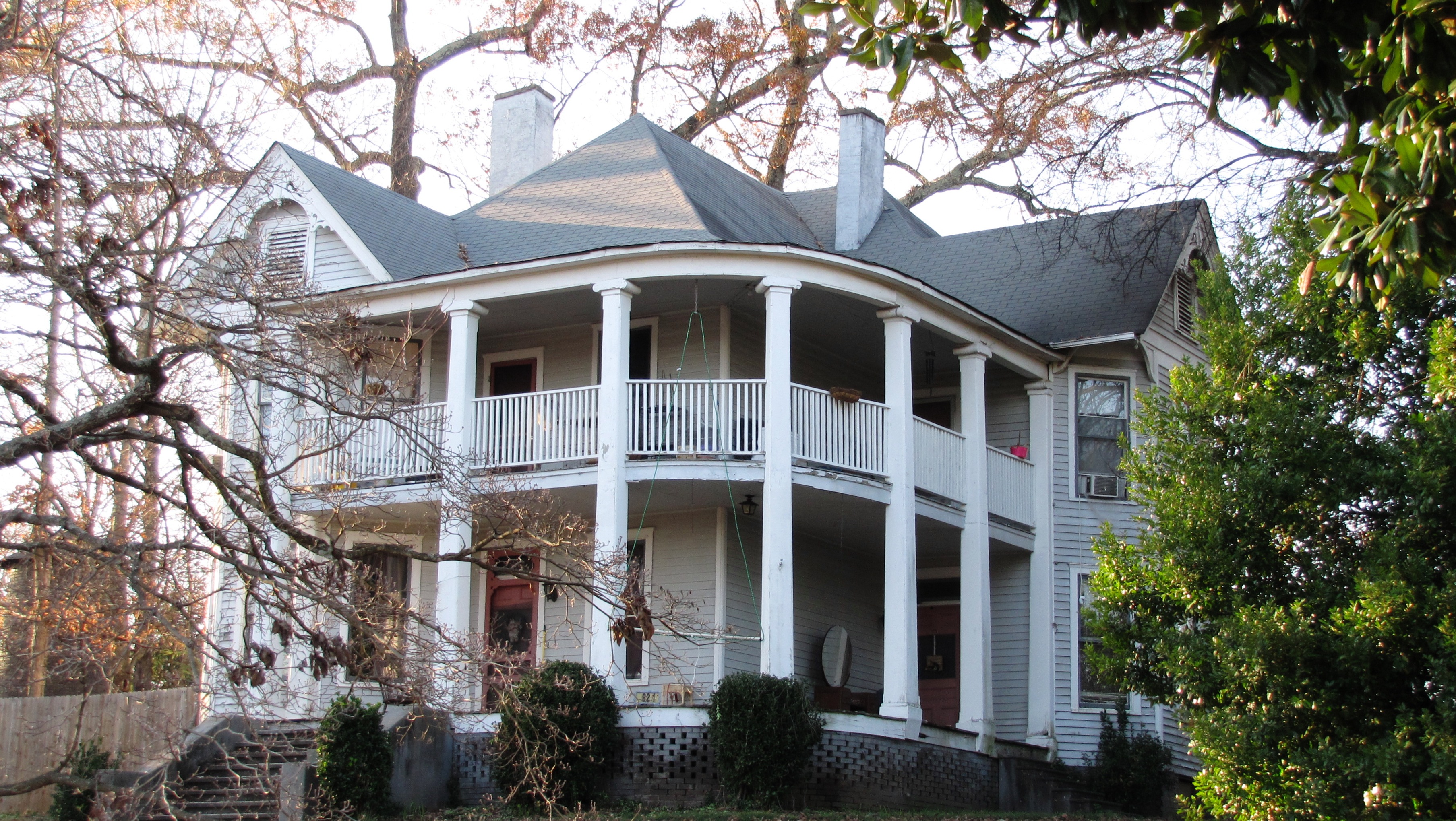
35°45′04″N 83°52′55″W / 35.751111°N 83.881944°WMaryville 33 Pete Hood House 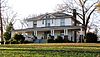
July 25, 1989 827 W. Broadway
35°44′55″N 83°58′50″W / 35.748611°N 83.980556°WMaryville Residence of early ALCOA executive Benton Glascock and his descendants 34 Indiana Avenue Historic District 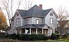
August 21, 1989 Roughly bounded by Goddard St., Court St., Indiana Ave., and Cates St.
35°45′00″N 83°58′07″W / 35.75°N 83.968611°WMaryville Now called the College Hill Historic District; includes several dozen houses built circa 1880–1940 35 David Jones House 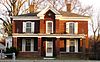
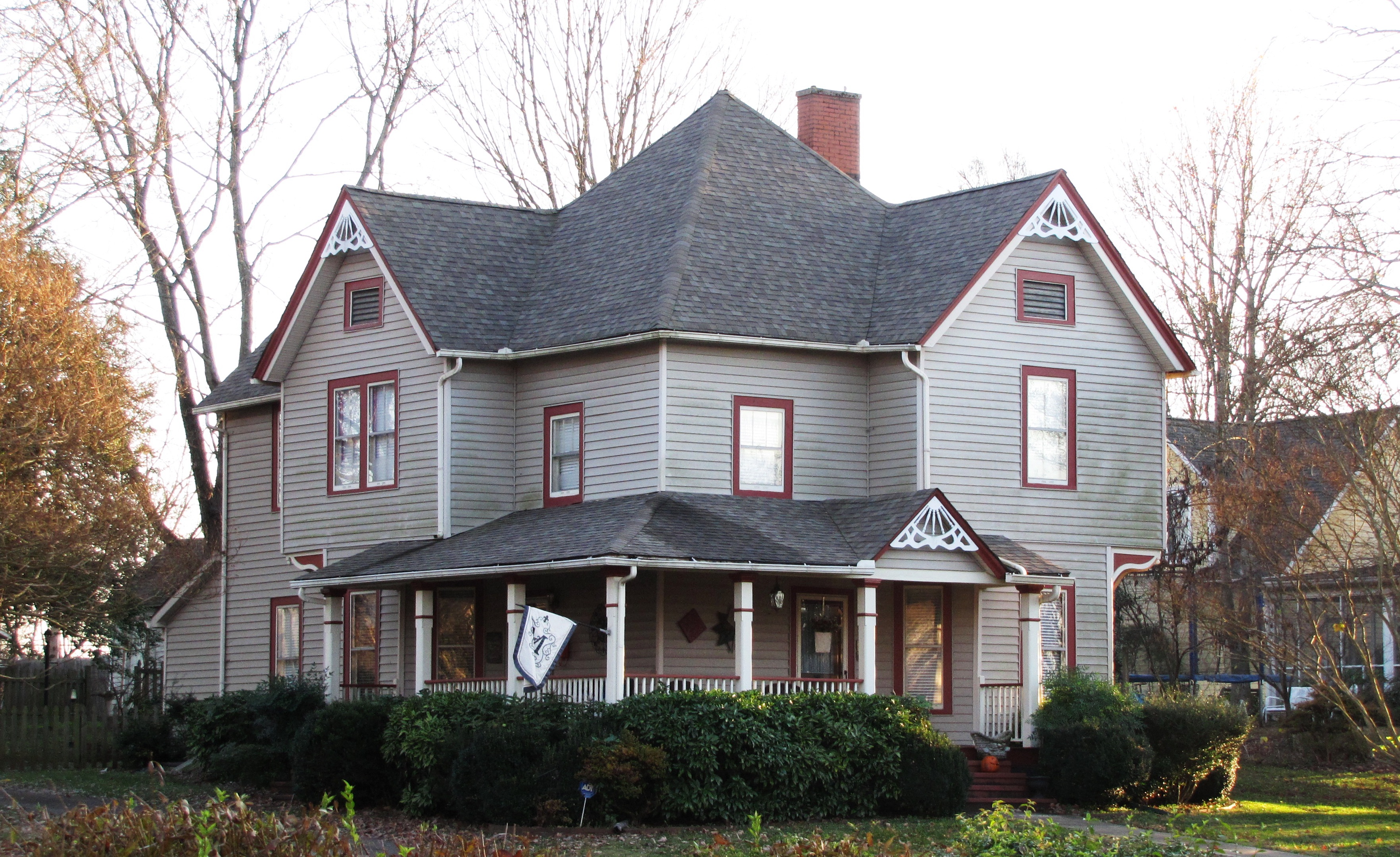
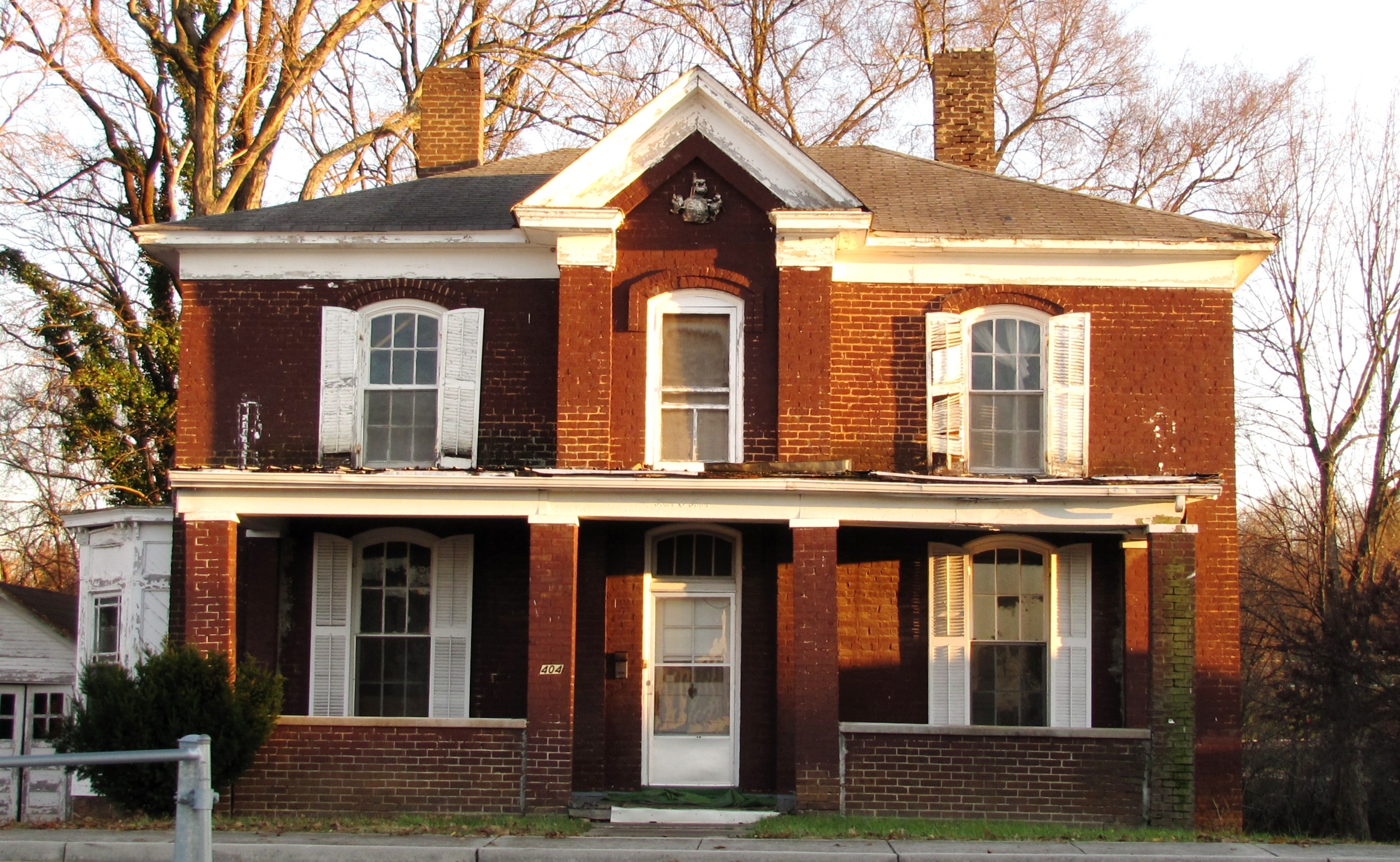
July 25, 1989 404 High St.
35°45′21″N 83°57′56″W / 35.755833°N 83.965556°WMaryville 36 David Jones House August 26, 1982 720 Tuckaleechee Pike
35°45′19″N 83°57′42″W / 35.755278°N 83.961667°WMaryville 37 Macklin Kerr House 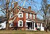
July 25, 1989 Big Gully Rd., 0.3 miles north of Kyker Rd.
35°36′19″N 84°07′26″W / 35.605278°N 84.123889°WMaryville Built circa 1847; briefly houses Union soldiers during the Civil War 38 Hezekiah Kizer House 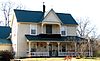
July 25, 1989 0.5 miles south of the junction of Marble Hill Rd. and Dunlap Hollow Rd.
35°42′49″N 84°09′07″W / 35.713611°N 84.151944°WMaryville 39 Louisville Historic District December 23, 1974 Between railroad tracks and the Tennessee River
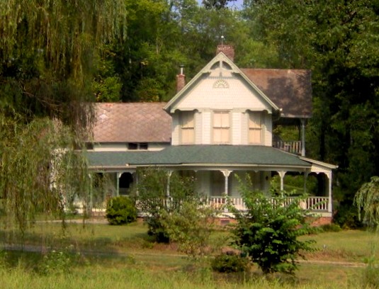
35°49′23″N 84°03′01″W / 35.823056°N 84.050278°WLouisville 40 James Martin House 
July 25, 1989 Martin Rd., 1 mile east of E. Millers Cove Rd.
35°43′47″N 83°47′46″W / 35.729722°N 83.796111°WWalland 41 John Martin Mill July 25, 1989 Mill Rd., 0.3 miles south of W. Millers Cove Rd.
35°42′33″N 83°49′24″W / 35.709167°N 83.823333°WWalland 42 Warner Martin House 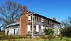
July 25, 1989 Central Point Rd. at Old Nails Creek
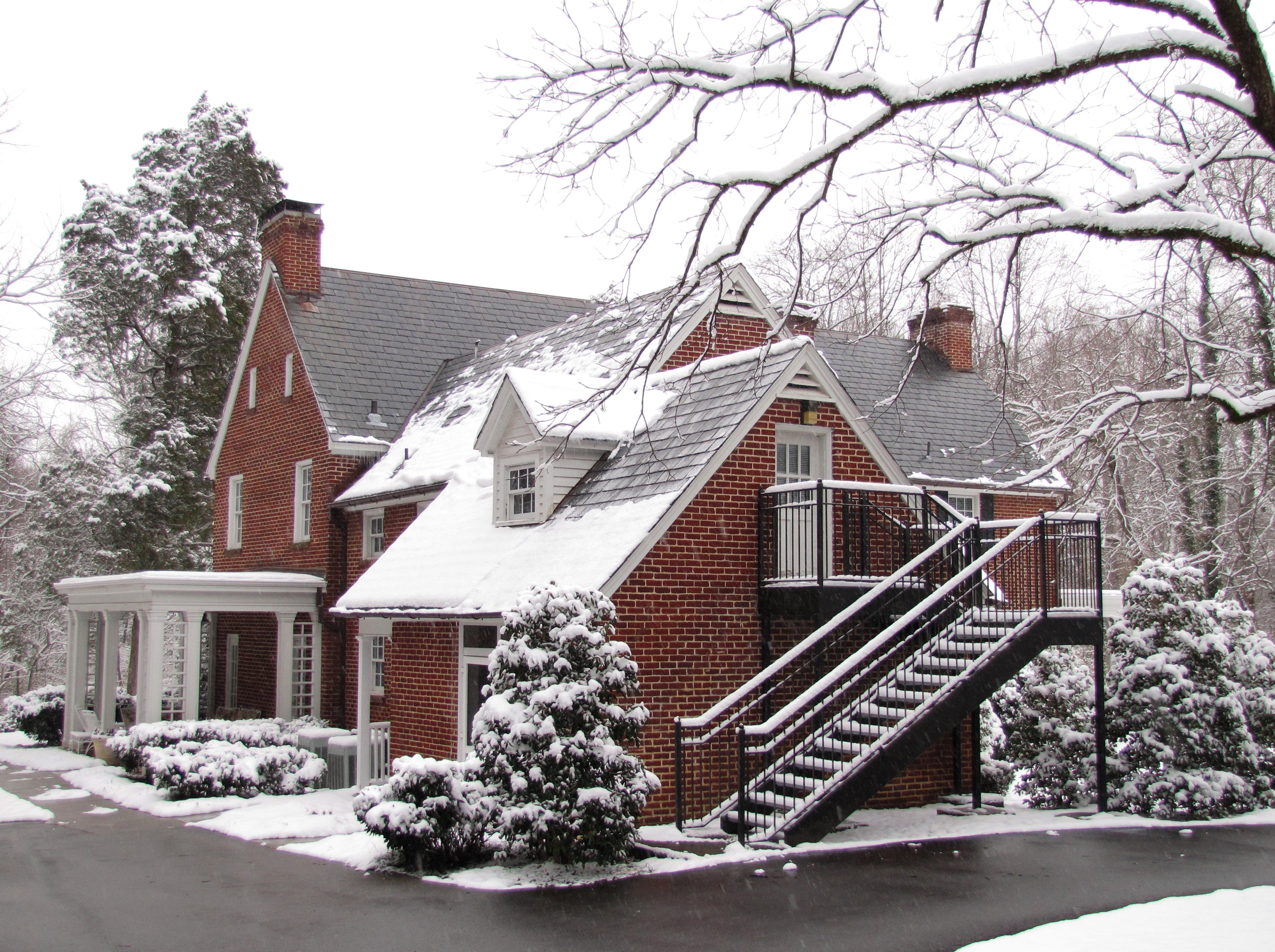
35°49′19″N 83°52′46″W / 35.821944°N 83.879444°WRockford Circa-1790s frame house 43 Maryville College Historic District 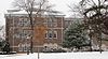
September 9, 1982 Washington St.
35°45′07″N 83°57′51″W / 35.751944°N 83.964167°WMaryville Includes Willard House (1891), Bartlett Hall (1901), Fayerweather Science Hall (1898), Carnegie Hall (1917), Thaw Hall (1923), and several others 44 James McCampbell Barn July 25, 1989 Old Cades Cove Rd., 0.1 miles south of Dry Valley Rd.
35°39′55″N 83°47′21″W / 35.665278°N 83.789167°WTownsend 45 Minnis McCampbell Barn July 25, 1989 Old Cades Cove Rd., 0.1 miles south of Dry Valley Rd.
35°39′54″N 83°47′14″W / 35.665°N 83.787222°WTownsend 46 John McConnell House July 25, 1989 McConnell Rd., 0.5 miles west of Maple Lane Rd.
35°41′27″N 84°08′24″W / 35.690833°N 84.14°WMaryville 47 Thomas McCullock House July 25, 1989 Junction of Martin Mill Pike and State Route 33
35°49′21″N 83°56′17″W / 35.8225°N 83.938056°WRockford 48 McNutt-Howard House 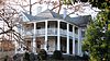
July 25, 1989 825 W. Broadway Ave.
35°44′59″N 83°58′49″W / 35.749722°N 83.980278°WMaryville 49 McNutt-McReynolds House July 25, 1989 803 W. Broadway Ave.
35°45′00″N 83°58′47″W / 35.75°N 83.979722°WMaryville 50 Miser Station Store July 25, 1989 Junction of Union Grove Rd. and Chestnut Hill Rd.
35°46′41″N 84°05′29″W / 35.778056°N 84.091389°WFriendsville 51 Morningside July 25, 1989 Maryville College campus
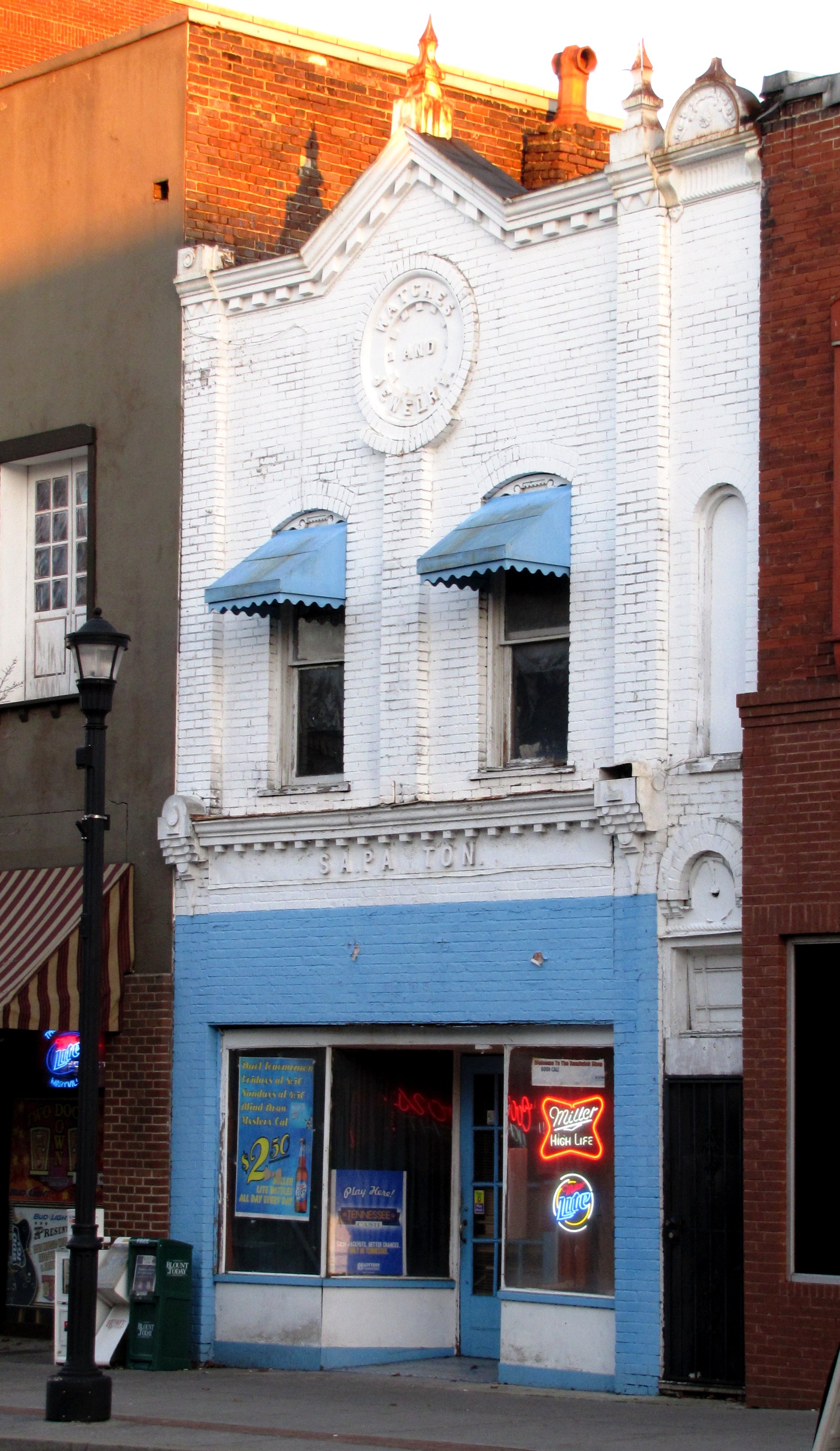
35°44′45″N 83°57′37″W / 35.745833°N 83.960278°WMaryville 52 Samuel A. Patton Building 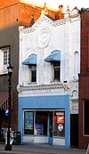
July 25, 1989 114 E. Broadway Ave.
35°45′23″N 83°58′15″W / 35.756389°N 83.970833°WMaryville Late-19th century commercial building that once housed a jewelry store; now a bar known as "The Sandwich Shop" 53 Peery Mill Site July 25, 1989 Old Walland Highway, 0.1 miles north of Cold Springs Rd.
35°44′58″N 83°50′07″W / 35.749444°N 83.835278°WWalland 54 People's Bank of Friendsville July 25, 1989 College St.
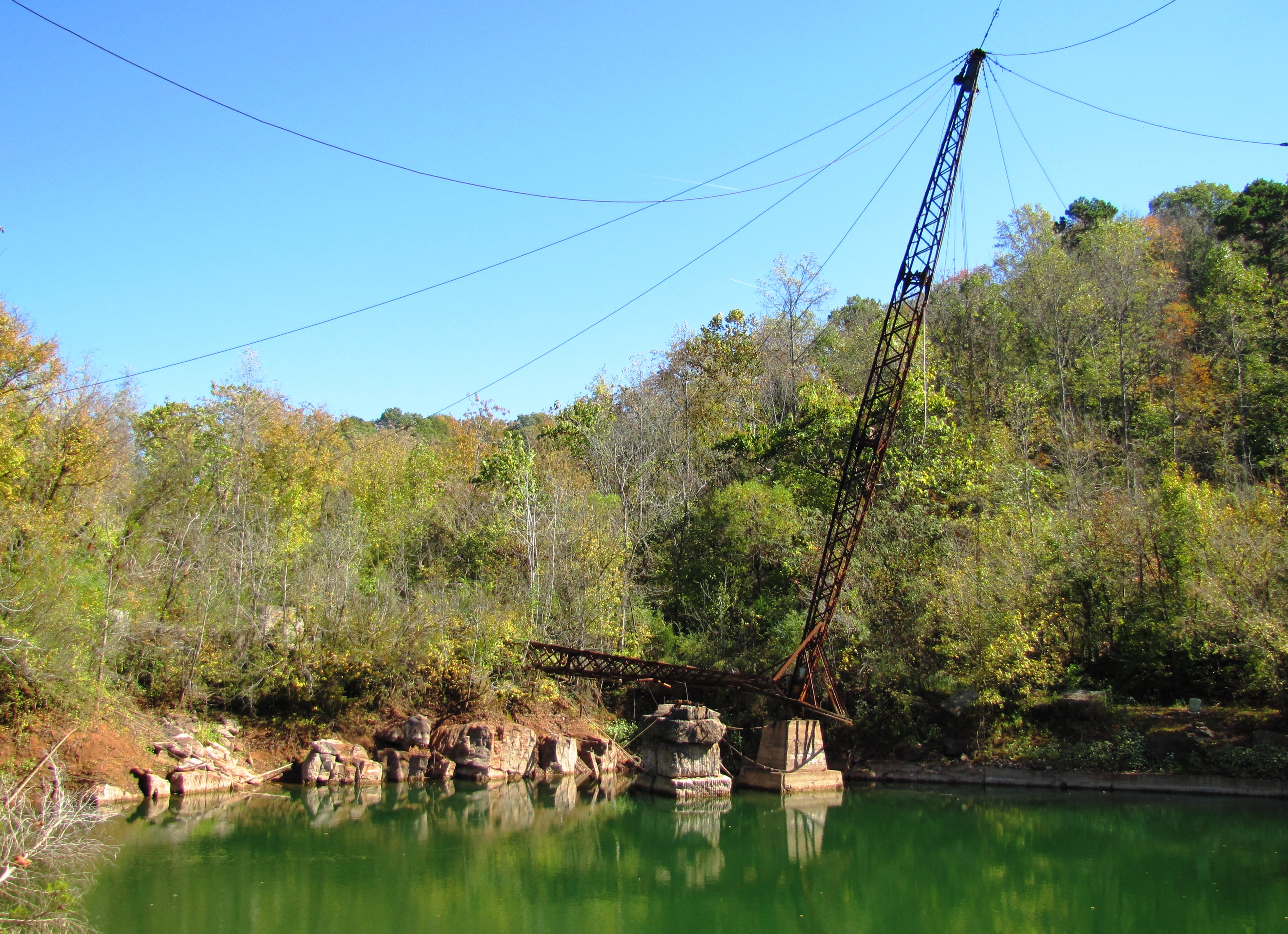
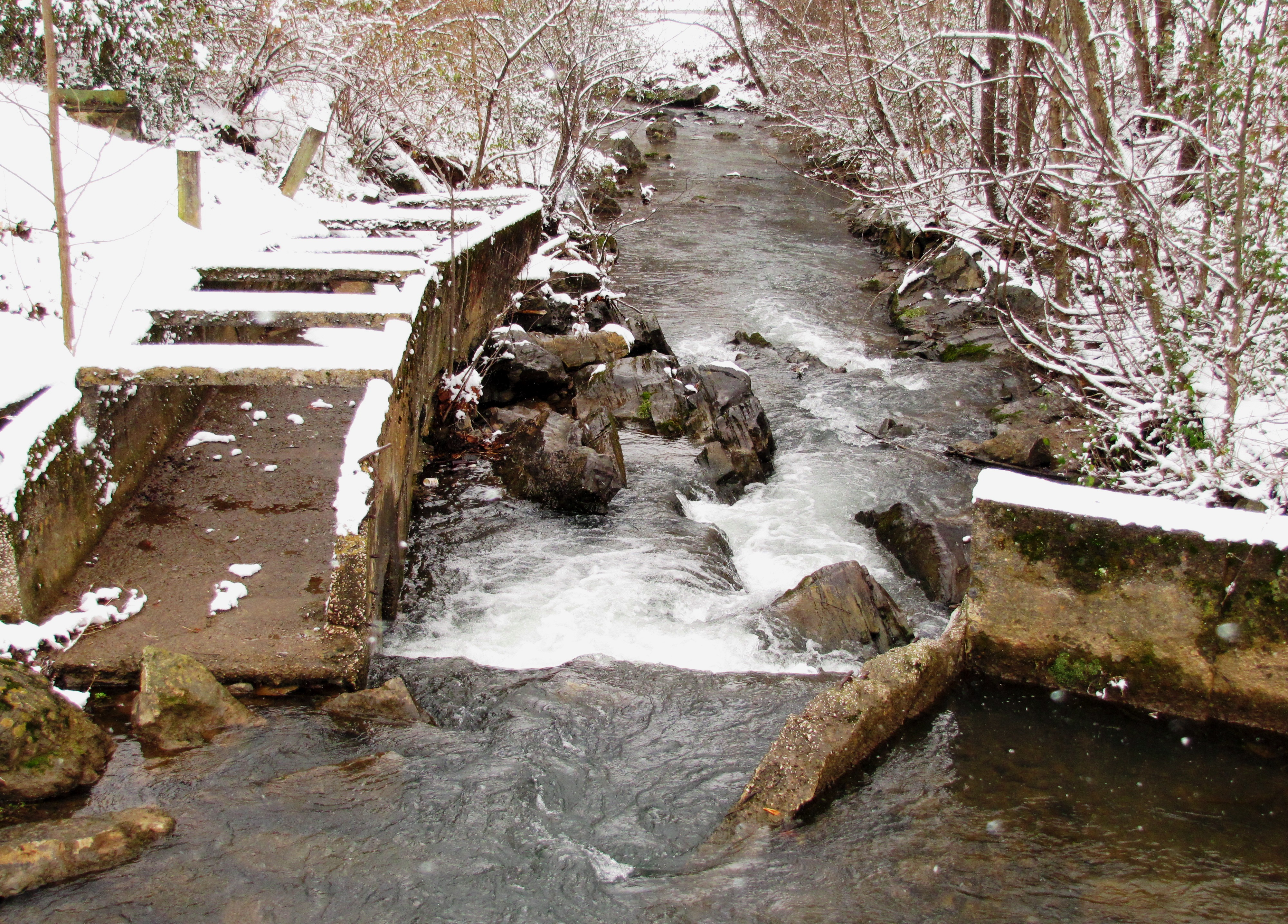
35°45′36″N 84°08′02″W / 35.76°N 84.133889°WFriendsville 55 Pistol Creek Dam and Mill Race 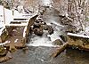
July 25, 1989 Pistol Creek between Church Ave. and Ellis St.
35°45′07″N 83°58′01″W / 35.751944°N 83.966944°WMaryville Ruins of the Pistol Creek Mill, located just off the greenway at Greenbelt Park 56 Stephen Porter House July 25, 1989 Martin Mill Pike, 0.2 miles west of Glover Rd.
35°49′20″N 83°54′15″W / 35.822222°N 83.904167°WRockford 57 John M. Rorex House July 25, 1989 Junction of Brick Mill Rd. and Old Niles Ferry Rd.
35°39′30″N 84°06′18″W / 35.658333°N 84.105°WMaryville 58 Russell-Lackey-Prater House November 20, 1989 Prater Rd. off Old Lowes Ferry Rd. at Poland Creek
35°50′04″N 84°06′32″W / 35.834444°N 84.108889°WLouisville 59 Sam Houston Schoolhouse 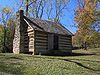
June 13, 1972 Northeast of Maryville on State Route 8
35°48′07″N 83°54′16″W / 35.801944°N 83.904444°WMaryville 60 Shaddon Mill Site August 21, 1989 Ninemile Creek at junction of Big Elm and Trigonia Rds.
35°36′21″N 84°10′21″W / 35.605833°N 84.1725°WMaryville 61 John F. Shea House July 25, 1989 Old Walland Highway
35°40′37″N 83°45′20″W / 35.676944°N 83.755556°WTownsend 62 Southern Railroad Bridge 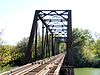
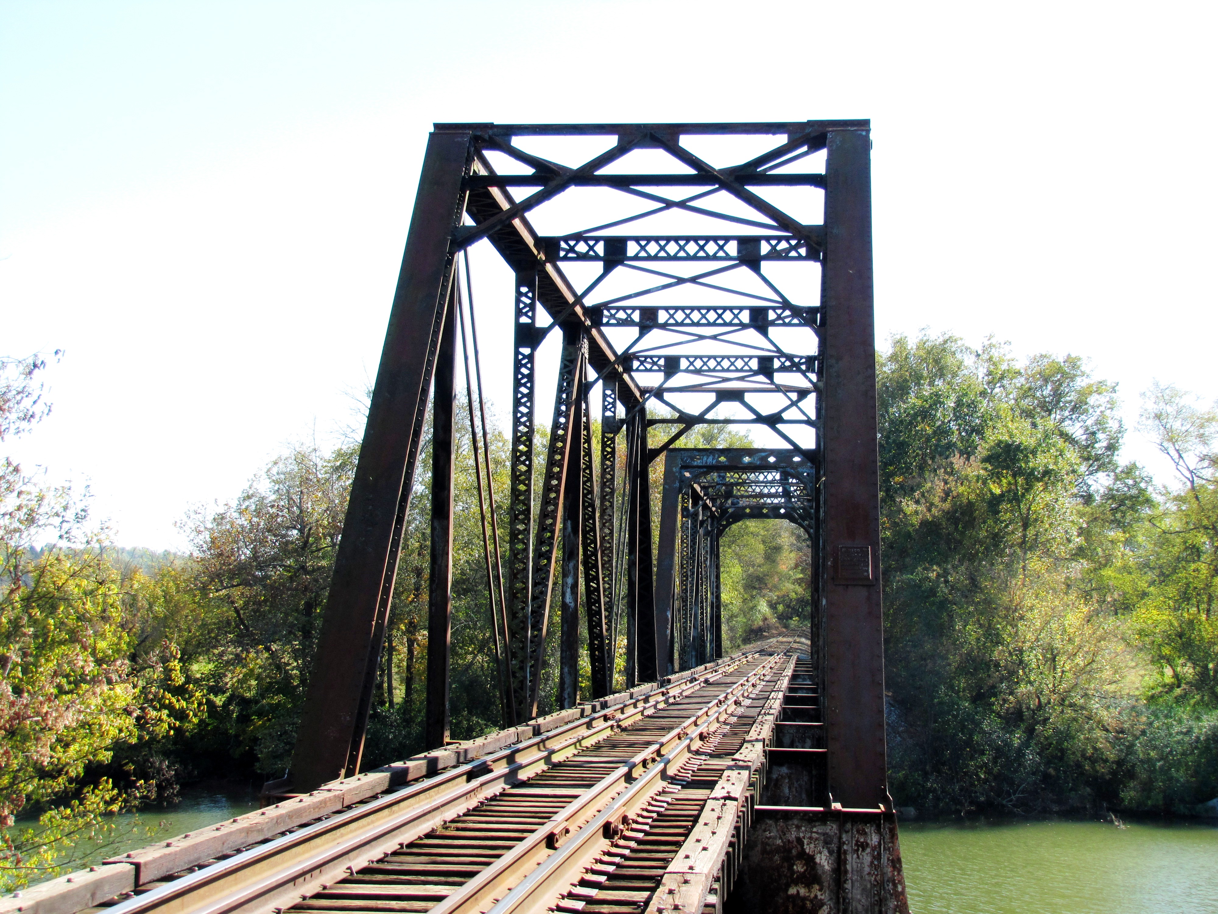
July 25, 1989 Southern Railroad right-of-way over the Little River
35°50′52″N 83°56′45″W / 35.847778°N 83.945833°WRockford Truss bridge built in 1930 by the Edgemoor Bridge Works 63 Southern Railroad Freight Depot 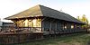
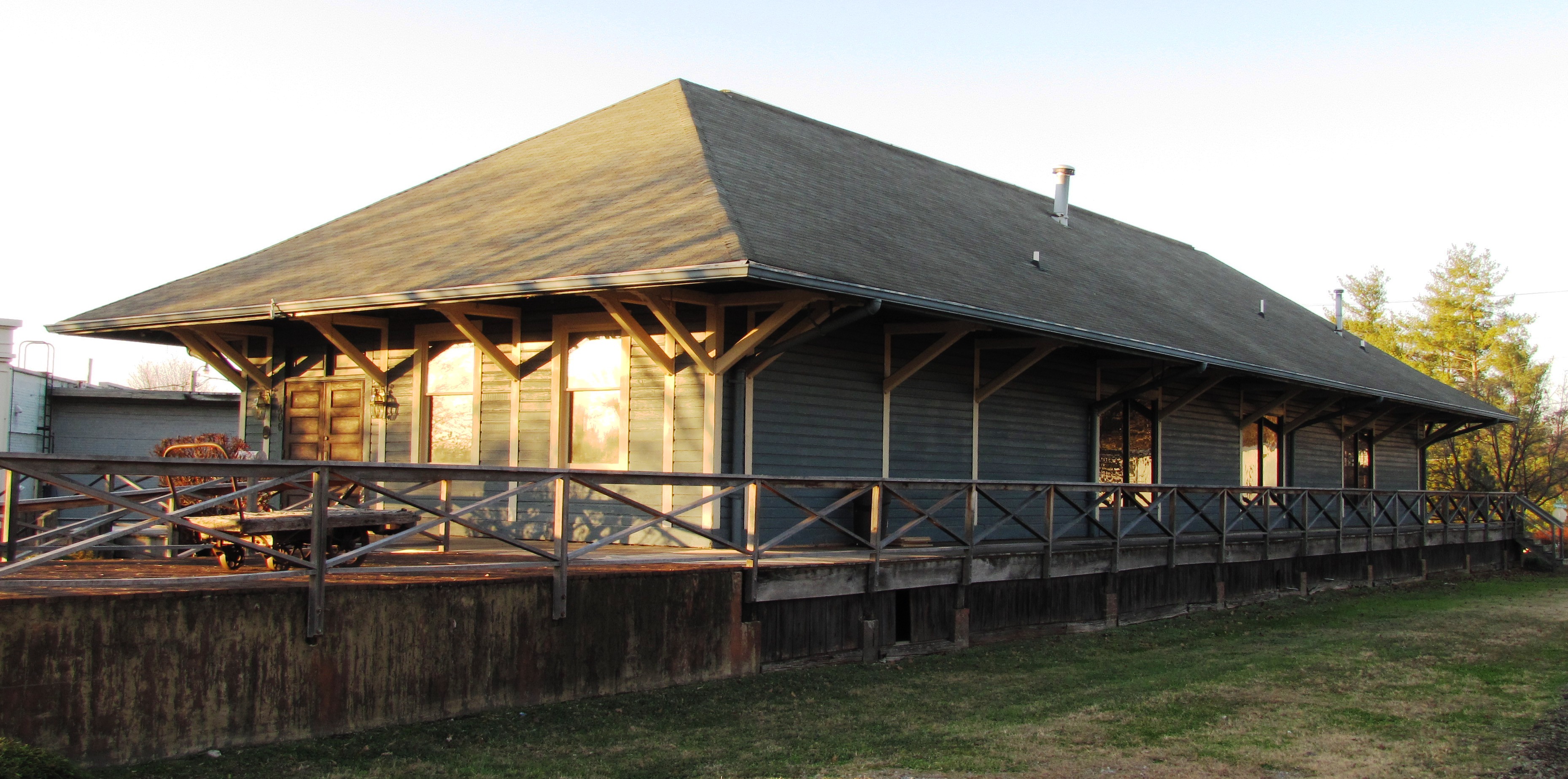
July 25, 1989 Southern Railroad right-of-way between Sevierville Rd. and Washington Ave.
35°45′30″N 83°57′53″W / 35.758333°N 83.964722°WMaryville 64 Dr. William P. Stevenson House 
July 25, 1989 Maryville College campus
35°44′45″N 83°57′21″W / 35.745833°N 83.955833°WMaryville Now called the "House in the Woods" 65 Thompson-Brown House 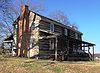
November 2, 1978 1005 Tuckleechee Pike
35°45′16″N 83°57′22″W / 35.754444°N 83.956111°WMaryville 66 Carl Trundle Barn July 25, 1989 Junction of U.S. Route 411 and Wildwood Rd.
35°48′01″N 83°51′30″W / 35.800278°N 83.858333°WWildwood 67 Tobler Vineyard House July 25, 1989 Hollybrook Rd., 1 mile north of Martin Mill Pike
35°49′59″N 83°54′20″W / 35.833056°N 83.905556°WRockford 68 Walland Bridge July 25, 1989 Old Walland Rd. over the Little River
35°43′46″N 83°48′58″W / 35.729444°N 83.816111°WWalland 69 Walland Power Plant July 25, 1989 Old Walland Highway, 0.75 miles north of Walland
35°44′11″N 83°49′23″W / 35.736389°N 83.823056°WWalland 70 Marcus Warren House 
July 25, 1989 Miser Station Rd., 0.2 miles south of Middle Settlement Rd.
35°47′44″N 84°03′26″W / 35.795556°N 84.057222°WLouisville Built late-19th century; the Warren Farm is now a Tennessee Century Farm 71 White's Mill July 25, 1989 Old White's Mill Rd.
35°44′03″N 83°53′02″W / 35.734167°N 83.883889°WMaryville 72 Willard-Clark House 
July 25, 1989 1125 Broadway
35°44′42″N 83°59′04″W / 35.745°N 83.984444°WMaryville Built in the early 1900s, designed by Charles H. Young 73 Isaac Yearout House 
July 25, 1989 Big Springs Rd., 0.3 miles north of Morganton Rd.
35°44′59″N 84°00′25″W / 35.749722°N 84.006944°WAlcoa See also
- List of National Historic Landmarks in Tennessee
- National Register of Historic Places listings in Tennessee
References
- ^ The latitude and longitude information provided in this table was derived originally from the National Register Information System, which has been found to be fairly accurate for about 99% of listings. For about 1% of NRIS original coordinates, experience has shown that one or both coordinates are typos or otherwise extremely far off; some corrections may have been made. A more subtle problem causes many locations to be off by up to 150 yards, depending on location in the country: most NRIS coordinates were derived from tracing out latitude and longitudes off of USGS topographical quadrant maps created under the North American Datum of 1927, which differs from the current, highly accurate WGS84 GPS system used by Google maps. Chicago is about right, but NRIS longitudes in Washington are higher by about 4.5 seconds, and are lower by about 2.0 seconds in Maine. Latitudes differ by about 1.0 second in Florida. Some locations in this table may have been corrected to current GPS standards.
- ^ "National Register of Historic Places: Weekly List Actions". National Park Service, United States Department of the Interior. Retrieved on November 10, 2011.
- ^ Numbers represent an ordering by significant words. Various colorings, defined here, differentiate National Historic Landmark sites and National Register of Historic Places Districts from other NRHP buildings, structures, sites or objects.
- ^ "National Register Information System". National Register of Historic Places. National Park Service. . http://nrhp.focus.nps.gov/natreg/docs/All_Data.html.
- ^ Blount County Farm Joins State's Century Farms Program, Office of News and Public Affairs, Middle Tennessee State University, press release, September 22, 2009
U.S. National Register of Historic Places Topics Lists by states Alabama • Alaska • Arizona • Arkansas • California • Colorado • Connecticut • Delaware • Florida • Georgia • Hawaii • Idaho • Illinois • Indiana • Iowa • Kansas • Kentucky • Louisiana • Maine • Maryland • Massachusetts • Michigan • Minnesota • Mississippi • Missouri • Montana • Nebraska • Nevada • New Hampshire • New Jersey • New Mexico • New York • North Carolina • North Dakota • Ohio • Oklahoma • Oregon • Pennsylvania • Rhode Island • South Carolina • South Dakota • Tennessee • Texas • Utah • Vermont • Virginia • Washington • West Virginia • Wisconsin • WyomingLists by territories Lists by associated states Other Municipalities and communities of Blount County, Tennessee Cities Alcoa | Friendsville | Louisville | Maryville | Rockford | Townsend

Town CDPs Unincorporated
communitiesHappy Valley | Walland | Tallassee
Footnotes ‡This populated place also has portions in an adjacent county or counties
Categories:- National Register of Historic Places in Tennessee by county
- Blount County, Tennessee
- Buildings and structures in Blount County, Tennessee
-


Wikimedia Foundation. 2010.