- National Register of Historic Places listings in Hamilton County, Tennessee
-
 Location of Hamilton County in Tennessee
This is a list of the National Register of Historic Places listings in Hamilton County, Tennessee.
This is intended to be a complete list of the properties and districts on the National Register of Historic Places in Hamilton County, Tennessee, United States. Latitude and longitude coordinates are provided for many National Register properties and districts; these locations may be seen together in a Google map.[1]
There are 100 properties and districts listed on the National Register in the county, including 1 National Historic Landmark.
Contents: Counties in Tennessee Anderson – Bedford – Benton – Bledsoe – Blount – Bradley – Campbell – Cannon – Carroll – Carter – Cheatham – Chester – Claiborne – Clay – Cocke – Coffee – Crockett – Cumberland – Davidson – Decatur – DeKalb – Dickson – Dyer – Fayette – Fentress – Franklin – Gibson – Giles – Grainger – Greene – Grundy – Hamblen – Hamilton – Hancock – Hardeman – Hardin – Hawkins – Haywood – Henderson – Henry – Hickman – Houston – Humphreys – Jackson – Jefferson – Johnson – Knox – Lake – Lauderdale – Lawrence – Lewis – Lincoln – Loudon – Macon – Madison – Marion – Marshall – Maury – McMinn – McNairy – Meigs – Monroe – Montgomery – Moore – Morgan – Obion – Overton – Perry – Pickett – Polk – Putnam – Rhea – Roane – Robertson – Rutherford – Scott – Sequatchie – Sevier – Shelby – Smith – Stewart – Sullivan – Sumner – Tipton – Trousdale – Unicoi – Union – Van Buren – Warren – Washington – Wayne – Weakley – White – Williamson – Wilson -
- This National Park Service list is complete through NPS recent listings posted November 10, 2011.[2]
Current listings
[3] Landmark name [4] Image Date listed Location City or town Summary 1 Audubon Acres Site (40 HA 84) October 7, 1982 Address Restricted Chattanooga 2 Nathan L. Bachman School April 17, 2001 281 Anderson Pike
35°09′47″N 85°19′20″W / 35.163056°N 85.322222°WWalden 3 Bonny Oaks 
August 11, 1980 5114 Bonny Oaks Dr.
35°04′20″N 85°11′01″W / 35.072222°N 85.183611°WChattanooga 4 Brabson House 
April 11, 1973 407 E. 5th St.
35°03′05″N 85°18′16″W / 35.051389°N 85.304444°WChattanooga 5 Brainerd Junior High 
September 15, 1980 4201 Cherryton Dr.
35°01′06″N 85°14′07″W / 35.018333°N 85.235278°WChattanooga 6 Brainerd Mission Cemetery 
December 6, 1979 5700 Eastgate Loop
35°00′43″N 85°12′46″W / 35.011944°N 85.212778°WChattanooga 7 Brown House April 11, 1973 9521 Ooltewah-Georgetown Rd.
35°11′21″N 85°01′16″W / 35.189167°N 85.021111°WOoltewah 8 Brown's Ferry Tavern March 24, 1971 Brown's Ferry Rd.
35°02′41″N 85°21′19″W / 35.044722°N 85.355278°WChattanooga 9 Central Block Building 
September 1, 1995 630-638 Market St.
35°02′55″N 85°18′35″W / 35.048611°N 85.309722°WChattanooga 10 Chattanooga Bank Building 
September 15, 1980 8th St.
35°02′50″N 85°18′36″W / 35.047222°N 85.31°WChattanooga 11 Chattanooga Car Barns 
July 9, 1979 301 Market St.
35°03′12″N 85°18′37″W / 35.053333°N 85.310278°WChattanooga 12 Chattanooga Electric Railway 
February 29, 1980 211-241 Market St.
35°03′13″N 85°18′36″W / 35.053611°N 85.31°WChattanooga 13 Chattanooga National Cemetery 
September 16, 1996 1200 Bailey Ave.
35°02′06″N 85°17′23″W / 35.035°N 85.289722°WChattanooga 14 Chattanooga Plow Power House 
October 7, 1999 1633-1635 Chestnut St.
35°02′14″N 85°18′52″W / 35.037222°N 85.314444°WChattanooga 15 Chattanooga, Harrison, Georgetown & Charleston Railroad Tunnel August 24, 1978 Below N. Crest Rd.
35°03′51″N 85°14′20″W / 35.064167°N 85.238889°WChattanooga 16 Chickamauga and Chattanooga National Military Park 
October 15, 1966 South of Chattanooga on U.S. Route 27
34°58′09″N 85°17′07″W / 34.969167°N 85.285278°WChattanooga 17 Civil War Fortification January 31, 1976 Bonny Oaks Dr.
35°04′06″N 85°09′12″W / 35.068333°N 85.153333°WChattanooga 18 Connor Toll House August 22, 1977 4212 Anderson Pike
35°10′45″N 85°20′11″W / 35.179167°N 85.336389°WSignal Mountain 19 Crane Building 
November 10, 1983 1317 Chestnut St.
35°02′24″N 85°18′45″W / 35.04°N 85.3125°WChattanooga 20 Cravens-Coleman House October 25, 1990 1 Cravens Terrace
35°00′49″N 85°20′26″W / 35.013611°N 85.340556°WChattanooga 21 Judge Will Cummings House July 3, 1980 West of Chattanooga at 4025 Cummings Rd.
35°01′03″N 85°23′33″W / 35.0175°N 85.3925°WChattanooga 22 Hiram Douglas House April 24, 1973 About 5 miles north of Ooltewah on Snow Hill Rd.
35°08′08″N 85°04′07″W / 35.135556°N 85.068611°WOoltewah 23 East Tennessee Iron Manufacturing Company Blast Furnace May 8, 1980 Address Restricted Chattanooga 24 Engel Stadium 
November 19, 2009 O'Neal St. and E. 3rd St.
35°02′43″N 85°17′12″W / 35.045258°N 85.286739°WChattanooga 25 Faxon-Thomas Mansion 
November 25, 1980 10 Bluff View Ave.
35°03′21″N 85°18′21″W / 35.055833°N 85.305833°WChattanooga 26 Ferger Place Historic District 
May 1, 1980 Evening Side Dr. and Morning Side Dr.
35°01′30″N 85°17′04″W / 35.025°N 85.284444°WChattanooga 27 First Baptist Church Education Building 
February 29, 1980 317 Oak St.
35°02′56″N 85°18′21″W / 35.048889°N 85.305833°WChattanooga 28 First Congregational Church July 22, 2010 901 Lindsay St.
35°02′42″N 85°18′26″W / 35.045°N 85.307222°WChattanooga 29 First Presbyterian Church 
November 18, 2009 554 McCallie Ave.
35°02′47″N 85°18′10″W / 35.046358°N 85.302744°WChattanooga 30 Fort Wood Historic District 
April 18, 1979 Roughly bounded by Palmetto, McCallie, Central, and 5th Sts.
35°02′42″N 85°17′34″W / 35.045°N 85.292778°WChattanooga 31 Fountain Square 
March 28, 1979 600-622 Georgia Ave. and 317 Oak St.
35°02′58″N 85°18′22″W / 35.049444°N 85.306111°WChattanooga 32 Gaskill House 
December 6, 1979 427 E. 5th St.
35°03′03″N 85°18′14″W / 35.050833°N 85.303889°WChattanooga 33 Glenwood Historic District July 25, 1989 Roughly bounded by Parkwood Dr., Glenwood Dr., Oak St., and Derby St.
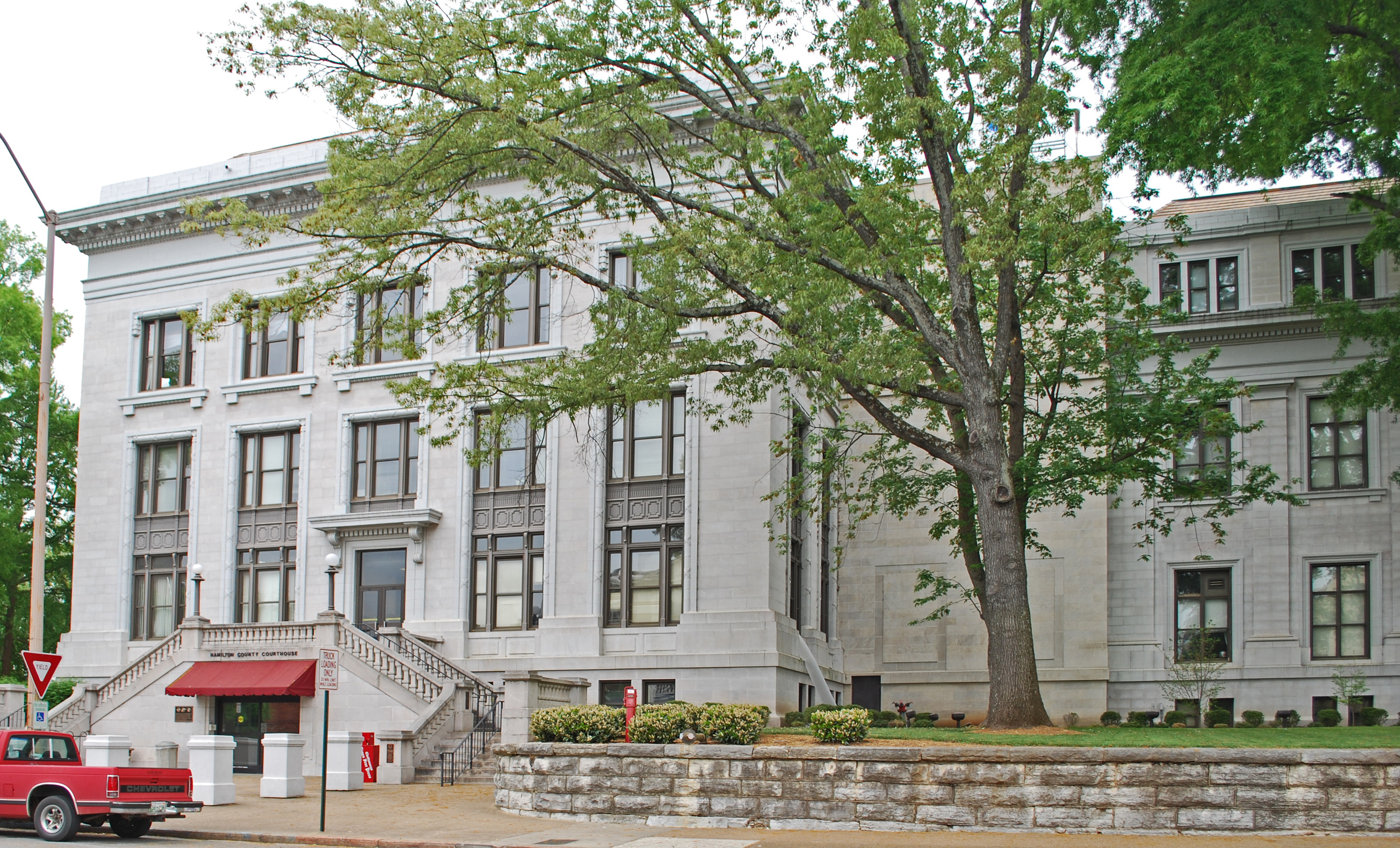
35°02′16″N 85°15′49″W / 35.037778°N 85.263611°WChattanooga 34 Hamilton County Courthouse 
November 21, 1978 W. 6th St. and Georgia Ave.
35°02′58″N 85°18′25″W / 35.049444°N 85.306944°WChattanooga 35 Hampton Place Archeological Site (40HA146) May 22, 1984 Address Restricted Chattanooga 36 Highland Park Methodist Episcopal Church February 29, 1980 Bailey Ave.
35°03′06″N 85°16′30″W / 35.051667°N 85.275°WChattanooga 37 Hutcheson House November 21, 1978 360 S. Crest Rd.
35°00′29″N 85°16′09″W / 35.008056°N 85.269167°WChattanooga 38 Caleb Isbester House 
March 25, 1982 551 Oak St.
35°02′53″N 85°18′14″W / 35.048056°N 85.303889°WChattanooga 39 James Building 
February 29, 1980 735 Broad St.
35°02′50″N 85°18′37″W / 35.047222°N 85.310278°WChattanooga 40 James County Courthouse November 7, 1976 Mulberry St.
35°04′17″N 85°03′37″W / 35.071389°N 85.060278°WOoltewah County courthouse for James County, which was merged into Hamilton County after its bankruptcy in 1919. 41 Clarence T. Jones Observatory 
November 20, 2009 10 N. Tuxedo Ave.
35°01′01″N 85°14′12″W / 35.016925°N 85.236794°WChattanooga Still in use 42 Kelley House 
May 14, 1980 1903 McCallie Ave.
35°02′08″N 85°16′27″W / 35.035556°N 85.274167°WChattanooga 43 M.L. King Boulevard Historic District 
March 20, 1984 Roughly M. L. King Boulevard between Browns and University Sts.
35°02′38″N 85°18′14″W / 35.043889°N 85.303889°WChattanooga 44 Lookout Mountain Caverns and Cavern Castle 
November 26, 1985 Scenic Highway
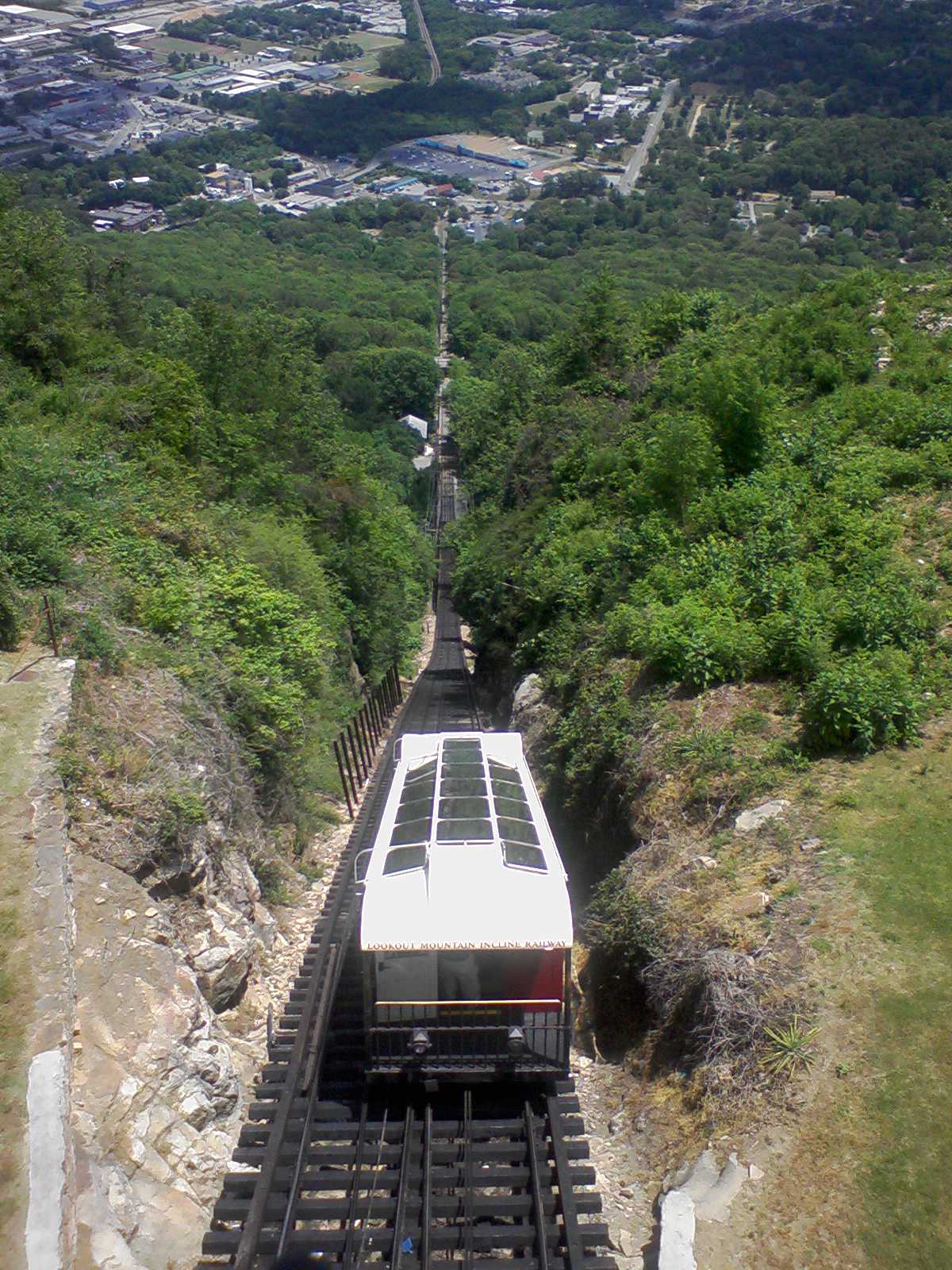
35°01′09″N 85°20′22″W / 35.019167°N 85.339444°WChattanooga 45 Lookout Mountain Incline Railway 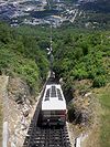
April 26, 1973 Off U.S. Route 11
35°00′28″N 85°20′08″W / 35.007778°N 85.335556°WChattanooga 46 Louise Terrace Apartments 
October 30, 1998 314 and 316 Walnut St.
35°03′10″N 85°18′27″W / 35.052778°N 85.3075°WChattanooga 47 Maclellan Building 
April 4, 1985 721 Broad St.
35°02′51″N 85°18′36″W / 35.0475°N 85.31°WChattanooga 48 Mallards Dozen Archeological Site (40HA147) May 22, 1984 Address Restricted Chattanooga 49 Market and Main Streets Historic District 
July 24, 1992 Roughly bounded by Cowart, King, Market, and Main Sts.
35°02′18″N 85°18′28″W / 35.038333°N 85.307778°WChattanooga 50 Market Square-Patten Parkway 
May 1, 1980 Roughly bounded by E. 8th and E. 9th Sts. and Georgia and Lindsay Aves.
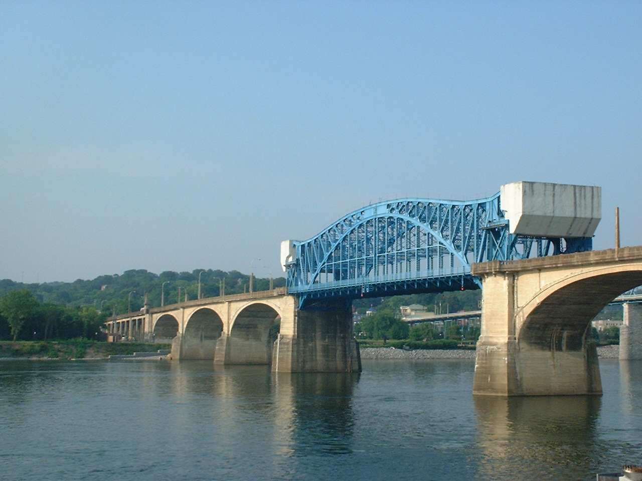
35°02′46″N 85°18′27″W / 35.046111°N 85.3075°WChattanooga 51 Market Street Bridge 
December 20, 2010 Market St. over the Tennessee River
35°03′31″N 85°18′33″W / 35.058611°N 85.309167°WChattanooga Also known as the Chief John Ross Bridge 52 Market Street Warehouse Historic District 
April 5, 1984 1118-1148 Market St.
35°02′35″N 85°18′32″W / 35.043056°N 85.308889°WChattanooga 53 Pleasant L. Matthews House December 12, 1976 Southwest of Georgetown on Ooltewah-Georgetown Rd.
35°16′38″N 84°57′57″W / 35.277222°N 84.965833°WGeorgetown 54 Chancellor T.M. McConnell House 
April 17, 1992 517 E. 5th St.
35°03′02″N 85°18′10″W / 35.050556°N 85.302778°WChattanooga 55 Medical Arts Building 
September 15, 1980 McCallie Ave.
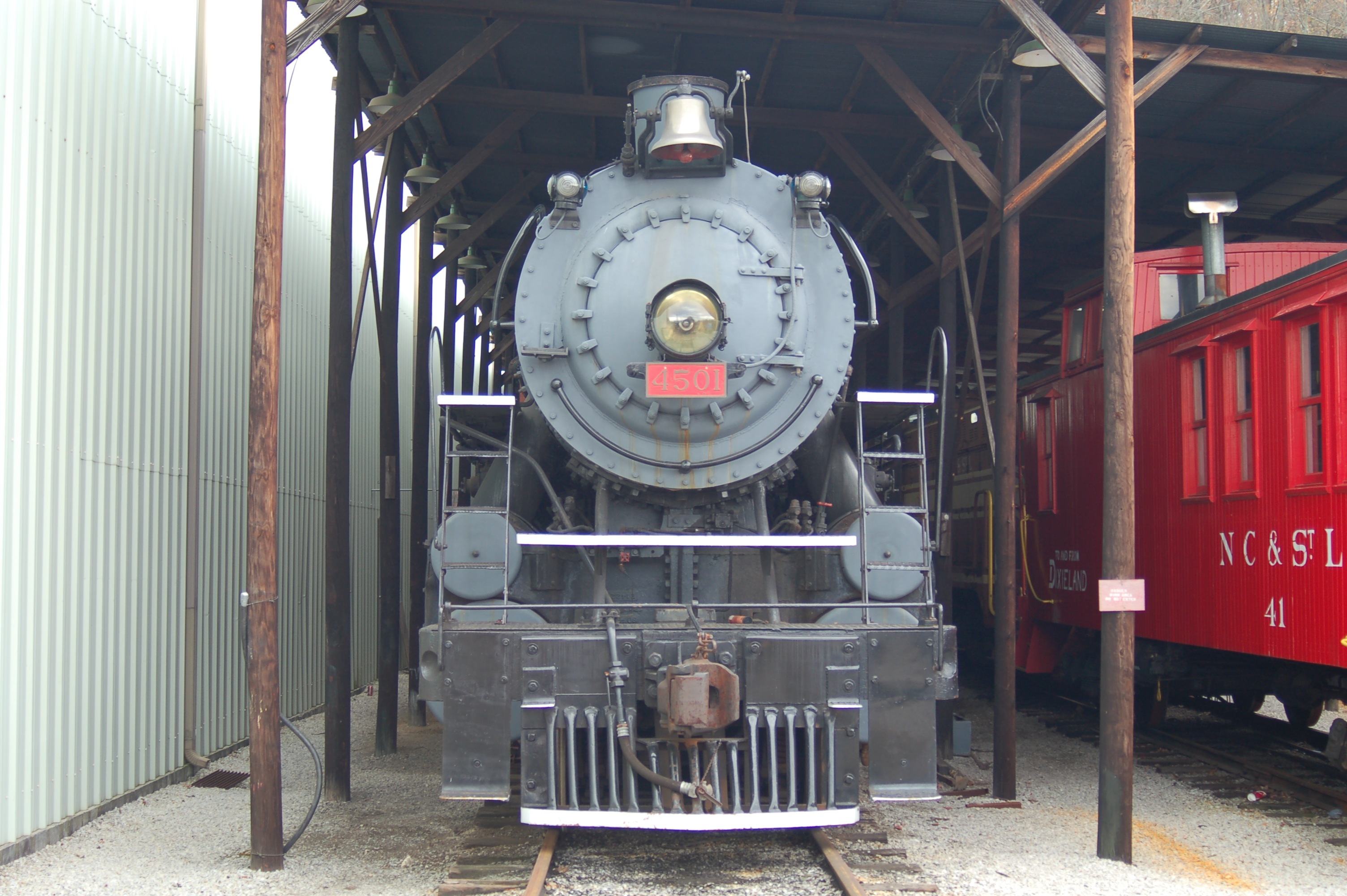
35°02′45″N 85°18′09″W / 35.045833°N 85.3025°WChattanooga 56 Mikado Locomotive No. 4501 
March 28, 1979 2202 N. Chamberlain Ave.
35°03′43″N 85°15′01″W / 35.061944°N 85.250278°WChattanooga 57 Miller Brothers Department Store 
September 17, 1987 629 Market St.
35°02′56″N 85°18′34″W / 35.048889°N 85.309444°WChattanooga See Miller's of Tennessee. 58 Missionary Ridge Historic District September 5, 1996 N. and S. Crest Rd. from Delong Reservation to 700 S. Crest Rd.
35°00′48″N 85°15′56″W / 35.013333°N 85.265556°WChattanooga 59 Moccasin Bend Archeological District 
September 8, 1986 Address Restricted Chattanooga 60 Model Electric Home 
July 15, 1993 1516 Sunset Rd.
35°04′33″N 85°17′07″W / 35.075833°N 85.285278°WChattanooga 61 Municipal Building 
February 29, 1980 E. 11th St.
35°02′36″N 85°18′27″W / 35.043333°N 85.3075°WChattanooga 62 Northside Presbyterian Church September 15, 1980 923 Mississippi Ave.
35°04′10″N 85°17′41″W / 35.069444°N 85.294722°WChattanooga Listed as "Northside United Presbyterian" 63 Oak Grove Elementary School July 6, 2011 1912 S. Willow St.
35°01′14″N 85°16′45″W / 35.020556°N 85.279167°WChattanooga 64 Ochs Building 
November 17, 1978 Georgia Ave.
35°02′50″N 85°18′26″W / 35.047222°N 85.307222°WChattanooga 65 Old Library Building 
March 14, 1973 200 E. 8th St.
35°02′48″N 85°18′26″W / 35.046667°N 85.307222°WChattanooga 66 Old Post Office 
April 13, 1973 E. 11th and Lindsay Sts.
35°02′37″N 85°18′27″W / 35.043611°N 85.3075°WChattanooga 67 Read House 
December 23, 1976 Broad and 9th Sts.
35°02′46″N 85°18′39″W / 35.046111°N 85.310833°WChattanooga 68 Ridgedale Methodist Episcopal Church July 30, 2010 1518 Dodds Ave.
35°01′15″N 85°16′12″W / 35.020833°N 85.27°WChattanooga vicinity 69 Ross's Landing 
June 27, 1974 Riverfront Parkway west of Market St.
35°03′23″N 85°18′32″W / 35.056389°N 85.308889°WChattanooga 70 St. Elmo Historic District April 15, 1982 Alabama, St. Elmo, and Tennessee Aves.
34°59′48″N 85°19′44″W / 34.996667°N 85.328889°WChattanooga 71 St. Paul's Episcopal Church 
September 1, 1978 7th and Pine Sts.
35°02′55″N 85°18′47″W / 35.048611°N 85.313056°WChattanooga 72 Saints Peter and Paul Catholic Church and Buildings 
December 11, 1979 214 E. 8th St.
35°02′47″N 85°18′23″W / 35.046389°N 85.306389°WChattanooga 73 Robert Schwartz and Company Building 
July 19, 1984 736-738 Cherry St.
35°02′50″N 85°18′29″W / 35.047222°N 85.308056°WChattanooga 74 Second Presbyterian Church 
February 29, 1980 700 Pine St.
35°02′53″N 85°18′45″W / 35.048056°N 85.3125°WChattanooga 75 Seamour and Gerte Shavin House March 23, 1993 334 N. Crest Rd.
35°03′07″N 85°15′01″W / 35.051944°N 85.250278°WChattanooga 76 Shiloh Baptist Church 
January 19, 1979 506 E. 8th St.
35°02′43″N 85°18′11″W / 35.045278°N 85.303056°WChattanooga 77 Signal Knitting Mills 
March 5, 1999 205 Manufacturers Rd.
35°03′46″N 85°18′47″W / 35.062778°N 85.313056°WChattanooga 78 Signal Mountain Elementary School April 19, 2001 809 Kentucky Ave.
35°07′30″N 85°20′44″W / 35.125°N 85.345556°WSignal Mountain 79 Signal Mountain Historic District October 5, 2001 Roughly along James Boulevard, Brady Point Rd., and Signal Point Rd.
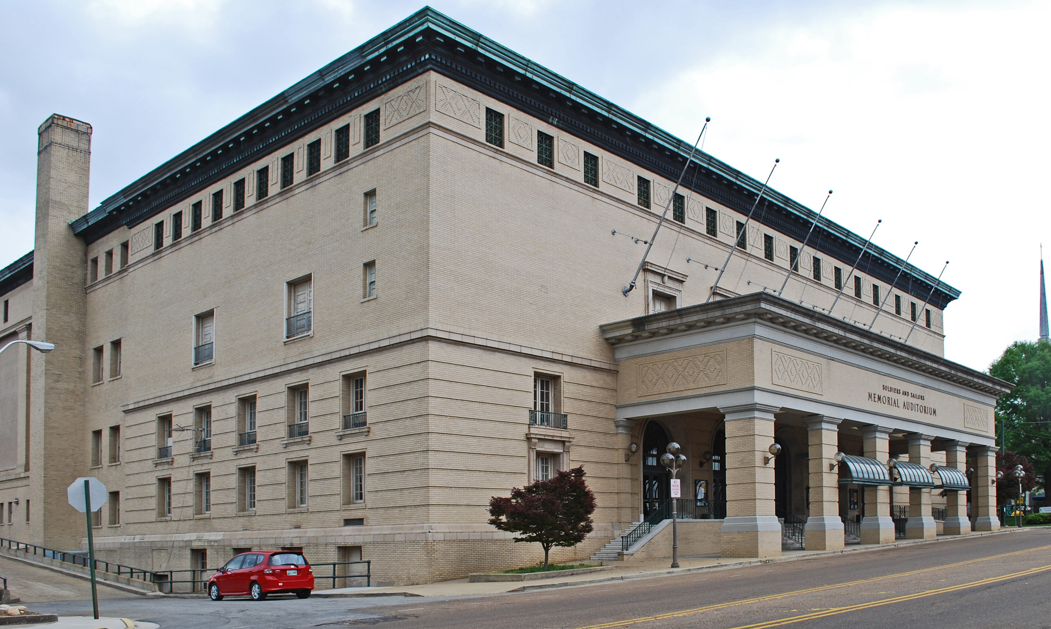
35°07′17″N 85°21′27″W / 35.121389°N 85.3575°WSignal Mountain 80 Soldiers and Sailors Memorial Auditorium 
September 15, 1980 McCallie Ave.
35°02′52″N 85°18′21″W / 35.047778°N 85.305833°WChattanooga 81 Southern Railway Freight Depot 
June 16, 1983 1140 Newby St.
35°02′30″N 85°18′30″W / 35.041667°N 85.308333°WChattanooga 82 Stone Fort Land Company Historic District 
July 1, 1999 10th, Newby, E. 11th, and Market Sts.
35°02′45″N 85°18′28″W / 35.045833°N 85.307778°WChattanooga 83 Stringer Ridge Historic District May 22, 1984 Address Restricted Chattanooga 84 Tennessee Valley Railroad Museum Rolling Stock 
August 6, 1980 2022 N. Chamberlain Ave.
35°03′52″N 85°13′31″W / 35.064444°N 85.225278°WChattanooga 85 Terminal Station 
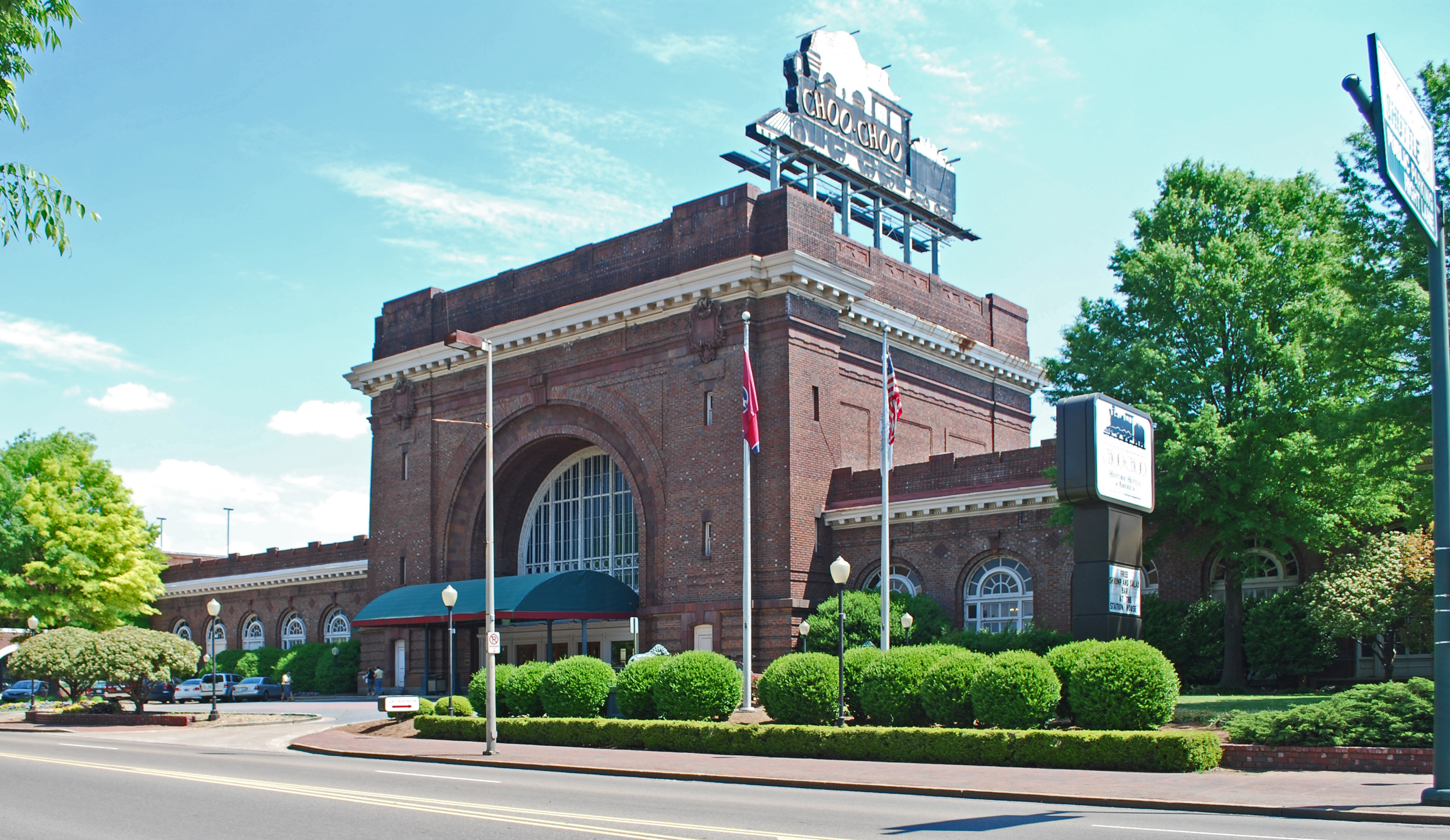
February 20, 1973 1434 Market St.
35°02′13″N 85°18′25″W / 35.036944°N 85.306944°WChattanooga 86 Tivoli Theater 
April 11, 1973 709 Broad St.
35°02′52″N 85°18′37″W / 35.047778°N 85.310278°WChattanooga 87 Topside April 11, 1973 North of Signal Mountain off State Route 8 on Wilson Ave.
35°09′57″N 85°18′28″W / 35.165833°N 85.307778°WSignal Mountain 88 Trigg-Smartt Building 
June 26, 1986 701-707 Broad St.
35°02′54″N 85°18′38″W / 35.048333°N 85.310556°WChattanooga 89 Trinity Methodist Episcopal Church 
February 29, 1980 McCallie Ave.
35°02′33″N 85°17′37″W / 35.0425°N 85.293611°WChattanooga 90 Turnbull Cone and Machine Company 
July 15, 1992 1400 Fort and W. 14th Sts.
35°02′22″N 85°18′52″W / 35.039444°N 85.314444°WChattanooga 91 U.S. Post Office 
February 29, 1980 Georgia Ave.
35°02′42″N 85°18′30″W / 35.045°N 85.308333°WChattanooga 92 Vulcan Archeological Site (40HA140) May 22, 1984 Address Restricted Chattanooga 93 W Road March 19, 1999 W Rd. from Spring St. east 0.4 miles
35°08′42″N 85°18′53″W / 35.145°N 85.314722°WWalden 94 Walnut Street Bridge 
February 23, 1990 Walnut St., over the Tennessee River
35°03′44″N 85°18′23″W / 35.062222°N 85.306389°WChattanooga Formerly a highway bridge, was closed to motor vehicles in 1978 and was eventually converted to a pedestrian bridge. 95 Wauhatchie Pike 
July 11, 2001 Old Wauhatchie Pike
35°01′10″N 85°20′22″W / 35.019444°N 85.339444°WLookout Mountain 96 Wiley United Methodist Church 
August 1, 1979 504 Lookout St.
35°03′03″N 85°18′22″W / 35.050833°N 85.306111°WChattanooga 97 Frances Willard House 
February 29, 1980 615 Lindsay St.
35°02′58″N 85°18′18″W / 35.049444°N 85.305°WChattanooga 98 Williams Island April 11, 1973 On Williams Island in the Tennessee River northwest of central Chattanooga
35°5′0″N 85°20′45″W / 35.083333°N 85.34583°W[5]Chattanooga 99 Woodland Mound Archeological District May 22, 1984 Address Restricted Chattanooga 100 Wyatt Hall 
October 23, 1986 865 E. 3rd St.
35°02′59″N 85°17′40″W / 35.049722°N 85.294444°WChattanooga See also
- List of National Historic Landmarks in Tennessee
- National Register of Historic Places listings in Tennessee
References
- ^ The latitude and longitude information provided in this table was derived originally from the National Register Information System, which has been found to be fairly accurate for about 99% of listings. For about 1% of NRIS original coordinates, experience has shown that one or both coordinates are typos or otherwise extremely far off; some corrections may have been made. A more subtle problem causes many locations to be off by up to 150 yards, depending on location in the country: most NRIS coordinates were derived from tracing out latitude and longitudes off of USGS topographical quadrant maps created under the North American Datum of 1927, which differs from the current, highly accurate WGS84 GPS system used by Google maps. Chicago is about right, but NRIS longitudes in Washington are higher by about 4.5 seconds, and are lower by about 2.0 seconds in Maine. Latitudes differ by about 1.0 second in Florida. Some locations in this table may have been corrected to current GPS standards.
- ^ "National Register of Historic Places: Weekly List Actions". National Park Service, United States Department of the Interior. Retrieved on November 10, 2011.
- ^ Numbers represent an ordering by significant words. Various colorings, defined here, differentiate National Historic Landmark sites and National Register of Historic Places Districts from other NRHP buildings, structures, sites or objects.
- ^ "National Register Information System". National Register of Historic Places. National Park Service. . http://nrhp.focus.nps.gov/natreg/docs/All_Data.html.
- ^ Location derived from its GNIS feature record; the NRIS lists it as "Address Restricted"
U.S. National Register of Historic Places Topics Lists by states Alabama • Alaska • Arizona • Arkansas • California • Colorado • Connecticut • Delaware • Florida • Georgia • Hawaii • Idaho • Illinois • Indiana • Iowa • Kansas • Kentucky • Louisiana • Maine • Maryland • Massachusetts • Michigan • Minnesota • Mississippi • Missouri • Montana • Nebraska • Nevada • New Hampshire • New Jersey • New Mexico • New York • North Carolina • North Dakota • Ohio • Oklahoma • Oregon • Pennsylvania • Rhode Island • South Carolina • South Dakota • Tennessee • Texas • Utah • Vermont • Virginia • Washington • West Virginia • Wisconsin • WyomingLists by territories Lists by associated states Other Municipalities and communities of Hamilton County, Tennessee Cities Chattanooga | Collegedale | East Ridge | Lakesite | Red Bank | Ridgeside | Soddy-Daisy

Towns CDPs Unincorporated
communitiesApison | Birchwood | Georgetown‡ | Hixson | Sale Creek
Footnotes ‡This populated place also has portions in an adjacent county or counties
Categories:- National Register of Historic Places in Tennessee by county
- Hamilton County, Tennessee
- Buildings and structures in Hamilton County, Tennessee
-


Wikimedia Foundation. 2010.