- National Register of Historic Places listings in Warren County, Tennessee
-
 Location of Warren County in Tennessee
This is a list of the National Register of Historic Places listings in Warren County, Tennessee.
This is intended to be a complete list of the properties and districts on the National Register of Historic Places in Warren County, Tennessee, United States. Latitude and longitude coordinates are provided for many National Register properties and districts; these locations may be seen together in a Google map.[1]
There are 22 properties and districts listed on the National Register in the county.
Contents: Counties in Tennessee Anderson – Bedford – Benton – Bledsoe – Blount – Bradley – Campbell – Cannon – Carroll – Carter – Cheatham – Chester – Claiborne – Clay – Cocke – Coffee – Crockett – Cumberland – Davidson – Decatur – DeKalb – Dickson – Dyer – Fayette – Fentress – Franklin – Gibson – Giles – Grainger – Greene – Grundy – Hamblen – Hamilton – Hancock – Hardeman – Hardin – Hawkins – Haywood – Henderson – Henry – Hickman – Houston – Humphreys – Jackson – Jefferson – Johnson – Knox – Lake – Lauderdale – Lawrence – Lewis – Lincoln – Loudon – Macon – Madison – Marion – Marshall – Maury – McMinn – McNairy – Meigs – Monroe – Montgomery – Moore – Morgan – Obion – Overton – Perry – Pickett – Polk – Putnam – Rhea – Roane – Robertson – Rutherford – Scott – Sequatchie – Sevier – Shelby – Smith – Stewart – Sullivan – Sumner – Tipton – Trousdale – Unicoi – Union – Van Buren – Warren – Washington – Wayne – Weakley – White – Williamson – Wilson -
- This National Park Service list is complete through NPS recent listings posted November 10, 2011.[2]
Current listings
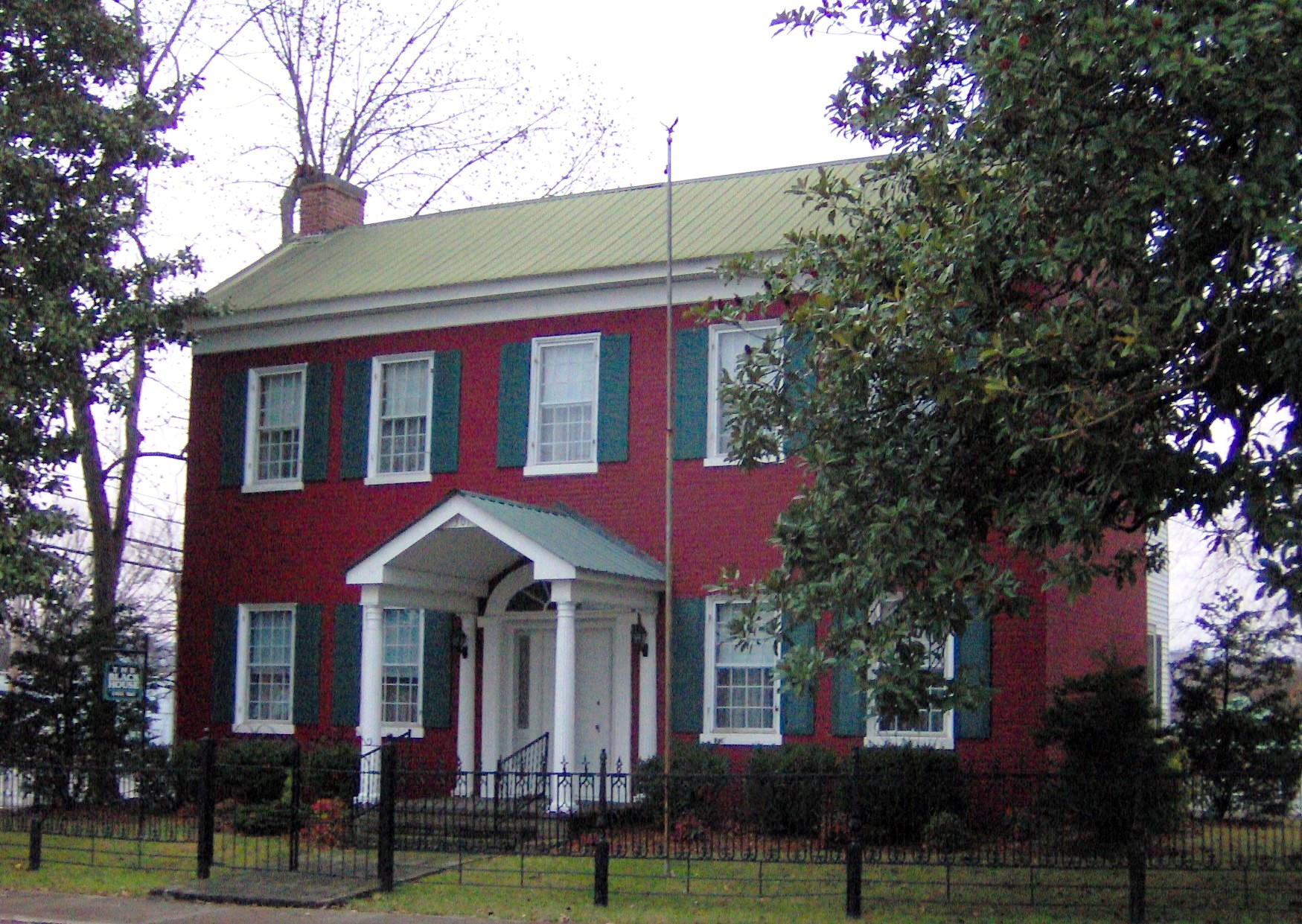
[3] Landmark name [4] Image Date listed Location City or town Summary 1 Black House 
November 17, 1983 301 W. Main St.
35°40′52″N 85°46′34″W / 35.681111°N 85.776111°WMcMinnville 2 Cardwell Mountain December 14, 1978 2.5 miles south-southeast of Union
35°40′56″N 85°40′49″W / 35.68222°N 85.68028°W[5]Union 3 City Cemetery November 21, 2002 S. High St.
35°40′41″N 85°46′36″W / 35.678056°N 85.776667°WMcMinnville 4 Falconhurst August 26, 1982 North of McMinnville on Faulkner Springs Rd.
35°42′57″N 85°46′03″W / 35.715833°N 85.7675°WMcMinnville 5 Clay Faulkner House March 5, 1992 Junction of Faulkner Springs and Flood Rds.
35°43′01″N 85°45′42″W / 35.716944°N 85.761667°WFaulkner Springs 6 First Methodist Church November 15, 2002 200 W. Main St.
35°40′54″N 85°46′29″W / 35.681667°N 85.774722°WMcMinnville 7 First Presbyterian Church September 13, 1995 205 W. Main St.
35°40′52″N 85°46′31″W / 35.681111°N 85.775278°WMcMinnville 8 Great Falls Cotton Mill 
August 26, 1982 West of Rock Island off U.S. Route 70S
35°48′09″N 85°37′31″W / 35.8025°N 85.625278°WRock Island 9 Great Falls Hydroelectric Station 
July 5, 1990 Off U.S. Route 70 at mile 91.1 on the Caney Fork
35°48′07″N 85°37′19″W / 35.801944°N 85.621944°WRock Island Extends into White County 10 William H. and Edgar Magness Community House and Library November 4, 1993 118 W. Main St.
35°40′53″N 85°46′27″W / 35.681389°N 85.774167°WMcMinnville 11 Martin-Miller Farm July 22, 2005 1597 Old Rock Island Rd.
35°44′26″N 85°40′19″W / 35.740556°N 85.671944°WRowland Station 12 McMinnville Hydroelectric Station February 26, 1990 State Route 55 bypass at the Barren Fork
35°40′29″N 85°46′36″W / 35.674722°N 85.776667°WMcMinnville 13 My Grandfather's House April 4, 1985 U.S. Route 70S
35°41′35″N 85°48′14″W / 35.693056°N 85.803889°WMcMinnville 14 Myers Mound December 14, 1978 Address Restricted McMinnville 15 Northcutt Plantation 
May 12, 1975 7 miles southwest of McMinnville off State Route 108 on Wheeler Lane
35°36′19″N 85°51′04″W / 35.605278°N 85.851111°WMcMinnville 16 Oakham August 11, 1983 U.S. Route 70 bypass
35°41′54″N 85°44′38″W / 35.698333°N 85.743889°WMcMinnville 17 Philadelphia Church of Christ November 17, 1988 Vervilla Rd.
35°35′33″N 85°52′19″W / 35.5925°N 85.871944°WVervilla 18 Spring Street Service Station November 21, 2001 200 N. Spring St.
35°40′55″N 85°46′17″W / 35.681944°N 85.771389°WMcMinnville 19 Stone-Pennebaker House November 17, 1988 229 Towles Ave.
35°41′34″N 85°46′16″W / 35.692778°N 85.771111°WMcMinnville 20 US Post Office-Main December 3, 1985 Morford St. and Court Sq.
35°40′54″N 85°46′21″W / 35.681667°N 85.7725°WMcMinnville 21 Edgar Walling House July 5, 1996 406 N. Spring St.
35°41′03″N 85°46′12″W / 35.684167°N 85.77°WMcMinnville 22 Joseph Daniel Walling House August 6, 1980 River Cliff and Old Viola Rds.
35°40′16″N 85°46′37″W / 35.671111°N 85.776944°WMcMinnville See also
- List of National Historic Landmarks in Tennessee
- National Register of Historic Places listings in Tennessee
References
- ^ The latitude and longitude information provided in this table was derived originally from the National Register Information System, which has been found to be fairly accurate for about 99% of listings. For about 1% of NRIS original coordinates, experience has shown that one or both coordinates are typos or otherwise extremely far off; some corrections may have been made. A more subtle problem causes many locations to be off by up to 150 yards, depending on location in the country: most NRIS coordinates were derived from tracing out latitude and longitudes off of USGS topographical quadrant maps created under the North American Datum of 1927, which differs from the current, highly accurate WGS84 GPS system used by Google maps. Chicago is about right, but NRIS longitudes in Washington are higher by about 4.5 seconds, and are lower by about 2.0 seconds in Maine. Latitudes differ by about 1.0 second in Florida. Some locations in this table may have been corrected to current GPS standards.
- ^ "National Register of Historic Places: Weekly List Actions". National Park Service, United States Department of the Interior. Retrieved on November 10, 2011.
- ^ Numbers represent an ordering by significant words. Various colorings, defined here, differentiate National Historic Landmark sites and National Register of Historic Places Districts from other NRHP buildings, structures, sites or objects.
- ^ "National Register Information System". National Register of Historic Places. National Park Service. . http://nrhp.focus.nps.gov/natreg/docs/All_Data.html.
- ^ Location derived from its GNIS feature record
U.S. National Register of Historic Places Topics Lists by states Alabama • Alaska • Arizona • Arkansas • California • Colorado • Connecticut • Delaware • Florida • Georgia • Hawaii • Idaho • Illinois • Indiana • Iowa • Kansas • Kentucky • Louisiana • Maine • Maryland • Massachusetts • Michigan • Minnesota • Mississippi • Missouri • Montana • Nebraska • Nevada • New Hampshire • New Jersey • New Mexico • New York • North Carolina • North Dakota • Ohio • Oklahoma • Oregon • Pennsylvania • Rhode Island • South Carolina • South Dakota • Tennessee • Texas • Utah • Vermont • Virginia • Washington • West Virginia • Wisconsin • WyomingLists by territories Lists by associated states Other Municipalities and communities of Warren County, Tennessee City 
Towns Centertown | Morrison | Viola
Unincorporated
communitiesBethany | Campaign | Dibrell | Rock Island | Smartt
Categories:- National Register of Historic Places in Tennessee by county
- Warren County, Tennessee
- Buildings and structures in Warren County, Tennessee
-


Wikimedia Foundation. 2010.