- National Register of Historic Places listings in Wilson County, Tennessee
-
 Location of Wilson County in Tennessee
This is a list of the National Register of Historic Places listings in Wilson County, Tennessee.
This is intended to be a complete list of the properties and districts on the National Register of Historic Places in Wilson County, Tennessee, United States. Latitude and longitude coordinates are provided for many National Register properties and districts; these locations may be seen together in a Google map.[1]
There are 24 properties and districts listed on the National Register in the county.
Contents: Counties in Tennessee Anderson – Bedford – Benton – Bledsoe – Blount – Bradley – Campbell – Cannon – Carroll – Carter – Cheatham – Chester – Claiborne – Clay – Cocke – Coffee – Crockett – Cumberland – Davidson – Decatur – DeKalb – Dickson – Dyer – Fayette – Fentress – Franklin – Gibson – Giles – Grainger – Greene – Grundy – Hamblen – Hamilton – Hancock – Hardeman – Hardin – Hawkins – Haywood – Henderson – Henry – Hickman – Houston – Humphreys – Jackson – Jefferson – Johnson – Knox – Lake – Lauderdale – Lawrence – Lewis – Lincoln – Loudon – Macon – Madison – Marion – Marshall – Maury – McMinn – McNairy – Meigs – Monroe – Montgomery – Moore – Morgan – Obion – Overton – Perry – Pickett – Polk – Putnam – Rhea – Roane – Robertson – Rutherford – Scott – Sequatchie – Sevier – Shelby – Smith – Stewart – Sullivan – Sumner – Tipton – Trousdale – Unicoi – Union – Van Buren – Warren – Washington – Wayne – Weakley – White – Williamson – Wilson -
- This National Park Service list is complete through NPS recent listings posted November 10, 2011.[2]
Current listings
[3] Landmark name [4] Image Date listed Location City or town Summary 1 Bailey Graveyard March 28, 1996 McKee Rd., west of Commerce
36°10′04″N 86°07′36″W / 36.167778°N 86.126667°WCommerce 2 Harry Bailey House March 15, 2000 423 Trousdale Ferry Rd.
36°12′33″N 86°16′07″W / 36.209167°N 86.268611°WLebanon 3 I.W.P. Buchanan House 
January 8, 1979 428 W. Main St.
36°12′31″N 86°18′02″W / 36.208611°N 86.300556°WLebanon Designed by Knoxville architect George F. Barber 4 Camp Bell 
April 15, 1982 Coles Ferry Pike
36°13′30″N 86°18′23″W / 36.225°N 86.306389°WLebanon 5 Dr. John Owen Campbell House 
December 8, 1980 West of Lebanon on U.S. Route 70
36°13′39″N 86°21′43″W / 36.2275°N 86.361944°WLebanon Built in 1842 6 Castle Heights Academy Historic District 
January 11, 1996 Junction of Castle Heights Ave., N. and Cadet Ct.
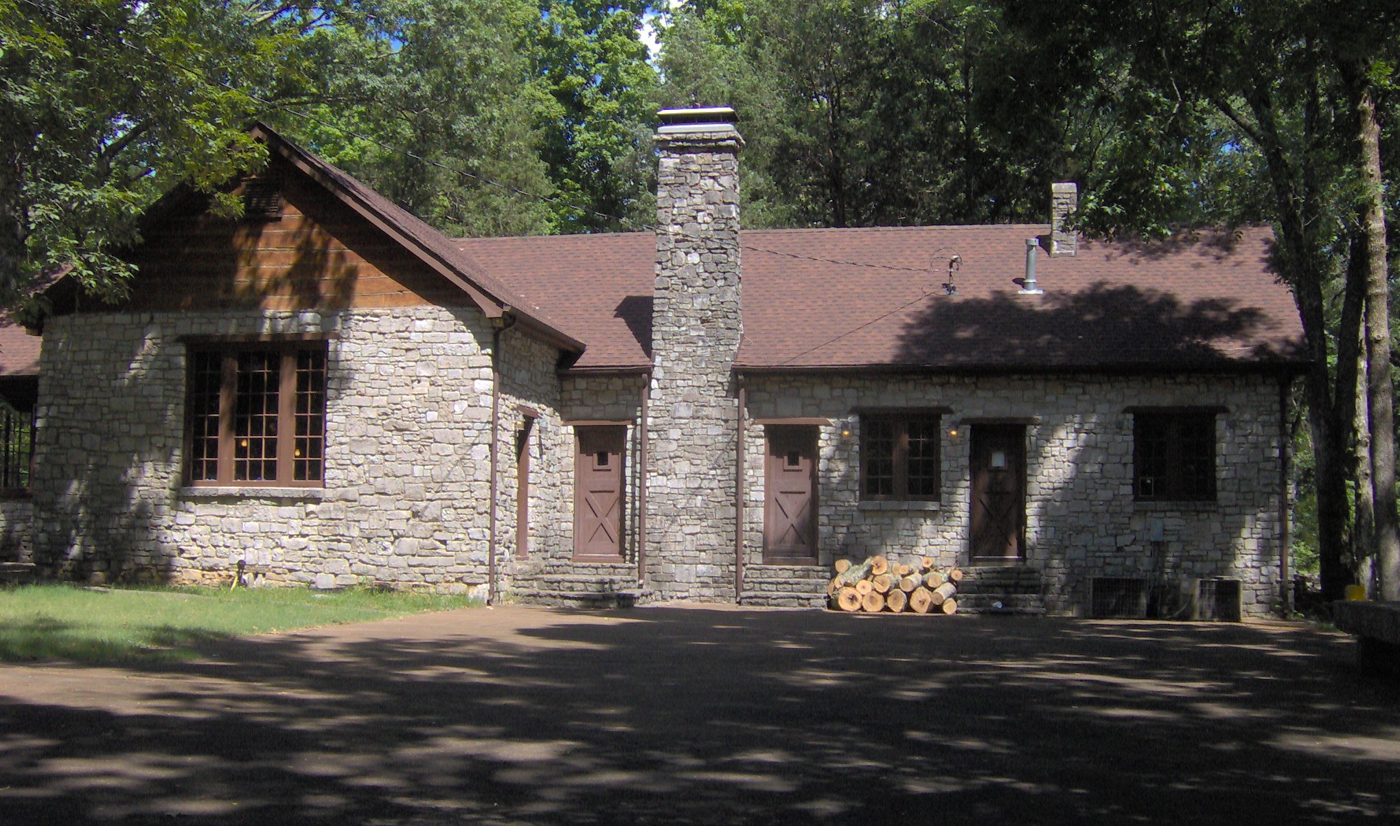
36°12′45″N 86°18′26″W / 36.2125°N 86.307222°WLebanon 7 Cedars of Lebanon State Park Historic District 
November 7, 1995 Cedar Forest Rd. in Cedars of Lebanon State Park
36°05′08″N 86°18′48″W / 36.085556°N 86.313333°WLebanon 8 Chandler Stone Wall July 19, 2001 Old Lebanon Rd., 2 miles west of Mount Juliet Rd.
36°11′23″N 86°33′06″W / 36.189722°N 86.551667°WMt. Juliet 9 John Cloyd House October 1, 1974 Northwest of Mount Juliet on U.S. Route 70
36°13′15″N 86°34′15″W / 36.220833°N 86.570833°WMt. Juliet 10 Fite-Fessenden House 
July 5, 1985 326 W. Main St.
36°12′30″N 86°17′42″W / 36.208333°N 86.295°WLebanon Actual street address is 236 W. Main; now houses the Wilson County Museum 11 Hale House-Patterson Hotel March 14, 1997 116 Depot St.
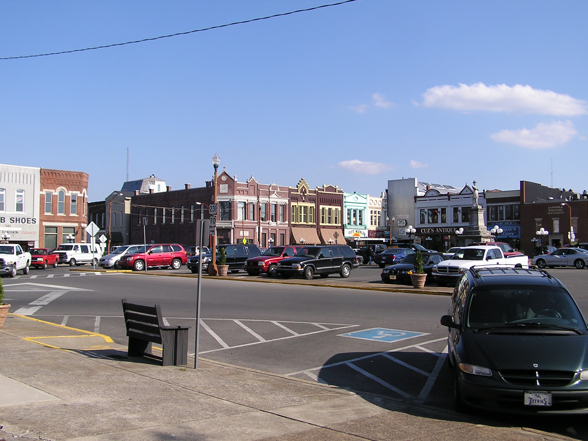
36°06′00″N 86°21′25″W / 36.1°N 86.356944°WWatertown 12 Lebanon Commercial Historic District 
November 18, 1999 Roughly around the public square, and 104-124 N. College, 105-115 N. Cumberland, 102-203 E. Main, and 103-122 E. Market St
36°12′29″N 86°17′27″W / 36.208056°N 86.290833°WLebanon 13 Lebanon Woolen Mills 
July 12, 2007 218 N. Maple St. Lebanon Now known as the Mill at Lebanon; currently being renovated as a shopping center 14 Memorial Hall, Cumberland University 
April 29, 1977 Cumberland University campus
36°12′14″N 86°18′00″W / 36.203889°N 86.3°WLebanon 15 Mitchell House 
December 6, 1979 W. Main St. on the grounds of Castle Heights Military Academy
36°12′40″N 86°18′29″W / 36.211111°N 86.308056°WLebanon Now serves as the corporate headquarters of the CBRL Group (Cracker Barrel) 16 Pickett Chapel Methodist Church 
April 18, 1977 E. Market St.
36°12′32″N 86°17′19″W / 36.208889°N 86.288611°WLebanon Built in 1827; currently being restored 17 Rest Hill Cemetery 
March 25, 1993 State Route 141 east of its junction with the State Route 24 bypass
36°12′35″N 86°16′13″W / 36.209722°N 86.270278°WLebanon 18 William Washington Seay House 
August 25, 1995 10575 Trousdale Ferry Pike
36°12′19″N 86°06′26″W / 36.205278°N 86.107222°WFlat Rock 19 Sellars Indian Mound 
December 11, 1972 Address Restricted Lebanon 20 Warner Price Mumford Smith House July 22, 1993 10277 Lebanon Rd.
36°13′56″N 86°29′49″W / 36.232222°N 86.496944°WMt. Juliet 21 Spring Creek Presbyterian Church November 8, 2000 Cainsville
36°05′34″N 86°14′20″W / 36.092778°N 86.238889°WDoaks Crossroads 22 Ida New and William Madison Turner Farm November 7, 1995 3964 Old Murfreesboro Rd.
36°09′02″N 86°19′36″W / 36.150556°N 86.326667°WLebanon 23 Watertown Commercial Historic District 
November 8, 2000 Roughly along Main St., Depot Ave., and Public Square
36°05′59″N 86°08′02″W / 36.099722°N 86.133889°WWatertown 24 Williamson Chapel CME Church Complex November 15, 2006 1576 Needmore Rd.
36°14′39″N 86°33′44″W / 36.244167°N 86.562222°WGreenlawn See also
- List of National Historic Landmarks in Tennessee
- National Register of Historic Places listings in Tennessee
References
- ^ The latitude and longitude information provided in this table was derived originally from the National Register Information System, which has been found to be fairly accurate for about 99% of listings. For about 1% of NRIS original coordinates, experience has shown that one or both coordinates are typos or otherwise extremely far off; some corrections may have been made. A more subtle problem causes many locations to be off by up to 150 yards, depending on location in the country: most NRIS coordinates were derived from tracing out latitude and longitudes off of USGS topographical quadrant maps created under the North American Datum of 1927, which differs from the current, highly accurate WGS84 GPS system used by Google maps. Chicago is about right, but NRIS longitudes in Washington are higher by about 4.5 seconds, and are lower by about 2.0 seconds in Maine. Latitudes differ by about 1.0 second in Florida. Some locations in this table may have been corrected to current GPS standards.
- ^ "National Register of Historic Places: Weekly List Actions". National Park Service, United States Department of the Interior. Retrieved on November 10, 2011.
- ^ Numbers represent an ordering by significant words. Various colorings, defined here, differentiate National Historic Landmark sites and National Register of Historic Places Districts from other NRHP buildings, structures, sites or objects.
- ^ "National Register Information System". National Register of Historic Places. National Park Service. . http://nrhp.focus.nps.gov/natreg/docs/All_Data.html.
U.S. National Register of Historic Places Topics Lists by states Alabama • Alaska • Arizona • Arkansas • California • Colorado • Connecticut • Delaware • Florida • Georgia • Hawaii • Idaho • Illinois • Indiana • Iowa • Kansas • Kentucky • Louisiana • Maine • Maryland • Massachusetts • Michigan • Minnesota • Mississippi • Missouri • Montana • Nebraska • Nevada • New Hampshire • New Jersey • New Mexico • New York • North Carolina • North Dakota • Ohio • Oklahoma • Oregon • Pennsylvania • Rhode Island • South Carolina • South Dakota • Tennessee • Texas • Utah • Vermont • Virginia • Washington • West Virginia • Wisconsin • WyomingLists by territories Lists by associated states Other Municipalities and communities of Wilson County, Tennessee Towns 
CDPs Unincorporated
communitiesBelinda City | Gladeville | LaGuardo | Norene | Statesville | Suggs Creek | Tuckers Crossroads
Categories:- National Register of Historic Places in Tennessee by county
- Wilson County, Tennessee
- Buildings and structures in Wilson County, Tennessee
-


Wikimedia Foundation. 2010.