- National Register of Historic Places listings in Bradley County, Tennessee
-
 Location of Bradley County in Tennessee
This is a list of the National Register of Historic Places listings in Bradley County, Tennessee.
This is intended to be a complete list of the properties and districts on the National Register of Historic Places in Bradley County, Tennessee, United States. Latitude and longitude coordinates are provided for many National Register properties and districts; these locations may be seen together in a Google map.[1]
There are 20 properties and districts listed on the National Register in the county.
Contents: Counties in Tennessee Anderson – Bedford – Benton – Bledsoe – Blount – Bradley – Campbell – Cannon – Carroll – Carter – Cheatham – Chester – Claiborne – Clay – Cocke – Coffee – Crockett – Cumberland – Davidson – Decatur – DeKalb – Dickson – Dyer – Fayette – Fentress – Franklin – Gibson – Giles – Grainger – Greene – Grundy – Hamblen – Hamilton – Hancock – Hardeman – Hardin – Hawkins – Haywood – Henderson – Henry – Hickman – Houston – Humphreys – Jackson – Jefferson – Johnson – Knox – Lake – Lauderdale – Lawrence – Lewis – Lincoln – Loudon – Macon – Madison – Marion – Marshall – Maury – McMinn – McNairy – Meigs – Monroe – Montgomery – Moore – Morgan – Obion – Overton – Perry – Pickett – Polk – Putnam – Rhea – Roane – Robertson – Rutherford – Scott – Sequatchie – Sevier – Shelby – Smith – Stewart – Sullivan – Sumner – Tipton – Trousdale – Unicoi – Union – Van Buren – Warren – Washington – Wayne – Weakley – White – Williamson – Wilson -
- This National Park Service list is complete through NPS recent listings posted November 10, 2011.[2]
Current listings
[3] Landmark name [4] Image Date listed Location City or town Summary 1 Blue Springs Encampments and Fortifications April 16, 1999 West of Blue Springs off Lead Mine Valley Rd., SW.
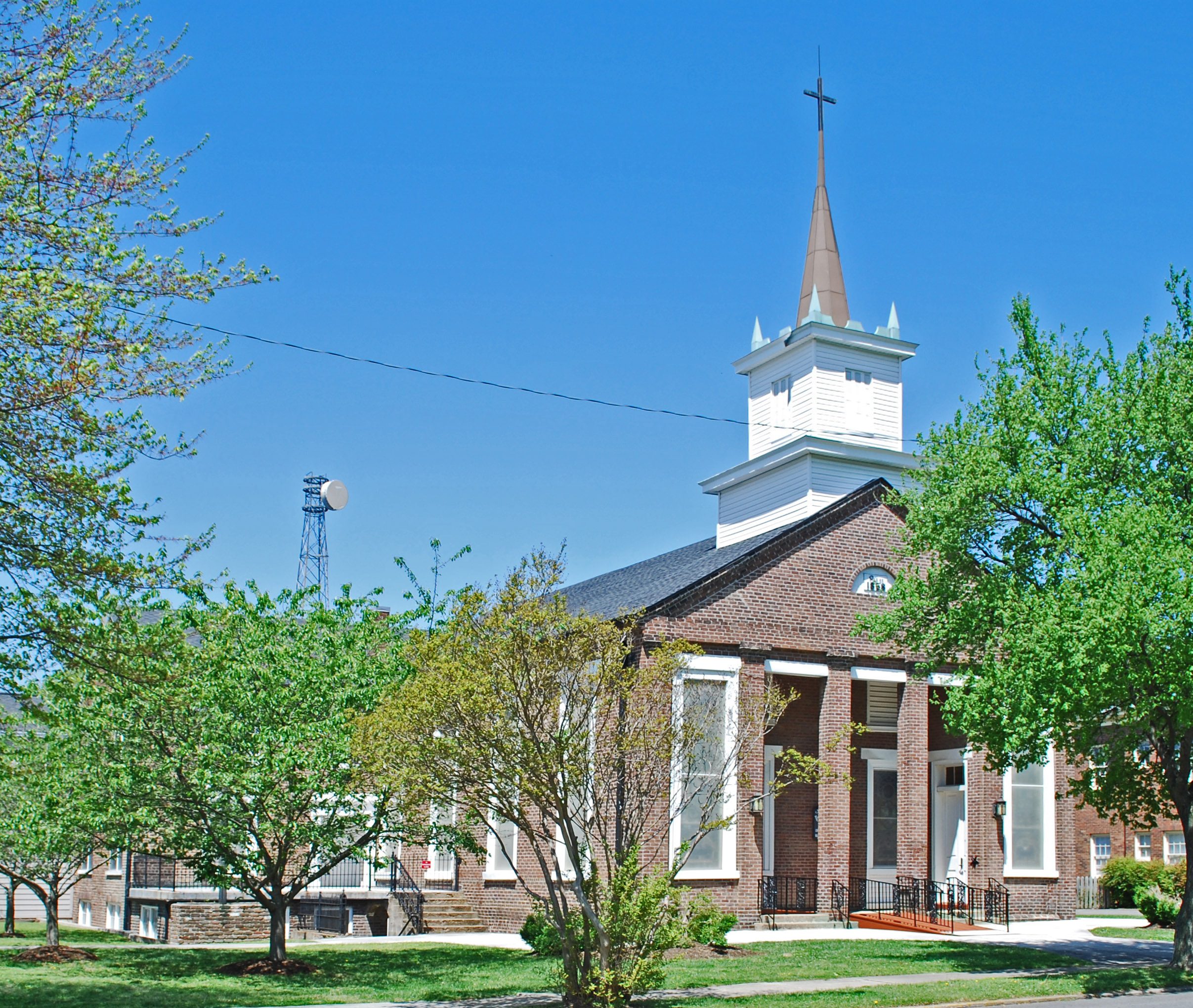
35°5′27″N 84°55′14″W / 35.09083°N 84.92056°W[5]Cleveland 2 Broad Street United Methodist Church 
April 5, 1984 263 Broad St., NW
35°09′08″N 84°52′34″W / 35.152222°N 84.876111°WCleveland 3 Centenary Avenue Historic District 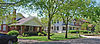
April 1, 1993 Roughly bounded by 8th, Harle, 13th, and Ocoee Sts.
35°10′03″N 84°52′29″W / 35.1675°N 84.874722°WCleveland 4 Charleston Cumberland Presbyterian Church July 12, 1984 Railroad St.
35°17′05″N 84°45′14″W / 35.284722°N 84.753889°WCharleston 5 Cleveland Southern Railway Depot 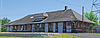
March 27, 2008 175 Edwards St.
35°09′24″N 84°52′23″W / 35.156667°N 84.873056°WCleveland 6 Cleveland to Charleston Concrete Highway January 10, 2008 Market and Water Sts.
35°17′14″N 84°45′05″W / 35.287222°N 84.751389°WCharleston 7 Hair Conrad Cabin September 13, 1976 433 Blythewood Rd., SW.
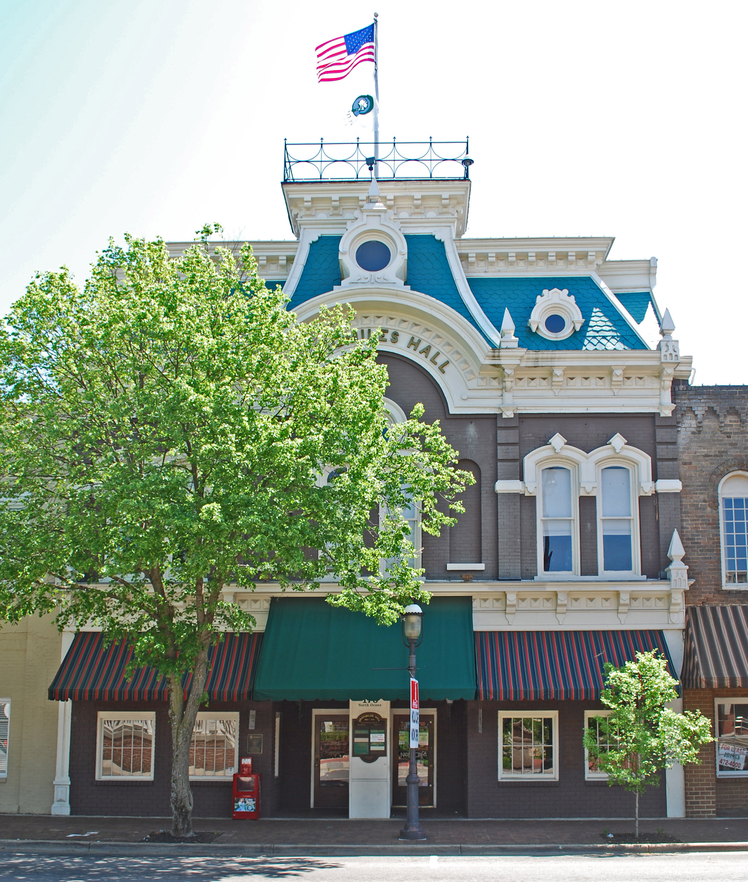
35°09′47″N 84°54′37″W / 35.163056°N 84.910278°WCleveland 8 Craigmiles Hall 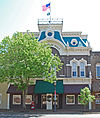
November 25, 1980 170 Ocoee St., NE.
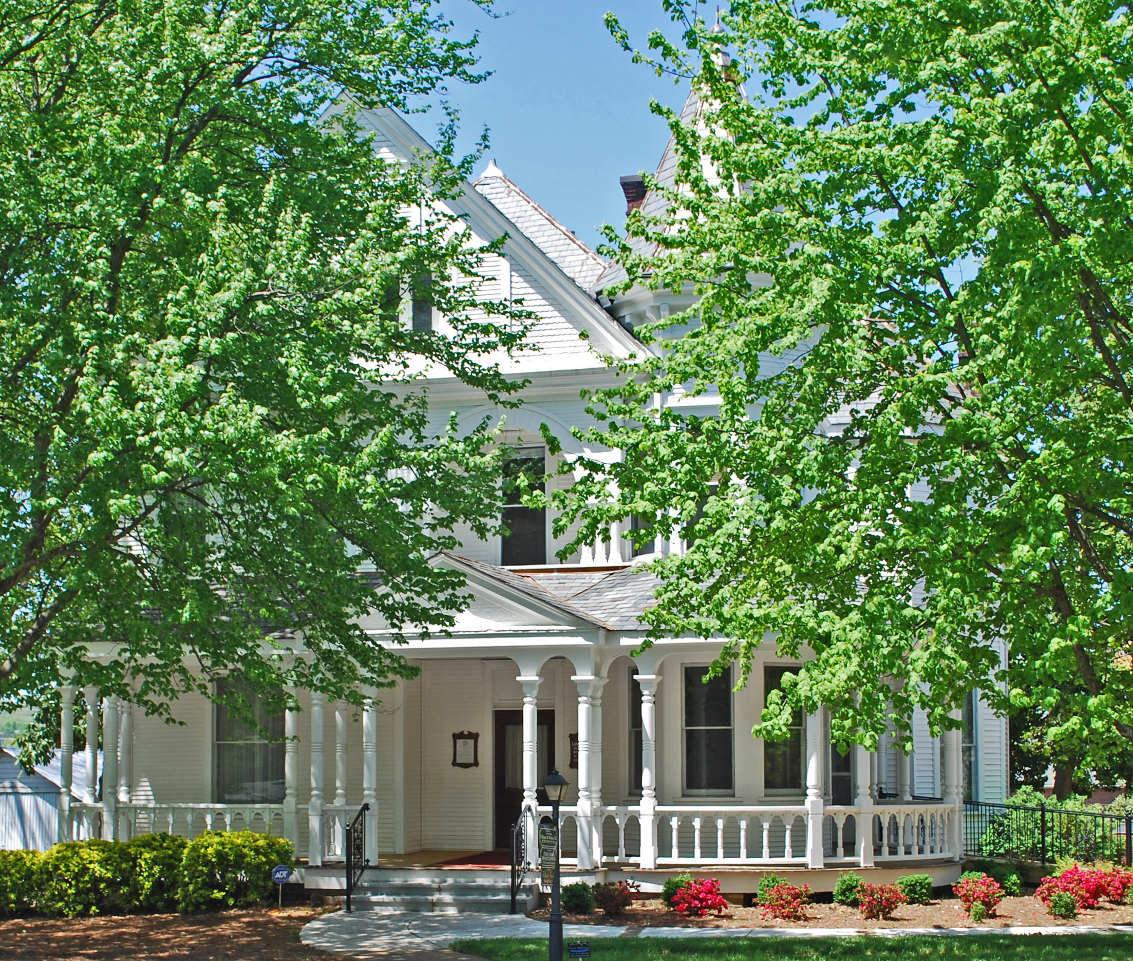
35°09′37″N 84°52′30″W / 35.160278°N 84.875°WCleveland 9 P.M. Craigmiles House 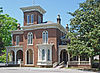
November 20, 1975 833 Ocoee St., NW.
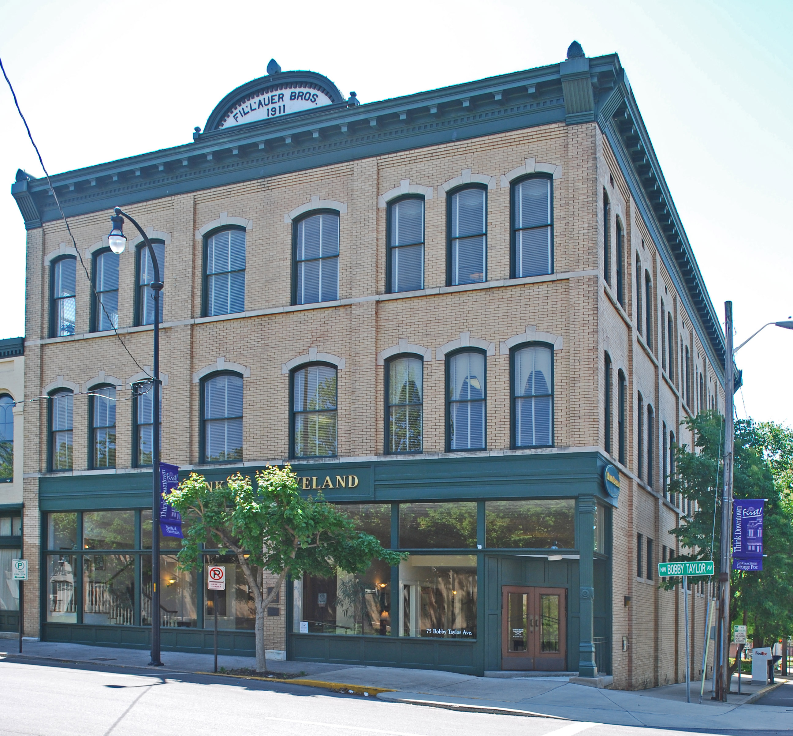
35°09′52″N 84°52′23″W / 35.164444°N 84.873056°WCleveland 10 Fillauer Brothers Building 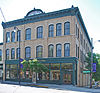
June 28, 1989 Broad and 1st Sts.
35°09′35″N 84°52′34″W / 35.159722°N 84.876111°WCleveland 11 First Presbyterian Church 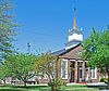
March 13, 1986 433 Ocoee St., NW.
35°09′44″N 84°52′25″W / 35.162222°N 84.873611°WCleveland 12 Hardwick Woolen Mills 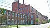
April 12, 2001 445 Church St., SE.
35°09′21″N 84°52′33″W / 35.155833°N 84.875833°WCleveland 13 Henegar House July 6, 1976 Market St.
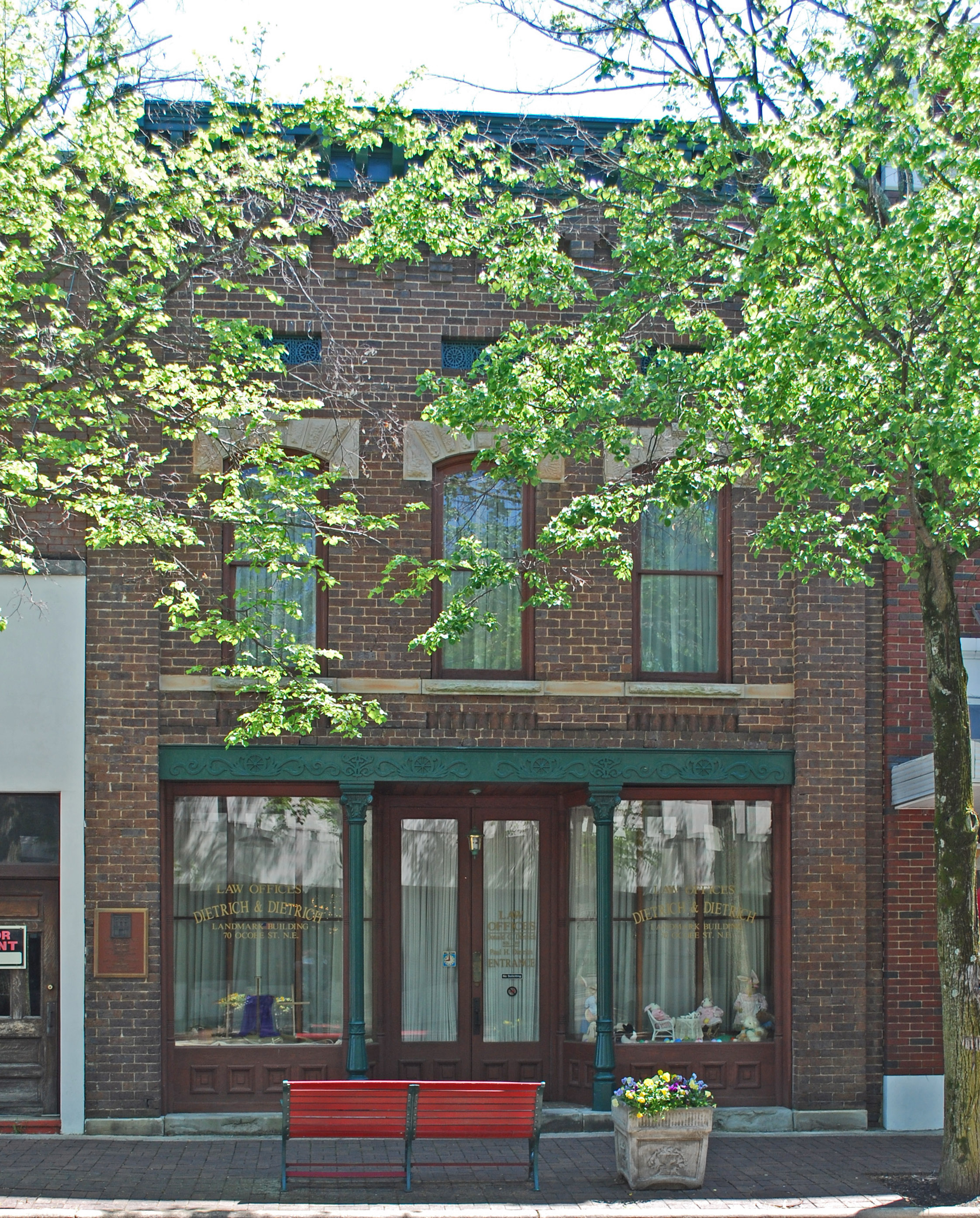
35°17′12″N 84°45′17″W / 35.286667°N 84.754722°WCharleston 14 W.J. Hughes Business House 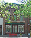
June 10, 1975 70 Ocoee St.
35°09′34″N 84°52′33″W / 35.159444°N 84.875833°WCleveland 15 Ocoee Street Historic District 
December 13, 1995 1455-1981 N. Ocoee St.
35°10′12″N 84°52′16″W / 35.17°N 84.871111°WCleveland 16 Rattlesnake Springs September 5, 1975 Northeast of Cleveland off Dry Valley Rd.
35°14′40″N 84°46′22″W / 35.244444°N 84.772778°WCleveland 17 Red Clay Council Ground September 14, 1972 13 miles south of Cleveland on Blue Springs Rd.
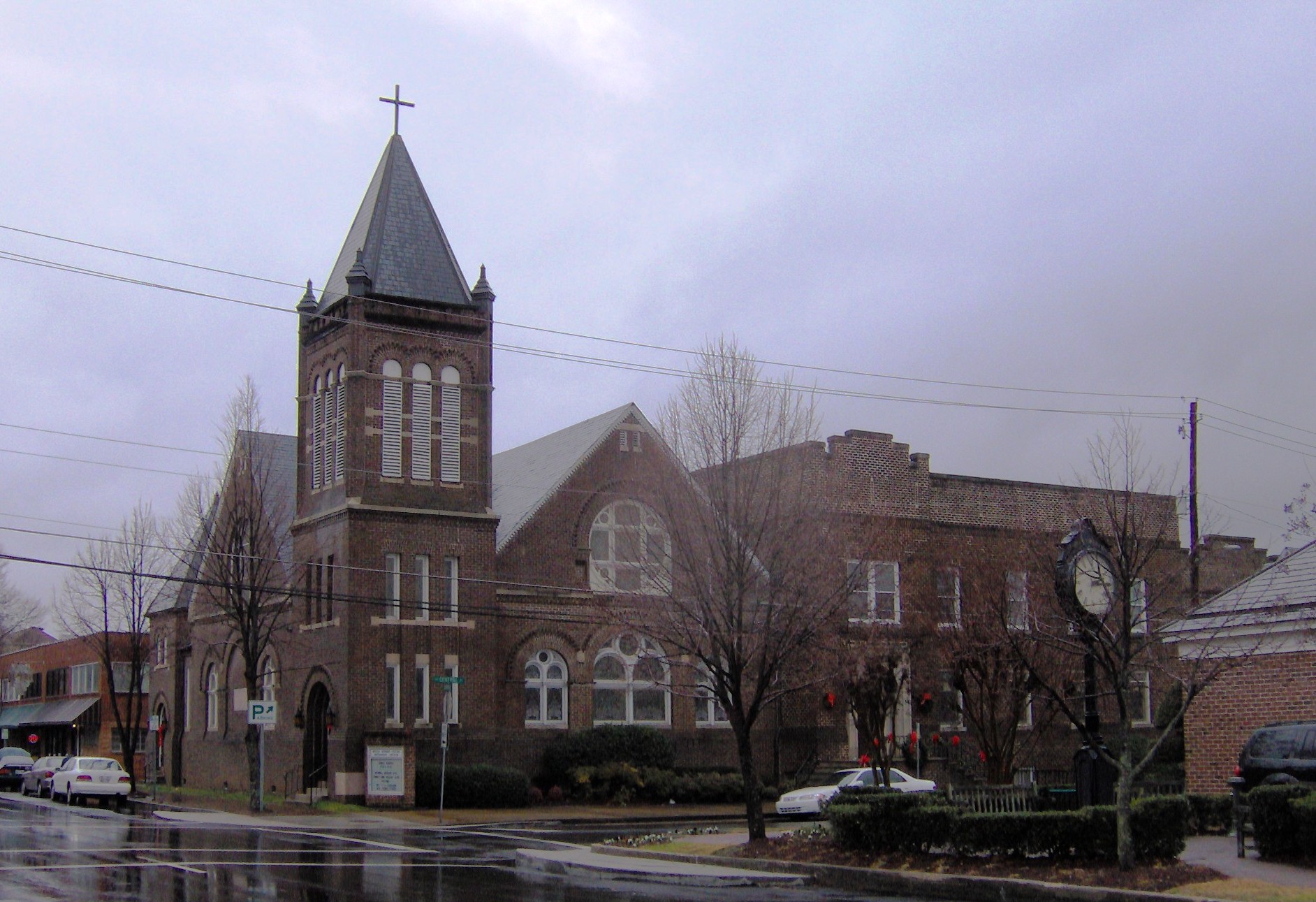
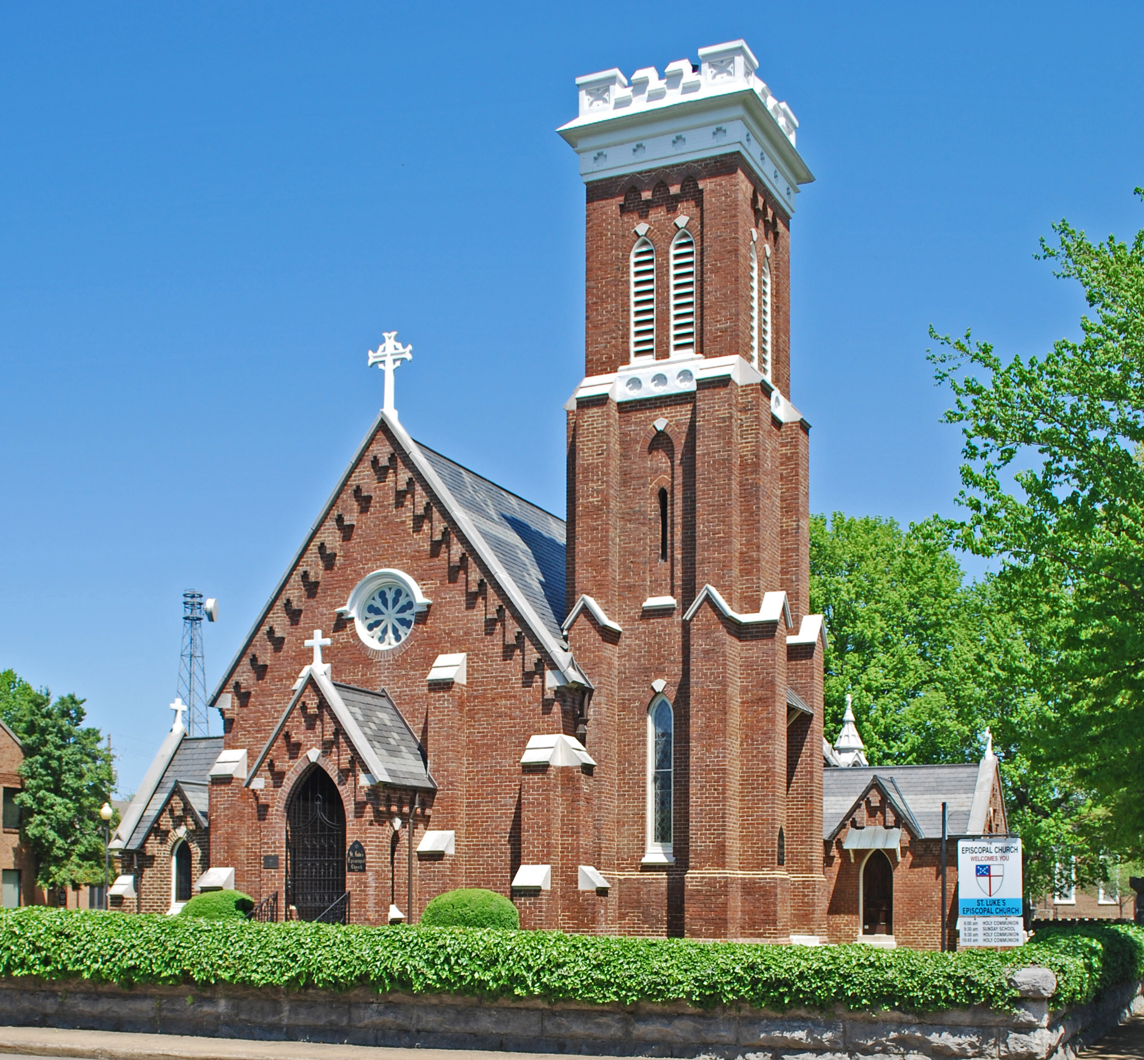
34°59′31″N 84°56′54″W / 34.991944°N 84.948333°WCleveland 18 St. Luke's Episcopal Church 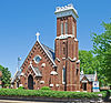
April 12, 1982 Ocoee and Central Sts., NW.
35°09′40″N 84°52′29″W / 35.161111°N 84.874722°WCleveland 19 Tipton-Fillauer House 
December 8, 1980 63 Broad St., NW.
35°09′36″N 84°52′36″W / 35.16°N 84.876667°WCleveland 20 U.S. Post Office 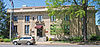
June 30, 1983 155 Board St., NW.
35°09′37″N 84°52′27″W / 35.160278°N 84.874167°WCleveland See also
- List of National Historic Landmarks in Tennessee
- National Register of Historic Places listings in Tennessee
References
- ^ The latitude and longitude information provided in this table was derived originally from the National Register Information System, which has been found to be fairly accurate for about 99% of listings. For about 1% of NRIS original coordinates, experience has shown that one or both coordinates are typos or otherwise extremely far off; some corrections may have been made. A more subtle problem causes many locations to be off by up to 150 yards, depending on location in the country: most NRIS coordinates were derived from tracing out latitude and longitudes off of USGS topographical quadrant maps created under the North American Datum of 1927, which differs from the current, highly accurate WGS84 GPS system used by Google maps. Chicago is about right, but NRIS longitudes in Washington are higher by about 4.5 seconds, and are lower by about 2.0 seconds in Maine. Latitudes differ by about 1.0 second in Florida. Some locations in this table may have been corrected to current GPS standards.
- ^ "National Register of Historic Places: Weekly List Actions". National Park Service, United States Department of the Interior. Retrieved on November 10, 2011.
- ^ Numbers represent an ordering by significant words. Various colorings, defined here, differentiate National Historic Landmark sites and National Register of Historic Places Districts from other NRHP buildings, structures, sites or objects.
- ^ "National Register Information System". National Register of Historic Places. National Park Service. . http://nrhp.focus.nps.gov/natreg/docs/All_Data.html.
- ^ Location derived from coordinates; the NRIS lists the site as "Address Restricted" but provides coordinates
U.S. National Register of Historic Places Topics Lists by states Alabama • Alaska • Arizona • Arkansas • California • Colorado • Connecticut • Delaware • Florida • Georgia • Hawaii • Idaho • Illinois • Indiana • Iowa • Kansas • Kentucky • Louisiana • Maine • Maryland • Massachusetts • Michigan • Minnesota • Mississippi • Missouri • Montana • Nebraska • Nevada • New Hampshire • New Jersey • New Mexico • New York • North Carolina • North Dakota • Ohio • Oklahoma • Oregon • Pennsylvania • Rhode Island • South Carolina • South Dakota • Tennessee • Texas • Utah • Vermont • Virginia • Washington • West Virginia • Wisconsin • WyomingLists by territories Lists by associated states Other Municipalities and communities of Bradley County, Tennessee Cities 
CDPs East Cleveland | Hopewell | South Cleveland | Wildwood Lake
Unincorporated
communitiesGeorgetown‡ | Hopewell Estates
Footnotes ‡This populated place also has portions in an adjacent county or counties
Categories:- National Register of Historic Places in Tennessee by county
- Bradley County, Tennessee
- Buildings and structures in Bradley County, Tennessee
-


Wikimedia Foundation. 2010.