- National Register of Historic Places listings in Anderson County, Tennessee
-
 Location of Anderson County in Tennessee
This is a list of the National Register of Historic Places listings in Anderson County, Tennessee.
This is intended to be a complete list of the properties and districts on the National Register of Historic Places in Anderson County, Tennessee, United States. Latitude and longitude coordinates are provided for many National Register properties and districts; these locations may be seen together in a Google map.[1]
Seventeen properties and districts in the county are listed on the National Register.
Contents: Counties in Tennessee Anderson – Bedford – Benton – Bledsoe – Blount – Bradley – Campbell – Cannon – Carroll – Carter – Cheatham – Chester – Claiborne – Clay – Cocke – Coffee – Crockett – Cumberland – Davidson – Decatur – DeKalb – Dickson – Dyer – Fayette – Fentress – Franklin – Gibson – Giles – Grainger – Greene – Grundy – Hamblen – Hamilton – Hancock – Hardeman – Hardin – Hawkins – Haywood – Henderson – Henry – Hickman – Houston – Humphreys – Jackson – Jefferson – Johnson – Knox – Lake – Lauderdale – Lawrence – Lewis – Lincoln – Loudon – Macon – Madison – Marion – Marshall – Maury – McMinn – McNairy – Meigs – Monroe – Montgomery – Moore – Morgan – Obion – Overton – Perry – Pickett – Polk – Putnam – Rhea – Roane – Robertson – Rutherford – Scott – Sequatchie – Sevier – Shelby – Smith – Stewart – Sullivan – Sumner – Tipton – Trousdale – Unicoi – Union – Van Buren – Warren – Washington – Wayne – Weakley – White – Williamson – Wilson -
- This National Park Service list is complete through NPS recent listings posted November 10, 2011.[2]
Current listings
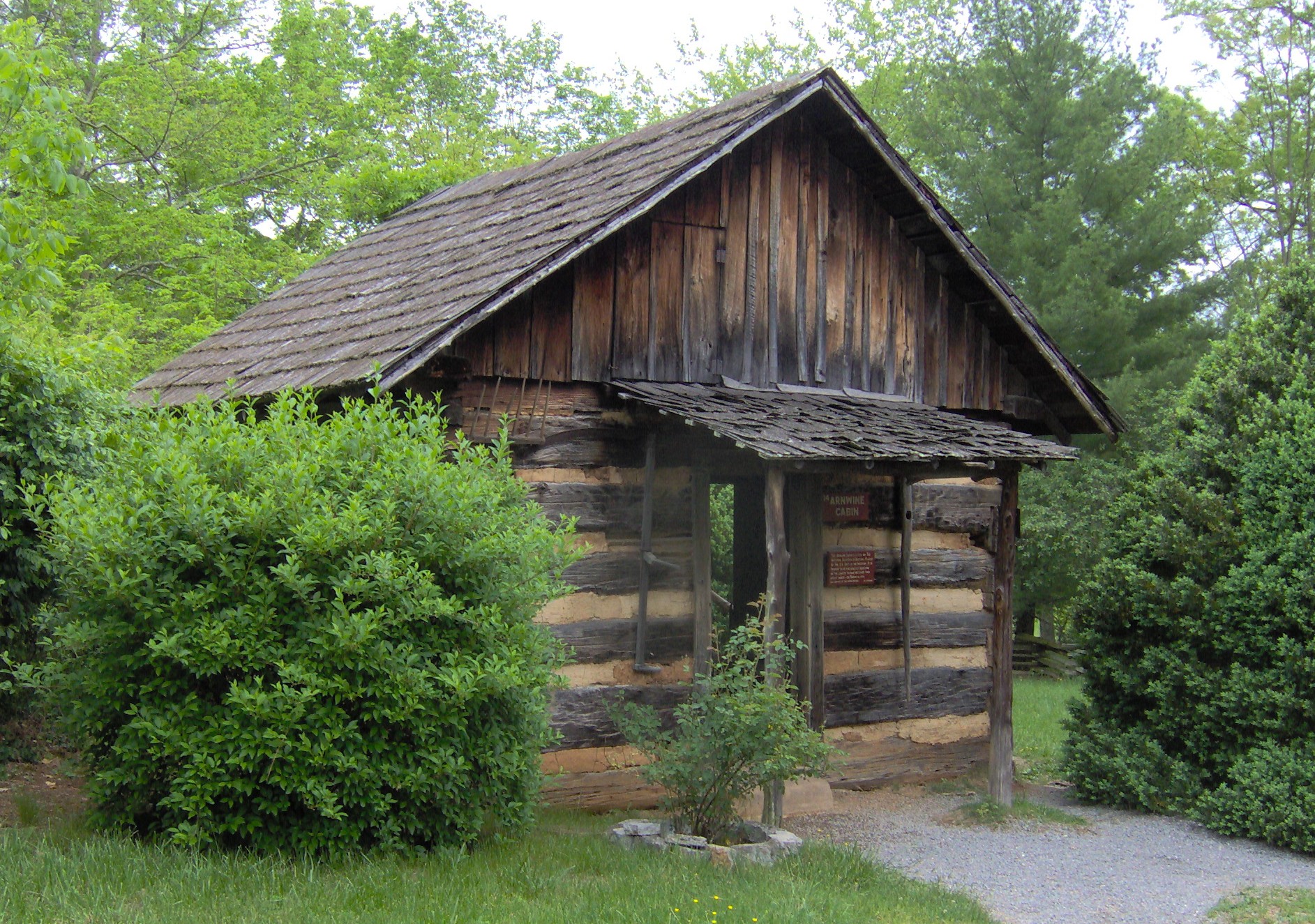
[3] Landmark name [4] Image Date listed Location City or town Summary 1 Arnwine Cabin 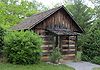
March 16, 1976 State Route 61
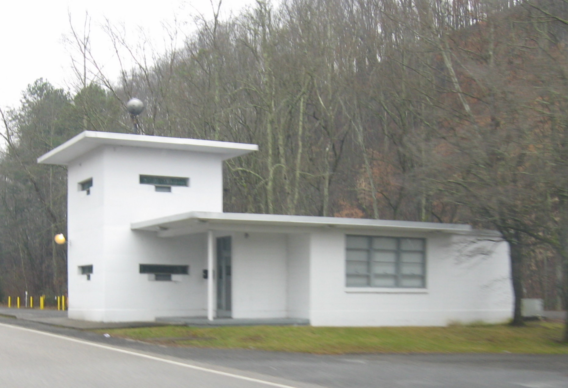
36°10′53″N 84°04′10″W / 36.181389°N 84.069444°WNorris Part of the collection of the Museum of Appalachia 2 Bear Creek Road Checking Station 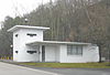
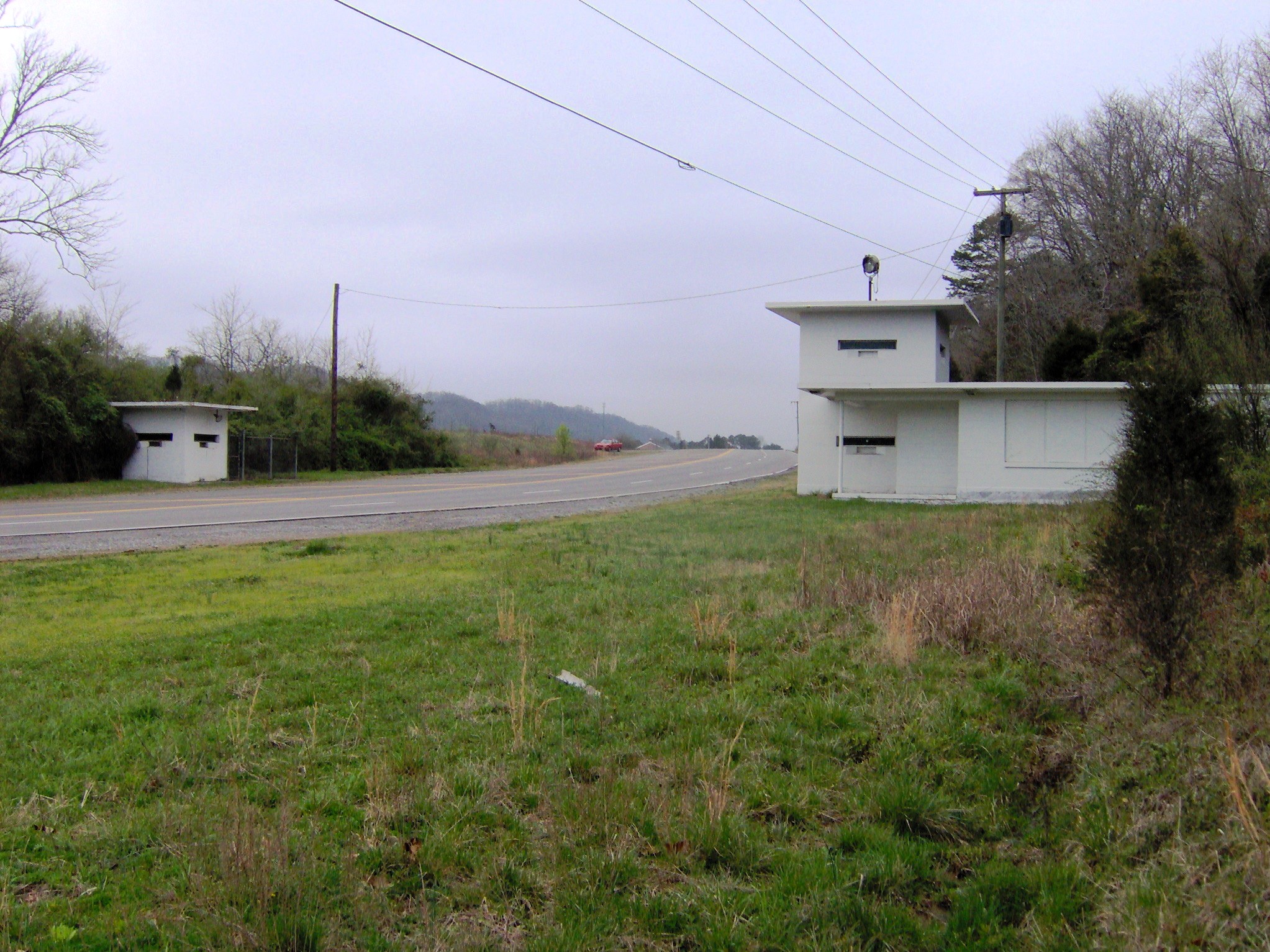
May 6, 1992 Junction of S. Illinois Ave. and Bear Creek Rd.
35°59′57″N 84°14′35″W / 35.999167°N 84.243056°WOak Ridge 3 Bethel Valley Road Checking Station 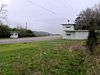
May 6, 1992 Junction of Bethel Valley and Scarboro Rds.
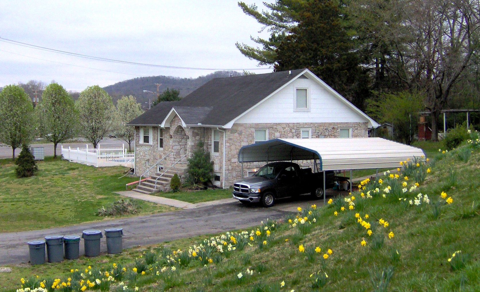
35°59′13″N 84°13′02″W / 35.986944°N 84.217222°WOak Ridge 4 Luther Brannon House 
September 5, 1991 151 Oak Ridge Turnpike
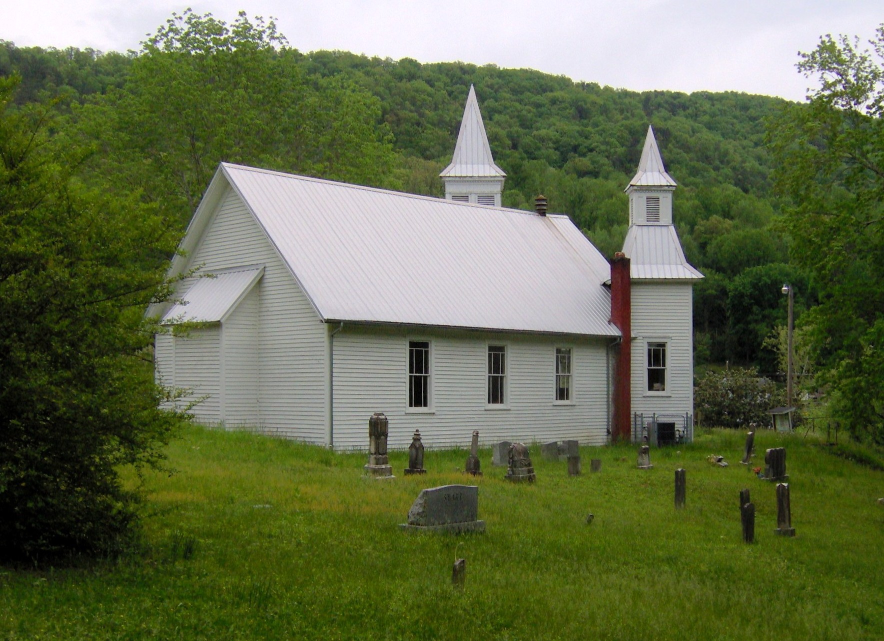
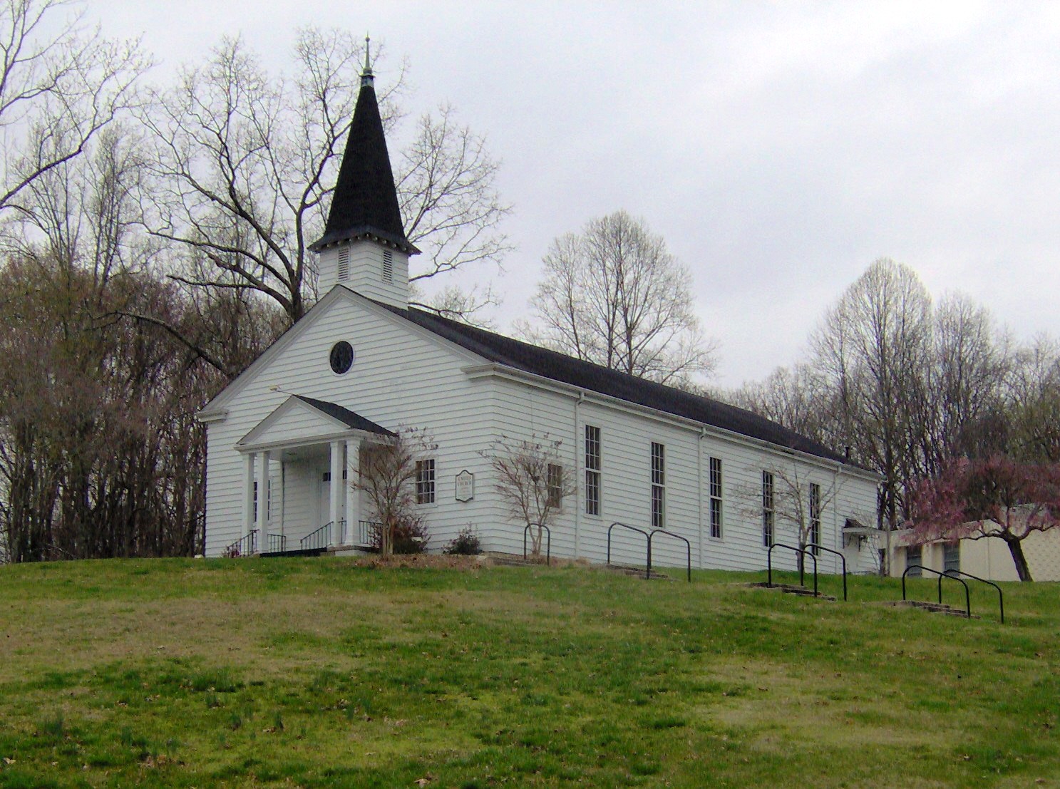
36°02′40″N 84°12′34″W / 36.044444°N 84.209444°WOak Ridge 5 Briceville Community Church and Cemetery 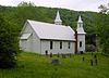
July 24, 2003 State Route 116
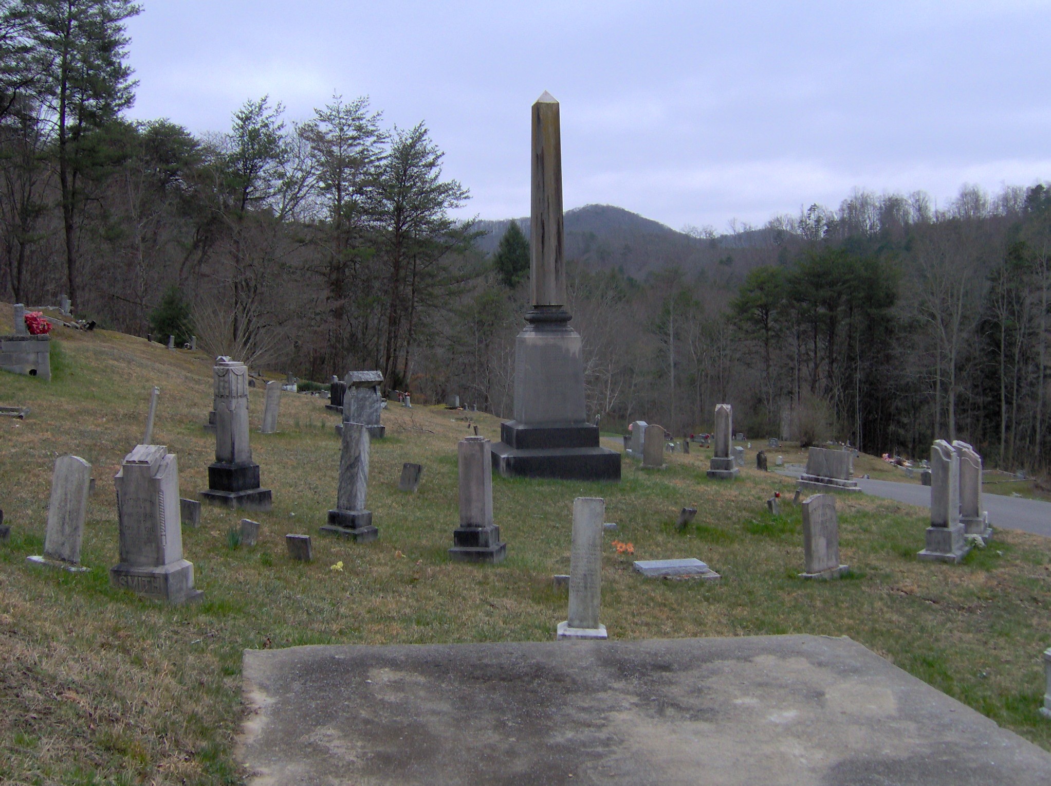
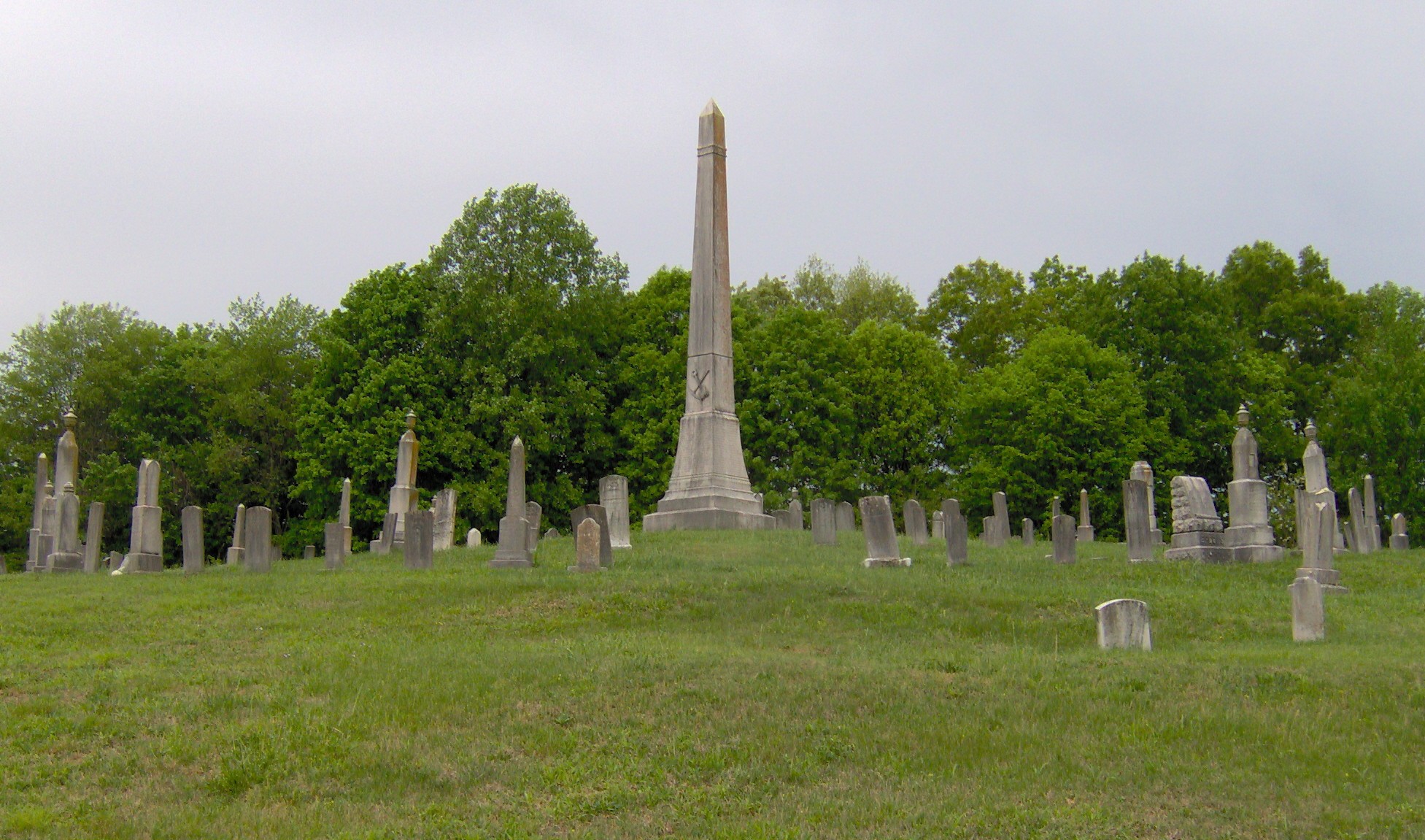
36°10′43″N 84°10′59″W / 36.178611°N 84.183056°WBriceville Rural Gothic Revival church, now primarily a community center 6 Cross Mountain Miners' Circle 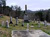
March 15, 2006 Circle Cemetery Ln.
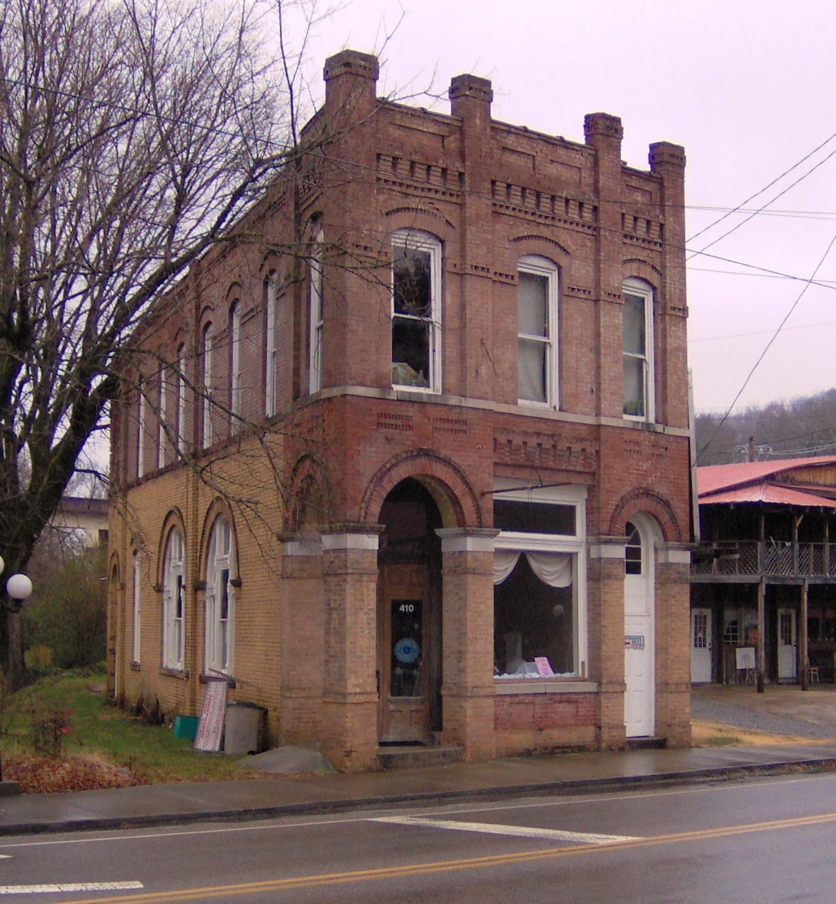
36°10′26″N 84°11′11″W / 36.173889°N 84.186389°WBriceville 7 Daugherty Furniture Building November 29, 2010 307 N. Main St.
36°06′09″N 84°07′55″W / 36.1025°N 84.131944°WClinton 8 Edwards-Fowler House May 29, 1975 3½ miles south of Lake City on Dutch Valley Rd.
36°10′18″N 84°10′03″W / 36.171667°N 84.1675°WLake City 9 Fraterville Miners' Circle 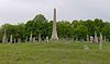
January 5, 2005 Leach Cemetery Lane
36°12′39″N 84°08′25″W / 36.210833°N 84.140278°WFraterville 10 Freels Cabin May 6, 1992 Freels Bend Rd.
35°57′48″N 84°13′25″W / 35.963333°N 84.223611°WOak Ridge 11 J. B. Jones House September 5, 1991 Old Edgemoor Road between Bethel Valley Road and Melton Hill Lake
36°00′33″N 84°10′09″W / 36.009167°N 84.169167°WOak Ridge 12 Green McAdoo School 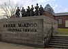
November 8, 2005 101 School St.
36°06′16″N 84°08′24″W / 36.104444°N 84.14°WClinton 13 Norris District 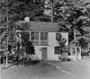
July 10, 1975 City of Norris on U.S. Route 441
36°11′47″N 84°04′08″W / 36.196389°N 84.068889°WNorris 14 Oak Ridge Historic District 
September 5, 1991 Roughly bounded by East Drive, West Outer Drive, Louisiana Avenue, and Tennessee Avenue
36°01′41″N 84°15′10″W / 36.028056°N 84.252778°WOak Ridge Contributing properties in the historic district include United Church, The Chapel on the Hill, the Alexander Inn, and the elementary school now occupied by the Children's Museum of Oak Ridge. 15 Oliver Springs Banking Company 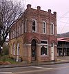
April 14, 1992 110 E. Tri County Boulevard
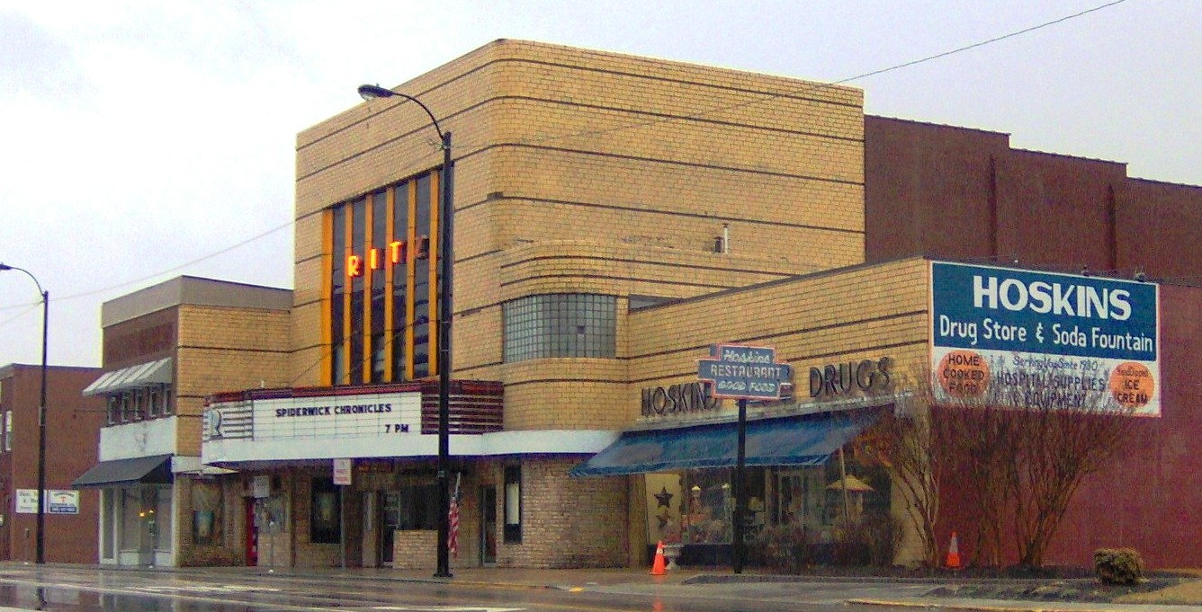
36°02′43″N 84°20′23″W / 36.045278°N 84.339722°WOliver Springs 16 Ritz Theatre and Hoskins Rexall Drug Store No. 2 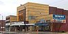
December 4, 1998 111-121 N. Main St.
36°06′00″N 84°07′59″W / 36.1°N 84.133056°WClinton Hoskins Drug Store is a family-owned business that was established on Market Street in Clinton in 1930 by R.C. "Dudley" Hoskins. The Main Street location, which is part of the National Register listing, opened in 1947. At one time there were as many as 13 Hoskins stores in East Tennessee.[5] 17 Woodland-Scarboro Historic District September 5, 1991 Roughly bounded by Rutgers Avenue, Lafayette Drive, Benedict Avenue, Wilberforce Avenue, and Illinois Avenue
36°00′16″N 84°15′06″W / 36.004444°N 84.251667°WOak Ridge See also
- List of National Historic Landmarks in Tennessee
- National Register of Historic Places listings in Tennessee
References
- ^ The latitude and longitude information provided in this table was derived originally from the National Register Information System, which has been found to be fairly accurate for about 99% of listings. For about 1% of NRIS original coordinates, experience has shown that one or both coordinates are typos or otherwise extremely far off; some corrections may have been made. A more subtle problem causes many locations to be off by up to 150 yards, depending on location in the country: most NRIS coordinates were derived from tracing out latitude and longitudes off of USGS topographical quadrant maps created under the North American Datum of 1927, which differs from the current, highly accurate WGS84 GPS system used by Google maps. Chicago is about right, but NRIS longitudes in Washington are higher by about 4.5 seconds, and are lower by about 2.0 seconds in Maine. Latitudes differ by about 1.0 second in Florida. Some locations in this table may have been corrected to current GPS standards.
- ^ "National Register of Historic Places: Weekly List Actions". National Park Service, United States Department of the Interior. Retrieved on November 10, 2011.
- ^ Numbers represent an ordering by significant words. Various colorings, defined here, differentiate National Historic Landmark sites and National Register of Historic Places Districts from other NRHP buildings, structures, sites or objects.
- ^ "National Register Information System". National Register of Historic Places. National Park Service. . http://nrhp.focus.nps.gov/natreg/docs/All_Data.html.
- ^ Clayton Hensley, Hoskins stores celebrate 80th anniversary; Pharmacy carries everything from gifts to soda fountain, Knoxville News Sentinel, April 29, 2010
U.S. National Register of Historic Places Topics Lists by states Alabama • Alaska • Arizona • Arkansas • California • Colorado • Connecticut • Delaware • Florida • Georgia • Hawaii • Idaho • Illinois • Indiana • Iowa • Kansas • Kentucky • Louisiana • Maine • Maryland • Massachusetts • Michigan • Minnesota • Mississippi • Missouri • Montana • Nebraska • Nevada • New Hampshire • New Jersey • New Mexico • New York • North Carolina • North Dakota • Ohio • Oklahoma • Oregon • Pennsylvania • Rhode Island • South Carolina • South Dakota • Tennessee • Texas • Utah • Vermont • Virginia • Washington • West Virginia • Wisconsin • WyomingLists by territories Lists by associated states Other Municipalities and communities of Anderson County, Tennessee Cities 
Towns Unincorporated
communitiesAndersonville | Briceville | Claxton | Devonia | Fork Mountain | Fraterville | Marlow
Footnotes ‡This populated place also has portions in an adjacent county or counties
Categories:- Anderson County, Tennessee
- National Register of Historic Places in Tennessee by county
- Buildings and structures in Anderson County, Tennessee
-


Wikimedia Foundation. 2010.