- Oak Ridge gatehouses
-
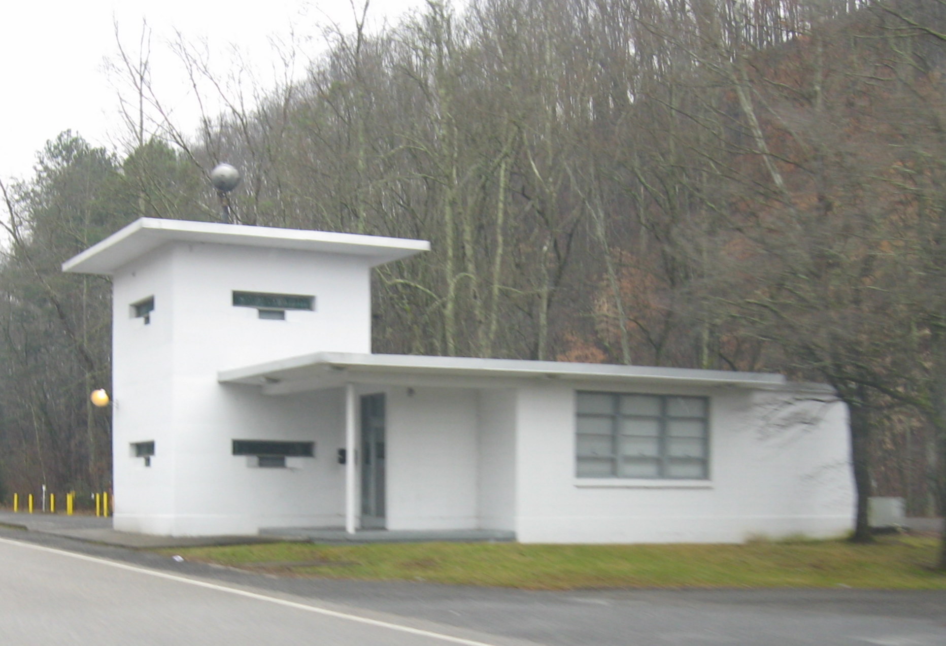
 Bethel Valley Road gatehouse, intended to control access to the Oak Ridge National Laboratory (X-10) site

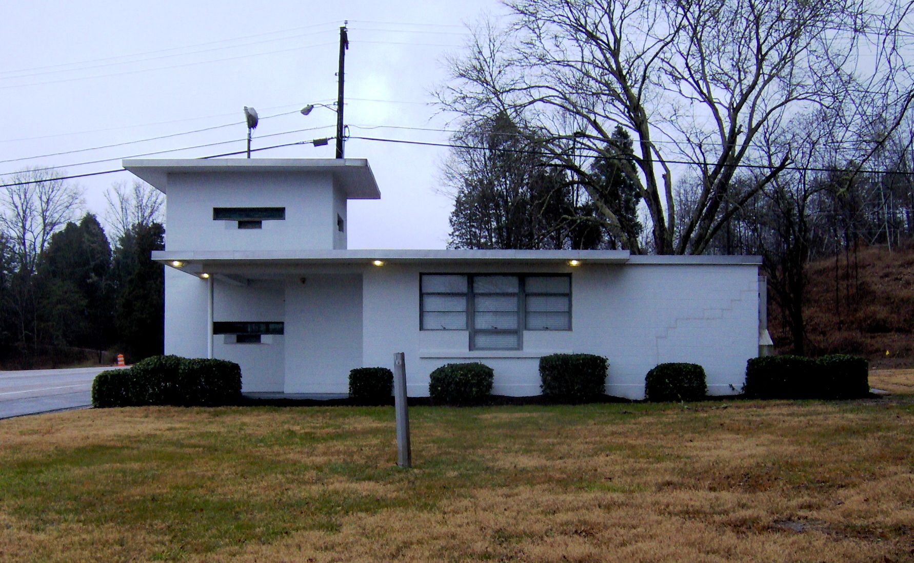
 Gatehouse on Oak Ridge Turnpike on west side of Oak Ridge, intended to control access to the K-25 Site
The three Oak Ridge gatehouses, also known as "checking stations", "guard houses", or "guard shacks", are security checkpoints in Oak Ridge, Tennessee, built circa 1948-1949 to control access to the Atomic Energy Commission (AEC) production and research facilities in Oak Ridge.[1] These are individually listed on the U.S. National Register of Historic Places as Bear Creek Road Checking Station, Bethel Valley Road Checking Station and Oak Ridge Turnpike Checking Station.
History
The three gatehouses were built circa 1948-1949 and went into service on March 19, 1949, when the residential and commercial portion of Oak Ridge, known as the "townsite," was opened to public access. During World War II and until 1949, the entire Oak Ridge area had been enclosed by a fence and was restricted. Access was controlled at seven security gates equipped with wooden guardhouses. In 1949, access restrictions on the Oak Ridge townsite were eliminated. At that time, the three checking stations went into use to control access between the townsite and the AEC facilities.[1] A station on Bethel Valley Road controlled access to the "X-10" site in Bethel Valley, where Oak Ridge National Laboratory is located;[2] a station on Scarboro Road near Bear Creek Road controlled access to the Y-12 nuclear weapons production facility in Bear Creek Valley;[3] and a station on Oak Ridge Turnpike (now part of Tennessee State Route 95) controlled access to the K-25 site uranium enrichment facility near the Clinch River in western Oak Ridge.[4]
The structures were used for their intended purpose until 1953 when the gates to each of the three government sites were relocated to the specific sites.[5] The three white Gatehouses remained in federal government ownership for many years, but stood vacant.[1] In 1992, they were listed on the National Register as three separate properties, identified as the Oak Ridge Turnpike Checking Station, Bear Creek Road Checking Station, and Bethel Valley Road Checking Station.[2][3][4][6] All three were included in a larger Multiple Property Submission for Oak Ridge-related properties.[7] In 1999, the U.S. Department of Energy (DOE), the AEC-successor agency that currently controls both the large and small structures of the Bear Creek Road and Oak Ridge Turnpike properties and the small structure on the Bethel Valley property restored the large structures at the checking stations at the Oak Ridge Turnpike and Bear Creek Road sites.[8] The large structure at the Bethel Valley Road site belongs to Lockheed Martin who obtained it with the Commerce Park property in 1984 when Martin Marietta took over the managing and operating contract for the three DOE sites in Oak Ridge as well as Portsmouth, Ohio and Paducah, KY. The Bethel Valley Road large structure was painted in 2005 but the interior remains untouched as does the small structure on the south side of the road.
Design and uses
Design of the three checking stations was identical. Each one consists of two concrete block buildings: a single-story main building with a two-story guard tower at one corner and a smaller one-story guard house across the street.[1] Gun portals are visible on both buildings in each pair, and the windows on both buildings are protected by bulletproof glass.[8] Military police controlled a metal gate that extended between the pair of buildings.[1] Workers and visitors had to show special badges to the guards in order to pass through the gates.[8]
The two restored gatehouses are now fitted with period and replica furniture from the 1940s and 1950s and decorated with historic photographs by Ed Westcott.[9] They are used as meeting rooms and for educational, cultural, and civic activities sponsored by DOE.[10] In 2010, the Tennessee Department of Transportation began a project to widen State Route 95 in the vicinity of the Oak Ridge Turnpike checking station with a road design that does not affect the checking station. The design for the widened roadway calls for five lanes and a sidewalk in the segment that passes between the two gatehouse structures.[8]
References
- ^ a b c d e Memos and other documents, Paul L. Ziemer and various others, May 20, 1992 and other dates
- ^ a b Kimberly A. Murphy (April 5, 1991). "National Register of Historic Places Inventory-Nomination: Bethel Valley Road Checking Station". Department of Energy. http://www.cfo.doe.gov/me70/history/NPSweb/doe_properties-multiple_property_documentation.pdf. (Document is pages 27-35 in PDF that includes other documents)
- ^ a b Kimberly A. Murphy (April 5, 1991). "National Register of Historic Places Inventory-Nomination: Bear Creek Road Checking Station". Department of Energy. http://www.cfo.doe.gov/me70/history/NPSweb/doe_properties-multiple_property_documentation.pdf. (Document is pages 17-26 in PDF that includes other documents; 3 photos which had accompanied nomination are omitted)
- ^ a b Kimberly A. Murphy (April 5, 1991). "National Register of Historic Places Inventory-Nomination: Oak Ridge Turnpike Checking Station". Department of Energy. http://www.cfo.doe.gov/me70/history/NPSweb/doe_properties-multiple_property_documentation.pdf. (Document is pages 7-16 in PDF that includes other documents; 3 photos which had accompanied nomination are omitted)
- ^ Smith, D. Ray "Little-known gates, communities in old Oak Ridge", "The Oak Ridger", Oak Ridge TN, July 18, 2006.
- ^ "National Register Information System". National Register of Historic Places. National Park Service. 2009-03-13.
- ^ Kimberly A. Murphy and Philip Thomason (April 5, 1991). "National Register of Historic Places Multiple Property Documentation: Historic and Architectural Resources of Oak Ridge". National Park Service. http://pdfhost.focus.nps.gov/docs/NRHP/Text/64500613.pdf.
- ^ a b c d Bob Fowler, Historic gatehouses to stand; Structures won't be altered during redesign of road, Knoxville News Sentinel, October 7, 2008
- ^ R. Cathey Daniels, DOE to highlight guard houses where once machine gunners sat watch over the city's gateways, The Oak Ridger, May 13, 2003
- ^ Cultural Resources of the Oak Ridge Reservation, Oak Ridge National Laboratory, May 2003
Categories:- Oak Ridge, Tennessee
- Buildings and structures completed in 1948
- National Register of Historic Places in Tennessee
- Buildings and structures in Anderson County, Tennessee
- Buildings and structures in Roane County, Tennessee

Wikimedia Foundation. 2010.