- National Register of Historic Places listings in Anderson County, South Carolina
-
 Location of Anderson County in South Carolina
This is a list of the National Register of Historic Places listings in Anderson County, South Carolina.
This is intended to be a complete list of the properties and districts on the National Register of Historic Places in Anderson County, South Carolina, United States. The locations of National Register properties and districts for which the latitude and longitude coordinates are included below, may be seen in a Google map.[1]
There are 19 properties and districts listed on the National Register in the county. Another 2 properties were once listed but have been removed.
-
- This National Park Service list is complete through NPS recent listings posted November 10, 2011.[2]
Current listings
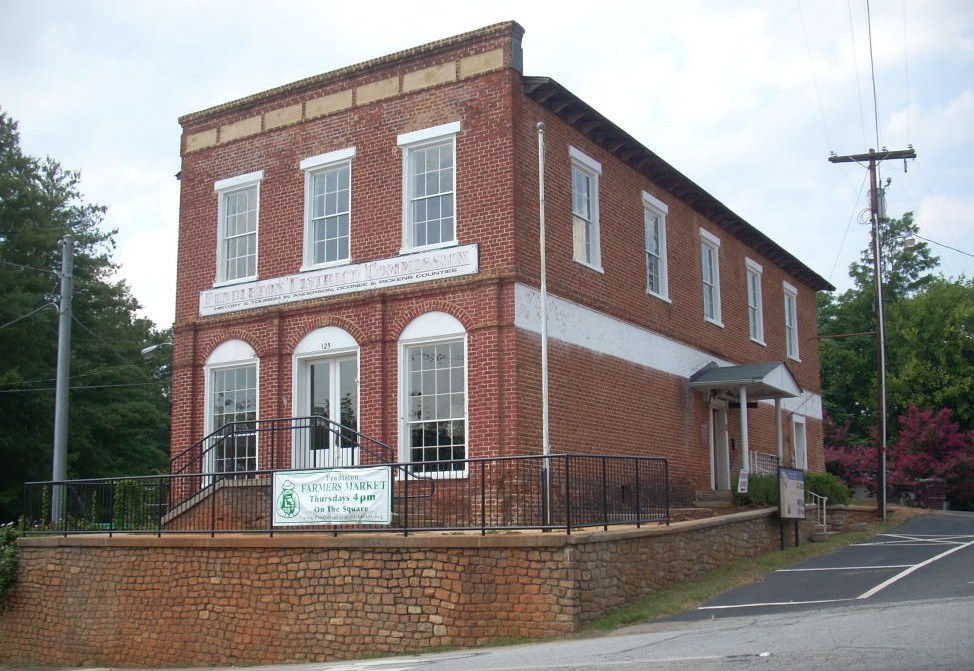
[3] Landmark name [4] Image Date listed Location City or town Summary 1 Anderson College Historic District May 20, 1998 316 Boulevard Ave.
34°30′49″N 82°38′18″W / 34.513611°N 82.638333°WAnderson 2 Anderson Downtown Historic District 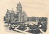
February 23, 1979 Main St. between Tribble and Market Sts.; also 402 N. Main St.
34°29′50″N 82°38′59″W / 34.497222°N 82.649722°WAnderson 402 N. Main represents a boundary increase of November 5, 2007 3 Anderson Historic District 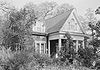
December 13, 1971 Bounded by Hampton, Main, Franklin, McDuffie, Benson, and Fant Sts.
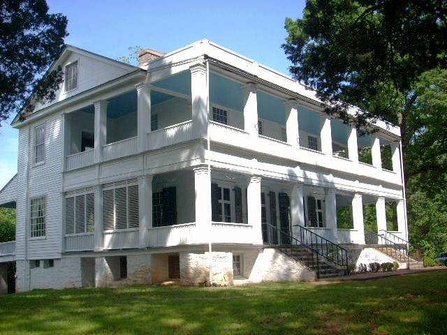
34°30′00″N 82°38′52″W / 34.5°N 82.647778°WAnderson 4 Ashtabula 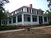
March 23, 1972 1.25 miles northeast of Pendleton off South Carolina Highway 88
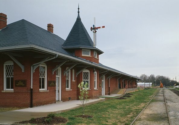
34°40′44″N 82°45′25″W / 34.678889°N 82.756944°WPendleton 5 Belton Depot 
August 13, 1979 Public Square
34°31′21″N 82°29′41″W / 34.5225°N 82.494722°WBelton 6 Belton Standpipe November 5, 1987 McGee St.
34°31′21″N 82°29′30″W / 34.5225°N 82.491667°WBelton 7 Boone-Douthit House July 3, 1997 1000 Milwee Creek Rd.
34°36′21″N 82°43′50″W / 34.605833°N 82.730556°WPendleton 8 Caldwell-Johnson-Morris Cottage October 7, 1971 220 E. Morris St.
34°29′55″N 82°38′50″W / 34.498611°N 82.647222°WAnderson 9 Chamberlain-Kay House November 25, 1980 205 River St.
34°31′26″N 82°29′29″W / 34.523889°N 82.491389°WBelton 10 Denver Downs Farmstead March 7, 2007 4915 Clemson Boulevard Anderson 11 Kennedy Street School October 24, 2007 816 Kennedy St.
34°29′54″N 82°38′34″W / 34.498333°N 82.642778°WAnderson 12 North Anderson Historic District July 31, 2008 E. and W. North Ave. between Boundary St. and Mauldin Dr., including parts of Edgewood Dr., Blair St., and Central Ave. Anderson 13 Dr. Samuel Marshall Orr House April 13, 1973 809 W. Market St.
34°30′00″N 82°39′39″W / 34.5°N 82.660833°WAnderson 14 Pelzer Presbyterian Church December 13, 1993 13 Lebby St.
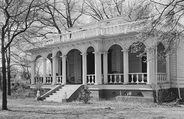
34°38′32″N 82°27′34″W / 34.642222°N 82.459444°WPelzer 15 Pendleton Historic District 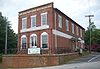
August 25, 1970 Bounded on the west by Hopewell and Treaty Oak, on the north by Old Stone Church, on the east by Montpelier, and on the south by the town limits
34°12′03″N 82°47′40″W / 34.200833°N 82.794444°WPendleton Extends into Oconee and Pickens counties 16 Ralph John Ramer House February 10, 1992 402 Boulevard
34°30′49″N 82°38′27″W / 34.513611°N 82.640833°WAnderson 17 Obediah Shirley House September 3, 1999 Bagwell Rd.
34°27′07″N 82°24′50″W / 34.451944°N 82.413889°WHonea Path 18 Woodburn 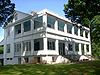
May 6, 1971 End of Woodburn Rd., west of Pendleton
34°38′26″N 82°47′47″W / 34.640556°N 82.796389°WPendleton 19 Woodson Farmstead April 30, 1998 3 Powdersville Rd.
34°47′15″N 82°29′10″W / 34.7875°N 82.486111°WGreenville Former listings
Landmark name Image Dates Location City or Town Summary 1 McFall House June 28, 1982
December 8, 2005 (delisted)County Road 247
34°26′40″N 82°35′40″W / 34.44444°N 82.59444°WAnderson No longer exists. 2 Nick Prevost House 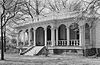
July 10, 1984
December 8, 2005 (delisted).
34°30′5″N 82°40′32″W / 34.50139°N 82.67556°WAnderson No longer exists. See also
- List of National Historic Landmarks in South Carolina
- National Register of Historic Places listings in South Carolina
References
- ^ The latitude and longitude information provided in this table was derived originally from the National Register Information System, which has been found to be fairly accurate for about 99% of listings. For about 1% of NRIS original coordinates, experience has shown that one or both coordinates are typos or otherwise extremely far off; some corrections may have been made. A more subtle problem causes many locations to be off by up to 150 yards, depending on location in the country: most NRIS coordinates were derived from tracing out latitude and longitudes off of USGS topographical quadrant maps created under the North American Datum of 1927, which differs from the current, highly accurate WGS84 GPS system used by Google maps. Chicago is about right, but NRIS longitudes in Washington are higher by about 4.5 seconds, and are lower by about 2.0 seconds in Maine. Latitudes differ by about 1.0 second in Florida. Some locations in this table may have been corrected to current GPS standards.
- ^ "National Register of Historic Places: Weekly List Actions". National Park Service, United States Department of the Interior. Retrieved on November 10, 2011.
- ^ Numbers represent an ordering by significant words. Various colorings, defined here, differentiate National Historic Landmark sites and National Register of Historic Places Districts from other NRHP buildings, structures, sites or objects.
- ^ "National Register Information System". National Register of Historic Places. National Park Service. . http://nrhp.focus.nps.gov/natreg/docs/All_Data.html.
U.S. National Register of Historic Places in South Carolina Lists by county Abbeville • Aiken • Allendale • Anderson • Bamberg • Barnwell • Beaufort • Berkeley • Calhoun • Charleston • Cherokee • Chester • Chesterfield • Clarendon • Colleton • Darlington • Dillon • Dorchester • Edgefield • Fairfield • Florence • Georgetown • Greenville • Greenwood • Hampton • Horry • Jasper • Kershaw • Lancaster • Laurens • Lee • Lexington • Marion • Marlboro • McCormick • Newberry • Oconee • Orangeburg • Pickens • Richland • Saluda • Spartanburg • Sumter • Union • Williamsburg • York

Lists by city Other lists Municipalities and communities of Anderson County, South Carolina Cities 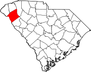
Towns Honea Path‡ | Iva | Pelzer | Pendleton | Starr | West Pelzer | Williamston
CDPs Centerville | Fair Play‡ | Homeland Park | Northlake | Piedmont‡ | Powdersville
Unincorporated
communityFootnotes ‡This populated place also has portions in an adjacent county or counties
Categories:- National Register of Historic Places in Anderson County, South Carolina
- National Register of Historic Places in South Carolina by county
-


Wikimedia Foundation. 2010.