- National Register of Historic Places listings in Berkeley County, South Carolina
-
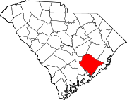
 Location of Berkeley County in South Carolina
This is a list of the National Register of Historic Places listings in Berkeley County, South Carolina.
This is intended to be a complete list of the properties and districts on the National Register of Historic Places in Berkeley County, South Carolina, United States. The locations of National Register properties and districts for which the latitude and longitude coordinates are included below, may be seen in a Google map.[1]
There are 25 properties and districts listed on the National Register in the county, including 5 National Historic Landmarks. Another 2 properties and districts were once listed but have been removed.
-
- This National Park Service list is complete through NPS recent listings posted November 10, 2011.[2]
Current listings
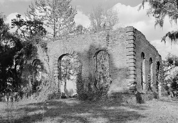
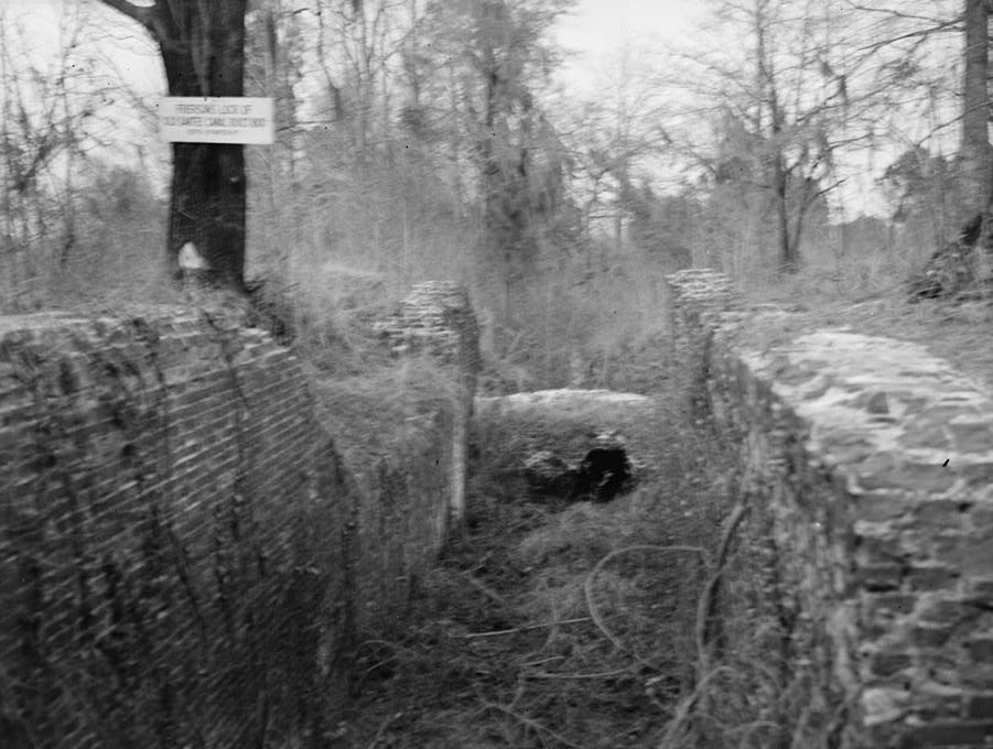
[3] Landmark name [4] Image Date listed Location City or town Summary 1 Biggin Church Ruins 
December 13, 1977 2 miles northeast of Moncks Corner on South Carolina Highway 402
33°12′45″N 79°58′02″W / 33.2125°N 79.967222°WMoncks Corner 2 Cainhoy Historic District March 11, 1982 Southeast of Huger
32°55′39″N 79°49′59″W / 32.9275°N 79.833056°WHuger 3 Cooper River Historic District February 5, 2003 Along the East and West Branches of the Cooper River
33°04′55″N 79°52′35″W / 33.081944°N 79.876389°WMoncks Corner 4 Keller Site February 1, 1980 Address Restricted St. Stephen 5 Lawson's Pond Plantation 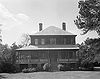
December 13, 1977 5 miles north of Cross off South Carolina Highway 6
33°22′13″N 80°13′22″W / 33.370278°N 80.222778°WCross 6 Lewisfield Plantation 
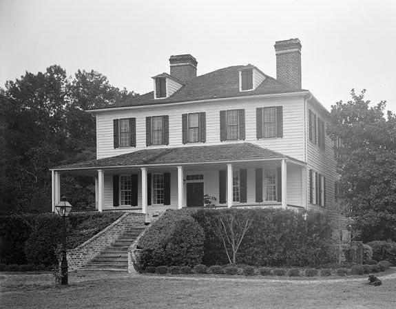
May 9, 1973 About 2.5 miles south of Moncks Corner on U.S. Route 52
33°09′36″N 79°59′37″W / 33.16°N 79.993611°WMoncks Corner 7 Loch Dhu 
September 22, 1977 North of Cross off South Carolina Highway 6
33°23′28″N 80°12′49″W / 33.391111°N 80.213611°WCross 8 Medway 
July 16, 1970 East of Mount Holly off U.S. Route 52
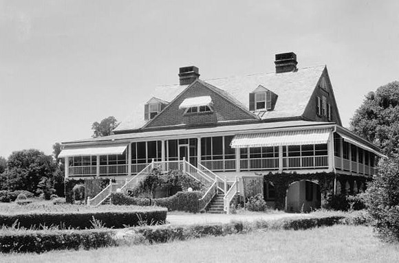
33°01′52″N 79°58′14″W / 33.031111°N 79.970556°WMount Holly 9 Middleburg Plantation 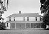
April 15, 1970 2 miles southwest of Huger on the East Branch of the Cooper River
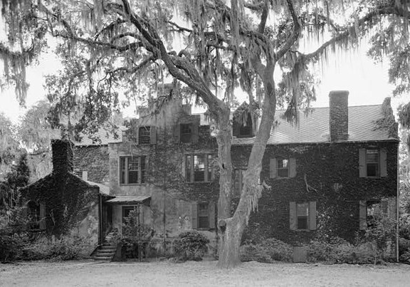
33°04′54″N 79°50′35″W / 33.081667°N 79.843056°WHuger 10 Mulberry Plantation 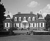
October 15, 1966 Off U.S. Route 52 on the Cooper River
33°08′37″N 79°59′21″W / 33.143611°N 79.989167°WMoncks Corner 11 Otranto Plantation February 17, 1978 18 Basilica Ave.
32°58′04″N 80°02′23″W / 32.967778°N 80.039722°WHanahan 12 Otranto Plantation Indigo Vats December 21, 1989 Secondary Road 503, east of Goose Creek
32°59′02″N 79°55′57″W / 32.983889°N 79.9325°WGoose Creek 13 Pineville Historic District February 10, 1992 Road S-8-204 south of its junction with South Carolina Highway 45
33°25′33″N 80°01′39″W / 33.425833°N 80.0275°WPineville 14 Pinopolis Historic District North August 19, 1982 Lake View St. south to Lake Moultrie
33°13′52″N 80°02′04″W / 33.231111°N 80.034444°WPinopolis 15 Pinopolis Historic District South August 19, 1982 County Road 5
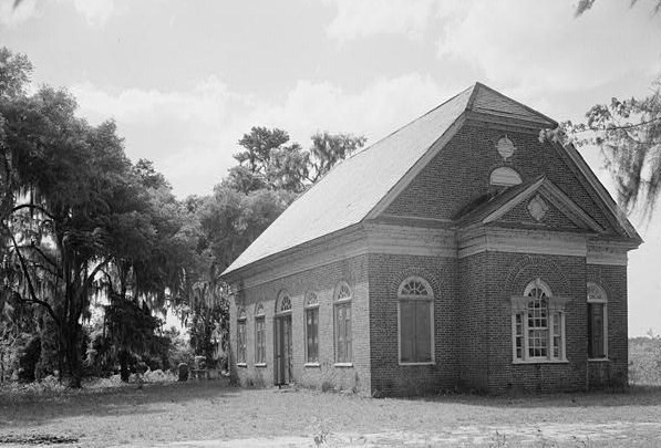
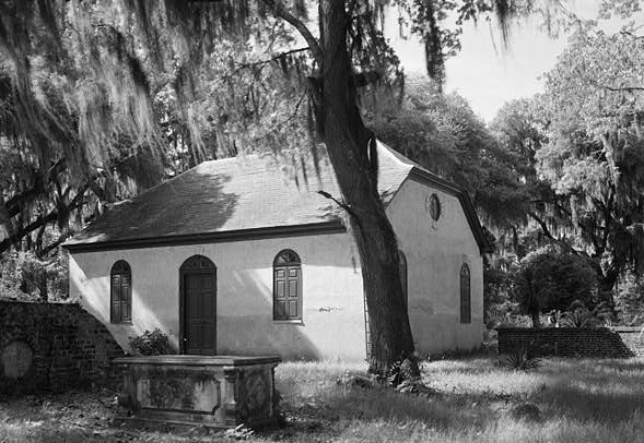
33°13′52″N 80°02′04″W / 33.231111°N 80.034444°WPinopolis 16 Pompion Hill Chapel 
April 15, 1970 0.5 miles southwest of the junction of South Carolina Highways 41 and 402
33°05′00″N 79°50′17″W / 33.083333°N 79.838056°WHuger 17 Quinby Plantation House-Halidon Hill Plantation October 10, 1985 3 miles west of Huger
33°03′36″N 79°50′18″W / 33.06°N 79.838333°WHuger 18 Richmond Plantation November 24, 1980 Southeast of Cordesville
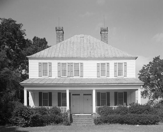
33°04′43″N 79°51′34″W / 33.078611°N 79.859444°WCordesville 19 William Robertson House August 19, 1982 County Road 5
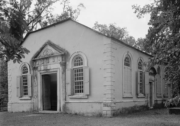
33°13′52″N 80°02′14″W / 33.231111°N 80.037222°WPinopolis 20 St. James' Church, Goose Creek 
April 15, 1970 South of Goose Creek
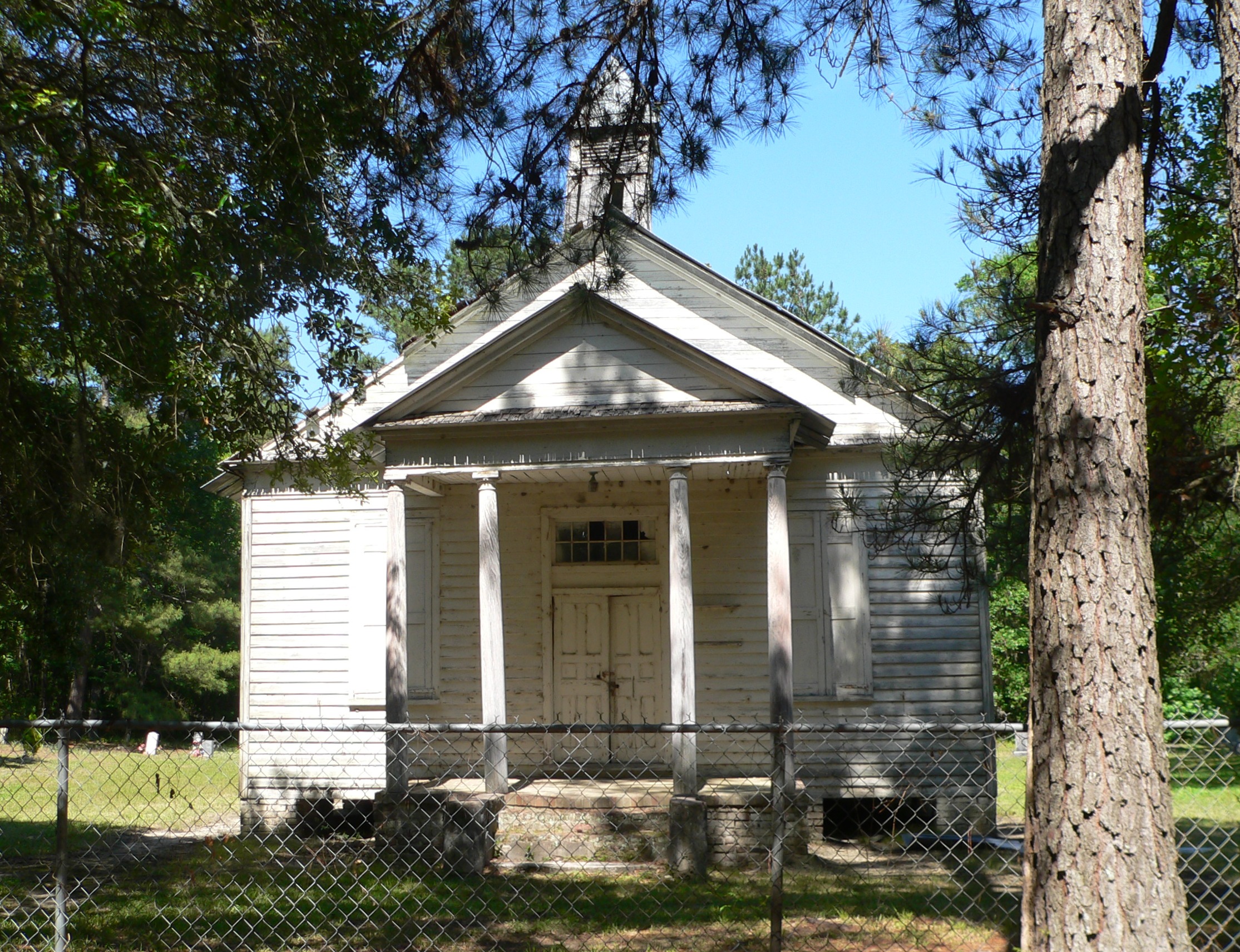
32°58′31″N 80°01′47″W / 32.975278°N 80.029722°WGoose Creek 21 St. Stephen's Episcopal Church 
April 15, 1970 On South Carolina Highway 45 St. Stephen 22 Santee Canal 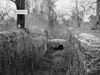
May 5, 1982 Northeast of Moncks Corner
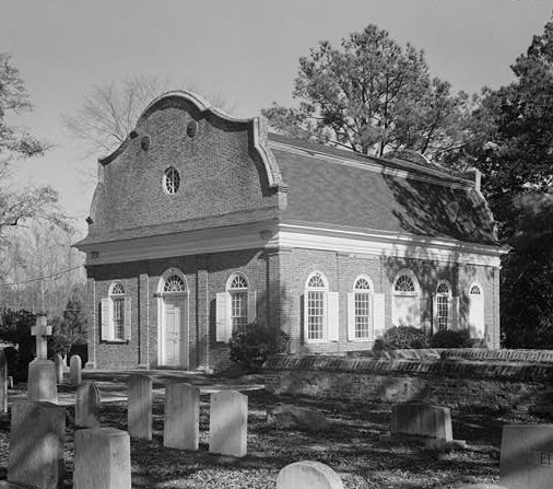
33°21′00″N 80°03′38″W / 33.35°N 80.060556°WMoncks Corner 23 Strawberry Chapel and Childsbury Town Site 
April 26, 1972 Southeast of Moncks Corner on County Road 44, north of the Tee of the Cooper River
33°05′33″N 79°54′12″W / 33.0925°N 79.903333°WMoncks Corner 24 Taveau Church 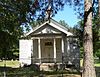
February 14, 1978 South of Cordesville on South Carolina Highway 44
33°06′21″N 79°56′23″W / 33.105833°N 79.939722°WCordesville 25 White Church 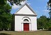
March 23, 1972 2 miles north of Cainhoy on County Road 98
32°57′37″N 79°51′29″W / 32.960278°N 79.858056°WCainhoy Former listings
Landmark name Image Dates Location City or Town Summary 1 Calais Milestones December 8, 2005 (delisted) 2 Dean Hall 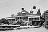
October 7, 1971 (delisted) It was moved. See also
- List of National Historic Landmarks in South Carolina
- National Register of Historic Places listings in South Carolina
References
- ^ The latitude and longitude information provided in this table was derived originally from the National Register Information System, which has been found to be fairly accurate for about 99% of listings. For about 1% of NRIS original coordinates, experience has shown that one or both coordinates are typos or otherwise extremely far off; some corrections may have been made. A more subtle problem causes many locations to be off by up to 150 yards, depending on location in the country: most NRIS coordinates were derived from tracing out latitude and longitudes off of USGS topographical quadrant maps created under the North American Datum of 1927, which differs from the current, highly accurate WGS84 GPS system used by Google maps. Chicago is about right, but NRIS longitudes in Washington are higher by about 4.5 seconds, and are lower by about 2.0 seconds in Maine. Latitudes differ by about 1.0 second in Florida. Some locations in this table may have been corrected to current GPS standards.
- ^ "National Register of Historic Places: Weekly List Actions". National Park Service, United States Department of the Interior. Retrieved on November 10, 2011.
- ^ Numbers represent an ordering by significant words. Various colorings, defined here, differentiate National Historic Landmark sites and National Register of Historic Places Districts from other NRHP buildings, structures, sites or objects.
- ^ "National Register Information System". National Register of Historic Places. National Park Service. . http://nrhp.focus.nps.gov/natreg/docs/All_Data.html.
U.S. National Register of Historic Places in South Carolina Lists by county Abbeville • Aiken • Allendale • Anderson • Bamberg • Barnwell • Beaufort • Berkeley • Calhoun • Charleston • Cherokee • Chester • Chesterfield • Clarendon • Colleton • Darlington • Dillon • Dorchester • Edgefield • Fairfield • Florence • Georgetown • Greenville • Greenwood • Hampton • Horry • Jasper • Kershaw • Lancaster • Laurens • Lee • Lexington • Marion • Marlboro • McCormick • Newberry • Oconee • Orangeburg • Pickens • Richland • Saluda • Spartanburg • Sumter • Union • Williamsburg • York

Lists by city Other lists Municipalities and communities of Berkeley County, South Carolina Cities Charleston‡ | Goose Creek‡ | Hanahan | North Charleston‡
Towns Bonneau | Jamestown | Moncks Corner | St. Stephen | Summerville‡
CDP Unincorporated
communitiesFootnotes ‡This populated place also has portions in an adjacent county or counties
Categories:- Berkeley County, South Carolina
- National Register of Historic Places in South Carolina by county
- Buildings and structures in Berkeley County, South Carolina
-


Wikimedia Foundation. 2010.