- National Register of Historic Places listings in Orangeburg County, South Carolina
-
 Location of Orangeburg County in South Carolina
This is a list of the National Register of Historic Places listings in Orangeburg County, South Carolina.
This is intended to be a complete list of the properties and districts on the National Register of Historic Places in Orangeburg County, South Carolina, United States. The locations of National Register properties and districts for which the latitude and longitude coordinates are included below, may be seen in a Google map.[1]
There are 40 properties and districts listed on the National Register in the county. Another 2 properties were once listed but have been removed.
-
- This National Park Service list is complete through NPS recent listings posted November 10, 2011.[2]
Current listings
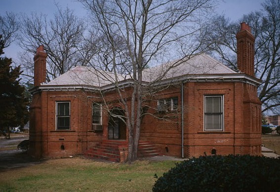
[3] Landmark name [4] Image Date listed Location City or town Summary 1 All Star Bowling Lane August 7, 1996 559 E. Russell St.
33°29′33″N 80°51′33″W / 33.4925°N 80.859167°WOrangeburg Protest against the bowling center's segregationist policy in 1968 led to the Orangeburg massacre in which 3 were killed 2 Amelia Street Historic District September 20, 1985 Amelia St. between Treadwell St. and Summers Ave.
33°29′39″N 80°51′37″W / 33.494167°N 80.860278°WOrangeburg 3 F.H.W. Briggman House September 20, 1985 156 Amelia St.
33°29′24″N 80°51′57″W / 33.49°N 80.865833°WOrangeburg 4 Donald Bruce House December 1, 1978 Southeast of Orangeburg on U.S. Route 301
33°28′36″N 80°48′53″W / 33.476667°N 80.814722°WOrangeburg 5 Cattle Creek Campground May 19, 1983 Off South Carolina Highway 210
33°19′20″N 80°45′08″W / 33.322222°N 80.752222°WRowesville 6 Claflin College Historic District 
September 20, 1985 On a portion of the Claflin College campus
33°29′51″N 80°51′18″W / 33.4975°N 80.855°WOrangeburg 7 Cope Depot March 29, 2001 Cope Rd.
33°22′39″N 81°00′28″W / 33.3775°N 81.007778°WCope 8 Dantzler Plantation March 1, 2007 2755 Vance Rd.
33°24′56″N 80°30′23″W / 33.415608°N 80.506383°WHolly Hill 9 Dixie Library Building September 20, 1985 Bull St.
33°29′33″N 80°52′06″W / 33.4925°N 80.868333°WOrangeburg 10 Dukes Gymnasium September 20, 1985 South Carolina State University campus
33°29′50″N 80°51′02″W / 33.497222°N 80.850556°WOrangeburg 11 East Russell Street Area Historic District September 20, 1985 Along sections of E. Russell St. between Watson and Clarendon Sts., and along portions of Oakland Pl. and Dickson and Whitman Sts.
33°29′36″N 80°51′04″W / 33.493333°N 80.851111°WOrangeburg 12 Ellis Avenue Historic District September 20, 1985 Along portions of Ellis Ave. between Summers Ave. and Wilson St.
33°29′53″N 80°51′47″W / 33.498056°N 80.863056°WOrangeburg 13 Enterprise Cotton Mills Building September 20, 1985 U.S. Route 21
33°29′12″N 80°51′13″W / 33.486667°N 80.853611°WOrangeburg 14 Eutaw Springs Battleground Park June 5, 1970 2 miles east of Eutawville on South Carolina Highways 6 and 45
33°24′30″N 80°17′57″W / 33.408333°N 80.299167°WEutawville 15 Maj. John Hammond Fordham House September 20, 1985 415 Boulevard
33°29′58″N 80°51′20″W / 33.499444°N 80.855556°WOrangeburg 16 Great Branch Teacherage October 24, 2007 2890 Neeses Highway
33°31′20″N 81°00′13″W / 33.522244°N 81.0036°WOrangeburg 17 Hodge Hall September 20, 1985 South Carolina State University campus
33°29′52″N 80°51′06″W / 33.497778°N 80.851667°WOrangeburg 18 Hotel Eutaw September 20, 1985 Russell and Centre Sts.
33°29′29″N 80°51′39″W / 33.491389°N 80.860833°WOrangeburg 19 Lowman Hall, South Carolina State College September 20, 1985 South Carolina State College campus
33°29′43″N 80°51′14″W / 33.495278°N 80.853889°WOrangeburg 20 Alan Mack Site (38OR67) January 6, 1986 Address Restricted Orangeburg 21 Mt. Pisgah Baptist Church September 20, 1985 310 Green
33°29′34″N 80°51′55″W / 33.492778°N 80.865278°WOrangeburg 22 Numertia Plantation 
March 19, 1982 East of Eutawville
33°23′00″N 80°16′51″W / 33.383333°N 80.280833°WEutawville 23 Orangeburg City Cemetery September 27, 1996 Junction of Bull and Windsor Sts.
33°29′25″N 80°52′02″W / 33.490278°N 80.867222°WOrangeburg 24 Orangeburg County Fair Main Exhibit Building September 20, 1985 U.S. Route 21
33°28′49″N 80°51′11″W / 33.480278°N 80.853056°WOrangeburg 25 Orangeburg County Jail October 2, 1973 44 Saint John St.
33°29′17″N 80°51′36″W / 33.488056°N 80.86°WOrangeburg 26 Orangeburg Downtown Historic District 
September 20, 1985 Russell, Broughton, Middleton, Church, Meeting, St. John, Hampton, and Amelia Sts. around the public square
33°29′24″N 80°51′49″W / 33.49°N 80.863611°WOrangeburg 27 Providence Methodist Church September 25, 2009 4833 Old State Rd.
33°23′30″N 80°32′25″W / 33.391594°N 80.540239°WHolly Hill 28 St. Julien Plantation November 28, 1980 South Carolina Highway 6
33°24′35″N 80°21′11″W / 33.409722°N 80.353056°WEutawville 29 South Carolina State College Historic District June 19, 1997 300 College St.
33°29′46″N 80°51′11″W / 33.496111°N 80.853056°WOrangeburg 30 Southern Railway Passenger Depot 
April 23, 1973 110 N. Main St.
33°15′04″N 80°48′57″W / 33.251111°N 80.815833°WBranchville 31 Springfield High School March 29, 2001 Brodie St., between South Carolina Highway 4 and Georgia St.
33°29′44″N 81°16′27″W / 33.495556°N 81.274167°WSpringfield 32 William P. Stroman House August 1, 1996 1017 N. Boulevard
33°30′12″N 80°51′34″W / 33.503333°N 80.859444°WOrangeburg 33 Tingley Memorial Hall, Claflin College August 4, 1983 College Ave.
33°29′53″N 80°51′14″W / 33.498056°N 80.853889°WOrangeburg 34 Treadwell Street Historic District September 20, 1985 Along portions of Treadwell and Amelia Sts.
33°29′45″N 80°51′30″W / 33.495833°N 80.858333°WOrangeburg 35 Trinity Lutheran Church August 1, 2008 390 Hampton St.
33°31′59″N 80°34′17″W / 33.533014°N 80.571467°WElloree 36 Trinity Methodist Episcopal Church August 26, 1994 185 Boulevard NE.
33°29′44″N 80°51′24″W / 33.495556°N 80.856667°WOrangeburg 37 White House United Methodist Church May 13, 1974 North of Orangeburg on U.S. Route 301
33°27′34″N 80°43′07″W / 33.459444°N 80.718611°WOrangeburg 38 Whitman Street Area Historic District September 20, 1985 Along sections of Whitman, Elliot, and E. Russell Sts.
33°29′28″N 80°51′29″W / 33.491111°N 80.858056°WOrangeburg 39 Williams Chapel A.M.E. Church September 20, 1985 1908 Glover St.
33°29′10″N 80°51′37″W / 33.486111°N 80.860278°WOrangeburg 40 Willow Consolidated High School July 11, 2006 2750 Cope Rd.
33°26′53″N 81°09′20″W / 33.448056°N 81.155556°WNorway Former listings
Landmark name Image Date Location City or Town Summary 1 Gilmore House December 8, 2005 (delisted) State St. & Eutaw Rd. Holly Hill It was demolished. 2 Rocks Plantation 
March 15, 2000 (delisted) Eutawville, South Carolina It has burned. See also
- List of National Historic Landmarks in South Carolina
- National Register of Historic Places listings in South Carolina
References
- ^ The latitude and longitude information provided in this table was derived originally from the National Register Information System, which has been found to be fairly accurate for about 99% of listings. For about 1% of NRIS original coordinates, experience has shown that one or both coordinates are typos or otherwise extremely far off; some corrections may have been made. A more subtle problem causes many locations to be off by up to 150 yards, depending on location in the country: most NRIS coordinates were derived from tracing out latitude and longitudes off of USGS topographical quadrant maps created under the North American Datum of 1927, which differs from the current, highly accurate WGS84 GPS system used by Google maps. Chicago is about right, but NRIS longitudes in Washington are higher by about 4.5 seconds, and are lower by about 2.0 seconds in Maine. Latitudes differ by about 1.0 second in Florida. Some locations in this table may have been corrected to current GPS standards.
- ^ "National Register of Historic Places: Weekly List Actions". National Park Service, United States Department of the Interior. Retrieved on November 10, 2011.
- ^ Numbers represent an ordering by significant words. Various colorings, defined here, differentiate National Historic Landmark sites and National Register of Historic Places Districts from other NRHP buildings, structures, sites or objects.
- ^ "National Register Information System". National Register of Historic Places. National Park Service. . http://nrhp.focus.nps.gov/natreg/docs/All_Data.html.
U.S. National Register of Historic Places in South Carolina Lists by county Abbeville • Aiken • Allendale • Anderson • Bamberg • Barnwell • Beaufort • Berkeley • Calhoun • Charleston • Cherokee • Chester • Chesterfield • Clarendon • Colleton • Darlington • Dillon • Dorchester • Edgefield • Fairfield • Florence • Georgetown • Greenville • Greenwood • Hampton • Horry • Jasper • Kershaw • Lancaster • Laurens • Lee • Lexington • Marion • Marlboro • McCormick • Newberry • Oconee • Orangeburg • Pickens • Richland • Saluda • Spartanburg • Sumter • Union • Williamsburg • York

Lists by city Other lists Municipalities and communities of Orangeburg County, South Carolina City 
Towns Bowman | Branchville | Cope | Cordova | Elloree | Eutawville | Holly Hill | Livingston | Neeses | North | Norway | Rowesville | Santee | Springfield | Vance | Woodford
CDPs Unincorporated
communitiesProvidence | Sixty Six | Wells
Categories:- Orangeburg County, South Carolina
- National Register of Historic Places in South Carolina by county
-


Wikimedia Foundation. 2010.