- National Register of Historic Places listings in Cherokee County, South Carolina
-
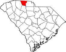 Location of Cherokee County in South Carolina
This is a list of the National Register of Historic Places listings in Cherokee County, South Carolina.
This is intended to be a complete list of the properties and districts on the National Register of Historic Places in Cherokee County, South Carolina, United States. The locations of National Register properties and districts for which the latitude and longitude coordinates are included below, may be seen in a Google map.[1]
There are 23 properties and districts listed on the National Register in the county. Another 4 properties and districts were once listed but have been removed.
-
- This National Park Service list is complete through NPS recent listings posted November 10, 2011.[2]
Current listings
[3] Landmark name [4] Image Date listed Location City or town Summary 1 Archeological Site 38CK1 December 10, 1980 Address Restricted Gaffney 2 Archeological Site 38CK44 December 10, 1980 Address Restricted Gaffney 3 Archeological Site 38CK45 December 10, 1980 Address Restricted Gaffney 4 Carnegie Free Library June 2, 2000 210 N. Limestone St.
35°04′25″N 81°38′54″W / 35.073611°N 81.648333°WGaffney 5 Coopersville Ironworks Site (38CK2) and Susan Furnace Site (38CK67) November 13, 1976 Address Restricted Gaffney 6 Cowpens Furnace Site (38CK73) 
May 8, 1987 Address Restricted Gaffney 7 Cowpens National Battlefield 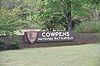
October 15, 1966 2 miles east of Chesnee at the junction of South Carolina Highways 11 and 110
35°8′2″N 81°48′40″W / 35.13389°N 81.81111°WChesnee 8 Winnie Davis Hall April 29, 1977 1115 College Dr.
35°03′23″N 81°39′00″W / 35.056389°N 81.65°WGaffney 9 Ellen Furnace Site (38CK68) May 8, 1987 Address Restricted Gaffney 10 Gaffney Commercial Historic District March 27, 1986 Roughly N. Limestone St. between Cherokee Ave. and E. Meadow St.
35°04′20″N 81°38′50″W / 35.072222°N 81.647222°WGaffney 11 Gaffney Residential Historic District March 27, 1986 Roughly bounded by Floyd Baker Boulevard, Johnson and Thompson Sts., Rutledge and Fairview Aves., and Limestone St.
35°04′01″N 81°38′54″W / 35.066944°N 81.648333°WGaffney 12 Zeno Hicks House February 9, 1989 U.S. Route 221 and Mill Gap Rd.
35°09′07″N 81°51′21″W / 35.151944°N 81.855833°WChesnee 13 Irene Mill Finishing Plant March 27, 1986 Western side of Buford St. between Liberty and Logan Sts.
35°04′28″N 81°38′36″W / 35.074444°N 81.643333°WGaffney 14 Jefferies House March 27, 1986 306 S. Grannard St.
35°04′16″N 81°39′11″W / 35.071111°N 81.653056°WGaffney 15 King's Creek Furnace Site (38CK71) May 8, 1987 Address Restricted Kings Creek 16 Kings Mountain National Military Park 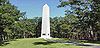
October 15, 1966 Northwest of Bethany on South Carolina Highway 161
35°8′16″N 81°23′22″W / 35.13778°N 81.38944°WBethany Extends into York County 17 Kings Mountain State Park Historic District March 14, 2008 1277 Park Rd. Blacksburg 18 Limestone Springs Historic District 
March 27, 1986 O'Neal St. extension and Limestone College campus
35°03′14″N 81°38′53″W / 35.053889°N 81.648056°WGaffney 19 Magness-Humphries House October 20, 2001 101 Grassy Pond Rd.
35°08′08″N 81°40′26″W / 35.135556°N 81.673889°WGaffney 20 Nesbitt's Limestone Quarry (38CK69) May 8, 1987 Address Restricted Gaffney 21 Nuckolls-Jefferies House April 18, 2007 571 Asbury Rd. Pacolet 22 Settlemyer House March 27, 1986 915 N. Limehouse St.
35°04′47″N 81°38′36″W / 35.079722°N 81.643333°WGaffney 23 Thicketty Mountain Ore Pits (38CK74) May 8, 1987 Address Restricted Shady Grove Church Former listings
Landmark name Image Dates Location City or Town Summary 1 Robbs House March 15, 2000 (delisted) Gaffney It was demolished. 2 Sarratt House March 15, 2000 (delisted) Gaffney It was demolished. 3 Victor Cotton Oil Company Complex March 15, 2000(delisted) Gaffney It was demolished. 4 West End Elementary School March 15, 2000(delisted) Gaffney It was demolished. See also
- List of National Historic Landmarks in South Carolina
- National Register of Historic Places listings in South Carolina
References
- ^ The latitude and longitude information provided in this table was derived originally from the National Register Information System, which has been found to be fairly accurate for about 99% of listings. For about 1% of NRIS original coordinates, experience has shown that one or both coordinates are typos or otherwise extremely far off; some corrections may have been made. A more subtle problem causes many locations to be off by up to 150 yards, depending on location in the country: most NRIS coordinates were derived from tracing out latitude and longitudes off of USGS topographical quadrant maps created under the North American Datum of 1927, which differs from the current, highly accurate WGS84 GPS system used by Google maps. Chicago is about right, but NRIS longitudes in Washington are higher by about 4.5 seconds, and are lower by about 2.0 seconds in Maine. Latitudes differ by about 1.0 second in Florida. Some locations in this table may have been corrected to current GPS standards.
- ^ "National Register of Historic Places: Weekly List Actions". National Park Service, United States Department of the Interior. Retrieved on November 10, 2011.
- ^ Numbers represent an ordering by significant words. Various colorings, defined here, differentiate National Historic Landmark sites and National Register of Historic Places Districts from other NRHP buildings, structures, sites or objects.
- ^ "National Register Information System". National Register of Historic Places. National Park Service. . http://nrhp.focus.nps.gov/natreg/docs/All_Data.html.
U.S. National Register of Historic Places in South Carolina Lists by county Abbeville • Aiken • Allendale • Anderson • Bamberg • Barnwell • Beaufort • Berkeley • Calhoun • Charleston • Cherokee • Chester • Chesterfield • Clarendon • Colleton • Darlington • Dillon • Dorchester • Edgefield • Fairfield • Florence • Georgetown • Greenville • Greenwood • Hampton • Horry • Jasper • Kershaw • Lancaster • Laurens • Lee • Lexington • Marion • Marlboro • McCormick • Newberry • Oconee • Orangeburg • Pickens • Richland • Saluda • Spartanburg • Sumter • Union • Williamsburg • York

Lists by city Other lists Municipalities and communities of Cherokee County, South Carolina Cities 
Towns Blacksburg | Smyrna‡
CDP Unincorporated
communitiesCashion Crossroads | Draytonville | Macedonia | Thicketty
Footnotes ‡This populated place also has portions in an adjacent county or counties
Categories:- National Register of Historic Places in Cherokee County, South Carolina
- National Register of Historic Places in South Carolina by county
-


Wikimedia Foundation. 2010.