- National Register of Historic Places listings in Chesterfield County, South Carolina
-
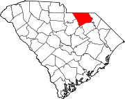
 Location of Chesterfield County in South Carolina
This is a list of the National Register of Historic Places listings in Chesterfield County, South Carolina.
This is intended to be a complete list of the properties and districts on the National Register of Historic Places in Chesterfield County, South Carolina, United States. The locations of National Register properties and districts for which the latitude and longitude coordinates are included below, may be seen in a Google map.[1]
There are 8 properties and districts listed on the National Register in the county.
-
- This National Park Service list is complete through NPS recent listings posted November 10, 2011.[2]
Current listings
[3] Landmark name [4] Image Date listed Location City or town Summary 1 Cheraw Historic District 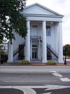
November 20, 1974 Bounded by Front, Kershaw, 3rd, McIver, Cedar, Greene, Christian, and Church Sts.
34°41′50″N 79°53′15″W / 34.697222°N 79.8875°WCheraw 2 East Main Street Historic District May 4, 1982 Hursey Dr. and E. Main and Craig Sts.
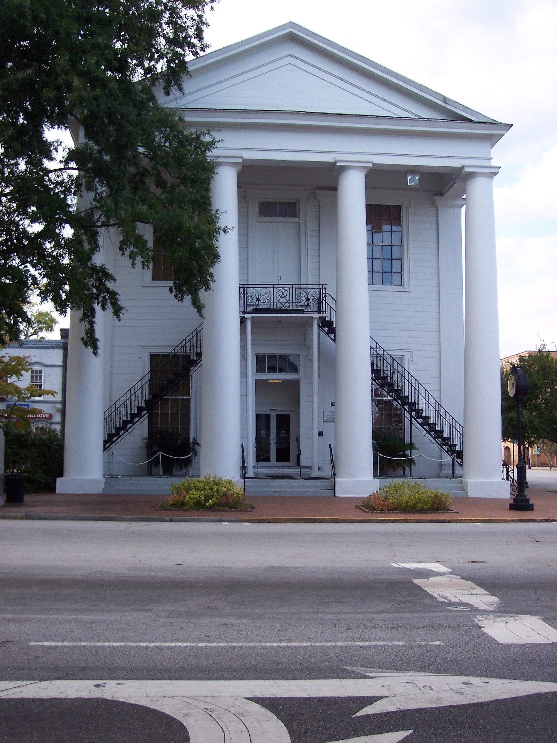
34°44′09″N 80°04′58″W / 34.735833°N 80.082778°WChesterfield 3 Evy Kirkley Site August 3, 1979 Address Restricted McBee 4 Dr. Thomas E. Lucas House May 4, 1982 716 W. Main St.
34°44′16″N 80°05′41″W / 34.737778°N 80.094722°WChesterfield 5 St. David's Episcopal Church and Cemetery 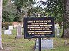
September 22, 1971 Church St.
34°41′44″N 79°52′46″W / 34.695556°N 79.879444°WCheraw 6 Seaboard Air Line Railway Depot in McBee September 2, 1999 W. Pine Ave., northwest of the junction of South Carolina Highway 151 and U.S. Route 1
34°28′09″N 80°15′27″W / 34.469167°N 80.2575°WMcBee 7 Seaboard Air Line Railway Depot in Patrick February 22, 1999 Winburn St., south of junction of South Carolina Highway 102 and U.S. Route 1
34°34′36″N 80°02′34″W / 34.576667°N 80.042778°WPatrick 8 West Main Street Historic District May 4, 1982 W. Main, Church, and Academy Sts.
34°44′09″N 80°05′33″W / 34.735833°N 80.0925°WChesterfield See also
- List of National Historic Landmarks in South Carolina
- National Register of Historic Places listings in South Carolina
References
- ^ The latitude and longitude information provided in this table was derived originally from the National Register Information System, which has been found to be fairly accurate for about 99% of listings. For about 1% of NRIS original coordinates, experience has shown that one or both coordinates are typos or otherwise extremely far off; some corrections may have been made. A more subtle problem causes many locations to be off by up to 150 yards, depending on location in the country: most NRIS coordinates were derived from tracing out latitude and longitudes off of USGS topographical quadrant maps created under the North American Datum of 1927, which differs from the current, highly accurate WGS84 GPS system used by Google maps. Chicago is about right, but NRIS longitudes in Washington are higher by about 4.5 seconds, and are lower by about 2.0 seconds in Maine. Latitudes differ by about 1.0 second in Florida. Some locations in this table may have been corrected to current GPS standards.
- ^ "National Register of Historic Places: Weekly List Actions". National Park Service, United States Department of the Interior. Retrieved on November 10, 2011.
- ^ Numbers represent an ordering by significant words. Various colorings, defined here, differentiate National Historic Landmark sites and National Register of Historic Places Districts from other NRHP buildings, structures, sites or objects.
- ^ "National Register Information System". National Register of Historic Places. National Park Service. . http://nrhp.focus.nps.gov/natreg/docs/All_Data.html.
U.S. National Register of Historic Places in South Carolina Lists by county Abbeville • Aiken • Allendale • Anderson • Bamberg • Barnwell • Beaufort • Berkeley • Calhoun • Charleston • Cherokee • Chester • Chesterfield • Clarendon • Colleton • Darlington • Dillon • Dorchester • Edgefield • Fairfield • Florence • Georgetown • Greenville • Greenwood • Hampton • Horry • Jasper • Kershaw • Lancaster • Laurens • Lee • Lexington • Marion • Marlboro • McCormick • Newberry • Oconee • Orangeburg • Pickens • Richland • Saluda • Spartanburg • Sumter • Union • Williamsburg • York

Lists by city Other lists Municipalities and communities of Chesterfield County, South Carolina Towns Cheraw | Chesterfield | Jefferson | McBee | Mount Croghan | Pageland | Patrick | Ruby
Ghost towns Categories:- Chesterfield County, South Carolina
- National Register of Historic Places in South Carolina by county
- Buildings and structures in Chesterfield County, South Carolina
-


Wikimedia Foundation. 2010.