- National Register of Historic Places listings in Fairfield County, South Carolina
-
 Location of Fairfield County in South Carolina
This is a list of the National Register of Historic Places listings in Fairfield County, South Carolina.
This is intended to be a complete list of the properties and districts on the National Register of Historic Places in Fairfield County, South Carolina, United States. The locations of National Register properties and districts for which the latitude and longitude coordinates are included below, may be seen in a Google map.[1]
There are 42 properties and districts listed on the National Register in the county. Another 2 properties were once listed but have been removed.
-
- This National Park Service list is complete through NPS recent listings posted November 10, 2011.[2]
Current listings
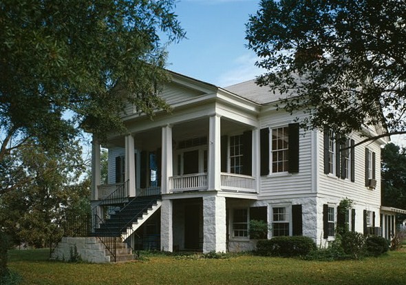
[3] Landmark name [4] Image Date listed Location City or town Summary 1 Albion December 6, 1984 West of Winnsboro off South Carolina Highway 34
34°27′22″N 81°14′36″W / 34.456111°N 81.243333°WWinnsboro 2 Balwearie December 6, 1984 West of Winnsboro on South Carolina Highway 34
34°27′14″N 81°14′41″W / 34.453889°N 81.244722°WWinnsboro 3 Blair Mound August 23, 1974 Address Restricted Winnsboro 4 Blink Bonnie April 13, 1972 About 10 miles northeast of Ridgeway
34°20′15″N 80°49′14″W / 34.3375°N 80.820556°WRidgeway 5 Dr. Walter Brice House and Office December 6, 1984 Northwest of Winnsboro
34°30′17″N 81°14′40″W / 34.504722°N 81.244444°WWinnsboro 6 Camp Welfare December 6, 1984 Off U.S. Route 21
34°29′23″N 80°57′04″W / 34.489722°N 80.951111°WRidgeway 7 Century House August 19, 1971 South Carolina Highway 34
34°18′13″N 80°57′30″W / 34.303611°N 80.958333°WRidgeway 8 Concord Presbyterian Church December 6, 1984 U.S. Route 321
34°31′27″N 81°10′10″W / 34.524167°N 81.169444°WWinnsboro 9 Davis Plantation May 6, 1971 South of Monticello on South Carolina Highway 215
34°22′36″N 81°18′59″W / 34.376667°N 81.316389°WMonticello 10 Ebenezer Associate Reformed Presbyterian Church 
August 19, 1971 4.3 miles north of Jenkinsville on South Carolina Highway 213
34°19′09″N 81°15′39″W / 34.319167°N 81.260833°WJenkinsville Also known as First ARP Church or "Old Brick Church." Built in 1788. 11 Fonti Flora Plantation April 24, 1979 5.4 miles northeast of Monticello on South Carolina Highway 99
34°24′06″N 81°20′45″W / 34.401667°N 81.345833°WMonticello 12 Furman Institution Faculty Residence December 6, 1984 Southwest of Winnsboro
34°20′53″N 81°07′23″W / 34.348056°N 81.123056°WWinnsboro 13 Dr. John Glenn House December 6, 1984 South Carolina Highway 215
34°14′51″N 81°15′06″W / 34.2475°N 81.251667°WJenkinsville 14 High Point December 6, 1984 South Carolina Highway 215
34°14′47″N 81°14′56″W / 34.246389°N 81.248889°WJenkinsville 15 Hunstanton December 6, 1984 U.S. Route 321
34°21′06″N 81°05′11″W / 34.351667°N 81.086389°WWinnsboro 16 Hunter House December 6, 1984 Northeast of Ridgeway
34°19′27″N 80°56′05″W / 34.324167°N 80.934722°WRidgeway 17 Ketchin Building December 18, 1970 231 S. Congress St.
34°22′33″N 81°05′08″W / 34.375833°N 81.085556°WWinnsboro 18 Kincaid-Anderson House July 30, 1974 Northeast of Jenkinsville off South Carolina Highway 213
34°19′10″N 81°14′32″W / 34.319444°N 81.242222°WJenkinsville 19 Bob Lemmon House December 6, 1984 Off South Carolina Highway 213
34°19′44″N 81°10′33″W / 34.328889°N 81.175833°WWinnsboro 20 Liberty Universalist Church and Feasterville Academy Historic District December 6, 1984 South Carolina Highway 215
34°30′13″N 81°21′36″W / 34.503611°N 81.36°WWinnsboro 21 Little River Baptist Church April 13, 1972 3.8 miles north of Jenkinsville on South Carolina Highway 213
34°18′38″N 81°16′31″W / 34.310556°N 81.275278°WJenkinsville 22 Mayfair February 6, 1985 Off South Carolina Highway 215
34°15′42″N 81°17′34″W / 34.261667°N 81.292778°WJenkinsville 23 McMeekin Rock Shelter August 23, 1974 Address Restricted Winnsboro 24 Monticello Methodist Church December 6, 1984 Off South Carolina Highway 215
34°20′59″N 81°17′57″W / 34.349722°N 81.299167°WMonticello 25 Monticello Store and Post Office December 6, 1984 Off South Carolina Highway 215
34°21′11″N 81°17′58″W / 34.353056°N 81.299444°WMonticello 26 Mount Hope December 6, 1984 South Carolina Highway 34
34°17′58″N 80°59′18″W / 34.299444°N 80.988333°WRidgeway 27 Mount Olivet Presbyterian Church August 13, 1986 Off South Carolina Highway 200
34°27′55″N 81°02′02″W / 34.465278°N 81.033889°WWinnsboro 28 New Hope A.R.P. Church and Session House December 6, 1984 Northwest of Winnsboro
34°30′33″N 81°14′47″W / 34.509167°N 81.246389°WWinnsboro 29 Old Stone House December 6, 1984 Off South Carolina Highway 34
34°23′48″N 81°11′53″W / 34.396667°N 81.198056°WWinnsboro 30 Ridgeway Historic District November 25, 1980 U.S. Route 21 and South Carolina Highway 34
34°18′26″N 80°57′39″W / 34.307222°N 80.960833°WRidgeway 31 Rockton and Rion Railroad Historic District December 6, 1984 South of Winnsboro from South Carolina Highway 34 west to South Carolina Highway 213
34°19′09″N 81°09′19″W / 34.319167°N 81.155278°WWinnsboro 32 Ruff's Chapel November 25, 1980 U.S. Route 21 and South Carolina Highway 34
34°18′15″N 80°57′28″W / 34.304167°N 80.957778°WRidgeway 33 Rural Point February 23, 1972 Old Camden Rd.
34°21′57″N 81°04′36″W / 34.365833°N 81.076667°WWinnsboro 34 St. Stephen's Episcopal Church May 6, 1971 Northeast of Ridgeway on County Road 106
34°18′42″N 80°57′23″W / 34.311667°N 80.956389°WRidgeway An 1854 Carpenter Gothic building which in 1920 had its wooden exterior veneered with brick. The Rev. William Porcher DuBose was an early rector. 35 Shivar Springs Bottling Company Cisterns December 6, 1984 West of Winnsboro
34°29′19″N 81°25′15″W / 34.488611°N 81.420833°WWinnsboro 36 The Oaks December 6, 1984 South Carolina Highway 213
34°21′15″N 81°10′44″W / 34.354167°N 81.178889°WWinnsboro 37 Tocaland 
December 6, 1984 Off South Carolina Highway 34
34°20′26″N 81°04′18″W / 34.340556°N 81.071667°WWinnsboro 38 Valencia May 6, 1971 Northwest of Ridgeway on County Road 106
34°19′40″N 80°59′00″W / 34.327778°N 80.983333°WRidgeway 39 Vaughn's Stage Coach Stop December 6, 1984 South Carolina Highway 34
34°18′36″N 81°02′00″W / 34.31°N 81.033333°WRidgeway 40 White Oak Historic District December 6, 1984 Off U.S. Route 321
34°28′26″N 81°07′02″W / 34.473889°N 81.117222°WWinnsboro 41 Monroe Wilson House November 25, 1980 Railroad Ave. and Secondary Route S20-20
34°18′30″N 80°57′54″W / 34.308333°N 80.965°WRidgeway 42 Winnsboro Historic District 
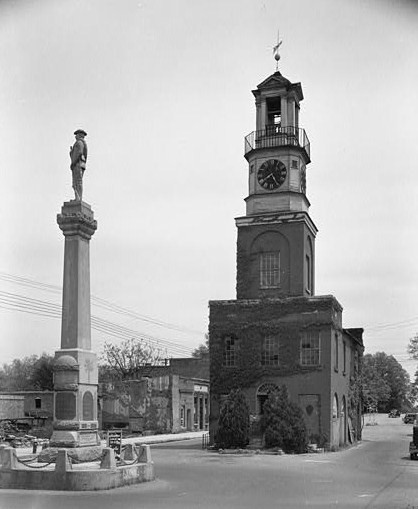
October 14, 1971 Roughly bounded by Gooding, Buchanan, Garden, and Fairfield Sts. Winnsboro Former listings
Landmark name Image Dates Location City or Town Summary 1 James Beard House December 8, 2005 (delisted) Ridgeway 2 Furman Institution Academic Building December 8, 2005 (delisted) Winnsboro See also
- List of National Historic Landmarks in South Carolina
- National Register of Historic Places listings in South Carolina
References
- ^ The latitude and longitude information provided in this table was derived originally from the National Register Information System, which has been found to be fairly accurate for about 99% of listings. For about 1% of NRIS original coordinates, experience has shown that one or both coordinates are typos or otherwise extremely far off; some corrections may have been made. A more subtle problem causes many locations to be off by up to 150 yards, depending on location in the country: most NRIS coordinates were derived from tracing out latitude and longitudes off of USGS topographical quadrant maps created under the North American Datum of 1927, which differs from the current, highly accurate WGS84 GPS system used by Google maps. Chicago is about right, but NRIS longitudes in Washington are higher by about 4.5 seconds, and are lower by about 2.0 seconds in Maine. Latitudes differ by about 1.0 second in Florida. Some locations in this table may have been corrected to current GPS standards.
- ^ "National Register of Historic Places: Weekly List Actions". National Park Service, United States Department of the Interior. Retrieved on November 10, 2011.
- ^ Numbers represent an ordering by significant words. Various colorings, defined here, differentiate National Historic Landmark sites and National Register of Historic Places Districts from other NRHP buildings, structures, sites or objects.
- ^ "National Register Information System". National Register of Historic Places. National Park Service. . http://nrhp.focus.nps.gov/natreg/docs/All_Data.html.
U.S. National Register of Historic Places in South Carolina Lists by county Abbeville • Aiken • Allendale • Anderson • Bamberg • Barnwell • Beaufort • Berkeley • Calhoun • Charleston • Cherokee • Chester • Chesterfield • Clarendon • Colleton • Darlington • Dillon • Dorchester • Edgefield • Fairfield • Florence • Georgetown • Greenville • Greenwood • Hampton • Horry • Jasper • Kershaw • Lancaster • Laurens • Lee • Lexington • Marion • Marlboro • McCormick • Newberry • Oconee • Orangeburg • Pickens • Richland • Saluda • Spartanburg • Sumter • Union • Williamsburg • York

Lists by city Other lists Municipalities and communities of Fairfield County, South Carolina Towns Blythewood‡ | Jenkinsville | Ridgeway | Winnsboro

CDP Unincorporated
communitiesBlackstock | Mitford | Monticello
Footnotes ‡This populated place also has portions in an adjacent county or counties
Categories:- Fairfield County, South Carolina
- National Register of Historic Places in South Carolina by county
- Buildings and structures in Fairfield County, South Carolina
-


Wikimedia Foundation. 2010.