- National Register of Historic Places listings in York County, South Carolina
-
 Location of York County in South Carolina
This is a list of the National Register of Historic Places listings in York County, South Carolina.
This is intended to be a complete list of the properties and districts on the National Register of Historic Places in York County, South Carolina, United States. The locations of National Register properties and districts for which the latitude and longitude coordinates are included below, may be seen in a Google map.[1]
There are 53 properties and districts listed on the National Register in the county.
-
- This National Park Service list is complete through NPS recent listings posted November 10, 2011.[2]
Current listings
[3] Landmark name [4] Image Date listed Location City or town Summary 1 Afro-American Insurance Company Building June 10, 1992 558 S. Dave Lyle Boulevard
34°55′19″N 81°02′09″W / 34.921944°N 81.035833°WRock Hill 2 Allison Plantation September 29, 1980 Off South Carolina Highways 40 and 60
35°00′08″N 81°22′32″W / 35.002222°N 81.375556°WYork 3 Anderson House May 13, 1982 227 Oakland Ave.
34°55′54″N 81°01′34″W / 34.931667°N 81.026111°WRock Hill Designed by architect George Franklin Barber 4 Banks-Mack House June 11, 1992 329 Confederate St.
35°00′11″N 80°56′18″W / 35.003056°N 80.938333°WFort Mill 5 Bethel Presbyterian Church December 10, 1980 South Carolina Highway 557
35°06′41″N 81°09′11″W / 35.111389°N 81.153056°WClover 6 Bethesda Presbyterian Church August 16, 1977 3.5 miles northeast of McConnells on South Carolina Highway 322
34°53′52″N 81°10′32″W / 34.897778°N 81.175556°WMcConnells 7 Bleachery Water Treatment Plant March 6, 2008 Stewart Ave. Rock Hill 8 Brattonsville Historic District 
August 19, 1971 East of McConnells on County Road 165 off South Carolina Highway 13
34°52′04″N 81°10′39″W / 34.867778°N 81.1775°WMcConnells 9 Charlotte Avenue-Aiken Avenue Historic District June 10, 1992 Roughly Aiken Ave. from College Ave. to Charlotte Ave. and Charlotte from Aiken to Union Ave.
34°56′09″N 81°01′28″W / 34.935833°N 81.024444°WRock Hill 10 Clover Downtown Historic District July 8, 1999 Junction of Main and Kings Mountain Sts.
35°06′42″N 81°13′36″W / 35.111667°N 81.226667°WClover 11 Ebenezer Academy August 16, 1977 2132 Ebenezer Rd.
34°58′01″N 81°03′06″W / 34.966944°N 81.051667°WRock Hill 12 First Presbyterian Church June 10, 1992 234 E. Main St.
34°55′25″N 81°01′31″W / 34.923611°N 81.025278°WRock Hill 13 Fort Mill Downtown Historic District June 11, 1992 Main St. from Confederate Park east to 233 Main
35°00′28″N 80°56′39″W / 35.007778°N 80.944167°WFort Mill 14 Hart House December 2, 1977 220 E. Liberty St.
34°59′29″N 81°14′12″W / 34.991389°N 81.236667°WYork 15 Hermon Presbyterian Church June 10, 1992 446 Dave Lyle Boulevard
34°55′24″N 81°02′03″W / 34.923333°N 81.034167°WRock Hill 16 Highland Park Manufacturing Plant and Cotton Oil Complex June 10, 1992 869 Standard St. and 732 and 737 E. White St.
34°55′15″N 81°00′42″W / 34.920833°N 81.011667°WRock Hill 17 Hightower Hall June 28, 1982 County Road 165
34°52′52″N 81°10′53″W / 34.881111°N 81.181389°WMcConnells 18 Hill Complex Historic District April 18, 2003 York and Shannon Sts.
34°57′09″N 81°20′12″W / 34.9525°N 81.336667°WSharon 19 W.L. Hill Store January 20, 1995 3034 York St.
34°57′05″N 81°20′18″W / 34.951389°N 81.338333°WSharon 20 Jackson's Furnace Site (38YK217) May 8, 1987 Address Restricted Smyrna 21 Kings Mountain National Military Park 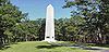
October 15, 1966 Northwest of Bethany on South Carolina Highway 161
35°8′16″N 81°23′22″W / 35.13778°N 81.38944°WBethany Extends into Cherokee County 22 Laurelwood Cemetery July 31, 2008 Bordered by Laurel, W. White, Stewart, and W. Main Sts. Rock Hill 23 Mack-Belk House June 11, 1992 119 Banks St.
35°00′24″N 80°56′06″W / 35.006667°N 80.935°WFort Mill 24 Marion Street Area Historic District June 10, 1992 Roughly Marion St. from Hampton St. to Center St. and Center from State St. to Marion
34°55′13″N 81°01′43″W / 34.920278°N 81.028611°WRock Hill 25 McCorkle-Fewell-Long House August 21, 1980 639 College Ave.
34°56′30″N 81°01′36″W / 34.941667°N 81.026667°WRock Hill 26 Mills House June 11, 1992 122 Confederate St.
35°00′23″N 80°56′36″W / 35.006389°N 80.943333°WFort Mill 27 Mount Prospect Baptist Church June 10, 1992 339 W. Black St.
34°55′45″N 81°02′08″W / 34.929167°N 81.035556°WRock Hill 28 Nation Ford Fish Weir March 1, 2007 In the Catawba River approximately 1200 feet upstream from the Nation Ford railroad trestle Rock Hill 29 Nation Ford Road March 1, 2007 5 noncontiguous sections of roadbed in Fort Mill Fort Mill 30 National Guard Armory June 11, 1992 Junction of Elliott and Unity Sts.
35°00′34″N 80°56′21″W / 35.009444°N 80.939167°WFort Mill 31 People's National Bank Building March 25, 1999 131-133 E. Main St.
34°55′32″N 81°01′37″W / 34.925556°N 81.026944°WRock Hill 32 Reid Street-North Confederate Avenue Area Historic District June 10, 1992 Roughly Reid St. and N. Confederate Ave. between E. Main St. and E. White St.
34°55′26″N 81°01′19″W / 34.923889°N 81.021944°WRock Hill 33 Rock Hill Body Company March 6, 2008 601 W. Main St. Rock Hill 34 Rock Hill Cotton Factory June 10, 1992 215 Chatham St.; also 130 W. White St.
34°55′42″N 81°01′39″W / 34.928333°N 81.0275°WRock Hill 130 White represents a boundary increase of March 6, 2008 35 Rock Hill Downtown Historic District June 24, 1991 Roughly S. Oakland Ave. from south of Peoples Pl. to E. Main St.
34°55′31″N 81°01′30″W / 34.925278°N 81.025°WRock Hill 36 Sharon Downtown Historic District November 2, 2001 York St. and Woodlawn Ave.
34°57′06″N 81°20′30″W / 34.951667°N 81.341667°WSharon 37 Spratt Cemetery March 1, 2007 Brickyard Rd.
34°59′58″N 80°57′10″W / 34.999444°N 80.952778°WFort Mill 38 Springfield Plantation House September 12, 1985 U.S. Route 21
35°02′54″N 80°55′41″W / 35.048333°N 80.928056°WFort Mill 39 Stokes-Mayfield House May 17, 1984 353 Oakland Ave.
34°56′03″N 81°01′40″W / 34.934167°N 81.027778°WRock Hill 40 Thornwell-Elliott House June 11, 1992 118 Confederate St.
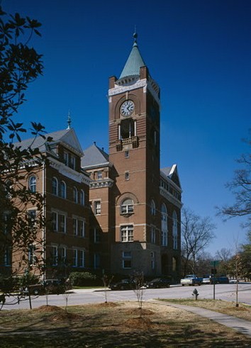
35°00′24″N 80°56′37″W / 35.006667°N 80.943611°WFort Mill 41 Tillman Hall 
December 2, 1977 Oakland Ave. on the Winthrop College campus
34°56′18″N 81°01′47″W / 34.938333°N 81.029722°WRock Hill 42 Unity Presbyterian Church Complex June 11, 1992 303 Tom Hall St.
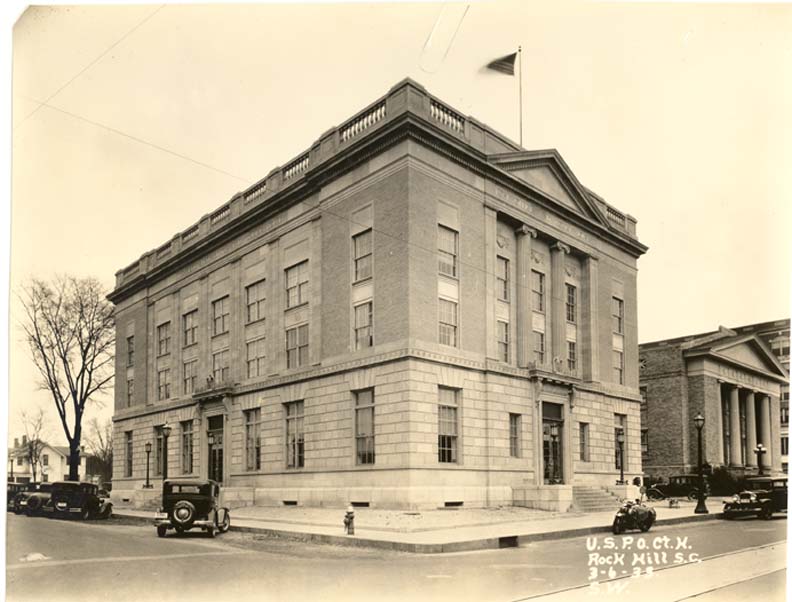
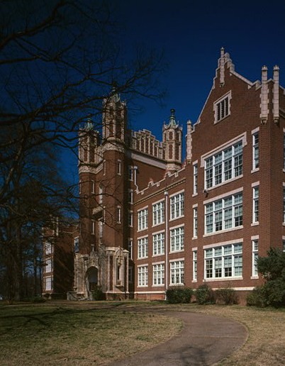
35°00′33″N 80°56′16″W / 35.009167°N 80.937778°WFort Mill 43 US Post Office and Courthouse 
January 21, 1988 102 Main St.
34°55′30″N 81°01′33″W / 34.925°N 81.025833°WRock Hill 44 White House December 3, 1969 258 E. White St.
34°55′33″N 81°01′18″W / 34.925833°N 81.021667°WRock Hill 45 John M. White House September 12, 1985 White and Skipper Sts.
35°00′36″N 80°56′50″W / 35.01°N 80.947222°WFort Mill 46 William Elliott White House March 22, 1987 N. White St.
35°00′57″N 80°57′01″W / 35.015833°N 80.950278°WFort Mill 47 Wilson House June 11, 1992 107 Clebourne St.
35°00′31″N 80°56′38″W / 35.008611°N 80.943889°WFort Mill 48 Wilson House November 20, 1974 3 S. Congress St.
34°59′36″N 81°14′32″W / 34.993333°N 81.242222°WYork 49 Winthrop College Historic District April 23, 1987 Along Oakland Ave. between Cherry Rd. and Stewart Ave. on the Winthrop College campus
34°56′22″N 81°01′48″W / 34.939444°N 81.03°WRock Hill 50 Withers Building 
August 20, 1981 Oakland Ave.
34°50′28″N 81°01′42″W / 34.841111°N 81.028333°WRock Hill 51 Witherspoon-Hunter House February 7, 1978 15 W. Liberty St.
34°59′50″N 81°14′37″W / 34.997222°N 81.243611°WYork 52 York County Courthouse October 30, 1981 Corner of W. Liberty and S. Congress Sts. York 53 York Historic District 
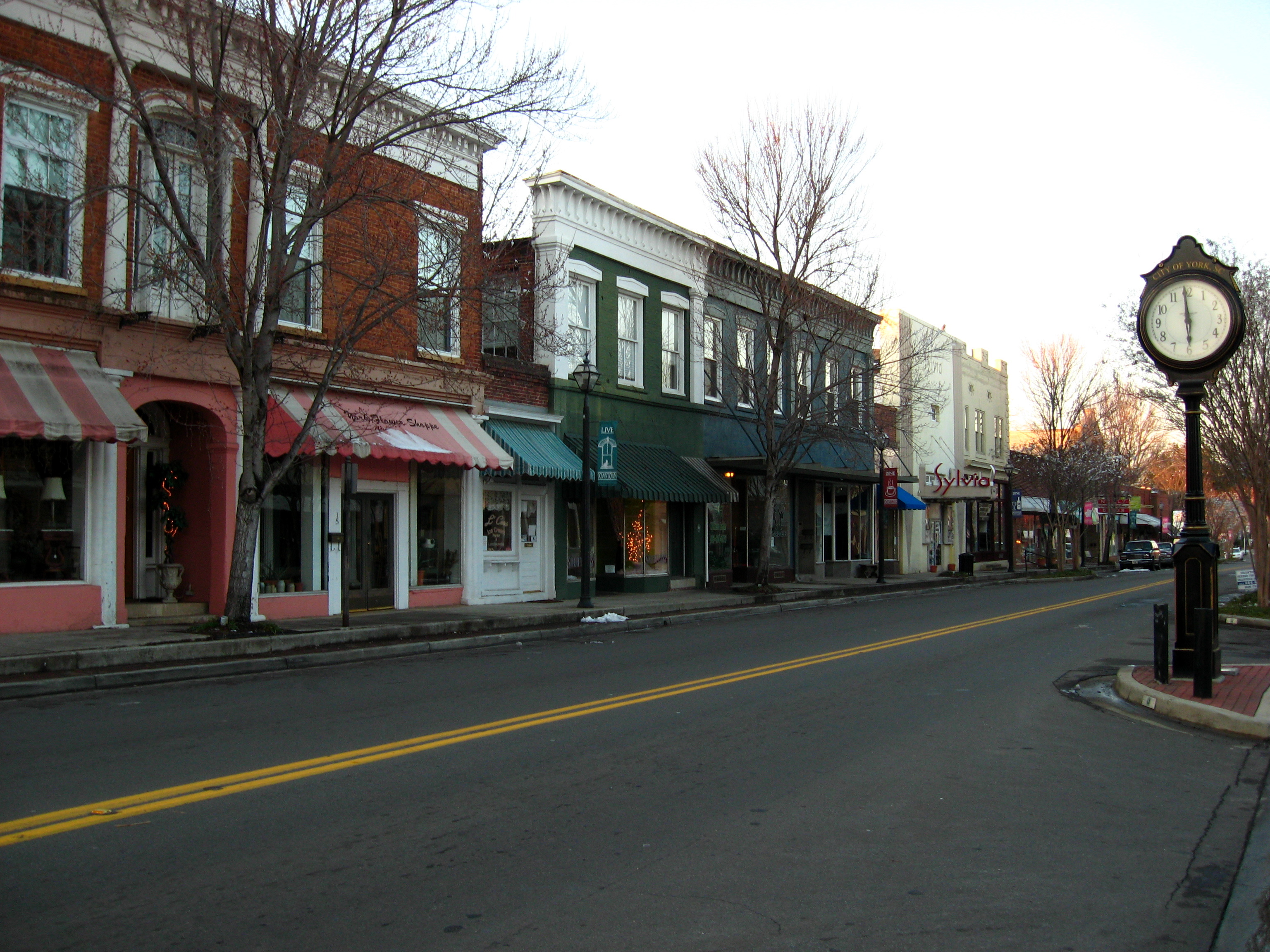
October 18, 1979 U.S. Route 321 and South Carolina Highway 5
34°59′53″N 81°13′35″W / 34.998056°N 81.226389°WYork See also
- List of National Historic Landmarks in South Carolina
- National Register of Historic Places listings in South Carolina
References
- ^ The latitude and longitude information provided in this table was derived originally from the National Register Information System, which has been found to be fairly accurate for about 99% of listings. For about 1% of NRIS original coordinates, experience has shown that one or both coordinates are typos or otherwise extremely far off; some corrections may have been made. A more subtle problem causes many locations to be off by up to 150 yards, depending on location in the country: most NRIS coordinates were derived from tracing out latitude and longitudes off of USGS topographical quadrant maps created under the North American Datum of 1927, which differs from the current, highly accurate WGS84 GPS system used by Google maps. Chicago is about right, but NRIS longitudes in Washington are higher by about 4.5 seconds, and are lower by about 2.0 seconds in Maine. Latitudes differ by about 1.0 second in Florida. Some locations in this table may have been corrected to current GPS standards.
- ^ "National Register of Historic Places: Weekly List Actions". National Park Service, United States Department of the Interior. Retrieved on November 10, 2011.
- ^ Numbers represent an ordering by significant words. Various colorings, defined here, differentiate National Historic Landmark sites and National Register of Historic Places Districts from other NRHP buildings, structures, sites or objects.
- ^ "National Register Information System". National Register of Historic Places. National Park Service. . http://nrhp.focus.nps.gov/natreg/docs/All_Data.html.
U.S. National Register of Historic Places in South Carolina Lists by county Abbeville • Aiken • Allendale • Anderson • Bamberg • Barnwell • Beaufort • Berkeley • Calhoun • Charleston • Cherokee • Chester • Chesterfield • Clarendon • Colleton • Darlington • Dillon • Dorchester • Edgefield • Fairfield • Florence • Georgetown • Greenville • Greenwood • Hampton • Horry • Jasper • Kershaw • Lancaster • Laurens • Lee • Lexington • Marion • Marlboro • McCormick • Newberry • Oconee • Orangeburg • Pickens • Richland • Saluda • Spartanburg • Sumter • Union • Williamsburg • York

Lists by city Other lists Municipalities and communities of York County, South Carolina Cities 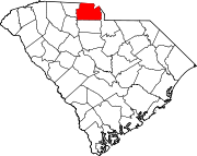
Towns Clover | Fort Mill‡ | Hickory Grove | McConnells | Sharon | Smyrna‡
CDPs India Hook | Lake Wylie | Lesslie | Newport | Riverview
Unincorporated
communitiesCatawba | Filbert | Holy Islamville | Hopewell | Ogden | Red River | Smith | Tirzah
Footnotes ‡This populated place also has portions in an adjacent county or counties
Categories:- National Register of Historic Places in York County, South Carolina
- National Register of Historic Places in South Carolina by county
-


Wikimedia Foundation. 2010.