- National Register of Historic Places listings in Pickens County, South Carolina
-
 Location of Pickens County in South Carolina
This is a list of the National Register of Historic Places listings in Pickens County, South Carolina.
This is intended to be a complete list of the properties and districts on the National Register of Historic Places in Pickens County, South Carolina, United States. The locations of National Register properties and districts for which the latitude and longitude coordinates are included below, may be seen in a Google map.[1]
There are 25 properties and districts listed on the National Register in the county, including 1 National Historic Landmark.
-
- This National Park Service list is complete through NPS recent listings posted November 10, 2011.[2]
Current listings
[3] Landmark name [4] Image Date listed Location City or town Summary 1 Central High School 
May 20, 1994 304 Church St.
34°43′22″N 82°46′52″W / 34.72278°N 82.78111°WCentral 2 Civilian Conservation Corps Quarry No. 1 and Truck Trail June 16, 1989 Off Section Rd. 25/Hickory Hollow Rd., 0.7 miles south of South Carolina Highway 11
35°0′17″N 82°42′46″W / 35.00472°N 82.71278°WPickens 3 Civilian Conservation Corps Quarry No. 2 June 16, 1989 0.2 miles north of Section Rd. 69/Sliding Rock Rd. near the Oolenoy River
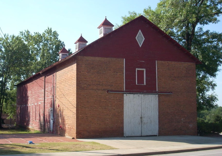
35°0′21″N 82°43′18″W / 35.00583°N 82.72167°WPickens 4 Clemson College Sheep Barn 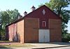
January 4, 1990 S. Palmetto Boulevard on the Clemson University campus
34°40′36″N 82°49′50″W / 34.67667°N 82.83056°WClemson 5 Clemson University Historic District I 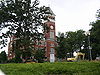
January 4, 1990 Northern portion of campus along U.S. Route 76
34°40′47″N 82°50′4″W / 34.67972°N 82.83444°WClemson 6 Clemson University Historic District II 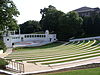
January 4, 1990 Center of campus
34°40′40″N 82°50′18″W / 34.67778°N 82.83833°WClemson 7 Easley High School Auditorium 
January 21, 1999 112 Russell St.
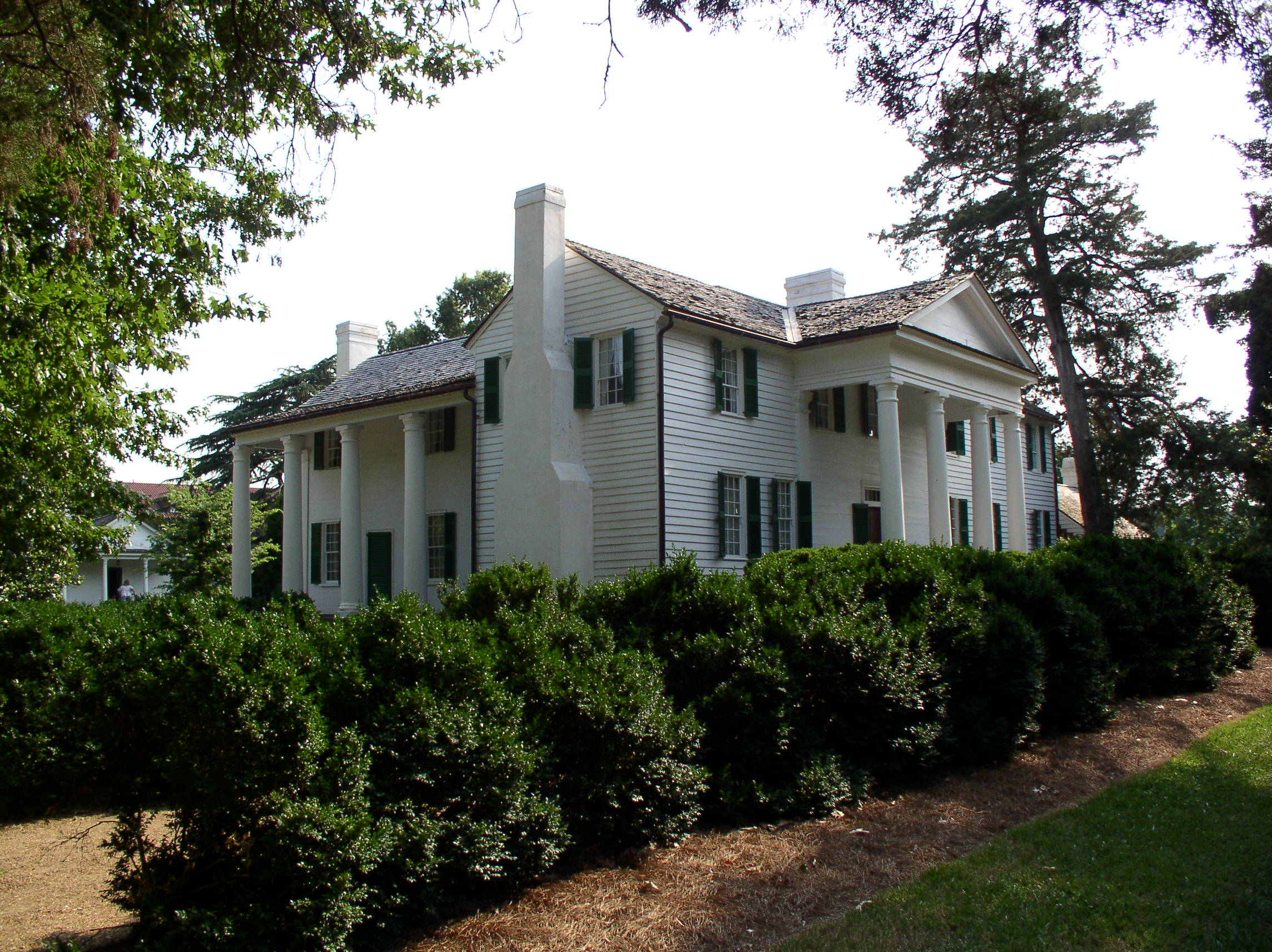
34°49′48″N 82°36′0″W / 34.83°N 82.6°WEasley 8 Fort Hill 
October 15, 1966 Clemson University campus
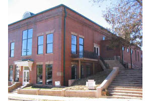
34°40′40″N 82°50′21″W / 34.67778°N 82.83917°WClemson 9 Griffin-Christopher House October 21, 2001 208 Ann St.
34°53′6″N 82°42′30″W / 34.885°N 82.70833°WPickens 10 Hagood Mill December 11, 1972 3.5 miles northwest of Pickens on U.S. Route 178
34°55′37″N 82°43′20″W / 34.92694°N 82.72222°WPickens 11 Hagood-Mauldin House October 9, 1997 104 N. Lewis St.
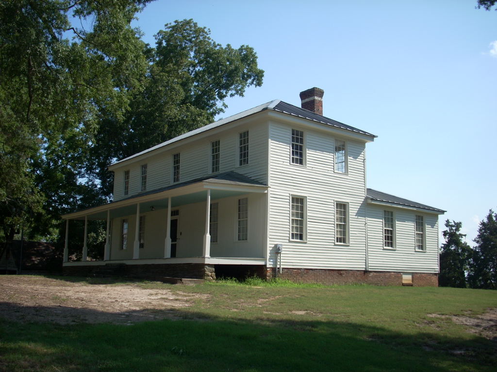
34°53′7″N 82°42′20″W / 34.88528°N 82.70556°WPickens 12 Hanover House 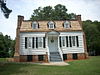
June 5, 1970 Clemson University campus
34°40′35″N 82°49′52″W / 34.67639°N 82.83111°WClemson 13 Liberty Colored High School 
April 18, 2003 Junction of South Carolina Highway 93 and Rosewood St.
34°47′23″N 82°41′23″W / 34.78972°N 82.68972°WLiberty 14 Morgan House March 29, 2001 416 Church St.
34°43′20″N 82°46′49″W / 34.72222°N 82.78028°WCentral 15 Old Pickens Jail April 11, 1979 Johnson and Pendleton Sts.
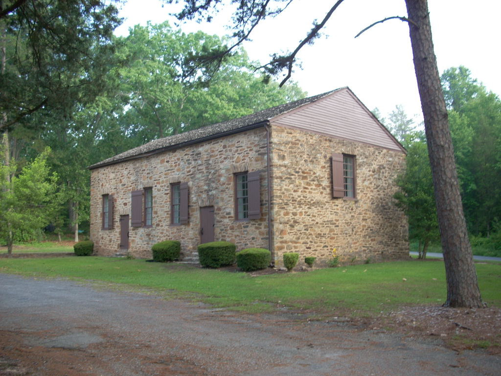
34°52′51″N 82°42′21″W / 34.88083°N 82.70583°WPickens 16 Old Stone Church and Cemetery 
November 5, 1971 1.5 miles north of Pendleton off U.S. Route 76
34°39′49″N 82°48′58″W / 34.66361°N 82.81611°WPendleton 17 Oolenoy Baptist Church Cemetery October 14, 2003 201 Miracle Hill Rd.
34°59′30″N 82°48′21″W / 34.99167°N 82.80583°WPickens 18 Pendleton Historic District 
August 25, 1970 Bounded on the west by Hopewell and Treaty Oak, on the north by the Old Stone Church, on the east by Montpelier, and on the south by the town limits
34°39′6.38″N 82°47′1.5″W / 34.6517722°N 82.78375°WPendleton Extends into Anderson and Oconee counties 19 Roper House Complex June 16, 1989 Section Road 25, 0.1 miles southeast of South Carolina Highway 11
35°1′18″N 82°41′32″W / 35.02167°N 82.69222°WPickens 20 Sheriff Mill Complex November 20, 1987 South Carolina Highway 40
34°47′18″N 82°34′8″W / 34.78833°N 82.56889°WEasley 21 J. Warren Smith House 
January 26, 2005 21 N. Palmetto St.
34°47′9″N 82°41′47″W / 34.78583°N 82.69639°WLiberty 22 J. C. Stribling Barn 
October 22, 2001 220 Issaqueena Trail
34°40′7″N 82°47′45″W / 34.66861°N 82.79583°WClemson 23 Structural Science Building 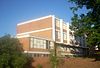
April 5, 2010 Palmetto Boulevard and Fernow Drive
34°40′30.5″N 82°50′18″W / 34.675139°N 82.83833°WClemson Now known as Lee and Lowry Halls; built in 1958 and designed by Harlan Ewart McClure, the first dean of architecture at Clemson University[5] 24 Table Rock Civilian Conservation Corps Camp Site June 16, 1989 Table Rock State Park Rd. Extension at South Carolina Highway 11
35°1′18″N 82°41′55″W / 35.02167°N 82.69861°WPickens 25 Table Rock State Park Historic District June 15, 1989 South Carolina Highway 11, 4.5 miles east of Primary Road 45
35°2′7″N 82°42′31″W / 35.03528°N 82.70861°WPickens See also
- List of National Historic Landmarks in South Carolina
- National Register of Historic Places listings in South Carolina
References
- ^ The latitude and longitude information provided in this table was derived originally from the National Register Information System, which has been found to be fairly accurate for about 99% of listings. For about 1% of NRIS original coordinates, experience has shown that one or both coordinates are typos or otherwise extremely far off; some corrections may have been made. A more subtle problem causes many locations to be off by up to 150 yards, depending on location in the country: most NRIS coordinates were derived from tracing out latitude and longitudes off of USGS topographical quadrant maps created under the North American Datum of 1927, which differs from the current, highly accurate WGS84 GPS system used by Google maps. Chicago is about right, but NRIS longitudes in Washington are higher by about 4.5 seconds, and are lower by about 2.0 seconds in Maine. Latitudes differ by about 1.0 second in Florida. Some locations in this table may have been corrected to current GPS standards.
- ^ "National Register of Historic Places: Weekly List Actions". National Park Service, United States Department of the Interior. Retrieved on November 10, 2011.
- ^ Numbers represent an ordering by significant words. Various colorings, defined here, differentiate National Historic Landmark sites and National Register of Historic Places Districts from other NRHP buildings, structures, sites or objects.
- ^ "National Register Information System". National Register of Historic Places. National Park Service. . http://nrhp.focus.nps.gov/natreg/docs/All_Data.html.
- ^ "Clemson's Lee Hall/Lowry Hall Listed on National Register of Historic Places". Targeted News Service. Washington, DC. June 1, 2010. ProQuest Document ID 2048606741.
U.S. National Register of Historic Places in South Carolina Lists by county Abbeville • Aiken • Allendale • Anderson • Bamberg • Barnwell • Beaufort • Berkeley • Calhoun • Charleston • Cherokee • Chester • Chesterfield • Clarendon • Colleton • Darlington • Dillon • Dorchester • Edgefield • Fairfield • Florence • Georgetown • Greenville • Greenwood • Hampton • Horry • Jasper • Kershaw • Lancaster • Laurens • Lee • Lexington • Marion • Marlboro • McCormick • Newberry • Oconee • Orangeburg • Pickens • Richland • Saluda • Spartanburg • Sumter • Union • Williamsburg • York

Lists by city Other lists Municipalities and communities of Pickens County, South Carolina Cities 
Towns CDP Unincorporated
communitiesDacusville | Pumpkintown
Footnotes ‡This populated place also has portions in an adjacent county or counties
Categories:- Pickens County, South Carolina
- National Register of Historic Places in South Carolina by county
-


Wikimedia Foundation. 2010.