- National Register of Historic Places listings in Richland County, South Carolina
-
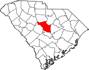
 Location of Richland County in South Carolina
This is a list of the National Register of Historic Places listings in Richland County, South Carolina.
This is intended to be a complete list of the properties and districts on the National Register of Historic Places in Richland County, South Carolina, United States. The locations of National Register properties and districts for which the latitude and longitude coordinates are included below, may be seen on a map.[1]
There are 152 properties and districts listed on the National Register in the county, including 5 National Historic Landmarks. The city of Columbia is the location of 118 of these properties and districts, including all of the National Historic Landmarks; they are listed separately, while the 34 properties and districts in the remaining parts of the county are listed here. Another property in Richland County outside of Columbia was once listed but has been removed.
-
- This National Park Service list is complete through NPS recent listings posted November 10, 2011.[2]
Current listings
[3] Landmark name[4] Image Date listed Location City or Town Summary 1 Barber House March 27, 1986 Off County Road 37
33°53′39″N 80°52′37″W / 33.89417°N 80.87694°WHopkins 2 Big Lake Cattle Mound November 25, 1996 Address Restricted Hopkins 3 Brady's Cattle Mound November 25, 1996 Address Restricted Hopkins 4 Bridge Abutments November 25, 1996 Address Restricted Hopkins 5 J.A. Byrd Mercantile Store March 27, 1986 Main St.
33°52′40″N 80°41′40″W / 33.87778°N 80.69444°WEastover 6 Cattle Mound No. 6 November 25, 1996 Address Restricted Hopkins 7 Chappell House March 27, 1986 Address Restricted Cedar Creek 8 Cook's Lake Cattle Mound 
November 25, 1996 Address Restricted Hopkins 9 Cooner's Cattle Mound 
November 25, 1996 Address Restricted Hopkins 10 Dead River Cattle Mound November 25, 1996 Address Restricted Hopkins 11 Dead River Dike November 25, 1996 Address Restricted Hopkins 12 Farmers and Merchants Bank Building March 27, 1986 Main St.
33°52′39″N 80°41′39″W / 33.8775°N 80.69417°WEastover 13 Good Hope Baptist Church March 27, 1986 U.S. Route 378 near Sandhill Rd.
33°56′23″N 80°42′41″W / 33.93972°N 80.71139°WEastover 14 Goodwill Plantation March 27, 1986 Off U.S. Route 378
33°57′28″N 80°38′57″W / 33.95778°N 80.64917°WEastover 15 Grovewood March 27, 1986 South Carolina Highway 769
33°54′24″N 80°48′9″W / 33.90667°N 80.8025°WCongaree 16 George P. Hoffman House March 27, 1986 North of County Road 54
34°12′53″N 80°58′19″W / 34.21472°N 80.97194°WBlythewood 17 Hopkins Family Cemetery April 8, 2010 Address Restricted Hopkins 18 Hopkins Graded School March 27, 1986 Junction of County Roads 37 and 1412
33°54′37″N 80°52′28″W / 33.91028°N 80.87444°WHopkins 19 Hopkins Presbyterian Church March 27, 1986 Near the junction of County Roads 66 and 86
33°54′36″N 80°52′26″W / 33.91°N 80.87389°WHopkins 20 John J. Kaminer House March 27, 1986 Near the junction of South Carolina Highways 48 and 769
33°50′43″N 80°45′40″W / 33.84528°N 80.76111°WGadsden 21 Kensington Plantation House 
January 25, 1971 East of Eastover off South Carolina Highway 764
33°52′12″N 80°39′8″W / 33.87°N 80.65222°WEastover 22 John Jacob Calhoun Koon Farmstead March 27, 1986 County Road 27 off U.S. Routes 76/176
34°6′51″N 81°12′24″W / 34.11417°N 81.20667°WBallentine 23 Magnolia March 27, 1986 Address Restricted Gadsden 24 Northwest Boundary Dike 
November 25, 1996 Address Restricted Hopkins 25 Oakwood March 27, 1986 South Carolina Highway 48
33°50′7″N 80°41′19″W / 33.83528°N 80.68861°WGadsden 26 Olympia Armory January 20, 1995 511 Granby Ln.
33°58′34″N 81°1′40″W / 33.97611°N 81.02778°WOlympia 27 Pine Grove Rosenwald School January 9, 2009 937 Piney Woods Rd.
34°3′46.82″N 81°7′28.41″W / 34.0630056°N 81.1245583°WSt. Andrews 28 Richland Presbyterian Church March 27, 1986 County Road 1313
33°50′38″N 80°42′3″W / 33.84389°N 80.70083°WGadsden 29 St. Phillip School April 19, 1996 4350 McCords Ferry Rd.
33°50′56″N 80°39′7″W / 33.84889°N 80.65194°WEastover 30 Saint Thomas' Protestant Episcopal Church March 27, 1986 Near the junction of U.S. Route 601 and South Carolina Highway 263
33°54′12″N 80°40′38″W / 33.90333°N 80.67722°WEastover 31 Claudius Scott Cottage March 27, 1986 County Road 1182
33°55′1″N 80°42′7″W / 33.91694°N 80.70194°WEastover 32 Siloam School April 15, 1996 1331 Congaree Rd.
33°56′15″N 80°49′33″W / 33.9375°N 80.82583°WEastover 33 Southwest Boundary Dike November 25, 1996 Address Restricted Hopkins 34 Woodlands February 1, 2006 409 Old Woodlands Rd.
33°58′30″N 80°58′10″W / 33.975°N 80.96944°WColumbia Former listing
Landmark name Image Dates Location City or Town Summary 1 Zion Protestant Episcopal Church March 13, 2000 (delisted) Highway 263 Eastover Burned See also
- List of National Historic Landmarks in South Carolina
- National Register of Historic Places listings in South Carolina
References
- ^ The latitude and longitude information provided in this table was derived originally from the National Register Information System, which has been found to be fairly accurate for about 99% of listings. For about 1% of NRIS original coordinates, experience has shown that one or both coordinates are typos or otherwise extremely far off; some corrections may have been made. A more subtle problem causes many locations to be off by up to 150 yards, depending on location in the country: most NRIS coordinates were derived from tracing out latitude and longitudes off of USGS topographical quadrant maps created under the North American Datum of 1927, which differs from the current, highly accurate WGS84 GPS system used by Google maps. Chicago is about right, but NRIS longitudes in Washington are higher by about 4.5 seconds, and are lower by about 2.0 seconds in Maine. Latitudes differ by about 1.0 second in Florida. Some locations in this table may have been corrected to current GPS standards.
- ^ "National Register of Historic Places: Weekly List Actions". National Park Service, United States Department of the Interior. Retrieved on November 10, 2011.
- ^ Numbers represent an ordering by significant words. Various colorings, defined here, differentiate National Historic Landmark sites and National Register of Historic Places Districts from other NRHP buildings, structures, sites or objects.
- ^ "National Register Information System". National Register of Historic Places. National Park Service. 2009-03-13. http://nrhp.focus.nps.gov/natreg/docs/All_Data.html.
U.S. National Register of Historic Places in South Carolina Lists by county Abbeville • Aiken • Allendale • Anderson • Bamberg • Barnwell • Beaufort • Berkeley • Calhoun • Charleston • Cherokee • Chester • Chesterfield • Clarendon • Colleton • Darlington • Dillon • Dorchester • Edgefield • Fairfield • Florence • Georgetown • Greenville • Greenwood • Hampton • Horry • Jasper • Kershaw • Lancaster • Laurens • Lee • Lexington • Marion • Marlboro • McCormick • Newberry • Oconee • Orangeburg • Pickens • Richland • Saluda • Spartanburg • Sumter • Union • Williamsburg • York

Lists by city Other lists Municipalities and communities of Richland County, South Carolina Cities Cayce‡ | Columbia‡ | Forest Acres
Towns Arcadia Lakes | Blythewood‡ | Eastover | Irmo‡
CDPs Unincorporated
communitiesBallentine | Gadsden | Hopkins | White Rock
Footnotes ‡This populated place also has portions in an adjacent county or counties
Categories:- Richland County, South Carolina
- National Register of Historic Places in South Carolina by county
-


Wikimedia Foundation. 2010.